Sunday, August 9, 2015, Mile 2308: The Social Trail

At a tiny, trailside campsite, next to a stream, Mile 2308

I slept in until 7:30, since I only have about nine miles on the agenda.  This pace is really frustrating…3 days for only 30 miles…but it’s the right thing to do, and I need to keep reminding myself of that. And best of all, I had zero pain today. That is a huge deal.

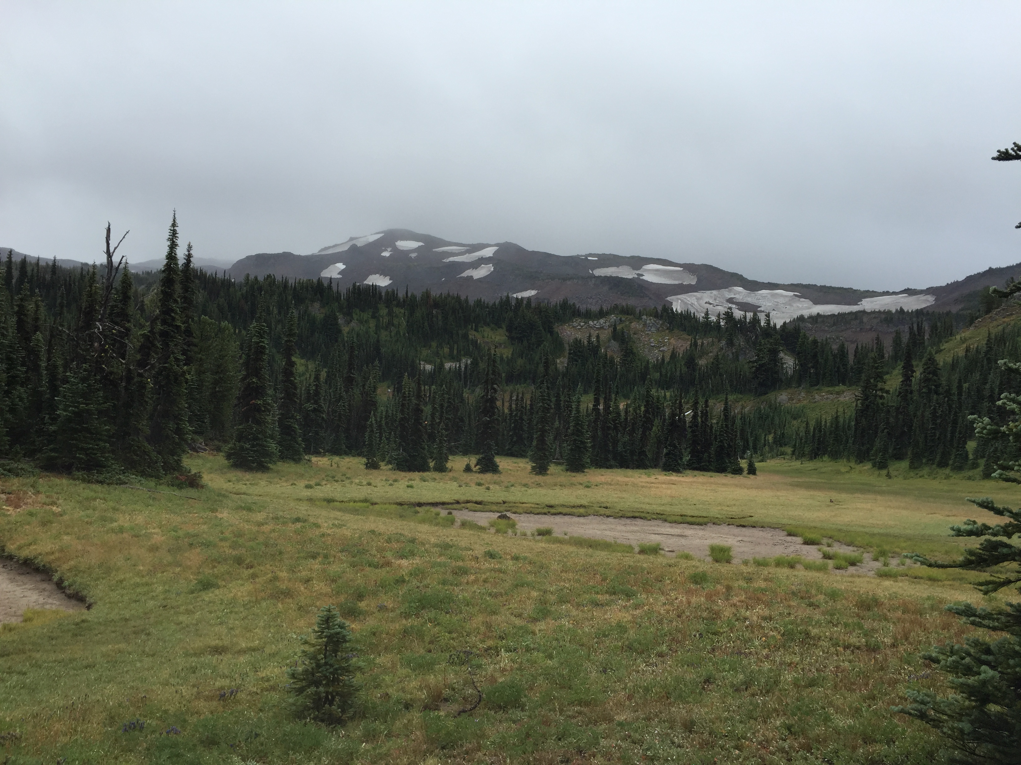
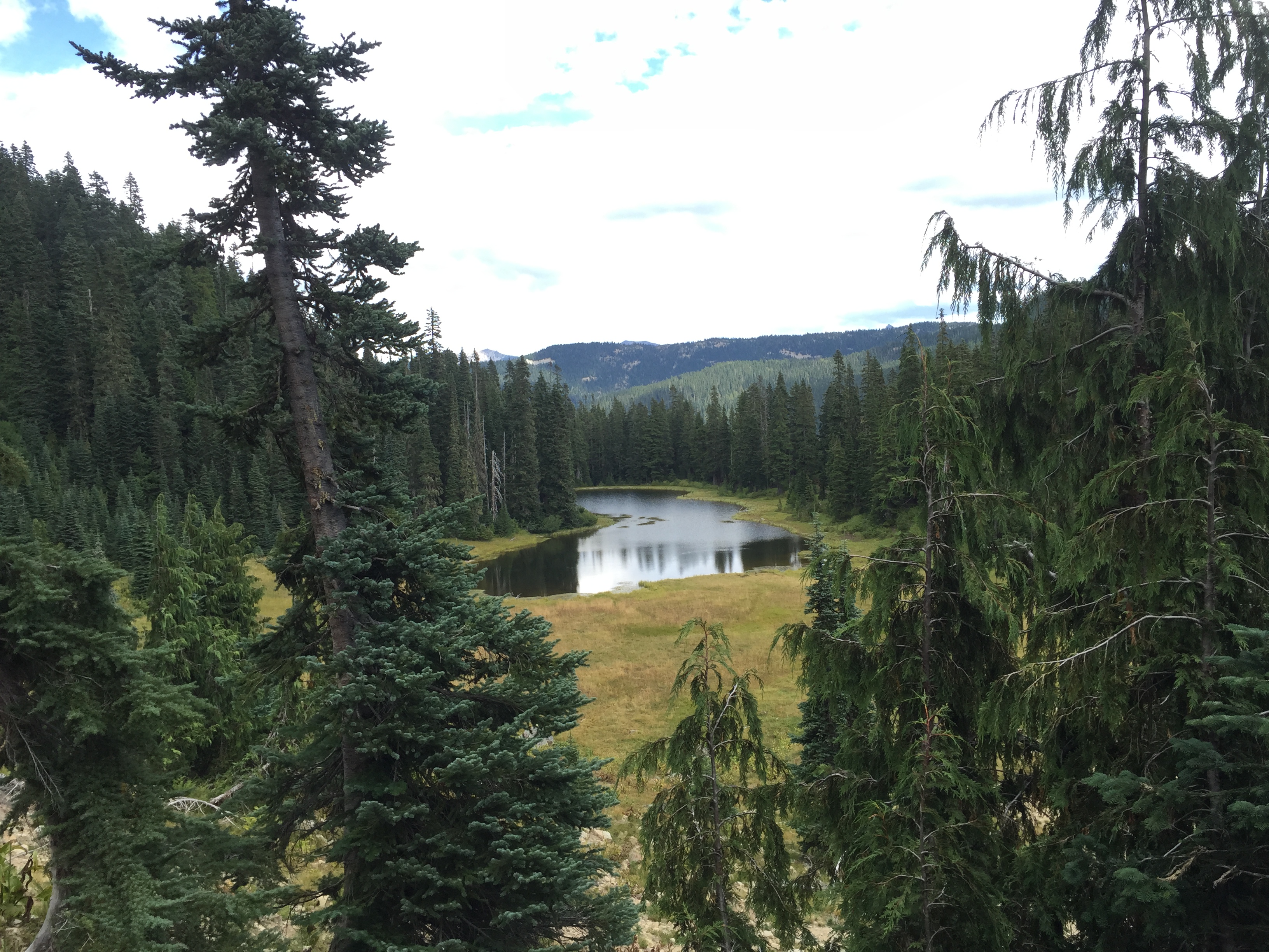
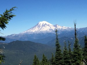
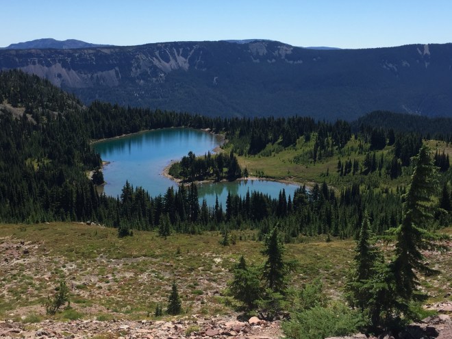
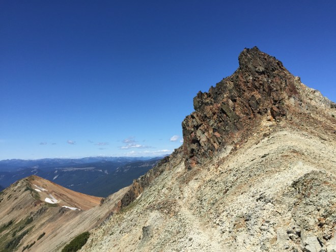
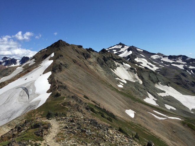
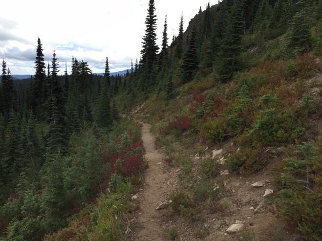
The hike today was easy, and gently downhill. I wove my way through wetlands, creeks, and lakes large and small…too many to count or even name.

2015-08-09 13.01.55
Crossing wetlands in the Fryingpan Lake region

2015-08-09 13.59.02

2015-08-09 14.57.17

After five miles I crossed a lovely little stream with a wooden bridge, at 2305. I had my lunch, refilled my water, and did a little no-soap laundry. A side note: it’s pretty hard to de-crustify a pair of hiking socks, but several rinses in flowing water can help a bit. While I was at the bridge, I met a thru doing the same thing, and a sectioner. He was taking a break as well, waiting for the rest of his group. More on him later.

Eventually, I forded the Bumping River. With the water so low, this was basically a matter of hopping across logs and rocks, and I did great. Log and rock hopping have always been problematic for me, but I am getting much better at it. And with trail runners, I’ll often just plow across the water.

2015-08-09 13.45.52
Bumping River

Another side note: trail runners drain and dry over a couple of hours, as opposed to waterproof boots, which dry over a couple of days. That waterproofing not only keeps water out, it keeps water in. So if you get water over the top of your boots, or if your feet sweat, or whatever, you’ll end up with wetter feet in the long run. This is the voice of experience.

I arrived at my campsite at the stunningly early hour of 3:00. It’s literally trailside, with a couple of good logs for seats. I set up camp in no time at all, and decided to have a snack break while reading my book (Master and Commander; I’m going through the Canon again).

An hour or so later, a girl came down the trail (please note that if I use the word “girl,” it’s because they’re under age 25). Her trail name is Dr. Beeker, because she’s a huge Muppets fan. We chatted for a while, and eventually we headed down to the stream to top off.

And then, who should come along but Thermo!

Thermo, aka Thermometer, aka Yun Eun Jung, is a retired gentleman from Korea. He’s had a longtime dream of hiking the PCT. He speaks very, very little English. He flew to San Diego this spring, purchased all of his gear, loaded up his 50 lb. pack (shockingly heavy), and started off at Campo in April. He got his name from Blue Sky, when he kept checking his little keychain thermometer. Anyway, people got to know him, both in person and virtually, and every so often on the PCT Class of 2015 Facebook page, you’ll see a Thermo Sighting. He doesn’t use a computer, but his daughter, Yun Sol, speaks a moderate amount of English, and is on Facebook. So she told us about him, and we tag her whenever we have news of him.

It was one of my great hopes to meet him and take a picture together, and that just happened!  I tried to tell him that I saw his picture on the computer; I’m not sure how much he understood. But he definitely understood when I mentioned his daughter, and I hope she enjoys the picture of her dad.

2015-08-09 17.34.21 - Crop
Rest Step and Thermo

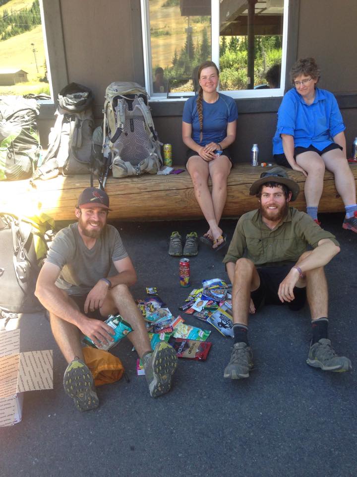
Another group I met while in this campsite was the Fakarwiis Band (as in, sorry, Where the —). One of them was the sectioner I met at the bridge. They are a group of five gentlemen who do all kinds of outdoor things year round, every weekend, and once a year they have a longer trip. This year, it was White to Stevens Passes. I really enjoyed our conversation. As it turns out, the leader of this hike is a thru named Snickers, who finished at the Northern Terminus, and went south to meet his buddies at White Pass.

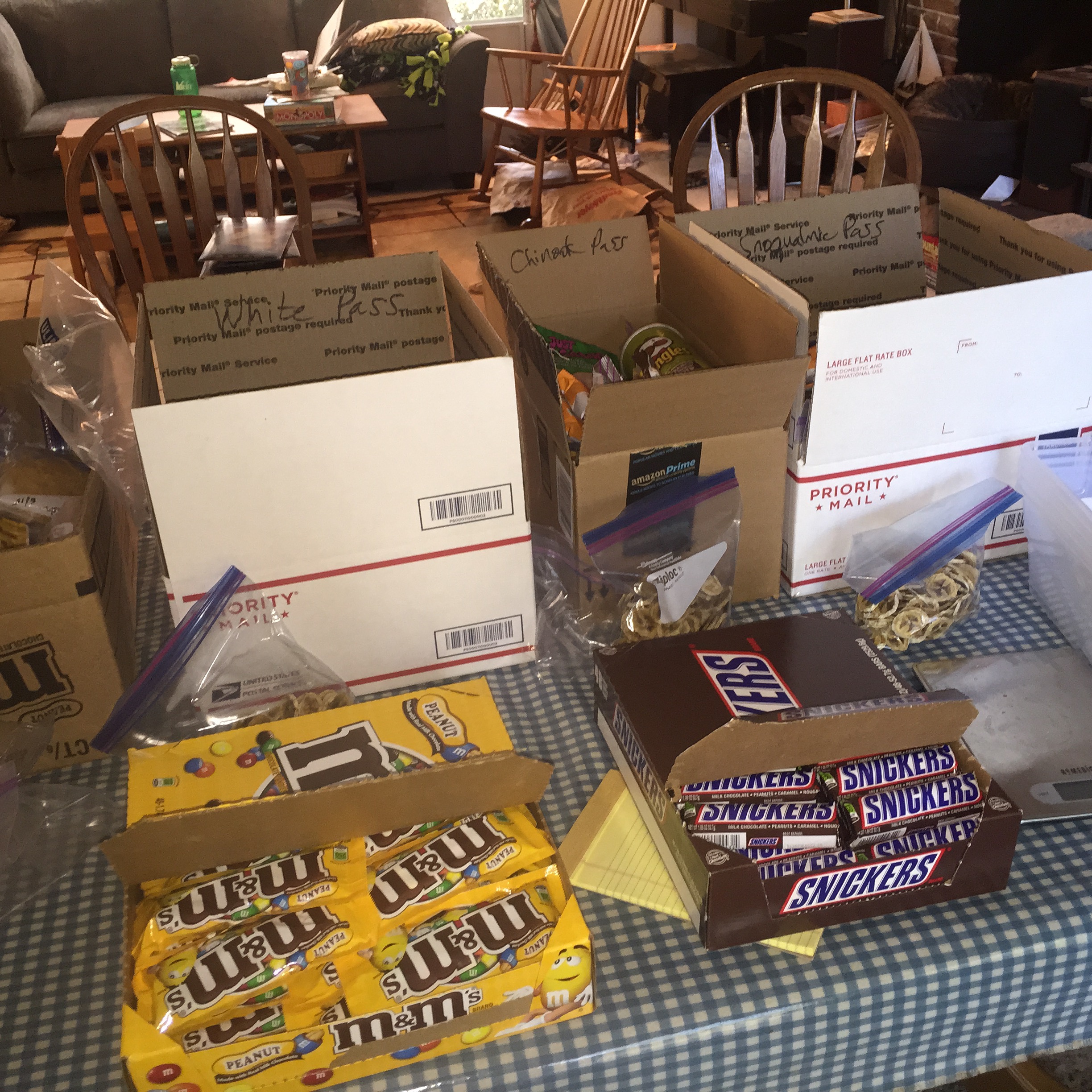
This is a great little campsite, because I get to chat with lots of people. I wouldn’t want it every night, but basically I’m a social creature on the trail. And the weather is nice, and Brendan has promised to show up at Chinook Pass on Tuesday, with some bagels and cream cheese. Mmmm!

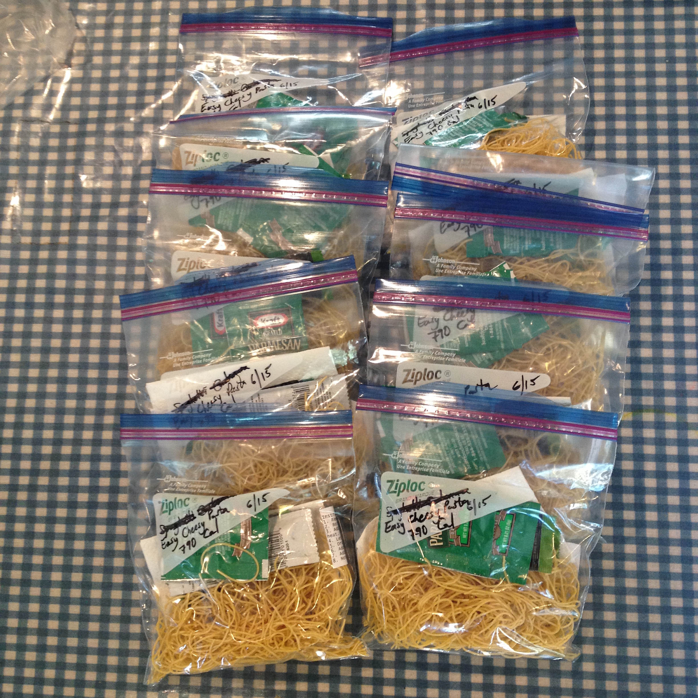
Time for dinner: beef stroganoff and apple pie!

Footnote: Thermo completed his thru hike in late August! After he got home, his daughter Yun Sol posted an update, and a video thank you from him. Many, many people responded with pictures of him on the trail, and he received many hundreds of likes. The community that gathered around this non-English-speaking gentleman is one of the great stories of the Trail.

Saturday, August 1 to Friday, August 7, 2015, Home: Impatience

Home

We were singularly unimpressed with the docs in Yakima, so after breakfast, we headed off to our urgent care. The doc on duty was a former section hiker, so he completely got how upset and worried I was.  I just wanted to know what it would take to get me back out to the mountains. His first thought was a stress fracture, but when he saw the pictures I took on Thursday night, with the very painful swelling and the redness and heat, he changed his diagnosis to cellulitis. I got an enormous shot of heavy duty antibiotics, a full course of more antibiotics, a follow-up appointment in five days, and the possibility of returning to the trail!

I hobbled my way back to the car, and we headed home. I was to keep my leg iced and elevated at all times, take those antibiotics religiously, and keep using the crutches.

Well, that’s what I did. It was too painful to put any weight on it until midday Monday; it was so swollen it felt like my skin was about to explode. I read books, and played a lot of Mahjongg, all the while trying not to think about having to cancel my trip.

2015-08-02 15.14.29
My life for a week

On Wednesday the 5th, Brendan drove me to my appointment.  I was more than a little nervous. But I was able to walk…I had ditched the crutches a couple of days prior.  So I nervously waited for the verdict…

…and got clearance to go!!!!!

2015-08-05 10.44.16

My plan was to keep icing and elevating until we left on Saturday. I also had to do short days between White and Chinook Passes, set bailout routes every ten miles, reevaluate at Chinook, and set bailouts between Chinook and Snoqualmie Pass every twenty miles.

The requirements were met, the bailout plan was in place, the pack was ready to go, and I hit the rack on Friday, August 7, beyond excited for my return.

Friday, July 31, 2015, Home: Wild Goose Chase

Home

Steve showed up first thing this morning, and bless his fuzzy little heart, he brought two enormous boxes of Top Pot donuts for all the hikers to share. Score!

Then we headed off to Yakima, to find an urgent care. The decent looking one refused to see me, because we didn’t have an appointment. The rinky-dink small town one did see me, and told me that I either had tendinitis or a stress fracture. They handed me some crutches and sent me home. No notice at all of the red, hot, swollen nature of my leg. Sigh.

Needless to say, I was rather dismayed by this turn of events, and it was a hard trip home. But I was totally pampered when I arrived, and spent the afternoon and evening on the couch.

Thursday, July 30, 2015, Mile 2292: White Pass Zero

At White Pass, Mile 2292

Got up this morning, and it was pretty clear that my leg wasn’t better. I went down to the store, had a heaping plate of biscuits and gravy, and decided to take a zero. A zero is when you stay two nights in one place, and have zero miles on the middle day. It gave me more time to organize my resupply, and to rest my leg. So after breakfast I went back up the (steep) stairs to the motel, and paid for another night.

2015-07-28 Kracker Barrel
Hanging out in front of the Kracker Barrel, with Caesar, Eastbound, and Fluffy Star. Photo credit: Teri Stalcup (Peanut).

I planned on hanging out at the store, and spending time napping and icing. I met Fluffy Star (aka Kathrin Schulte), a girl from Germany (who likes fluffy things, and stars). And I met Peanut (aka Teri Stalcup), and Goat.

After lunch, I bought another bag of ice and headed back to the motel room. A few hours of reading, napping, and icing later, I gave it up and had another enormous sub sandwich for dinner.

2015-07-29 19.58.16
Relaxing and putting the feet up

While I was down there, a woman named Peter Pan (aka Denise Lane) arrived. There were no more hotel rooms, as there was a large high school cross country camp going on. I offered to share mine, and so we got her situated. A couple of the guys wanted to share as well, but that was not where I needed to go.

I called Steve from the motel room, and said I thought I needed to see a doctor, but that I’d decide in the morning. A bit later, Denise (who is an acupuncturist from Oregon) was looking at my leg, and saying “Oh, that’s not good.” It was getting more red, hot and swollen by the hour, and I finally called Steve and said I needed to go to the doctor first thing on Friday 7/31.

2015-07-30 21.50.45
Nasty medical-type picture. This was the shot we shared with the doc.

So his plan was to arrive by nine, and we’d head into Yakima. I packed up my stuff, carefully so that everything was in its place, and not haphazardly like I didn’t care anymore. Because I do care, and I need to have hope.

Wednesday, July 29, 2015, Mile 2292: Kracker Barrel

At White Pass, Mile 2292

I got up at 5. Today’s goal, of course, was the Kracker Barrel, 13 miles and 2000 feet; my resupply box was there, and they closed in the late afternoon. I had to hit the trail early, as I knew I’d be in pain all the way.  My leg was *really* beginning to hurt. Well, actually, it has been hurting, since the second day. It’s my foot, ankle, and lower leg, getting worse. And worse. And worse. But my only choice has been to hike 40 miles on a bad leg.

It was time to quit my complaining, and head for White Pass. I refilled at the spring, which was maybe a quarter mile off trail, and I was off. It was a long day, but not without its eye candy.

2015-07-29 10.54.21
Mt. Rainier was becoming a much more frequent visitor

The trail went generally up, until the junction with the Shoe Lake Trail. I met the group of retirees there while I was having a snack break. They were going to take the alternate loop down to Shoe Lake. I stuck to the main PCT; there was a large talus slope, but after that the views were amazing.

2015-07-29 11.23.10
Shoe Lake, looking down from the main PCT

We met again at the junction, crested the ridge, and then traversed a stunning basin around Hogback Mountain and Hogback Ridge. Mt. Rainier showed her head above the ridge, and behind us was a beautiful view of the Goat Rocks.

2015-07-29 11.38.55
The trail around the basin, toward Hogback on the right
2015-07-29 11.39.08
One last view of the Goat Rocks, with the top of Mt. Adams just visible behind the ridge

Alas, with my reduced speed, they were soon out of sight. The trail began a long descent to Ginette Lake, where I grabbed a liter, and then switchbacked down to White Pass.

From the pass itself, it’s a half mile road walk west to the Kracker Barrel, home to resupply boxes, convenience store foods, a little bit of a menu, and all kinds of general goodness. I arrived about 4, only a little later than I thought I’d be.

My plan was to grab my resupply box and hit the trail. But I decided the heck with it: I’m going to get a room at the lodge, resupply, sleep late, and regroup in the morning. So I’ve got a nice Motel-6-esque room with kitchenette, which as far as I’m concerned is the Taj Mahal. I exploded my pack (yes, that is a phrase), and headed down to pick up my resupply.

2015-07-29 17.02.50
My first resupply box. Best part? More Snickers.
2015-07-29 17.51.57
And then, FOOD! For the record, that sandwich was huge.

I took the last bit of my dinner, went out, and camped on the bench along the front of the store. It’s the hiker hangout, and I got to chatting with a girl (whose name I can’t remember). Turns out she has shin splints, and was going to skip a SOBO section to head to Trout Lake. She’s getting compression sleeves, and is the second person who is using those for shin splints (Casey Burt being the other one).  We compared symptoms, and at this juncture it looks like it could be a leading candidate for me. It’s certainly not an uncommon injury among long distance hikers. Anyway, Steve will be bringing compression sleeves up with the Chinook Pass resupply (THANK YOU).

I’ve been having a great time at the Kracker Barrel so far; lots of giggles over this, that, and the other thing. Far more so than last year, I feel part of a community. And that’s good, because that’s one of the things I’ve been hoping to find.

Tuesday, July 28, 2015, Mile 2281: The Knife’s Edge

At Tieton Pass, Mile 2281

The wind kicked up quite a bit last night, enough so that I had to get up and snug down the tent. I didn’t know how it was over the ridge, but there’s no way I’d do the Knife’s Edge in that kind of wind. So I slept in a bit, to give the wind time to die down.

The other problem is that, well, there’s no water until after the Knife’s Edge. It’s a constant juggle of where I am, where I want to go, where the water is, and how my foot is doing.

So I got up, headed back down to the last water source, checked to see if there was a hose there that I dropped (yes, I retrieved it), and then headed out. Thank God, the wind died down. I was not about to do the Knife’s Edge with a howling crosswind. In talking with other hikers, it appears that the wind was local to the Cispus Drainage.

Before I left camp, I met a group of four retirees, out having a week’s worth of fun. We hit it off, and were leapfrogging throughout the morning. And I also met a group of three women from Tallahassee, and leapfrogged with them.

After descending into the drainage, it was (predictably) time to climb back up over the ridge, toward Snowgrass Flats. The weather was clear, and suddenly the eye candy began.

2015-07-28 09.51.25
Mt. St. Helens
2015-07-28 09.59.19
Mt. Adams
2015-07-28 10.11.49
I loved this little section of trail. Some wonderful souls spent a great deal of time putting this together.

And all of a sudden, blam! There was Mt. Adams, appearing for the first time, now that the weather had cleared. One of the women from Tallahassee took a very nice picture of me.

2015-07-28 11.04.42

It was time to work our way around the next ridge, which included a lunch stop with all of the aforementioned folks.

2015-07-28 12.21.45
From our lunch spot, we could see all three of the volcanoes: Adams, St. Helens, and Rainier peeking over the trail to the north. Also on the right is the very turquoise Goat Lake.

And then, The Decision. Do I do the traditional route, which traverses Packwood Glacier, or do I do the Old Snowy Alternate, which scrambles steeply up and down Old Snowy, a mountain with year round snow and glaciers, plus lots of steep scree slopes.

I chose to do the traditional route. The only problem with that is that, well, there’s a glacier, with a 30 degree slope and no safe runout. Fortunately, there were footprints kicked in, so with some solid concentration, I safely crossed. And with the exceptionally low snow pack this year, the actual glacier was only about a hundred feet across. But the rest of the traverse was over an enormous talus slope, with refrigerator-sized boulders.  With my unique version of visual perception, and the ongoing pain in my ankle, it was a hell of a time getting across; I had to cross a slope, descend (read butt scoot), cross the glacier, and then re-ascend.

2015-07-28 13.42.07
The north end of the talus slope, after the glacier and boulders

Once I crossed the slope, I headed up a ridge, and there was the Knife’s Edge!

2015-07-28 13.49.17
Almost there
2015-07-28 14.02.48
Mt. Rainier, the Knife’s Edge, and me

It’s really, really pretty, and it’s not as dangerous as some of the slopes I’ve been on over the years. There were a couple of spots which made me stop and think “Oh, how interesting!” but for the most part it wasn’t too big of a deal. I would definitely not want to be up there in the dark, wind, or fog.

2015-07-28 13.48.41

The trail winds along a very steep ridge, and around rocky knobs

2015-07-28 15.04.48

2015-07-28 15.39.00
Looking back south. Old Snowy and its glaciers are just right of center.

The trail gradually came off of the ridge, and then turned west at Elk Pass. It became a lovely meadow walk, heading gradually downhill, past the headwaters of several creeks, around Lutz Lake, and eventually to Tieton Pass.

2015-07-28 16.32.48
Standing guard over my trail. I just started talking to him, and eventually he scampered into the brush.

When I finally made it down the series of ridges, to Elk Pass, it became apparent that my lovely forward progress, which probably averaged around ½ mph with the scree, talus, and photo ops, needed some help…if I were to make White Pass by Wednesday. So I dropped it in low and added another four miles before reaching camp around 8PM.

At this point, each and every step was a pain…quite literally. By the time I reached camp at Tieton Pass, I was just DONE. I knew I needed to be up by 5, to make it up the next ridge and then down again, given my slow forward progress, and given the closing time of the store at White Pass, where my resupply was waiting. So I pounded a Snickers bar for dinner, and crawled into bed.

Footnote 1: The talus slope/glacier traverse is notorious. A PCTA (Pacific Crest Trail Association) work crew spent a week in 2013 putting the trail back into place. The pictures give a good sense of what that area looks like. I didn’t use my camera while on the slope. Take a look at the link…it’s pretty incredible.

Footnote 2: I would later learn that during the rather miserable rain/wind/snow/fog the last week of August, some of my fellow hikers ended up crawling the entire length of the Knife’s Edge.

Monday, July 27, 2015, Mile 2270: Entering the Goat Rocks

At a tributary of the Cispus River, Mile 2270

My goal today was to head over Cispus Pass, and around to the other side of the Cispus River drainage. I want to position myself for tomorrow, by camping near the last water supply until after the Knife’s Edge. Backpacking is like that: some days it’s all about positioning yourself for the next day (or the next, or the next).

Once again, I played leapfrog with the Scouts. I think the boys are beginning to warm up to me. I suppose being a woman backpacking solo is something they haven’t seen much. I’d like to make it a little more commonplace.

I was going slow today, as I’ve got something going on with my left ankle. Either that, or it’s my lower shin. I’m praying it will work out. So I’m doing the ice/ibuprofen thing, and elevating at night by putting my pack under the foot of my sleep pad.

I instantly forgot about my pesky ankle midafternoon, when I looked up and got my first eyeful of the Goat Rocks.

2015-07-27 15.28.10
A hint of things to come

I did make it over Cispus Pass, although with the ankle thing I was going pretty slowly. It’s absolutely gorgeous up there. The Goat Rocks area is an extinct volcano, so it’s got a different look than, say, the granite of the North Cascades.  On the runup to Cispus Pass, the right side of the trail is Yakama tribal lands; they request that you stay on trail at all times. The whole area is just mind-numbingly beautiful, and I could have stayed for hours.

2015-07-27 15.52.11

2015-07-27 16.01.54        2015-07-27 15.52.27

But it was getting late, and I needed to grab some water and set up camp, on the opposite side of the river drainage.

2015-07-27 16.37.30
Cresting the pass, and heading down into the basin
2015-07-27 17.01.13
It’s called the Goat Rocks for a reason
2015-07-27 17.34.15
The Cispus River

On the opposite side were a couple of smaller tributaries; I camped shortly after the second one. Tomorrow, the Knife’s Edge!

Sunday, July 26, 2015, Mile 2258: Friends

At a campsite with a small stream, Mile 2258

It rained most of the night, but quit early this morning, in time for me to break camp, including putting my rather damp tent into my pack. I chose not to take a pack cover this year, instead relying on the trash compactor bag to keep the critical items dry. It seems to be working okay, although it is rather awkward having a very wet pack. We’ll see how it goes; I can always ask Steve to bring up my pack cover at a resupply point.

My goal was about 11 miles and 1800 feet today, giving myself a short day to make sure I’m getting used to things and that my body is strengthening. I’m a pretty conservative hiker; I’m not 20 anymore, and I’ve got a family back home. I met my goal, and although I’m relatively out of shape, I’ll get back into the swing of things soon enough. I’m just incredibly grateful to be on the trail.

My plan is to hit the Knife’s Edge on Tuesday. I’ll have to check the water sources, because I’m not sure where I can refill before there; I think there’s a long dry stretch ahead. That’s part of the hike: planning water sources, destinations, and the calendar.

The Knife’s Edge is a stretch through the Goat Rocks Wilderness; it is literally a trail along a knife’s edge ridge, punctuated by small rocky knobs. I’ve been looking forward to hiking it.

Once I hit the trail, I began skirting an ancient lava flow. It was like a wall had stopped just short of the trail.

IMG_1256
Lava Flow

I played Hiker Tag with the Scouts all day. They’re separated into multiple groups, and the Scoutmaster isn’t too happy about that. It’s kind of interesting to watch, having BTDT.

At mile 2255, I left the Mt. Adams Wilderness and entered the Goat Rocks Wilderness.  I finally feel like I’m heading north.

IMG_1257
Northbound!

And wouldn’t you know, the weather is improving, and I’m getting to see sights like this.

IMG_1258
Trail towards the Goat Rocks

I camped in a large site, with room for multiple tents. While I was making my stroganoff, a SOBO (Southbound) party appeared. I immediately invited them to join me. I really enjoy spending time with other hikers. It’s an amazing community.

One of the girls in the party was, believe it or not, sporting a Venturing hat! I introduced myself, and long story short, she was Casey Burt, from a Bremerton crew, and past president of both the Chief Seattle and Western Region Area 1 Venturing Officer’s Association. We had missed meeting each other by probably a year, but we knew a ton of the same people, and it was like old home week! Her group consisted of sectioners and thrus; Casey is a SOBO thru. It was really awesome to hang out with other hikers.

IMG_1262
Chief Seattle Council Venturing, represent!

And speaking of sectioners and thrus, they aren’t exactly alike, but they are similar enough. A thru hiker is a person who completes the entire trail in a season, usually roughly April to late September. This is usually accomplished by hiking from the Mexican border to the Canadian border. Sometimes people will flip, usually in response to weather or a personal obligation. I met one couple who hiked from Campo, CA (at the border), to northern CA.  From there they went to a wedding in Washington, headed to the Canadian border, and began hiking south to their jump-off point.

A section hiker is just that: a person who hikes a section of the trail. This usually refers to a longer section, rather than a day hike or overnight; many people section for several years in order to complete the trail. The PCT is actually divided up into sections, and oftentimes section hikers will use these to determine their hike from year to year. For example, my hike last year consisted of 2/3 of Washington Section H; this year, I plan to finish H, and continue through I, J, K, and L.

While I was getting water that night, I met Shadowfax; he’s a Scottish NOBO (Northbound) thru, of retirement age. We had a delightful conversation.

Tomorrow, staging for the Knife’s Edge.

Footnotes: Casey continued south, and reached Campo on December 5! Her trail name is SAR (for Search and Rescue).

Shadowfax did indeed finish the trail, and was generally keeping the same pace as I did all the way north.

Saturday, July 25, 2015, Mile 2247: Heading North

At Lava Springs, Mile 2247

2015-07-25 11.33.50
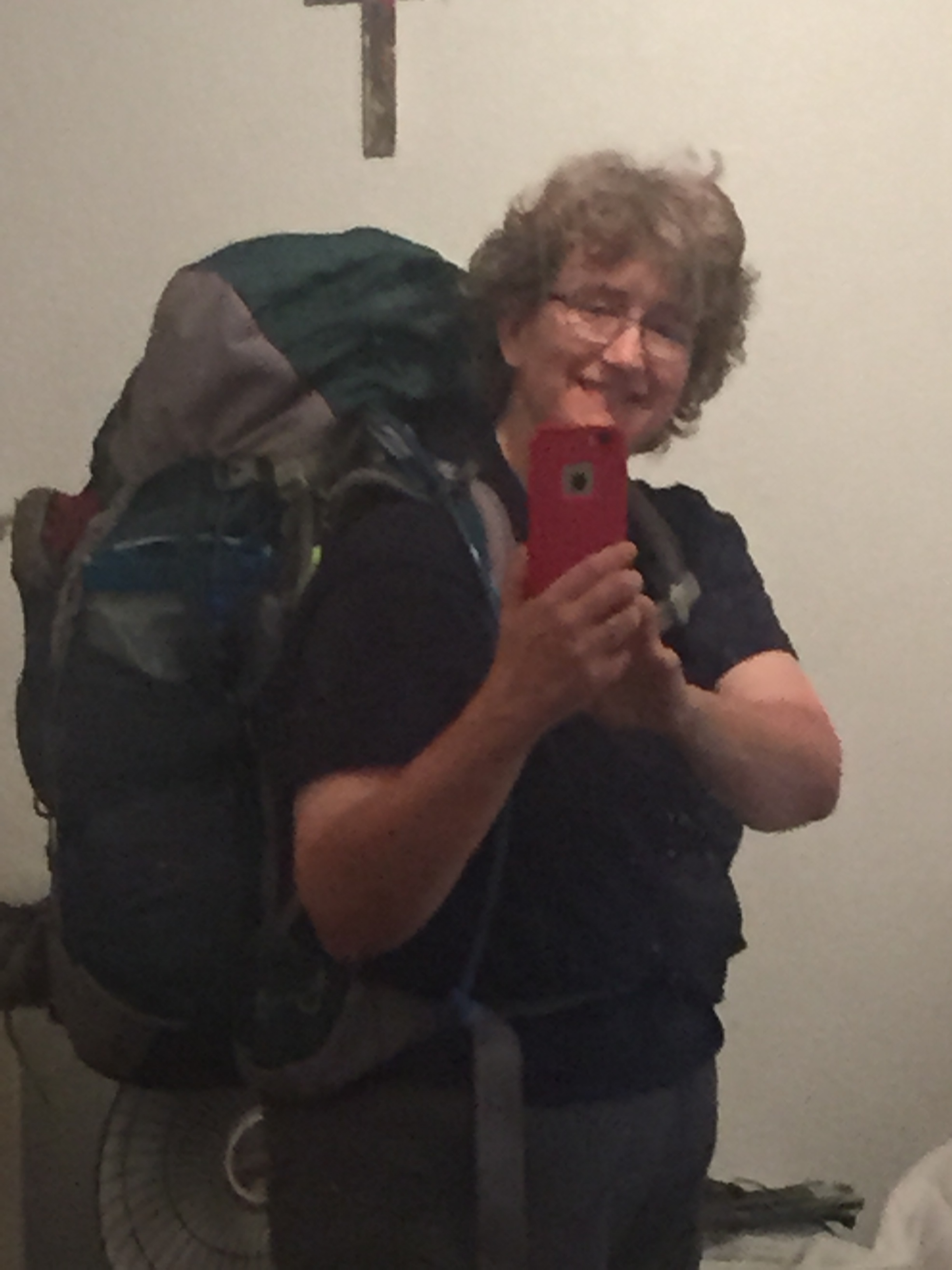
Today!!! I couldn’t believe it was finally here! We departed around 8:00, and arrived at the Divide Camp Trailhead at 9:30. After a quick picture, and goodbyes, I was OFF!!!

2015-07-25 11.32.11
The trail reopened south of Divide Camp, only the day before I began my hike

Divide Camp was open, finally. It had been closed for a couple of weeks, due to the Horseshoe/Mt. Adams Complex fire. That was now under control, and I headed up the newly opened trail. The rangers hadn’t been by to remove the tape, but that wasn’t a big deal…I was going north. I took a picture by my sign, and then I hit the trail, at PCT Mile 2239. Awesome!

Once I was on the trail, it started raining in earnest. I didn’t get my rainskirt out in time, so I got damper than I thought. This year, I’m hiking in a Purple Rain Adventure Skirt + compression shorts, and a Lightheart Gear sil nylon rainskirt. So far, through several day hikes, I like this combo better. I’m also using a Sierra Designs Ultralight Trench rain shell. It has a unique ventilation system, where the pack’s hip strap fastens underneath the jacket, by way of two flaps.

2015-07-25 12.02.17
Taken from a distance. The river was much wider than it appears here

The ford across Adams Creek was challenging; it was up to my knees, fast, and opaque with silt. It was hard to see the trail on the opposite bank, but I got some tips from a couple of SOBOs (southbound thru hikers or sectioners). Because of the silt, I extended my poles and used them as probes. Mission accomplished.

2015-07-25 13.05.17
Adams hiding behind the clouds. There’s also a dried up tarn in the foreground; water in general was extremely low

After Adams, the trail was more or less downhill.

I met a very large Scout troop from Yakima. The kids weren’t too sure about me, but the Scoutmasters were nice enough. And I met a group of about five NOBOs (northbounders), as well as a ranger, all at Killen Creek, while I was getting my water. I’m carrying a 2L Platypus bladder with an inline filter, a 1L collapsible bladder, and a 0.75L Smartwater bottle, for clean water and drinks. I usually only fill the 2L bladder, unless I have a dry stretch coming up. I’ve arranged the 2L bladder so that it can also be used as a gravity feed filter in camp.

Several miles on, I found a nice campsite at Lava Springs, which (speaking of water) is known to have some of the best water on the entire trail. I thought the Scouts would be here, as there’s plenty of room, but apparently they stopped at Muddy Fork. Tonight, that was fine with me, as I really wanted some quiet.

Friday, July 24, 2015, Home: Almost there

There is absolutely no way I could attempt this hike without Steve’s love and support. I am forever grateful

I can’t believe it. After months of thought and preparation, I hit the trail this weekend. My resupply boxes are ready, my food has been prepared (with a 1.5 pound per day average), my gear has been researched and purchased, and I’m ready to go.

Easy Cheesy Pasta, my simplest and favorite meal. 800 calories of carbs and fat...what's not to love?
Easy Cheesy Pasta, my simplest and favorite meal. 800 calories of carbs and fat…what’s not to love?
Peanut M&Ms and Snickers. It's what's for dinner. And breakfast. And lunch...
Peanut M&Ms and Snickers. It’s what’s for dinner. And breakfast. And lunch…
2015-07-18 18.42.08
Resupply boxes for White, Chinook, Snoqualmie, and Stevens passes, plus another for Stehekin, near the end of my hike.
2015-07-20 21.04.27
Done!
2015-07-23 20.45.01
The night before I left, the guys took me out to one of my favorite restaurants. They were their usual wacky selves.

And finally, today. After long goodbyes with the boys, Steve and I left for points south, around noon. Today’s destination was a B&B on the way to Mt. Adams.

Predictably, traffic was a nightmare, but we finally at the Shepherd’s Inn in Salkum. We checked in, and relaxed on the patio for a while, watching a couple of young fawns who pranced around like they owned the place.

2015-07-24 17.58.36

We went out for dinner, and then just put our feet up and watched a movie. Tomorrow…