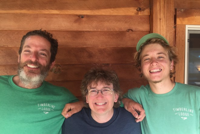
Steve and I returned home on Saturday the 3rd. It was terrific to see the boys! Booker (the dog) spent several days refusing to let me out of his sight.
By the numbers, this year’s hike was 400 miles between the two sections. Oregon was 240 miles and 35,000 feet of elevation gain. Washington was 160 miles and 36,000 feet gain. In other words, I did the same elevation change over 2/3 of the miles. There’s a reason the northernmost sections of Washington, especially Section K, are considered among the toughest on the entire trail.
In total, and most importantly to me, I have hiked the northernmost 750 miles of the PCT. I’m pretty happy about that.
As I promised my leg, I took it to the doctor the next morning. Long story short, we ruled out tendinitis and a stress fracture. I had a boot cast and crutches for ten days, antibiotics for cellulitis, a final diagnosis of shin splints, and a three month prescription for physical therapy. Oh yeah, and a whole lot of spoiling from my guys!
Really, I couldn’t care less about the injury. I’ll pound the physical therapy, and get this episode behind me. The most important thing to me is that I made it to Canada. I will never forget that moment. And, God willing, I’ll take that feeling with me, to my next hike on the PCT.
In August 2017, I returned to Oregon, this time heading southbound towards California. My adventures continue here.
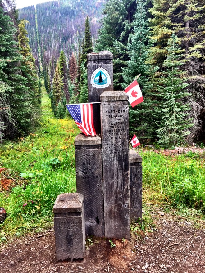
Today was the day I had dreamed about for two years. Monument 78 was in my sights.
The International Boundary Commission has placed roughly eight thousand monuments along the US-Canada border. The PCT’s Northern Terminus is right next to the silver Monument 78. And I was almost there.
I bundled up in all my layers. The couple in the next tentsite took a picture of me next to the U.S. BORDER sign. And I was off.
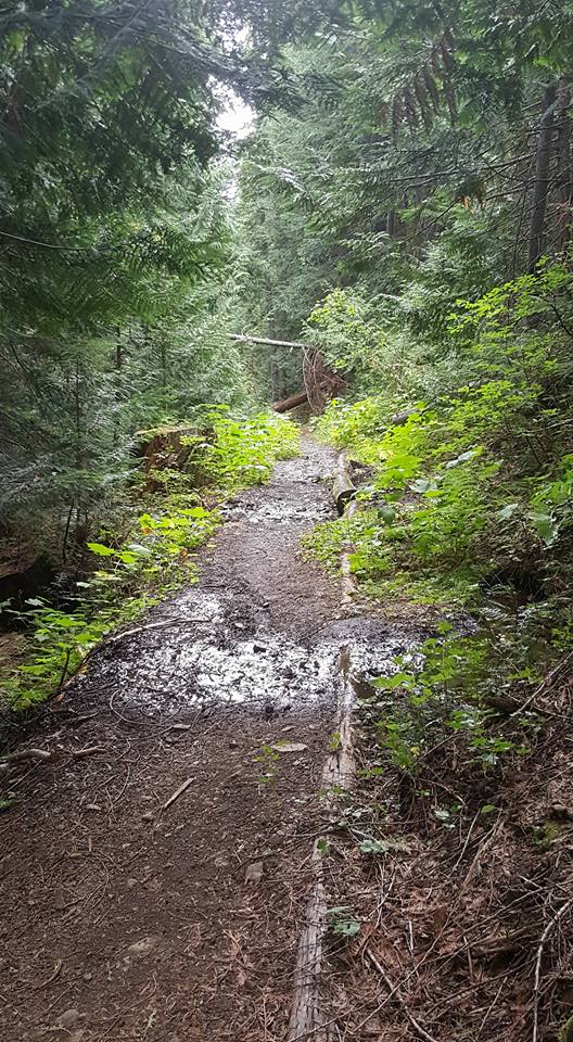
The next three miles of trail were unremarkable, except for perhaps twenty blowdowns. All those did was slow me down…I paid them no mind. I just kept walking.
And then, I rounded a corner, and saw a glint of silver between the trees. Monument 78!
A couple hundred yards later, and I was at the Northern Terminus. I hugged it tight. And I wept. And I didn’t stop for awhile.
The Northern TerminusMonument 78The American sideThe Canadian sideMy very favorite picture from the entire trail
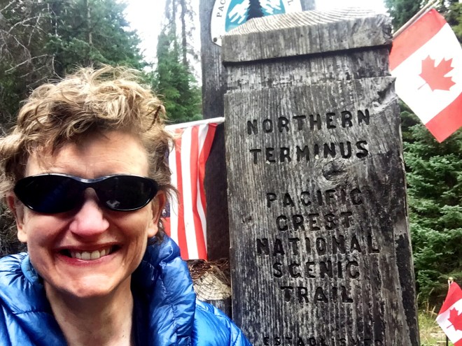
I had the clearing to myself. So I took some pictures, including a good selfie. And I read the trail register, which had lots of friends’ names in it. I signed my name, with a dedication.
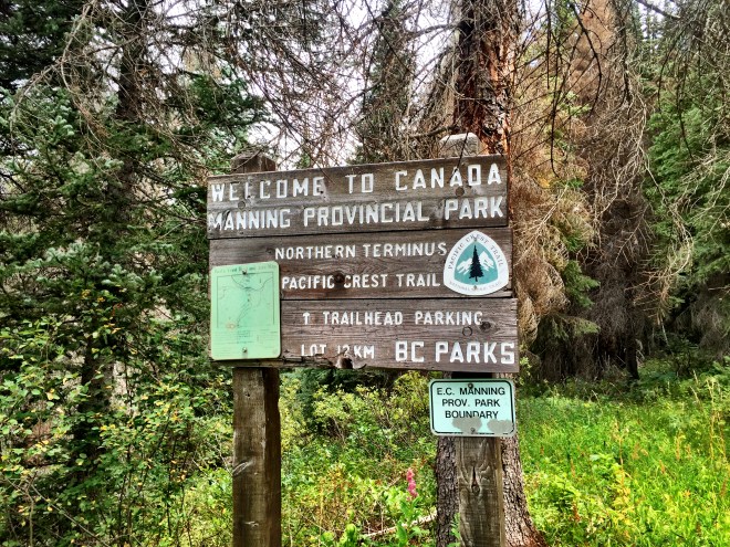
A goodbye to the Northern Terminus, and I shouldered my pack, stepping into Canada.
In the movies, a hiker would step into Canada and have a short walk downhill to the end of the trail. The PCT didn’t get the memo, and the trail goes up four miles before heading down another four. I turned on my music, planning to just jam out the last bit of the trail. Finally, the slope trended down, with a couple of forest road miles and a couple of flat trail miles. The forest road didn’t do my leg any favors, but I didn’t care at all.
At five miles, somebody had left a greeting for the hikers. I grinned all over.
I saw a German couple going uphill on the forest road, and they asked if I was Liz. I said yes, and did you see my husband? So I knew that he had been at the trailhead. I kept going.
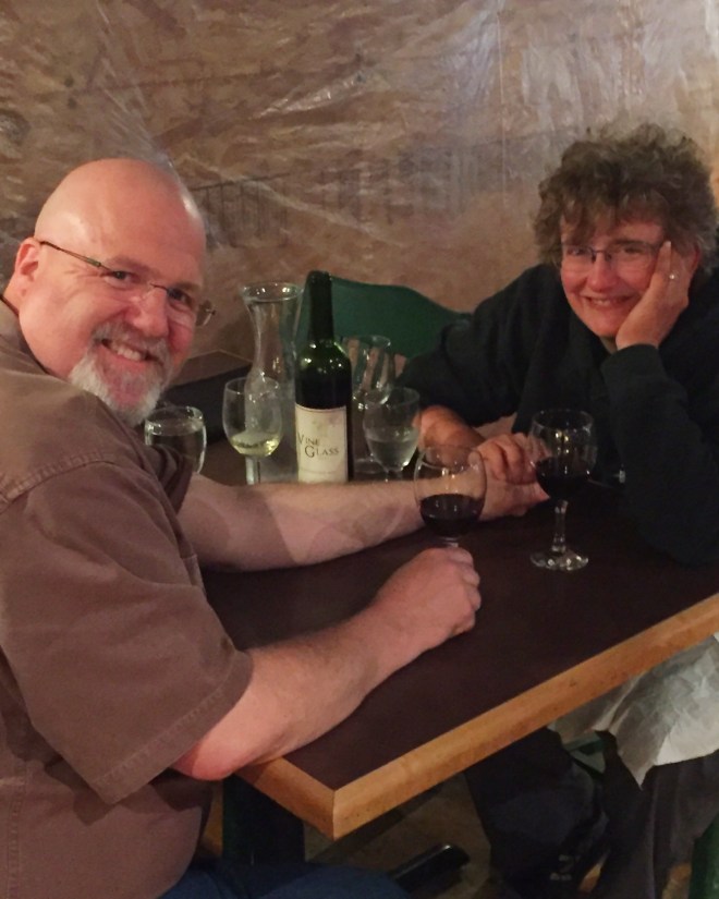
At 4:00, I hit the road. Steve wasn’t at the trailhead, so I hung a right and went down 1 km to Manning Park Resort. I made it as far as the lodge parking lot, and there he was. Again, I wept.
I signed the register at the front desk, and found a great note from Tim and Tyler. And I counted several other friends’ names. It was mighty cool to see.
Tonight’s agenda was bubbly, relaxation, and a nice dinner. And an incredible amount of gratitude, especially for Steve, without whose love and support I could never have completed my hike.
I got zero sleep last night. And when I say zero, I mean zero…no dozing, no nothing. I was going to get up at five and zoom ahead to Castle Pass 2647, which is a perfect spot for staging a border crossing. But by five I was completely zonked.
I finally got up at six and poured some coffee down my throat. Then I threw my gear in my pack, told Jessi that I was going to go for it, and planned on hiking to 2647, but 2643 was my backup. She gave me a hug and wished me good luck. I texted Steve too, telling him that I’d confirm midday whether I could make it to Manning Park on Friday afternoon.
Then I saddled up, wished everybody well, and split, at top speed.
A couple of miles in, I felt great relief. Like I said, the group of women was great…they had their own goals, their own modus operandi, and so on. It just didn’t mesh with my hike. And at this juncture, nearly 400 miles in, I wanted to finish on *my* terms.
I kept my pace up, and in a little while I stopped for water. While I was there, I met Last Call and Zinger, two women I’d met at Shrek’s, in Cascade Locks. They said they’d see me in Manning Park, which will be great.
As I was putting on my pack, the group arrived and started getting water. They asked how my leg was doing, and I said Great! And I smiled, wished them a good hike, and headed up the trail.
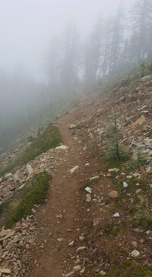
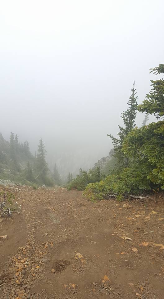
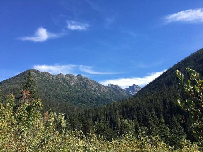
Today’s stretch was full of ridge walks, long traverses, gorgeous views, and alpine meadows. Unfortunately, it was also full of thick fog, ice cold rain, howling wind, and occasional snow. This is the second of two times I’ve been in the North Cascades, when snow has fallen at the end of August. Sigh. Anyway, it was miserable enough, and exposed enough, that even though I was cold, I couldn’t stop to add a layer. I did manage to text Steve; the miles were good enough that Friday was a go! And that added to my impetus to just keep walking.
There wasn’t even the temptation to stop and take a few pictures…there was nothing but fog. The pictures I’m using here are from Zen; he and Vanilla were right behind me on the trail, and managed to stop and get a few shots.
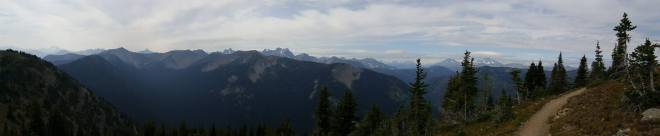
Panorama from before the storms set in
I plugged away over four passes, the largest of which was the Woody Pass area, about five miles long. This section kept wrapping around and climbing ridges. I really wanted views, but it was not to be.
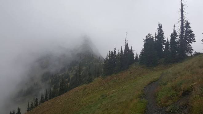
Actual view from on top of the ridge
With about three miles left, I dropped into the trees. It was more sheltered, but I was cold, and decided to keep plowing ahead. Just keep walking. Remember Billy Goat. Just keep walking.
Finally, I hit Castle Pass, said hi to the couple one tentsite over, tossed up my tent, climbed in, stripped out of the wet stuff, put on every available layer, and started pounding instant mashed potatoes and hot cocoa.
The rain kept falling, with occasional letups. I set my alarm for five, and crashed hard. On my terms.
This morning, I hiked out of the Guard Station, climbing the ridge to Slate Peak. This is the actual trailhead, and sports an old radio tower as well as the trail register.
Looking back towards Harts Pass
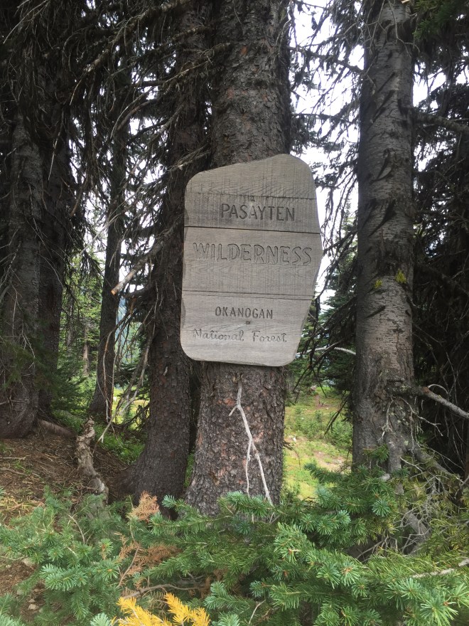
From there, I entered the Pasayten Wilderness: the last National Forest boundary before the border.
Less than a mile later, I ran into two women leaving their campsite. I let them go first, but suddenly asked, “Jessi?” It was my friend! She had joined hiking forces with another woman (Denise), and we had a great reunion. Turns out Jessi has a faster pace, but prefers less miles in a day, which is how I caught up with her. We chatted for awhile, and then the two of them headed up the trail.
Jessi had mentioned that she and Denise were hiking with an informal group. I met up with them further down the trail, at a lunch and water stop. There was also a group of day hikers, so it was quite the scene. I’m used to hiking solo, or perhaps hanging out briefly at a campsite with other hikers. This was a bit overwhelming.
My leg was giving me more grief, so my pace was slower. I focused on going forward, rather than stopping to look around. The clouds were thickening, so apparently I didn’t miss much. Keep walking.
I eventually caught up with the backpacking group at Shaw Creek 2630. They had decided to go to a large campsite just a mile up the trail, and I decided that that would work for me too. I got there late afternoon, and set up camp quickly against the coming rain.
I also messaged Steve a few times. I had planned on finishing on Friday 9/2, but I didn’t know what my pace would look like. So on the surface of things, it looked like it would be best if I stuck with the group and did things at their pace and with their priorities, to make sure that I actually made it. Their next day’s goal was 2643, which was quite a bit shy of what I wanted to do. They were going to take three days instead of two, and they were functioning differently than I did as a solo. Not bad, just different. And I wasn’t sure what to do.
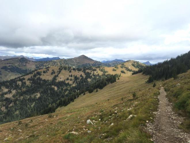
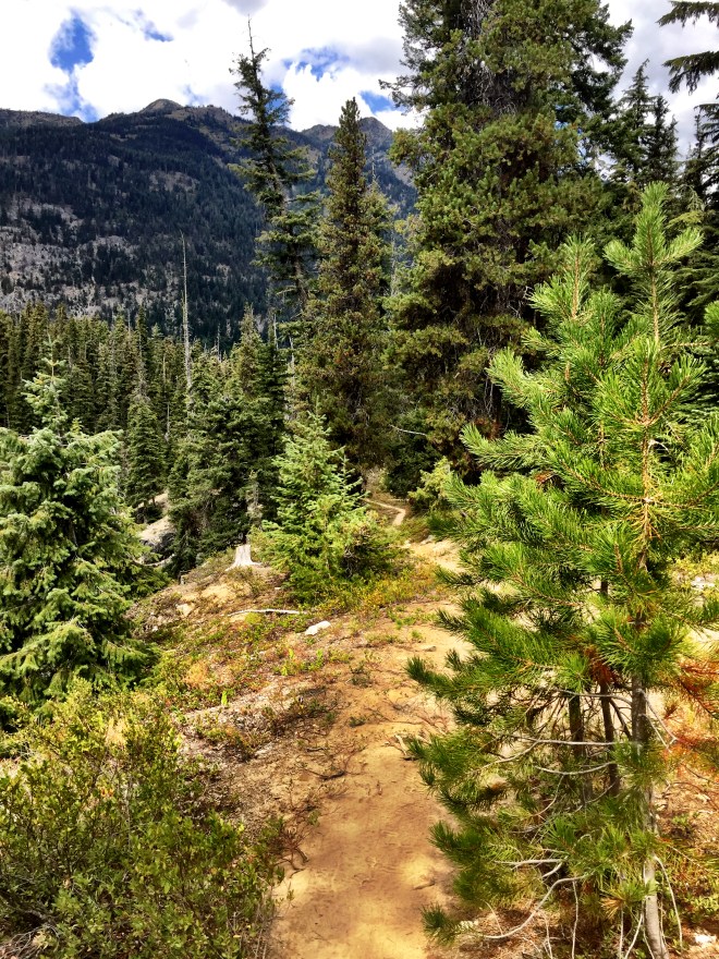
I hit the trail around 7:30 today. The first order of business was up. As I mentioned, the Scout troop had done this hike in 2010, but in reverse. There were a passel of switchbacks, and I remember thinking at the time that I’d hate to go up. Less of an issue in 2016, as I’d already had a few warmup miles. But it was still nice to get to the top, and, as I remembered, the views were stunning.
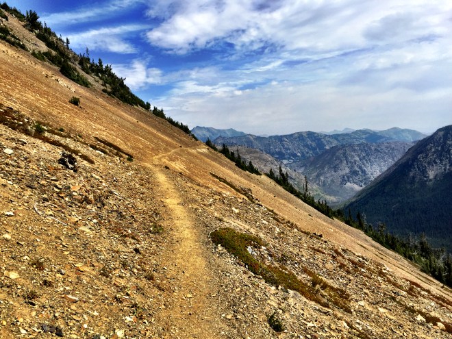
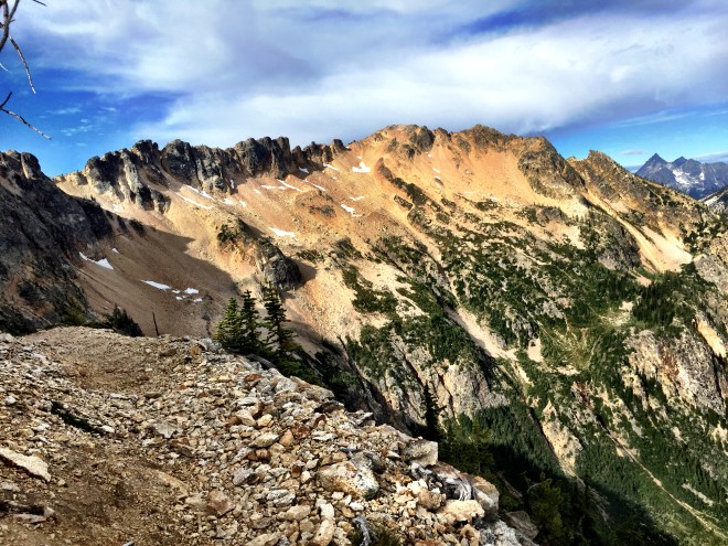
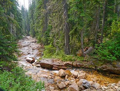
From Grasshopper Pass, the trail traverses very steep slopes for about ten miles. Some of the trail had slumped, which made for an interesting few feet here and there. But it was gorgeous, and I stopped every so often to look up from the trail and take in the vistas.
I needed to stop for water, and there was a spring at Glacier Pass 2610. It’s maybe 100 vertical feet below a large campsite, so it took a bit to find. Another hiker pointed the way, and soon I found myself in a squishy little meadow, gathering ice cold water. Score!
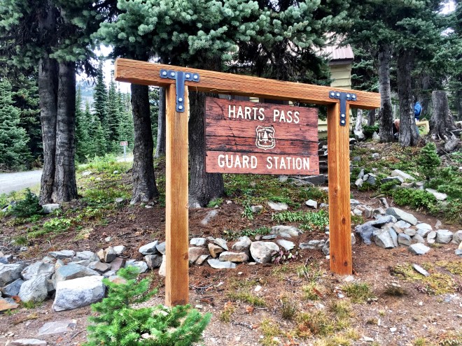
The trail wound some more, passing uphill of Meadows Campground, and then around the ridge to Harts Pass Guard Station 2620. The ranger wasn’t on duty, but there was one thru at the site: Jan, from Cologne. He was happily munching dinner, and so I signed the register and went to chat for a bit. Turns out he has wretched blisters, making each step a painful challenge. I told him about my leg, and we both agreed that we could pound out thirty miles to the border, plus eight into Manning Park, BC, which is the actual end of the trail.
I had had a meaningful conversation with my leg. It was hurting more, so I pointed out that I was *not* going to brook any nonsense, nor listen to any complaints, for the next thirty eight miles. Its sorry self had carried me twenty five miles since whatever the injury was, and it had damned well wait until Manning Park before I listened to it. Thirty plus eight.
Jan took off, wanting more miles before dark. I paid for a campsite next to the guard station (and next to an Actual Privy). The Actual Privy had a great sign, which read PCT Hikers Only: Please Leave Your Hiker Trash in the Blue Bin. All Else Please Pack Out. The amusing, and no doubt intentional thing was that, within the hiking community, long distance hikers are collectively referred to as hiker trash. It’s less of a commentary on our worth, and much more of a commentary on our appearance.
Shortly after I set up camp, I had company. Speedy Squirrel, an AT thru, was bringing up some flippers. Fox had already done the Harts to the border section, so he was heading south in the morning. Zen and Vanilla needed to go north to tag the border, and then they were going to decide what to do. They flipped up from northern California, so they’ve got a thousand+ miles remaining.
Fox, Zen, and Vanilla sat down with me at the large Actual Picnic Table, and began sorting their resupplies. I made my dinner, and we hung out for the evening.
Today’s goal was Brush Creek 2607. This was part of our Scout troop’s 2010 backpacking trip; the uphill section will be tomorrow.
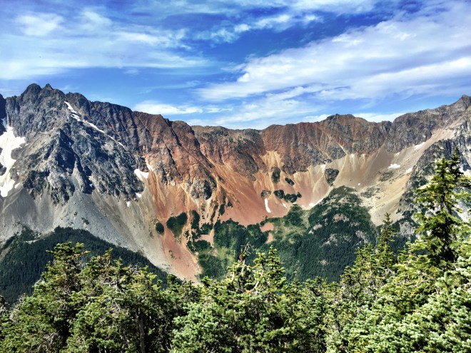
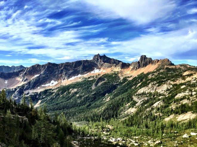
Just 1.5 miles up the trail from my campsite was Cutthroat Pass 2594. The views were stunning, and I had more Ansel Adams moments. Wow!
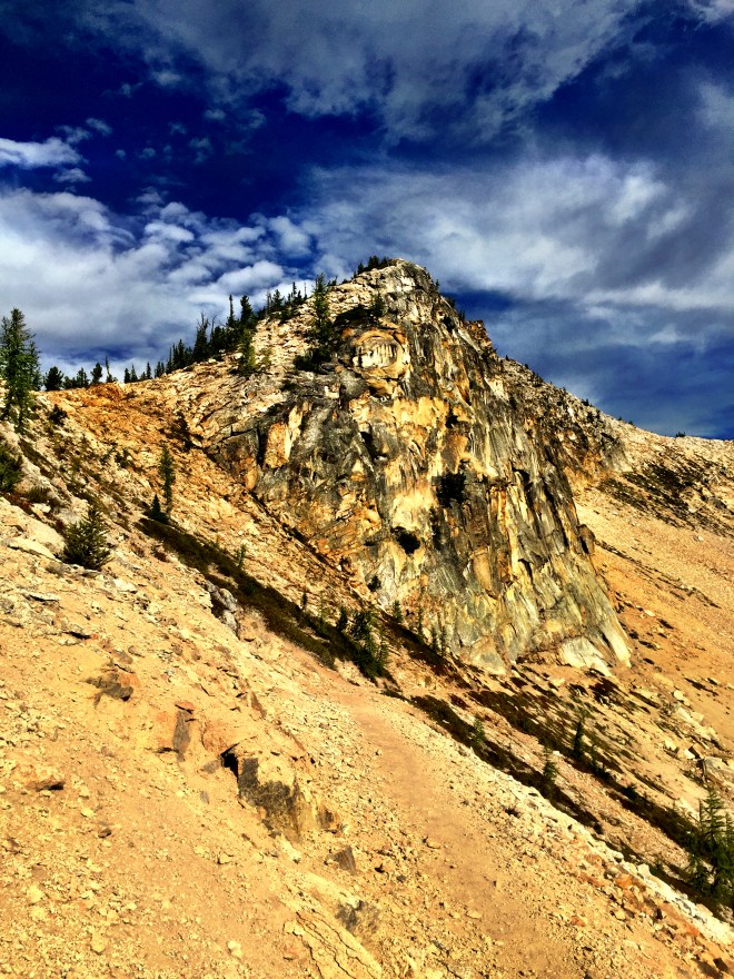
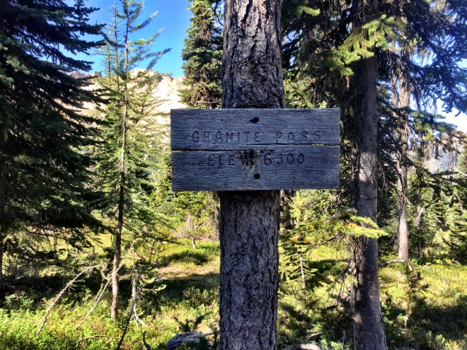
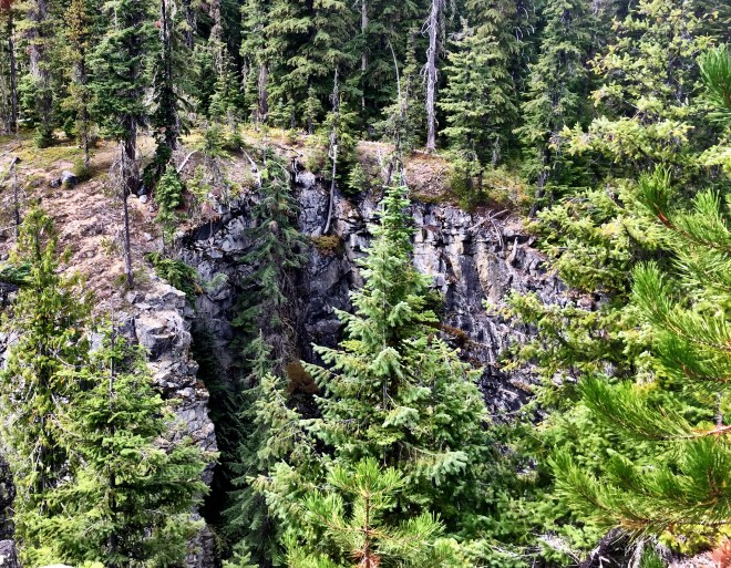
From there, it’s a 2.5 mile traverse across steep slopes, hundreds or more feet high, to Granite Pass 2596. This is pretty typical for the North Cascades, and slumped portions made me a titch nervous. But I met a USFS crew out working on the trail, and as I found out later, a North 350 Blades crew had just completed a full week on this section. The North 350 Blades are one of a handful of volunteer trail maintenance groups, and they have my undying gratitude.
It’s near impossible to see the trail on the traverse, even after the work parties had been through. This is why trail maintenance is critical
During the descent from Cutthroat to Granite, my right shin started hurting. I had been using a short step, to prevent skids on the scree (small rocks), but I think I tweaked something in the process. It’s mostly sore on the downhills, with the uphills being fine. I popped some Vitamin I, and I’ll have to watch it as I continue.
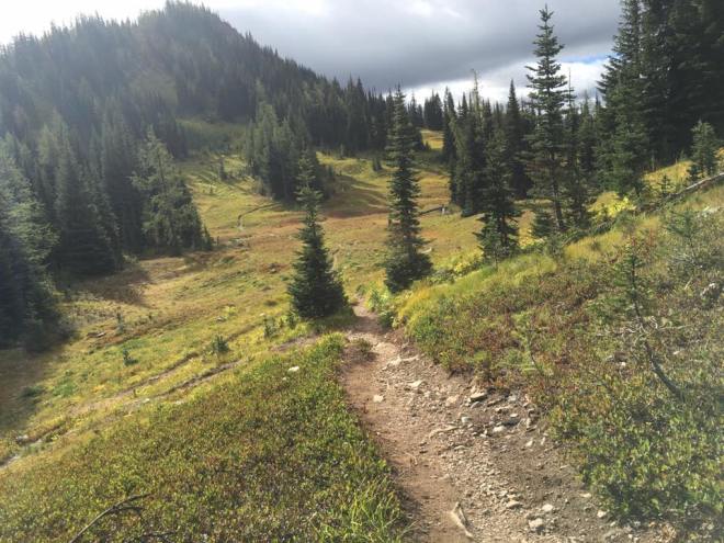
The trail continued on, but it was no longer as steep. It wound around a ridge and landed in the trees again.
Just after Methow Pass, I hit mile 2600! As I’ve mentioned, hikers will often mark big milestones on the trail. Sure enough, there was a 2600 scratched into the dirt. Getting close!
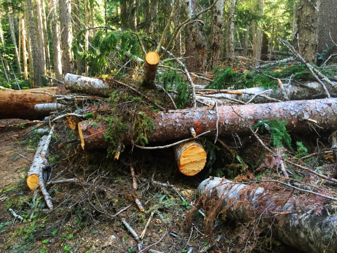
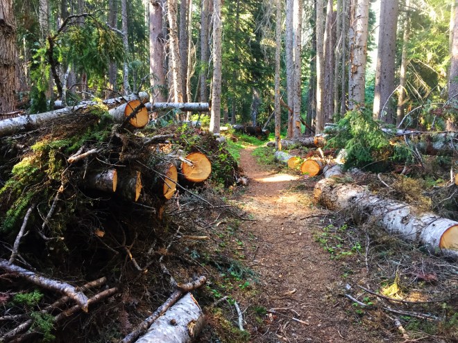
And speaking of trail crews, there has been a *lot* of work in Section L. In June, there was a work crew logging out just north of Rainy Pass. In just half a mile, a volunteer crew from North 350 Blades cleared 41 blowdowns. And north of that, they could walk from log to log to log, without ever touching the ground. I encounter their work every day, and I am incredibly grateful.
There was lots of overgrowth in the Brush Creek area…go figure. I reached the campsite around six, and over the next couple of hours probably ten hikers showed up. They ended up camping in tight quarters, slinging hammocks wherever, and just plain throwing down tents. I had a decent tent site, but there was only one barely flat spot.
The other hikers were headed in both directions. I talked with one who was flipping: jumping ahead to a section with the plan of hiking back to the jumpoff point. As a Washingtonian who is passing familiar with the weather and terrain around here, I tell flippers that they’re really doing a wise thing. Unless you’ve got a relatively quick pace, you won’t reach Washington before September. And we’ve had nasty storms as early as mid-month. Case in point: in 2013, we had a storm with 6-ish feet of snow in the third week. But if a hiker is in, say, Northern California, and then they jump north to the border and go south, they skip that risk. When I talk with flippers about that, they look almost relieved, as if they feel like they have been cheating. Not a chance, in my (not so) humble opinion.
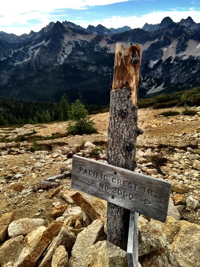
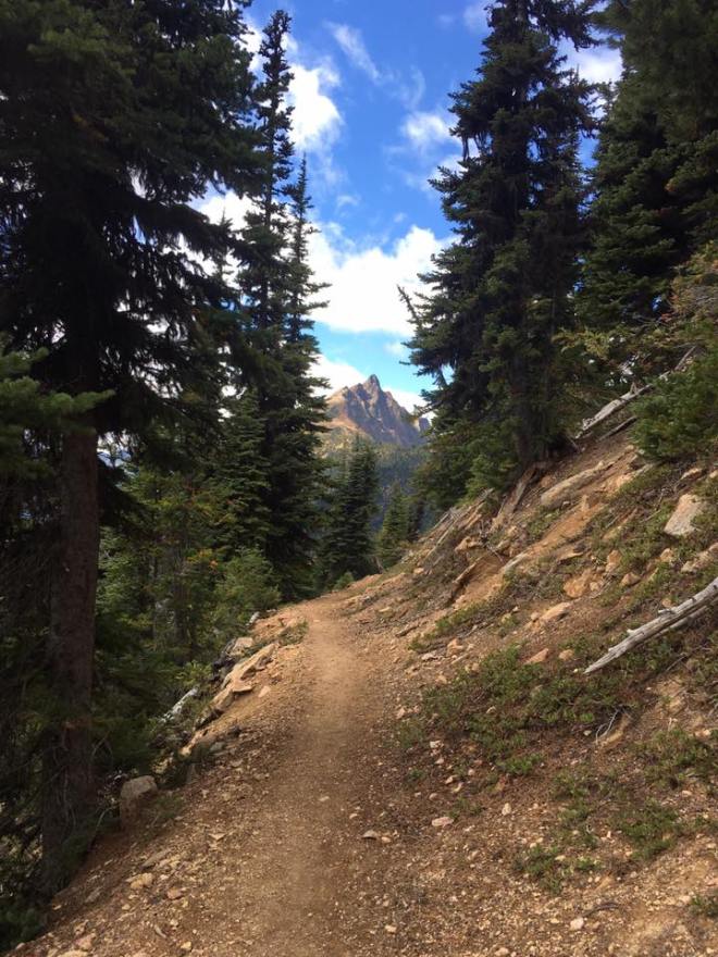
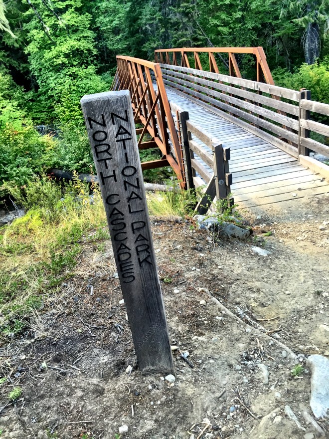
Today I finished Section K, and began hiking Section L…the last on the PCT. Excitement!
The trail headed mostly north, and then began a parallel course with Highway 20, the North Cascades Highway. It was pretty loud, and rather jarring; I hadn’t seen traffic in over a week.
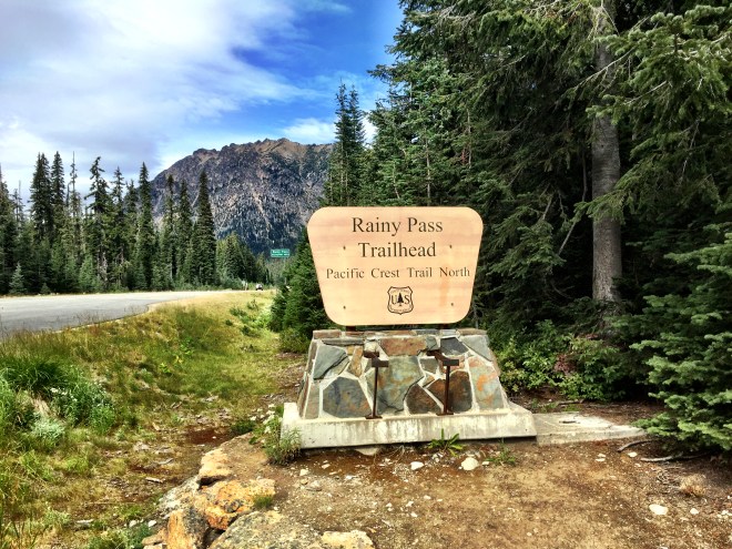
I finally reached Rainy Pass, crossed the highway, and BOOM! I was in Section L. I walked along the long trailhead parking lot, passing several groups of people who were finishing their day and weekend trips.
A group of people in their 30s were hanging out, drinking beer and talking about their multi-day trip. I said, “How’s it going?” They answered, “Great…how about you?”
My reply was, “Fantastic! I’m heading to Canada!”. And they responded with, “Whoa! Here, have a beer!” I responded enthusiastically, joined the circle, and quaffed an IPA. Yes!
So I have officially yogi’d my first beer (pats self on back). To yogi means to get food, drink, whatever, simply by virtue of what you’re doing or what you might need (or by semi-subtle begging). Think Yogi Bear, only with a pack.
After gratefully finishing my beer, I went to the trailhead. Somebody had left several dozen apples, clearly meant for PCT hikers. I grabbed a handful and loaded them into my pack. My plan was to have one a day over the next few days…and it was wonderful.
I signed the registry, with both my regular and trail names, and noticed that my friend Jessi had signed in just a few hours before. I was doubtful that I’d catch her, with my slower-than-average pace, but time would tell.
I had one more bit of yogi-ing today: a Swiss couple who shared not only a couple of treats from home, but an incredibly fresh chocolate chip cookie from a local bakery. Such goodness!
It’s been hard to read the water supply lately. The weather hasn’t been scorching hot, but there’s only been a bit of rain. Both of my PCT apps list seasonal streams, which may or may not be running. I need to bring about 2.5 L to any dry camp, with an absolute minimum of 1 L. This of course depends on the availability of the water immediately after the camp, plus the weather, distance, and elevation gain to the water. After you do this awhile, you get good at making educated guesses, but it’s not foolproof. So if you’re like me, and have a hard and fast minimum, you often end up schlepping more than you need.
Such was the case today. Porcupine Creek, two miles and 800 feet before my destination, was listed as the last reliable stream for many miles, including over two exposed passes with very steep traverses. I filled up with 4 L, knowing that I could share out the water if needed, but couldn’t risk doing the exposed areas while dehydrated.
Of course because I was prepared it was unnecessary. I showed up at camp with probably 1.5 L too much. Such is life.
I shared a camp with JIF. He’s in charge of trail maintenance in So Cal, and I met him in Stehekin. JIF stands for Joe’s Invisible Friend, Joe being Joe Anderson, a well-known trail angel in Californa. JIF had some great ideas he shared with me, including the trick of using a garbage bag to inflate a mattress. He said he’d had great luck with it, so I’m planning on trying it at home. He also gave me some excellent beta on the JMT, especially in terms of talus slopes. Next year’s proposed destination is the Sierra, so this was great information to have.
I packed up my stuff this morning, and headed down to the Lodge to wait for the bus. We all piled in, slightly cross-eyed from the food and relaxation of the previous day.
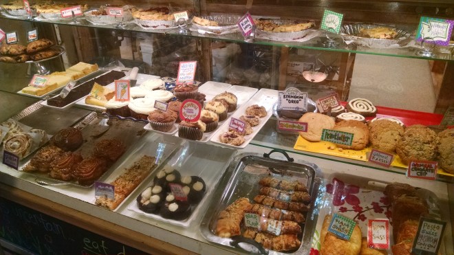
The bus driver always stops at the bakery for about fifteen minutes, on the first run upvalley. All the passengers get front-of-the-line privileges, so that we can grab whatever we want before we hit the trail. I snagged a giant ginger cookie (as big as my hand), a ham and cheese croissant (bigger than my hand and twice as thick), and a huge ham and cheese sub (as big as my forearm) . Turns out that all of this food lasted me a full day. Darn.
I decided to spend a few minutes at the trailhead updating my journal. I said goodbye to everyone, got big hugs from Tim and Tyler, and then I sat down to record my voice memo. That accomplished, I headed up the trail to begin my last section.
I was moving like a slug today. Might have been all that food I recently consumed. In thinking about it, I realized that my food consumption schedule was out of whack compared to what I was used to…to say nothing of quality, quantity, and type. I’m sure this will shake out in a day or so.
I passed through a couple of beautiful gorges, plus a reasonable amount of vertical. I came across Stoic, who had caught a later bus. He and I spent time getting water at Maple Creek, and of course I spent time falling into the water (sigh). It was warm enough that I dried quickly, and I said goodbye to him while making sure my gear was in order.
There are an abundance of black bears in this area. One of the hard and fast rules in North Cascades National Park is that you must secure your food and smellables (anything with a fragrance, like toothpaste and toiletries). The definition of “secure” varies throughout the park; the Thunder Creek area allows Ursacks, but tonight’s campsite requires the use of a bear wire.
I saw bear sign in a few places, including clawed trail signs, but I never saw nor heard a bear.
I reached the steep spur trail that led down to South Fork. It’s a huge area, with a horse camp hidden to one side, and two hiker sites much further down the spur. I met two hikers in my site, Mike and Sarah: he’s the superintendent for Death Valley National Monument, and she’s an interpretive ranger.
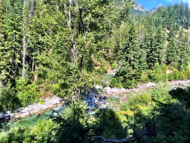
The view from the trail junctionBridge Creek
After getting my camp set up, I went down to Bridge Creek to get water. It was large enough that you’d have to think about a ford, but certainly not challenging at all at this time of year. I sat down on a rock and began to scoop water, when the rock shifted and I ended up in the drink again (sigh again). I finished my chores, brought the water back, and changed into my base layer before hanging up my wet stuff.
While I was enjoying my sub sandwich, another couple came along. They’re with the PCTA, and had been doing some trail maintenance. I gave them some solid beta on the thirty mile stretch of Section K, which was in desperate need of care.
They also said they’d seen Billy Goat, and gave a ride to him in Wenatchee. Apparently he’d finished at Stevens, and caught a ride east. His plan was to go to Wisconsin, and rack up some miles on the Ice Age Trail. And he’s going to be featured in an upcoming issue of Backpacker Magazine. Can’t wait to read it!
Pretty soon it was time to use the bear wire. What the fine folks in Stehekin had neglected to mention was that I needed to bring a 50 ft length of rope or paracord…the wire was only a wire. My only experience with a National Parks wire was one with multiple cables/carabiners, allowing you to hook up your food, pull it up, and then tie off the cable. Not so much here. Fortunately, Mike and Sarah had a large rope, and we clipped my Ursack to the pack they were using. Sigh. Knowledge is power.
Time to check my route for tomorrow, as I enter Section L!
Even though it was a zero, I got up early, in the name of cleanliness. There was no soap in the shower, but as I made my way back toward the lodge, I saw one of the local hikers from yesterday. He had extra soap and shampoo in his room at the lodge, and so I was able to take a ten minute shower. Woohoo…clean! Well, don’t look at my feet…
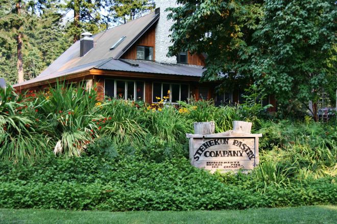
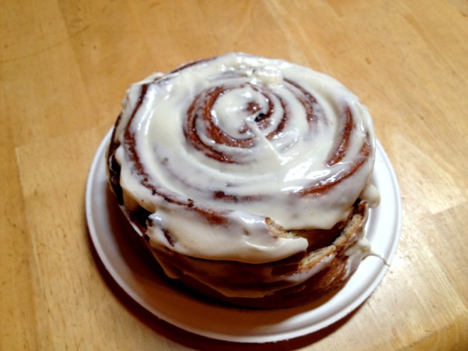
I got a load of clothes through the wash and into the dryer, and then ran to catch the bus to the Bakery. Ah, the Bakery. All scratch. A giant cinnamon roll, bigger than my hand and three inches thick (sans frosting, but with melted butter). A huge slice of quiche, with melt-in-your-mouth crust. A ginger cookie. A berry scone. Orange juice. Coffee. Nirvana. For the uninitiated, the Stehekin Pastry Company is listed as one of the top ten restaurants along any of the major trails in the country. If you’re in town, do not miss it.
That cinnamon roll is as big as a full sized dinner plate
Once we got back, I finished my laundry and hit the post office to grab my resupply. From there, I headed to the ranger station (Stehekin is in the North Cascades National Park). I needed to get reservations for a campsite for tomorrow, as I wouldn’t be able to make it out of the park before dark. Reservation secured, for South Fork (11 miles up), and it was back to camp.
I spent some quality time sorting through my resupply, and ended up with five days of food. I’ll get the sixth day tomorrow at the bakery, and that should be just enough to reach Manning Park on Friday (I normally pack a titch more food per day than I usually eat, so this would give me 6.5 days…plenty for my needs).
Once my pack was ready to go, I gathered up the extras. I had probably ¾ of the priority mail box full of hiker box goodies. I took the box down to the deck (outside of the restaurant), and set it on a table. Within seconds, the locusts descended: there were easily half a dozen hikers vying for space. I got incredulous looks” “You’re giving away M&Ms?” “This is seriously homemade?” and so on. You could almost hear the giant sucking sound as everything was scooped up.
XC, Green Bean, and Ethan doing their part to empty the box
There were several new hikers at the Lodge. Green Bean showed up; he’s the Israeli guy whom I met at Big Lake. Stoic, from Australia, had pitched his tent right behind mine. I also met Ethan, Google and XC. And I met a couple in their 60s who were doing a short section. He had a too-close encounter with one of the larger, nastier blowdowns I dealt with…close enough that it left him with a big gash on his forehead. After confirming that it would be okay, I dubbed him Blowdown. And he loved it.
The story of the afternoon was munchies, hanging out, and (for some) swimming off of the float plane dock. I spent most of the time at a table with Tim and Tyler, which was a blast. I’m really glad we met up again.
Meister Trekker, Rest Step, and Tye Bye!
Dinner tonight was smoked prime rib, but I couldn’t manage to swallow any more dessert.
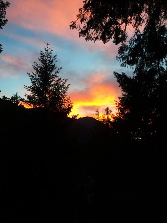
I went up to the campsite shortly after dinner, and got everything ready for tomorrow, in the midst of a glorious sunset. It’s been a blessed zero with good friends.
I got up at five this morning, as did Hoops. She was out before I was, but I hit the trail in short order. I dry camped last night, and picked up water a little ways up the trail this morning.
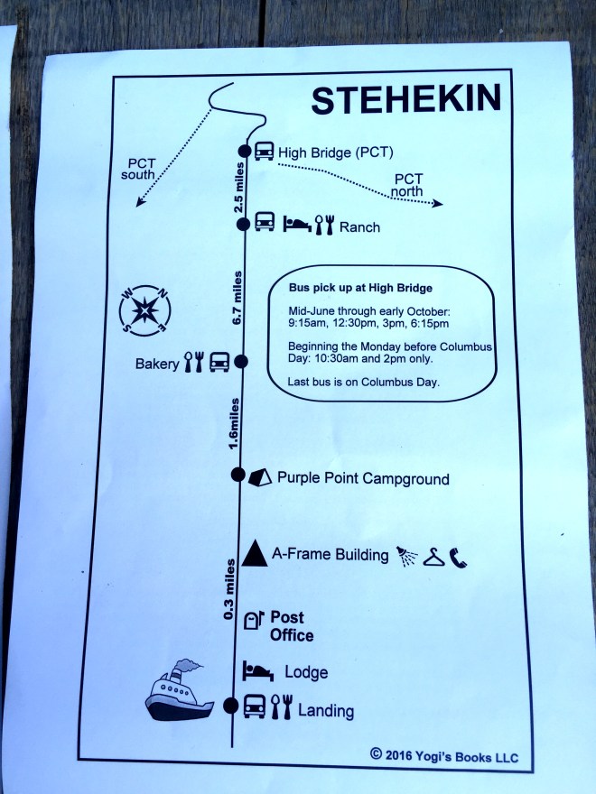
Today’s plan was 16 miles, with only 1500 gain, and making the 6:15 bus into Stehekin. The bus is at mile 2569. It runs upvalley and downvalley four times a day. High Bridge Ranger Station is at the uphill end, and Stehekin itself is eleven miles downhill. If I caught the final bus, I’d be able to eat at the lodge before pitching my tent at one of the two campsites in town.
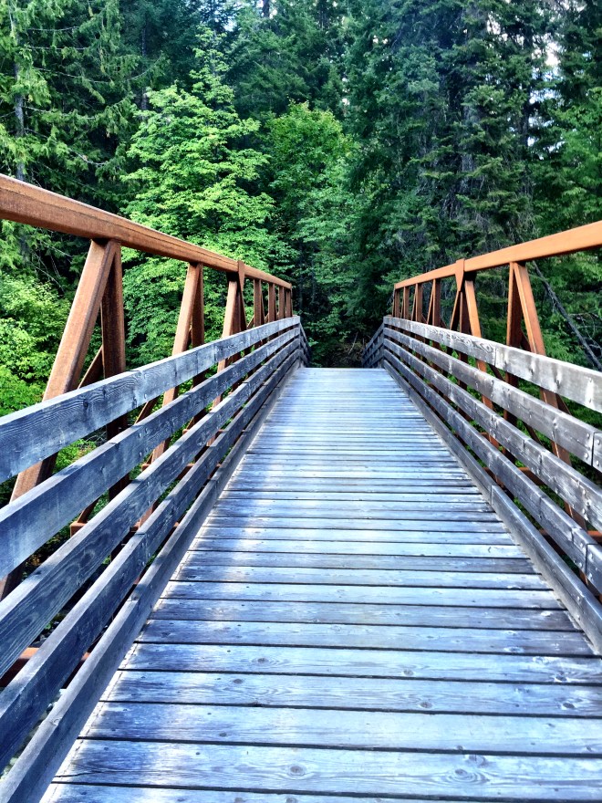
Just up the trail from my campsite, I came across this bridge. With careful footing, it was very crossable. I thought it was lovely.
I kept plugging along, with my “go fast” playlist on my phone. All day long I kept doing the math, calculating speed, distance, how much allotted time per break, and so on. It’s math. I do this.
I forded a very wide creek, at mile 2557. I met a couple of girls who told me that there were a pair of water shoes someone had left on the bank, and that I could use them. I smiled, and said I almost always ford. And that’s true: I have non-waterproof trail runners, which dry reasonably quickly. And with the support and tread of my shoes, fording is that much more stable. At any rate, I forded, and got my feet and legs rinsed off in the process. Win!
The last half of the day was spent following the Agnes Creek gorge. It was stunning, with lots of east-of-the-crest flora. I am very partial to the ponderosa pine, and stopped more than a few times to bury my nose in the vanilla-scented bark.
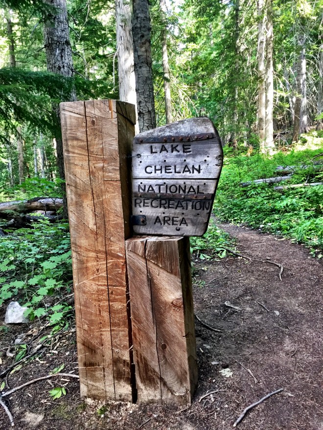
Around four it was clear that I *was* going to make it, and ahead of time. Woohoo! I entered the Lake Chelan Recreation Area, and then the North Cascades National Park. Almost there!
As I pushed my way up the final hill, I heard “I know you!” and stopped. Turns out it was Tim and his son Tyler, whom I met at Big Lake! They had picked up a resupply (sharing beef sticks with me), and spent the night at the cove on my first night there. We had hit it off very well in Oregon, and it was great to see them! They had picked up trail names: Tim was now Meister Trekker, and Tyler was now Tye Bye.
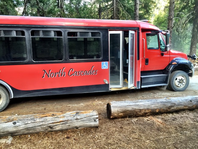
The bus stop at High BridgeOur chariot arrives!
The bus pulled up a little after six, and we climbed aboard. It was me, Tim and Tyler, Peter Pan (a sectioner prepping for next year’s thru), and a few local hikers who were spending the night in Stehekin before catching the boat.
We were dropped off right in front of the Lodge, stopped at the store to get quarters for the shower and laundry, and found our way to the restaurant. Food! Real Food! Cooked and Everything!
But the best part was the long table full of hikers, and a handful of voices calling “Rest Step!” “Rest Step’s here!” I was grinning all over, surrounded by my peeps. Life is good.
In this wonderful picture (with a few odd reflections), we have Papa Razzi, Hobbit, Six Paws, Wildfire, Tye Bye, Rest Step, Meister Trekker, Hot Potato, Matt (newly named Lifesaver), Shower, and Peter Pan.
One ribeye steak, a huge salad, and a mountain of homemade ice cream later, we grabbed our gear and headed up to the overflow campsite. I hit the rack as soon as I could, because I want to grab a shower and do laundry before I catch the 8:15 bus to the bakery. And I canNOT wait.