My First Five Hikes

It’s been a handful of years since I first stepped onto the trail, and many friends have been curious about my hikes. So here they are, in one convenient location. You can watch me grow as a hiker, see what I’ve learned not to do, and hopefully experience the beauty that is the PCT. Welcome to my world!

Why the Pacific Crest Trail?

2014: Cascade Locks to Mt. Adams

2015: Mt. Adams to Glacier Peak

2016: Willamette Pass to Cascade Locks, and Glacier Peak to Manning Park, BC

2017: Willamette Pass to Southern Oregon

2018: Crater Lake, and Southern Oregon to the Klamath River Basin

My PCT Packing List

I gave a Backpacking and Camping for Women presentation in 2020, for the Chief Seattle Council (BSA) Program and Training Conference. As part of the class, I shared my packing list. Many folks requested the list, so I’m including it here. Use it as a starting point for your own gear-gathering journey. If you’d like to share, please attribute it to me, and link back to my blog. Enjoy!

Epilogue

I did it. I had three goals for this summer, and thank God, I was able to meet every one.

I met some awesome people, and got to experience some beautiful places.

I fought through smoke, asthma, and fatigue.

I had very little injury.

I learned a lot about myself.

By the numbers, I hiked 138 miles. I completed both Oregon Section C and California Section R.

I’ve completed the entire state of Oregon, and there is a new tat in my future.

I’ve completed my first thousand miles on the PCT. I’m pretty proud of that as well.

Most of all, I’m grateful to Steve, and to the boys, for their support and their belief in me, as I’ve pursued this crazy dream.

I don’t know what the future will hold, but I do know that, as I’ve hiked down the trail, Steve’s love has been the single most important thing to me. It doesn’t get any better than that.

August 8, 2018: The Last Chapter

Home

I got up at six, to make sure and catch the bus. The café didn’t open until after we left, so after I’d packed up I ran over to the store and grabbed a bite.

UFOFE8610.JPG
Looking down the highway while waiting for the bus

Simon and Petra were waiting at the bus stop. We debriefed a bit, both about our hike and about Seiad Valley. And we sat together on the bus, so that we could talk some more. I really hope we can connect on FB.

The ride was about 90 minutes long, and included a quick break halfway through. The route runs 70 miles from Happy Camp to Yreka, along the Klamath River. And the bus only runs on Tuesdays and Fridays, which was why I needed to get down the road on Monday.

96_e_siskiyou_2.jpg

There was no signal along the river, so I didn’t have an address for the motel where I would be meeting Steve. I asked the driver, and he talked it over with two local women, and then he ended up just driving down the road until we found the place. I gave Simon and Petra a hug, and wished them well. Then I grabbed my pack, and headed to the motel.

The room was bare bones, but comfy. I was still slightly clean from the shower at Seiad Valley, so I crashed on the bed, almost instantly. Steve had messaged me with an ETA, and I had a couple of hours to snooze before I grabbed a shower.

Then there was a knock on the door, and my favorite person in the world walked in. Tears ensued. I was so grateful that he drove down to pick me up!

We headed out for lunch, at a place that has 24-hour breakfast. I had a platter of French toast, a 3-egg veggie omelette, a giant biscuit, a fruit bowl, two enormous glasses of OJ, and endless mugs of coffee. Such is hiker hunger. And then, three hours later, I had a steak dinner.

In the morning, we grabbed coffee, and then started north. I debriefed for awhile, watched as we passed Callahan’s, and then fell asleep until we got lunch in central Oregon. Steve kept driving, solo, and we reached home in the early evening.

It was SO good to see my guys. I was still grubby…three or four showers later I would be clean…and it was a little strange to be in the land of creature comforts, but I was mighty happy to be home, where I belong.


August 6, 2018: Downhill to the Finish Line

At Seiad Valley, Mile 1655.9

The plan today was to reach Seiad before the café closed at 2:00. Sometimes, it’s all about the food, and this was one of those days.

TCWNE4364

I got up before dawn, and before the rest of the hiker trash, and was out the door in record time. I stopped for a minute, before heading down the road, because I was well and truly leaving the trail, at least for this year. The tears flowed, the accomplishments overwhelmed me, and I said goodbye to my beloved trail. For now.

To my complete surprise, Steve messaged me on my inReach. Not that he doesn’t do that, because I hear from him every day or so, but the topic of this message blew me away. He’s driving to Yreka to pick me up! For those of you playing along at home, that’s at least 9 hours of driving! He decided to do this because the bus and train systems would have taken me up to 48 hours to get home. So he will be meeting me in Yreka on Tuesday afternoon, and we’ll head north on Wednesday morning!

I turned on my music, and went downhill, in a much better mood. The first part of today’s journey, maybe half, is a hard pan forest road. Eventually, it turns into a very rural paved road, and gradually gets more and more busy. I didn’t have a precise map, but I did have GPS, which gave me a rough idea of how long the road was. I also talked with other hikers, and that helped me figure things out.

At the top, I felt like a poser, taking the road, even though it absolutely made sense. But there were a couple of dozen hikers going uphill, so I didn’t feel so alone.

My feet were hurting more and more. I had tweaked my heel a few days prior, and it tended to swell (nights were especially bad), but I kept plugging along.  Once I hit the paved road, I met several non-hikers along the way, and they cheered me on.

Shortly after noon, I reached Seiad Valley.

seiad

The “town”, if you will, is just a few buildings. I went to the main building, which houses the café, store, and post office, and I added my pack to the line outside. Then, it was time for that food!

Seiad Store Backpacks

Chocolate banana milkshake, a giant mushroom and Swiss burger, a huge soda, and I was in hog heaven. They even had a small charging station, and I added some juice to my battery.

KUJJE6417.JPG

The one thing I didn’t see was the Pancake Challenge. There was a debris field left over from a guy who had tried, unsuccessfully. His compatriots were making short work of the leftovers.

Seiad Cafe sign

The Pancake Challenge is one of a handful of food challenges along the PCT. The rules are all the same: eat some ungodly amount of food in a set time, and your food is free. I’d rather just pay, but a lot of 20-something guys can’t resist the siren song.

In Seiad Valley, the challenge is to eat five pancakes in two hours. However, those aren’t just ordinary pancakes. They are bigger than dinner plates, and an inch thick. Total weight is five pounds. According to the café owner, of all the hundreds of hopefuls, only four have actually succeeded. Like I said, I’ll just pay.

When I finished my non-challenge-burger, I went next door (the other side of the building), and claimed my resupply. Obviously, I didn’t need it, so I just had it returned home. I bought my “I Walked to Seiad Valley on the PCT” shirt, and then headed next store to the Mid River RV park, to settle into my in-town routine.

Mid River Sign

First stop was the office. Bruce, the owner of the park, wasn’t back from his errands in Yreka, but I kicked back and caught up on Facebook and email until he returned.

Bruce is originally from Lynnwood, so it was old home week. He explained the rules. $15 got me a camping spot, a shower, soap, shampoo, the use of a towel, laundry detergent, and places to relax both inside and out. Because he had to water the grass during the day, we couldn’t set up our tents until after six. That was a little inconvenient, but it was a small price to pay.

I changed into my wash-in-the-shower clothes, threw everything else into the laundry, and spent a long time under the hot water. Then it was time to relax in the office/hiker lounge. It was smoky and hot outside, but the lounge area was dark and cool, with a couple of huge fans going.

The wifi password was “NOMONUMENT!” And Bruce was eager to explain why. The far northern reaches of California are the home to the proposed Siskiyou Crest National Monument. Locals fear that this “government intrusion” will damage or destroy their way of life. But apparently many in the far southern reaches of Oregon feel that the “government intrusion” will protect the wild places.

This ties in nicely with the State of Jefferson movement, which would mean secession from California. It’s about as libertarian as you can get, and Seiad Valley’s attitude towards life reflects this. I’m not a libertarian, for the most part, and so when Bruce (or anybody else) started telling us about all this, I just had to smile and nod. No need to stir the pot, in a little town that welcomes hikers.

When the laundry was done, I headed back to the store. Because the café was closed, I needed to grab some snacks for dinner. This involved an entire carton of milk, and some very low quality donuts. Such is life, but the milk was wonderful, and the company was great.

SBBEE5012.JPG

And speaking of company, who should show up but Simon and Petra, the couple from Switzerland! We hugged, and caught up on each others’ hikes. I had met them just south of Ashland, and again near the California border, but because they were hiking faster, I hadn’t seen them since. They took the trail downhill, which is why we met up again. They were off the trail as well, and, like me, were taking the bus into Yreka the next day.

APPSE9765.JPG

Six o’clock came, and we all pitched our tents. I was pretty tired, so I climbed in bed around eight. Tomorrow I had an early morning bus, so after recording my journal, my last trail day drew to a close.


August 5, 2018: One Thousand

At Cook and Green Pass, Mile 1670.7

Today was my last full day on the trail. I had decided a couple of days ago that I would be getting off trail at Seiad Valley.

The decision was multifaceted. I started this hike with three goals. First, I wanted to complete Section C, which I missed last year. Second, I wanted to complete Oregon, which I did a couple of days ago. And third, I wanted to complete my first thousand miles. Finishing Washington, Oregon, and the first 31 miles of California led me to just over 1000. The road was almost exactly the same length as the last portion of the trail.

My plans were also tempered by my fatigue and the smoke. If there was a way to meet my final goal without the last climb, and allow me to reach Seiad Valley around noon, I’d take it. The road allowed me to do that. It headed almost due south, instead of climbing west and curving back to reach Seiad. And I needed to be there in time to do my camp chores, have lunch at the café, and prepare for the twice-a-week bus into Yreka, first thing on the morning of the seventh.

I left Alex Hole Spring fairly early. Today would be a lot of up, followed by a lot of bumps, followed by a whole bunch of downhill.

The trail started up, with a bit of a vengeance…400 ft up in half a mile. But I plowed through through it…music on, breathing focused, not stopping for much of anything. From there, it was almost all bumps, flat with just a bit of up. And before I knew it, I was approaching Bear Dog Spring.

I asked a NOBO how far it was to the spring, and she chuckled, saying “Just ahead. Look for the sleeping hikers.”

Sure enough, just down the trail was a spur to the left and downhill, and a nicely shaded clearing to the right. And in that clearing was at least a dozen hikers. Some were snacking, some were relaxing, and several of them had pulled out their pads and were snoozing. Yes, hikers can sleep anywhere, at any time.

I said hi, and got my water stuff ready. I only had six more miles to go, so I didn’t need to fill up everything. I grabbed my water carriers and my filter, and headed down the spur.

Once again, the spring would have been puddles, no more, except for the ingenious placement of a couple of leaves. I waited my turn and filled up. Then I scooted back, filtered, pounded a liter, and got some more. With two clean liters, I headed back up to the clearing.

CDZVE4585

Almost all of the hikers had departed, but I did get to chat briefly with a NOBO, as he was packing up. He had been reading, but now he loaded things into his pack, finishing with his mascot, Frankie Fox. I don’t see mascots that often, so when they show up it’s always worth a smile.

The trail traversed a ridge for the next mile, and I finally started to see some wildflowers.

IDXUE0744

VOHHE4176

And then the trail headed downward. Cook and Green Pass is a full 2000 ft below the campsites at Alex Hole Spring, and most of that loss was in front of me. I tightened my laces, adjusted my pack, and began hiking toward my destination.

As if to say goodbye, the trail wound its way through the Abney Fire burn. This was part of the Miller Complex Fire, from 2017, which was one of the reasons I didn’t reach California last year.

CJEQE0362

Past the burn was the rocky trail around Copper Butte. The red rocks were lovely in the late afternoon sun.

Cook-and-Green-Pass-550x413

CookGreenTrail

And then, I reached the pass. Cook and Green Pass is essentially the Siskiyou Gap. The southern portion of the gap was where I’d be heading in the morning.

I hiked up a short spur, loaded all of my water at a piped spring, and then picked a campsite. Several other hikers were coming in; we had probably a dozen when all was said and done.

I pitched my tent, had some dinner, and then attended to the most important part of the day.

When a hiker hits a significant milestone, it’s tradition for them to use stones, sticks, pine cones, or whatever is available, to mark that milestone on the trail. Now, it was my turn.

I gazed at the stones, almost overcome, while the rest of the hikers cheered.

HASGE4131

August 4, 2018: Surprises

At Alex Hole Spring, Mile 1683.2

As I had my breakfast and broke camp this morning, several hikers stopped by to see the cabin and sign the registry. I hope the signatures are encouraging to the Offenbacher family. They’re really doing a wonderful job.

I headed south through Donomore Meadows, after leaving the cabin. The Meadows have recently been acquired by the PCTA, protecting not only the trail, but habitat for elk, owls, wolves, and a wide variety of rare plant species. It was a beautiful walk, and led to Donomore Creek.

According to my sources, the creek smelled vaguely of cow, and wasn’t the best place to get water. It seemed fine to me, although retrieving the water meant crawling down next to the bridge, and carefully scooping. But eventually I got enough to top off. Bearground Springs was a few miles down the trail, and I’d heard it was running well. The NOBO I talked to said that it was unmistakable, and it poured into a wooden trough.

Sure enough, the spring was flowing nicely. The inside of the trough was fit for neither man nor beast, but I was able to collect enough via the pipe to last me to the evening’s destination, Alex Hole Spring.

JRTHE4653

I continued on, paying more attention to my music than to my surroundings, when all of a sudden I heard a big rumbly bass noise. I stopped in my tracks, dropped my headphones, and tried to make sense of it. I turned this way and that, wondering where it had come from. Finally, I headed back down the trail, and I heard it again. I had no clue what it was. An elk maybe? Certainly not a bear. I puzzled over the situation, until suddenly I heard…wait for it…cowbells.

I knew it was more wild-west-like in northern California than it was in southern Oregon. Nevertheless, I still couldn’t believe I was fooled by a cow. The cows and their cowbells were right where I needed to go, but I figured I’d solve that problem when I came to it. And I never saw them, not once.

Bearground Cows
The cows I didn’t see. Photo credit: Curtis Mekemson

Having rolled my eyes at myself…cows, for heaven’s sake…I headed through some trees, and came out at a road junction. There was a 20-something woman sitting under a tree, having some lunch, and much to my surprise, she said, “Are you Rest Step?”

I was speechless. Somebody recognizing me in California? OMG! I finally stammered, “Why, yes I am.”

She introduced herself as Socks, aka Sara, and said we’d chatted on the Women of the PCT Facebook group. Wow! I remembered talking with her. She said I’d given her a lot of advice, and gear recommendations, and she really appreciated it. How cool!

We hung out for awhile, chatting like new-old friends. It was delightful. Finally, I had to keep going, so I gave her a big hug. I hope we can connect on FB!

There were only a few more miles to go before tonight’s goal. A lot of it was level, in and out of the trees.

VUFDE1466

Not too far before Alex Hole Spring, I had yet another surprise encounter. As happens on these hikes, I needed to find a bush. This is generally pretty easy, although you may have to push aside branches, swat some mosquitoes, that sort of thing. This day, I had found a pleasant little spot, where I could commune with Mother Nature. The bugs were buzzing, the birds were flitting, life was good. I prepared for that special moment, when all of a sudden something darted between my knees, buzzing like all get out.

I had no idea what happened. A large insect maybe? Whatever it was, this was the wrong time and place for a visit. Then it zoomed back, and stopped in front of me. It was a hummingbird! Poor thing nearly had an unpleasant encounter!

Once I had, umm, gathered my composure, I headed down the trail, and in no time I was at my destination.

Alex Hole Spring is off to one side of the trail, and down a steep spur. The tentsites are wedged between the trail and a small Forest Service road, but only a couple of trucks drove by. I dropped my pack and emptied it out. Then I put all of my water carriers, and my filter, into the pack. I grabbed my poles, because yes indeed, it was a steep little spur. This situation is a textbook example of why I load up in the evening, and filter the last bit in the morning.

I reached the bottom, and I saw one of my favorite new inventions. I don’t know why I haven’t seen it before, so I’ll just say it’s new, and call it good. Somebody had taken a large leaf, and placed it under the slow outflow of the spring. They’d put a rock on it, and held it in place. This turned it into a spigot, and that in turn made it much easier to collect water. It wasn’t instantaneous, but I collected two liters, and filtered them into my Smartwater bottles (my clean containers). Then I collected three more, left them in my Evernew bladders (dirty), loaded everything up, and went back uphill.

I started setting up when I got back to my gear, and in fairly short order there were three other hikers. One of them was a woman from Graz, Austria, and I told her about our family connection. It was a nice way to end the day, and I crawled in my tent.

Tomorrow’s goal is Cook and Green Pass, where I will head down the road.

August 3, 2018: The Border

At Donomore Cabin, Mile 1690.9

I got up at 5:00, but with our conversation I ended hitting the trail around 7:30. It was still fairly cool, though, and that was good news, as I had a bit of a climb.

The topography for the day got the harder stuff out of the way first. I started at 6000 ft, eventually climbed to 7100, and then functionally coasted downhill to the border. That’s the best way to do it. A couple of years ago, when I reached the Northern Terminus, I had another four mile climb and a four mile downhill before reaching Manning Park. No offense, Canada, but this part of the trail got it right.

This morning brought more smoke. I knew I’d climb out of it sometime during the day, but in the meantime, cough, cough, and more cough. I’m pounding a couple of different inhalers during the day, which helps temper things, but I’d still rather be in top form.

YCKDE3454

I had a sobering moment a couple of miles up the trail, at Siskiyou Gap. There was a collection of fire fighting equipment at the clearing, which is on FR 20. There were hoses going uphill on the trail, as well. I also saw several trucks heading downhill. I said a silent prayer of gratitude, before heading on.

AMQZE0462

Just ahead, I had a view in all directions. I could see back towards Ashland, and once again, it was a sobering moment.

GRSKE7843

As I reached the ridge, I had clear skies for the first time all day. Again, I paused, this time to enjoy clean air.

WNYZE7351

The day wore on, and I started running low on water. I wound along ridges and through bowls, stopping at a small spring to get a liter. It was nice and cold, and I got to chat with a couple of NOBOs.

Finally, I hit my midday goal: Sheep Camp Spring. This is a piped spring, which basically means somebody put a small PVC pipe into the outlet. This makes it much easier to gather water; you can put your bottle right up to the flow, rather than scooping from puddles. The water was pouring out, and is the best water source I’ve seen all summer.

HOPZE4887

I filled up, rinsed my hands and face, and had a quick bite. My goal was 4.5 miles ahead, and I didn’t want to waste any time. It was also 700 feet down, and made things a lot faster.

My excitement grew. One of the fun things about this leg was meeting NOBOs. I got to be the first to congratulate them on finishing California. Without exception, I was met by enormous grins, a few fist bumps, and cheers for me for almost finishing Oregon.

Suddenly, I heard a ruckus ahead of me. This could only mean one thing: the border was right around the corner. And there it was. I DID IT!!

I said hi to the four guys who were celebrating, introduced myself, and told them in a couple of words what this meant to me. Fist bumps and introductions all around. I shed a tear, and touched the sign.

Border Touch

There were a couple of welcome signs, with mileage. They had seen better days, and the mileage was off, but they were still worthy of pictures.

It became clear a few minutes later that not only were the guys celebrating, they were celebrating with their pipes. They kept at it, until it was getting a bit raucous. I really wanted my moment, so I just sat down and waited, and waited. Finally I started dropping hints, and once it got obvious, they moved on. And then I signed the register.

JMJOE1220

A Canadian guy, Cashew, showed up a couple of minutes later. He signed the register and had his moment with the sign, and then took a couple of pictures of me.

SSCLE7389

I had my moment, then shouldered my pack, and headed into California.

Now that I was on the other side, I cheered on the NOBOs, with “You’re practically there!” and “Way to go!” And it was my turn to receive congratulations.

Less than a mile downhill was the Donomore Cabin, also known as the Offenbacher Cabin. It was built in 1935, as a shelter for ranchers who were running their cattle in the summer.

Until very recently, it was in shambles, but descendants of the Offenbacher family have taken it upon themselves to restore it. There are camp chairs, a lounge chair, a table and a register. And just a few weeks before I arrived, they installed a sheltered porch. It was here that I enjoyed my dinner.

KETOE7945

Because the cabin had mice, and because I liked sleeping in my tent more than sleeping on a strange floor, I pitched my tent nearby. Tomorrow would be a short day, because of water sources, so I turned off my alarm, climbed under my quilt and recorded my journal.

I am beyond grateful.


August 2, 2018: Low and Slow

At a stream and tentsite, Mile 1703.9

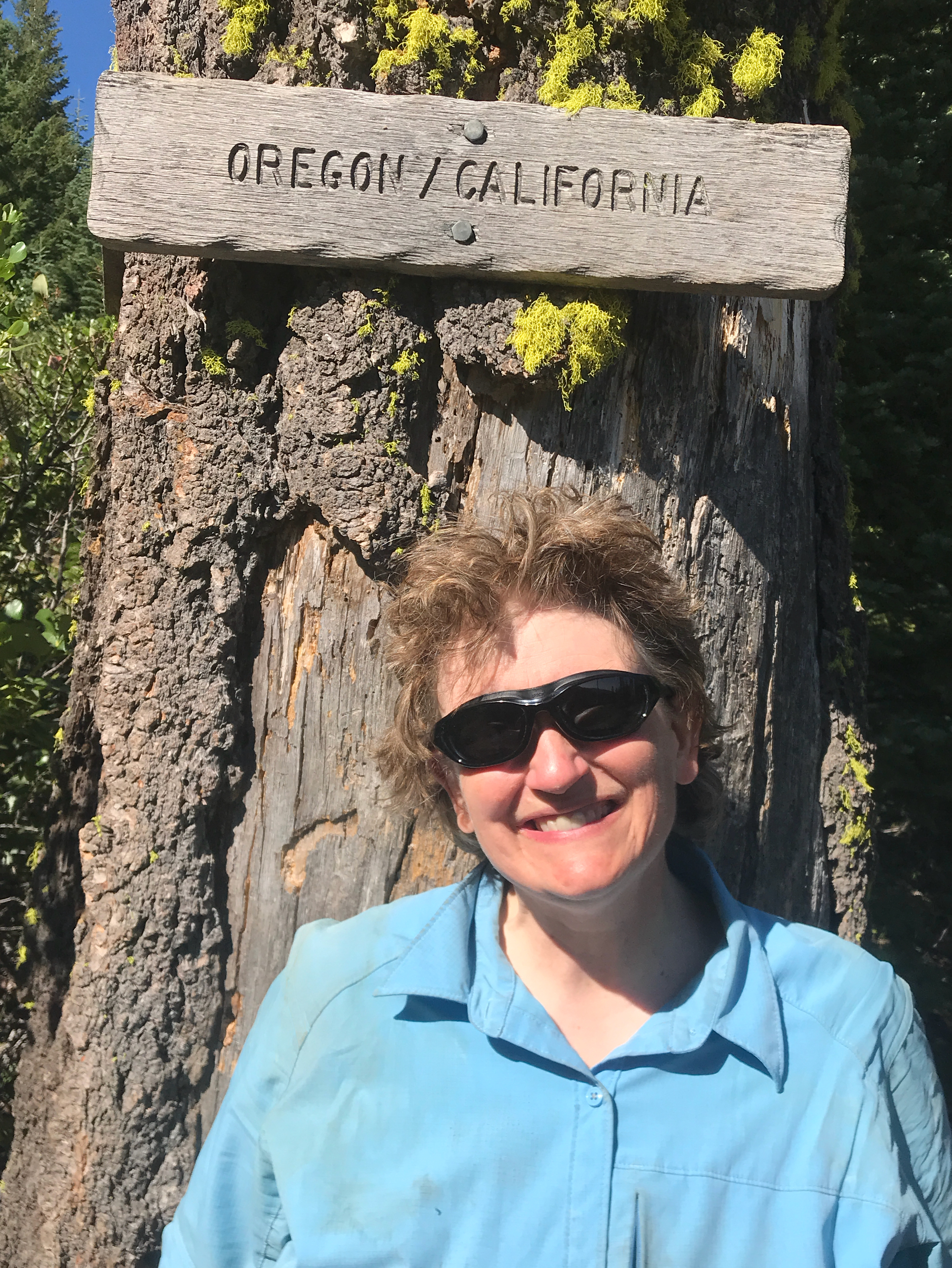
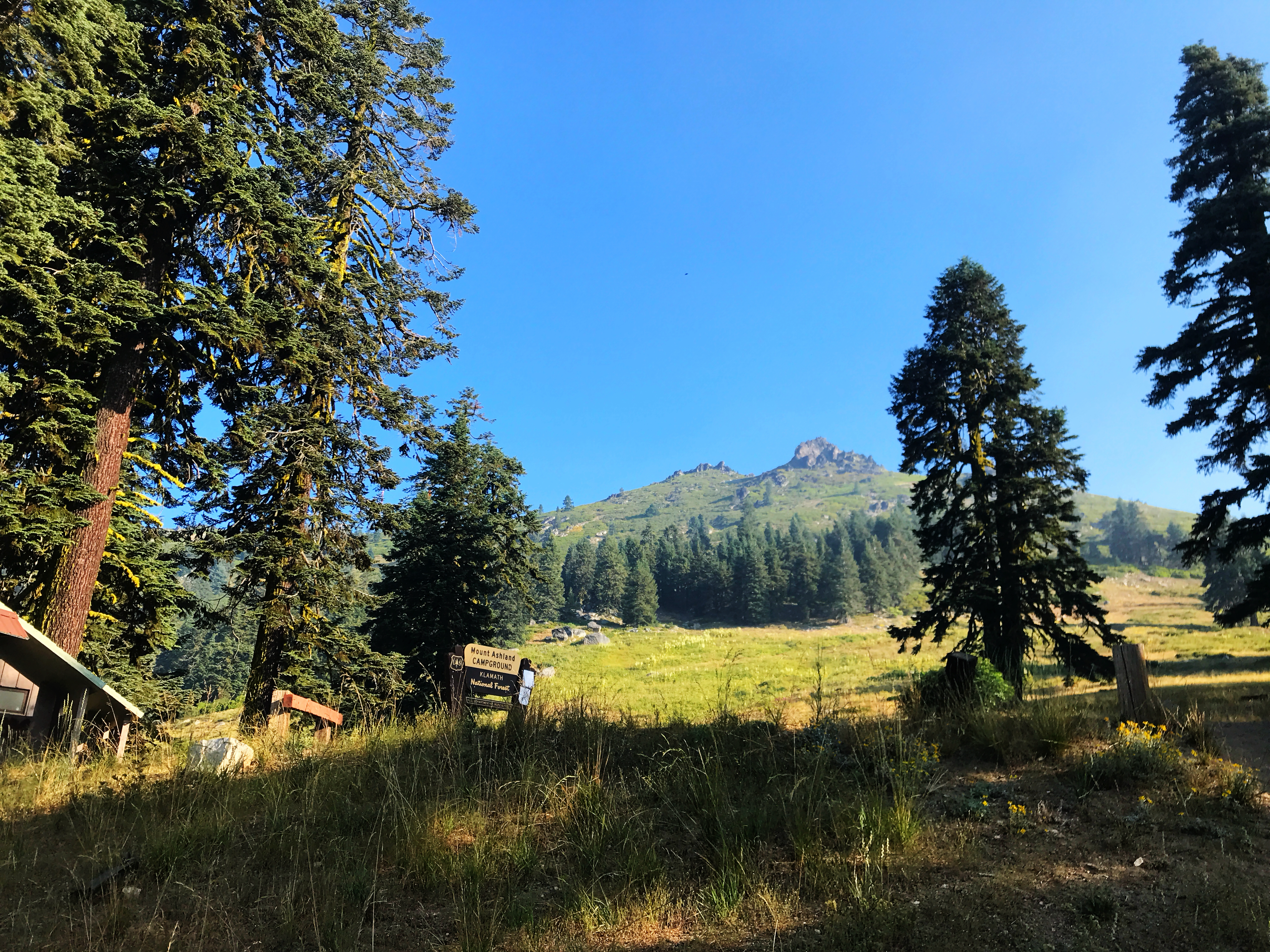
I woke up this morning to blue sky! There has been so much smoke that this was a welcome surprise.

PIBCE8724

My campsite mates had left before dawn. Fairweather’s parents were down from Canada, and were meeting the three of them in Ashland. I hope they have a wonderful time.

I got everything packed up, and saw a man from the next campsite. He asked how I was doing (opportunity knocks), and I said my water was low, but otherwise everything was great. Ta-da! I yogi-ed a full liter of ice water!

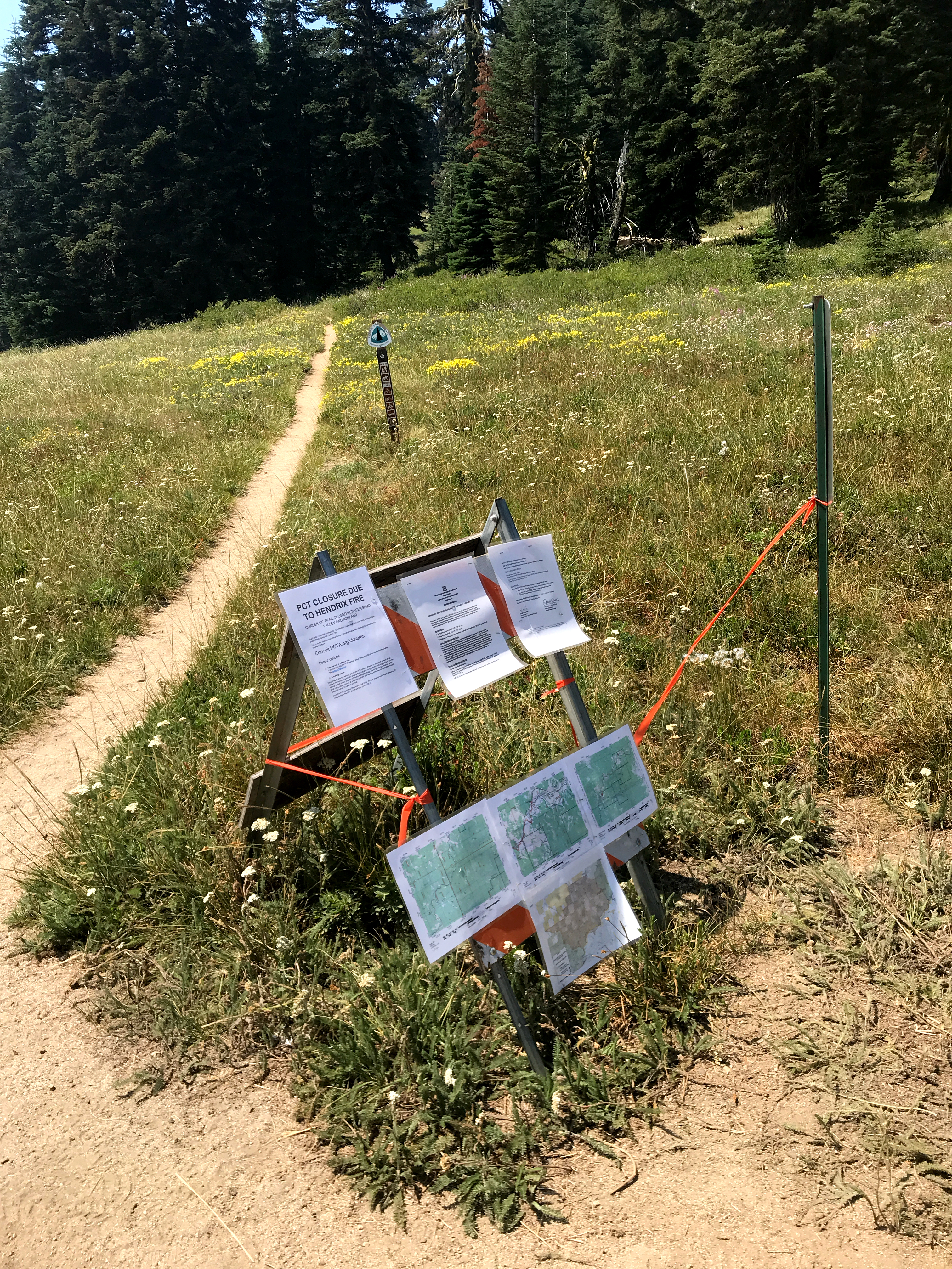
I headed back down the road and hung a right, heading up the hill. Two miles later, I hit the junction with Forest Service Road 20. This was the southbound end of the detour for the Hendrix Fire closure. The first detour involved more convoluted intersections than a rat maze in a lab. I think there were 21, and most of the roads were difficult to follow. FR 20 was closed to foot traffic, as it was the primary road for fire equipment. But after some discussion, FR 20 became the detour. While I couldn’t have successfully followed the original route, FR 20 is easy. Fortunately, the closure was lifted a few days before I hit the trail in Section R.

The trail closure had been lifted, but there was still a set of laminated maps for the detour. I recognized them, because they were on the floor next to me as Devilfish picked me up from the airport.

JHLRE1173

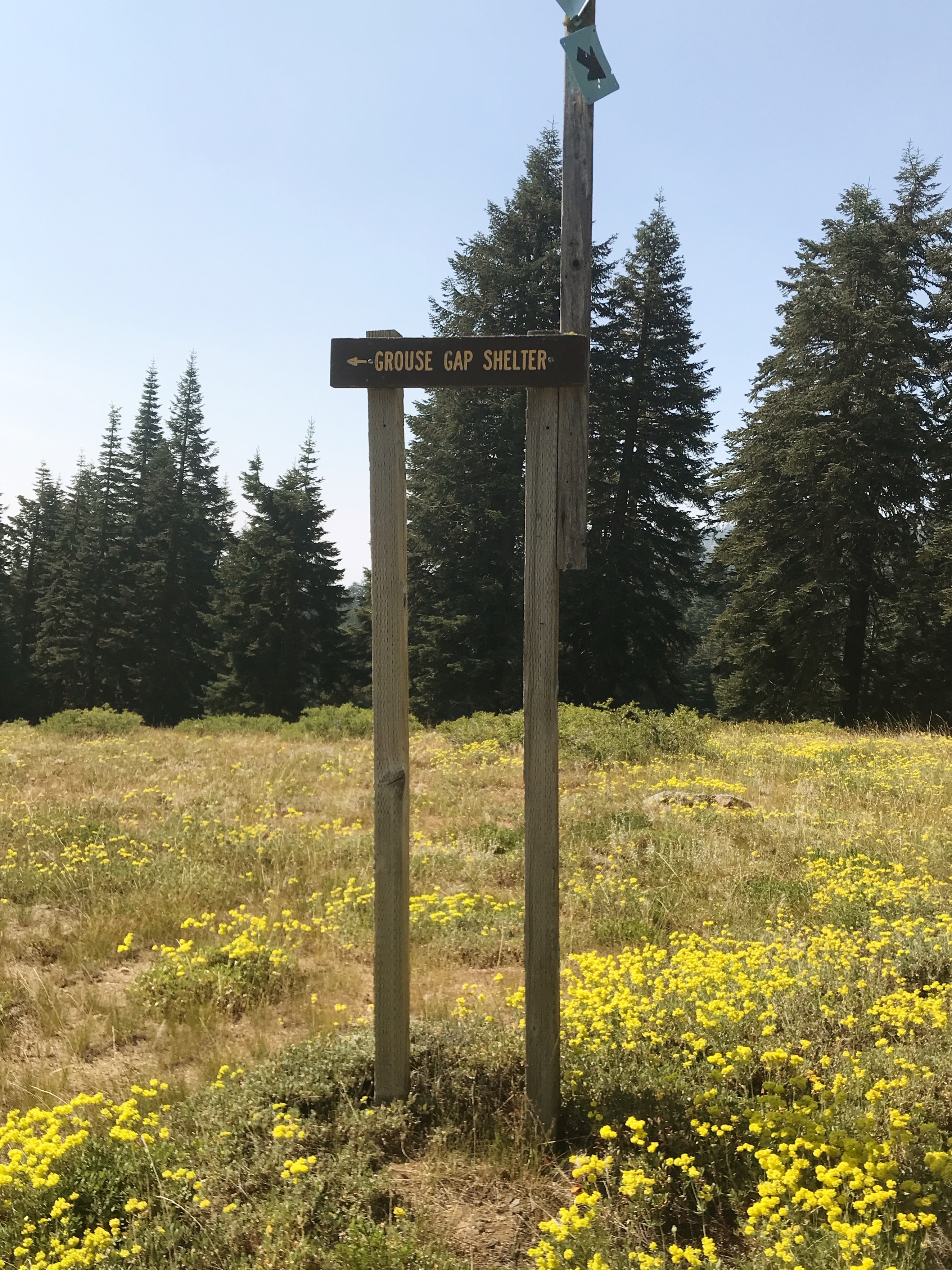
The other thing at the junction was the sign for the Grouse Gap Shelter. It was pretty tall, because the shelter is used for skiers after the snow hits.

KSXEE9878

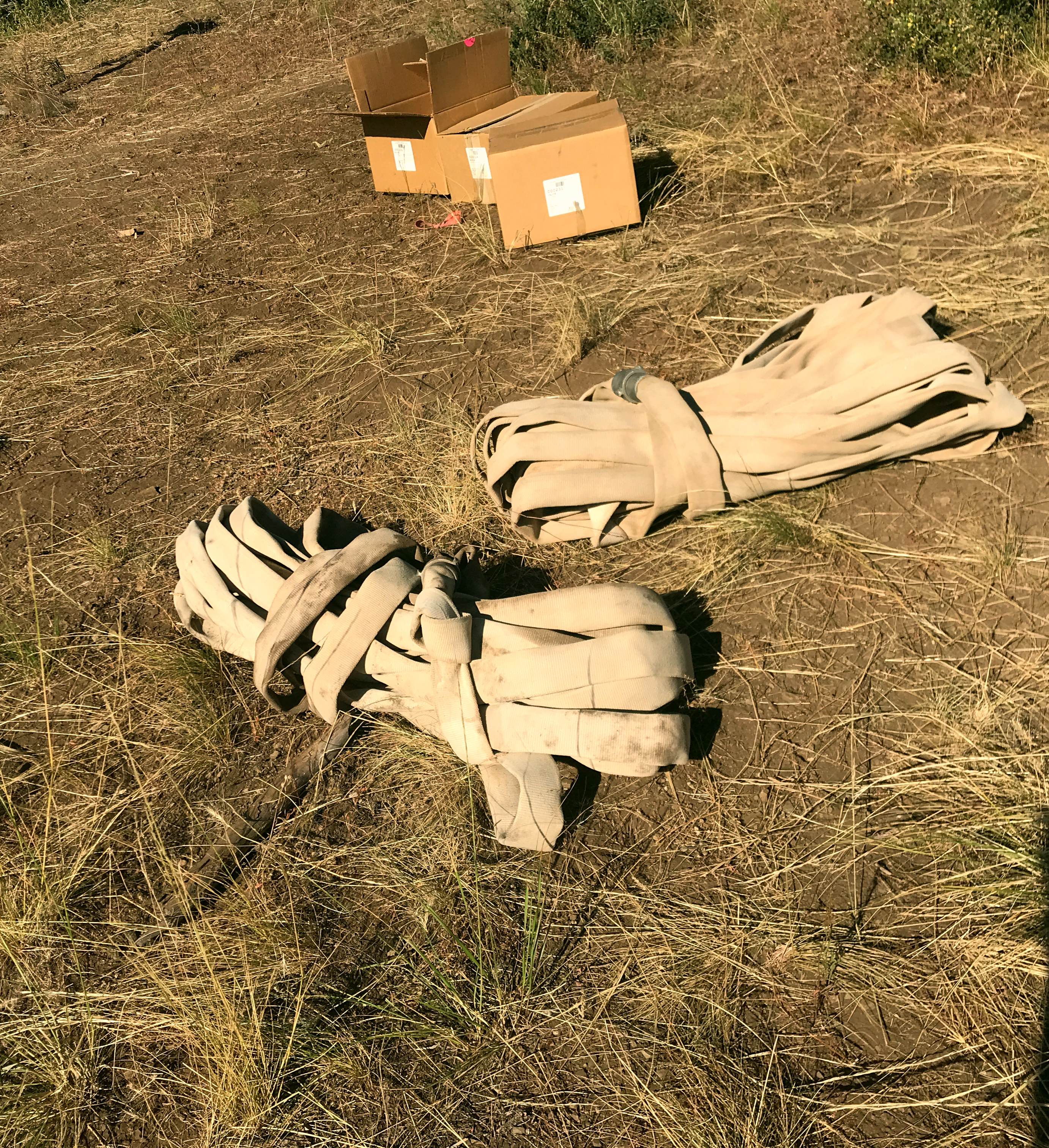
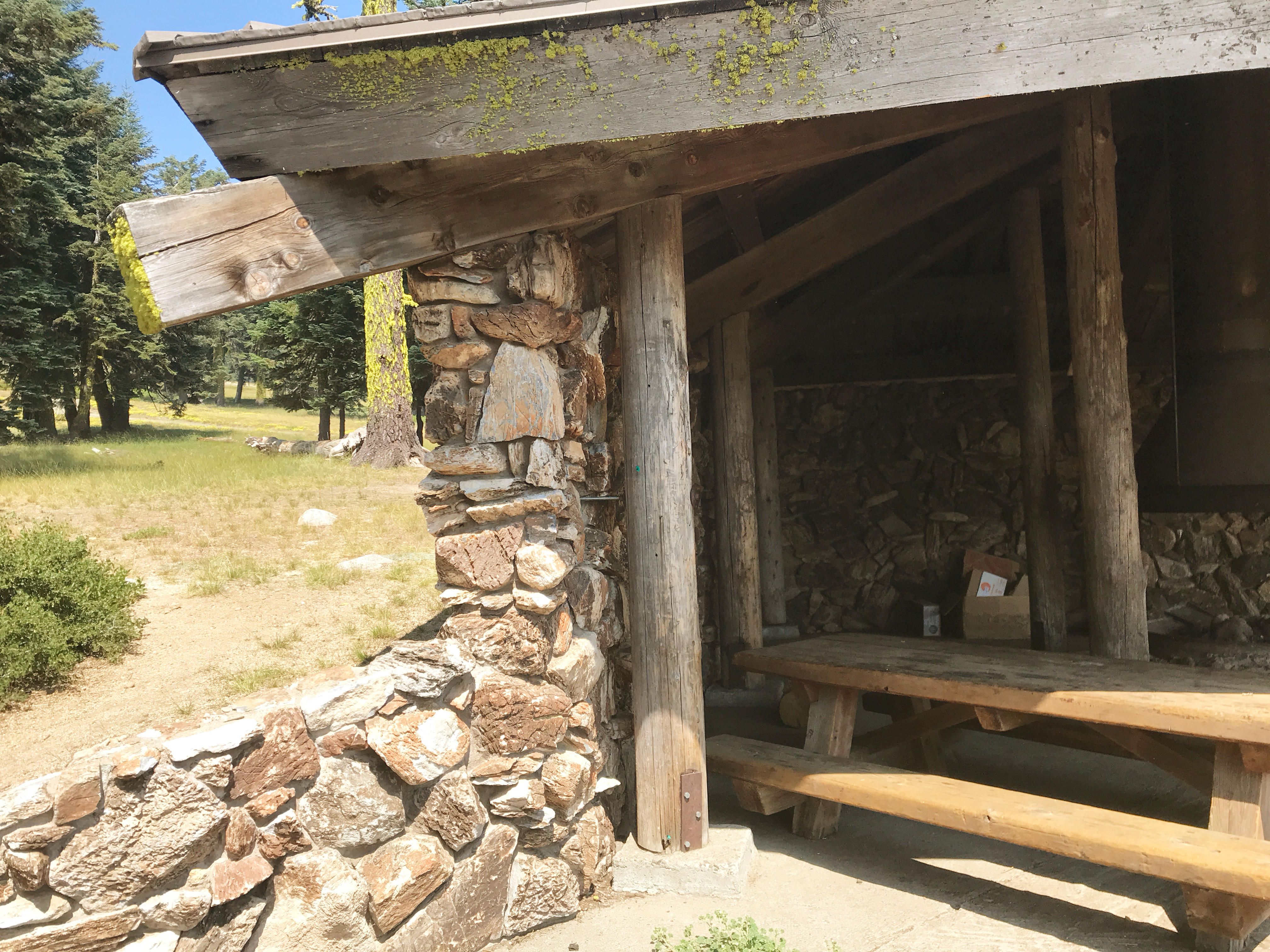
The shelter is three sided, and made predominately of stone. There’s a fireplace in the center, plus benches and a large table. It looked as if Scouts had been there recently, because the firewood area had a large pile of plywood creations, just waiting to be turned into kindling.

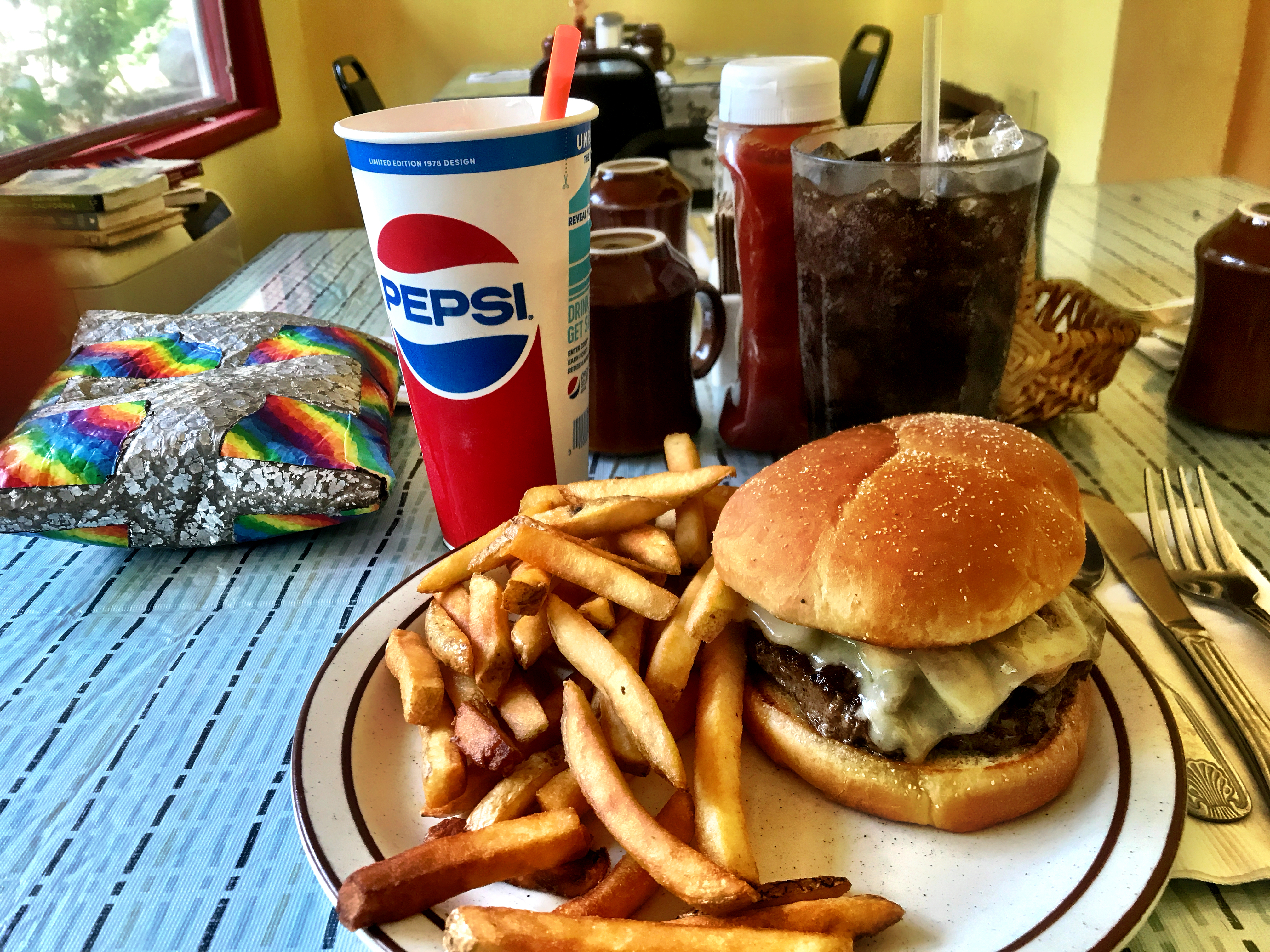
I dropped my pack and made brunch. Basically, this meant I had my granola a little later than normal. I’m a real brunch junkie, but not even I will carry omelette fixings and mimosas.

DQRTE5452

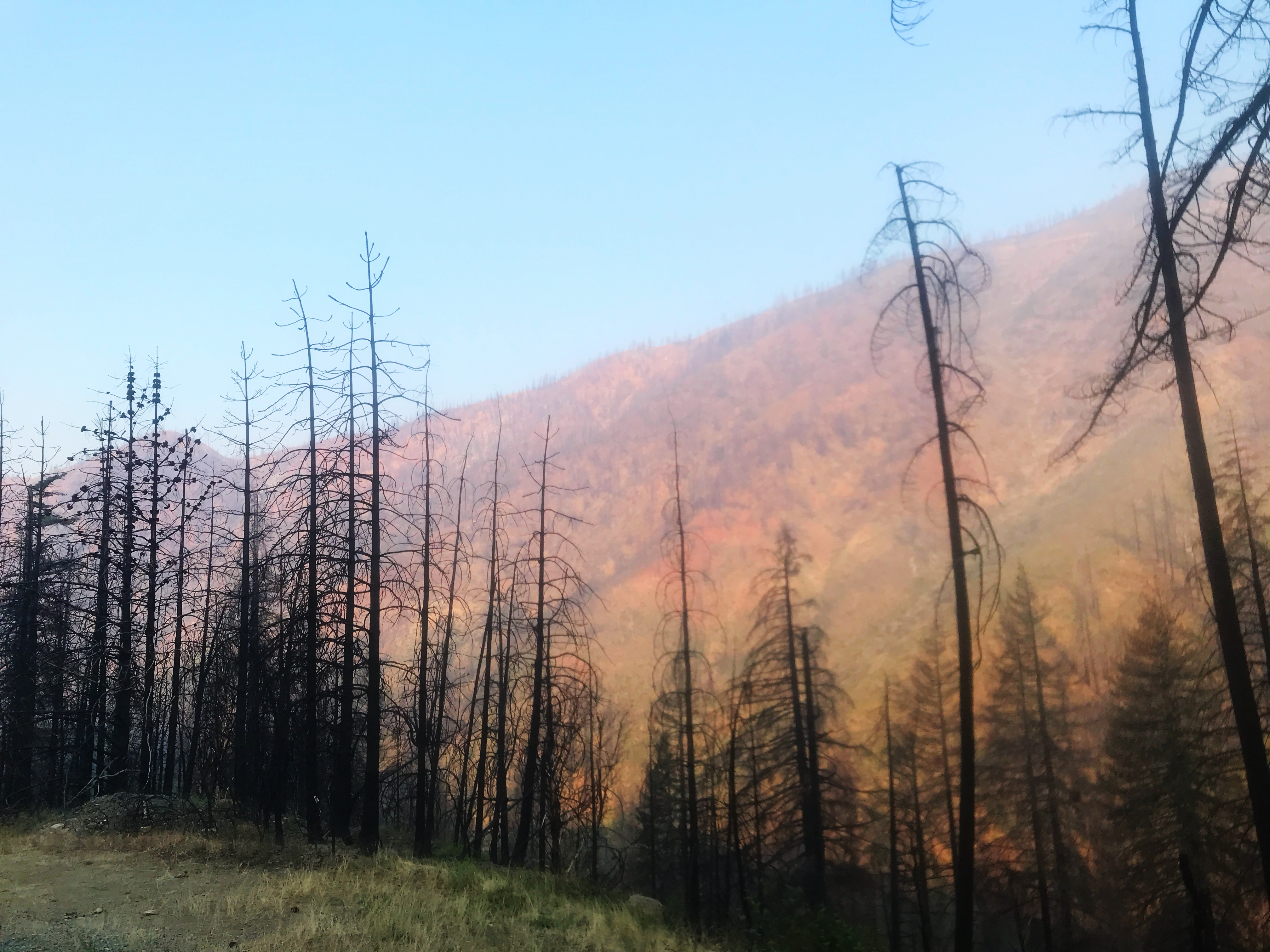
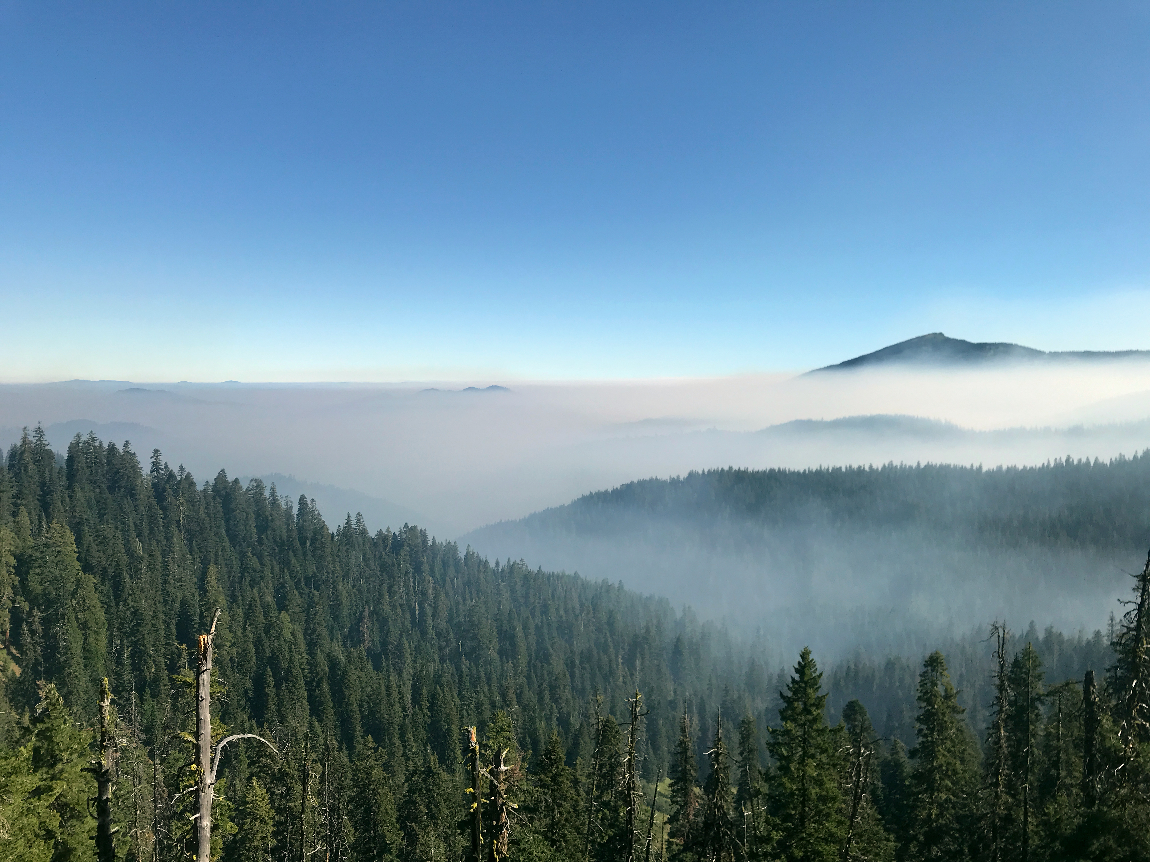
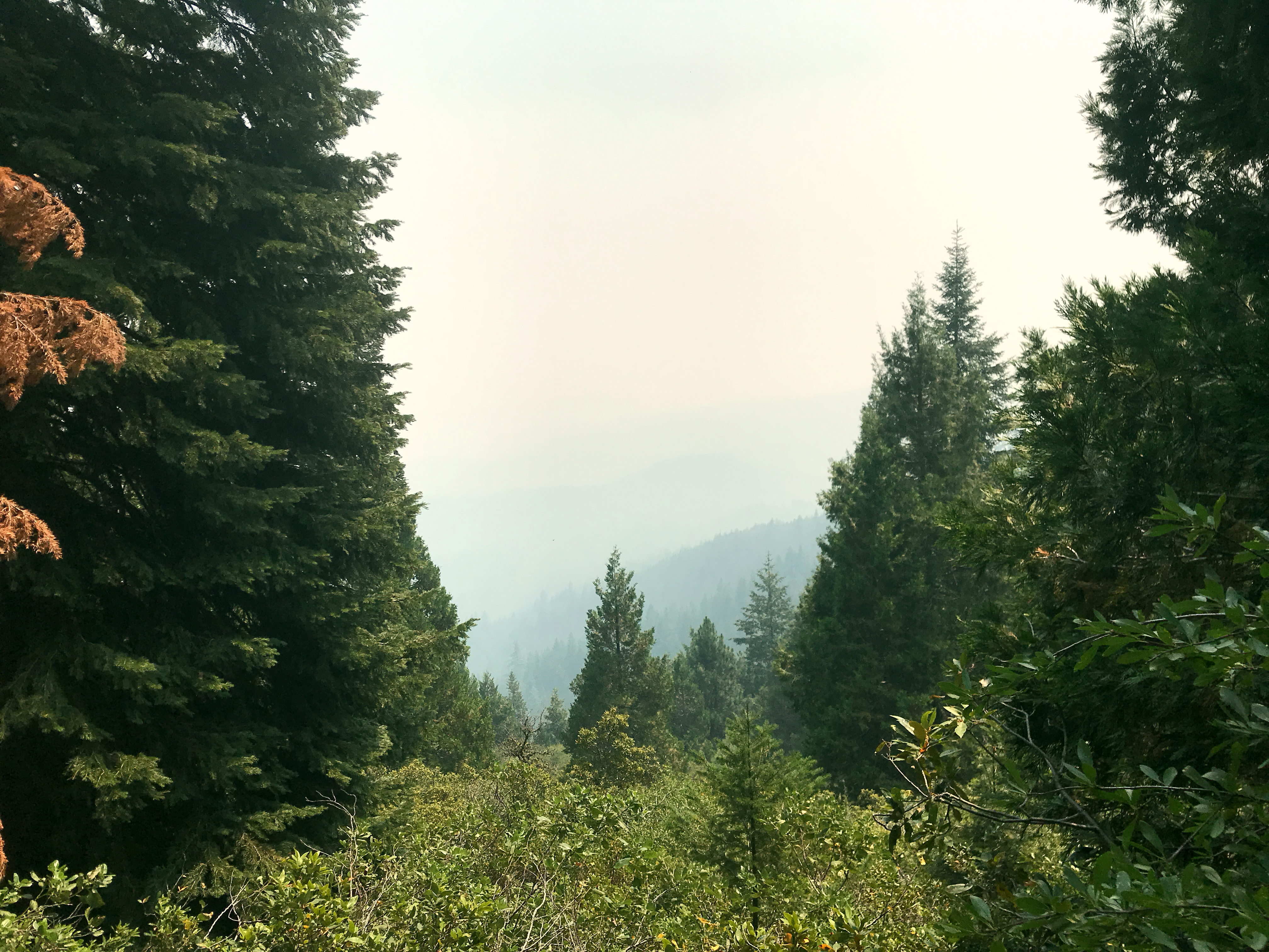
Today was another slow-day-on-purpose. The smoke was returning, and it’s been having a cumulative effect on me. It was a day of coughing and nausea. I just couldn’t turn on the afterburners. So I resigned myself to low and slow. At least I’m moving, right?

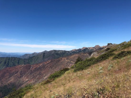
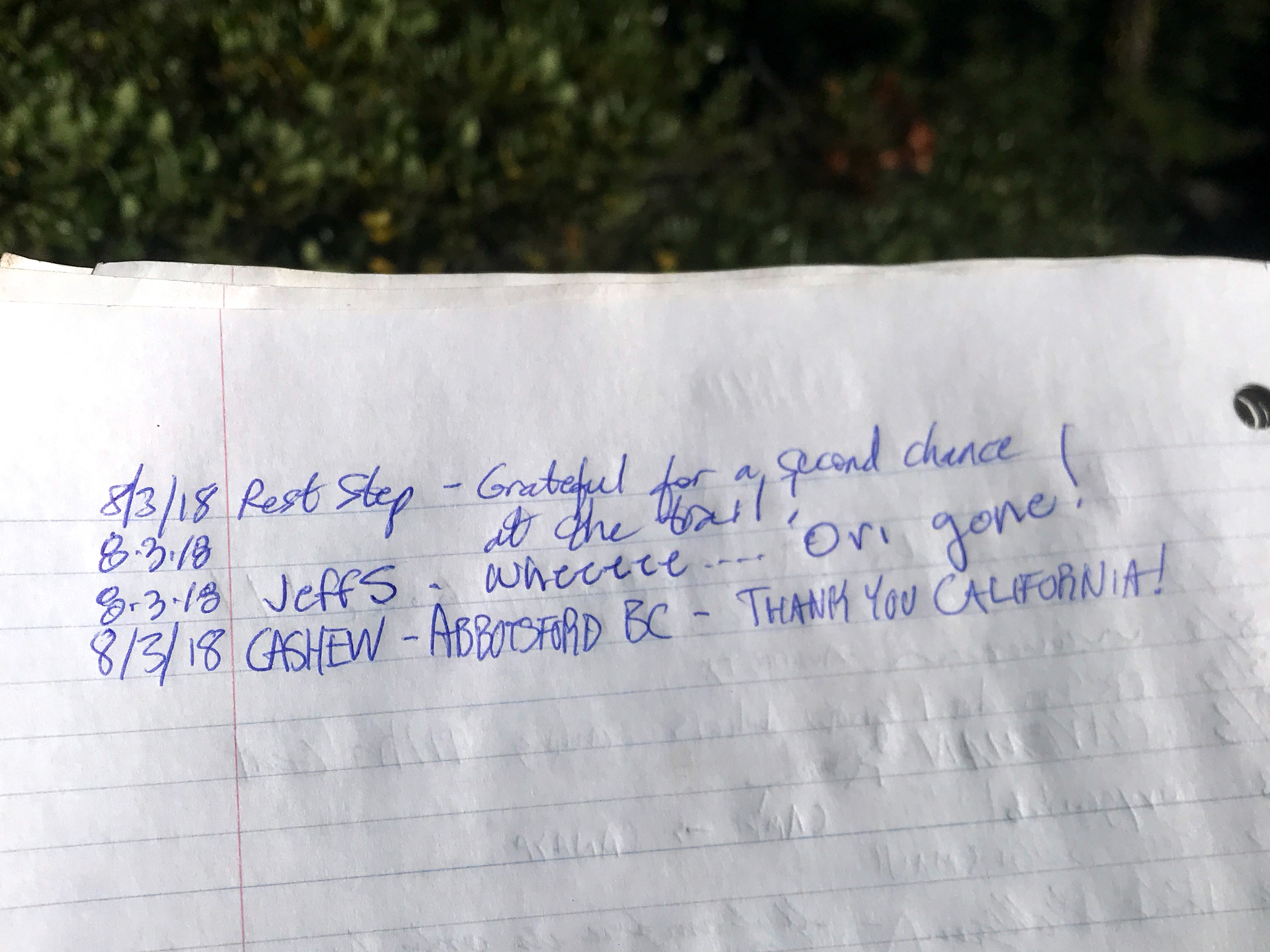
I climbed the rest of the ridge, topping out at just over 7000 feet, near another dirt road. It was time for a quick break, and all of a sudden there was an angel! The Inquisitor, a longtime trail angel for this area, stopped me, said hi, introduced himself, and pointed me around the corner. “There’s some magic over there. Enjoy, and don’t forget to sign the register!” He disappeared back the way he came.

Imagine my delight when I found two coolers, filled with ice cold soda! OMG Magic! I signed the register, and there were names going back three summers. I’d heard of The Inquisitor once or twice, and I was very grateful to see him. I rummaged around for a Cherry Pepsi, pulled up a spare piece of dirt, and sat down to enjoy.

MMJJE9695

After slurping every last drop, and taking a couple of minutes for a journal entry, I flattened my can and dropped it in the trash bag next to the coolers. Ahh, that was much better!

TRGOE4118

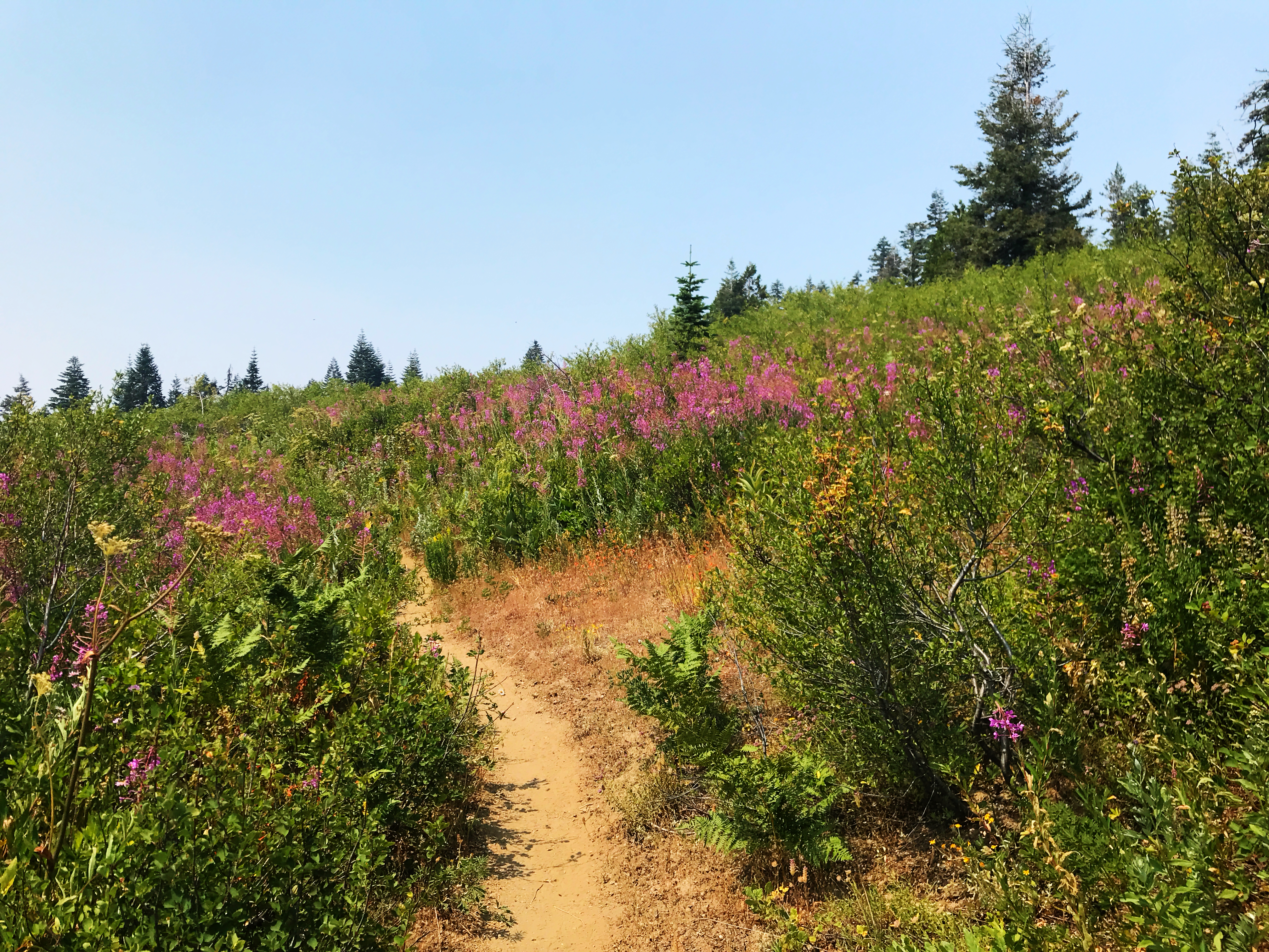
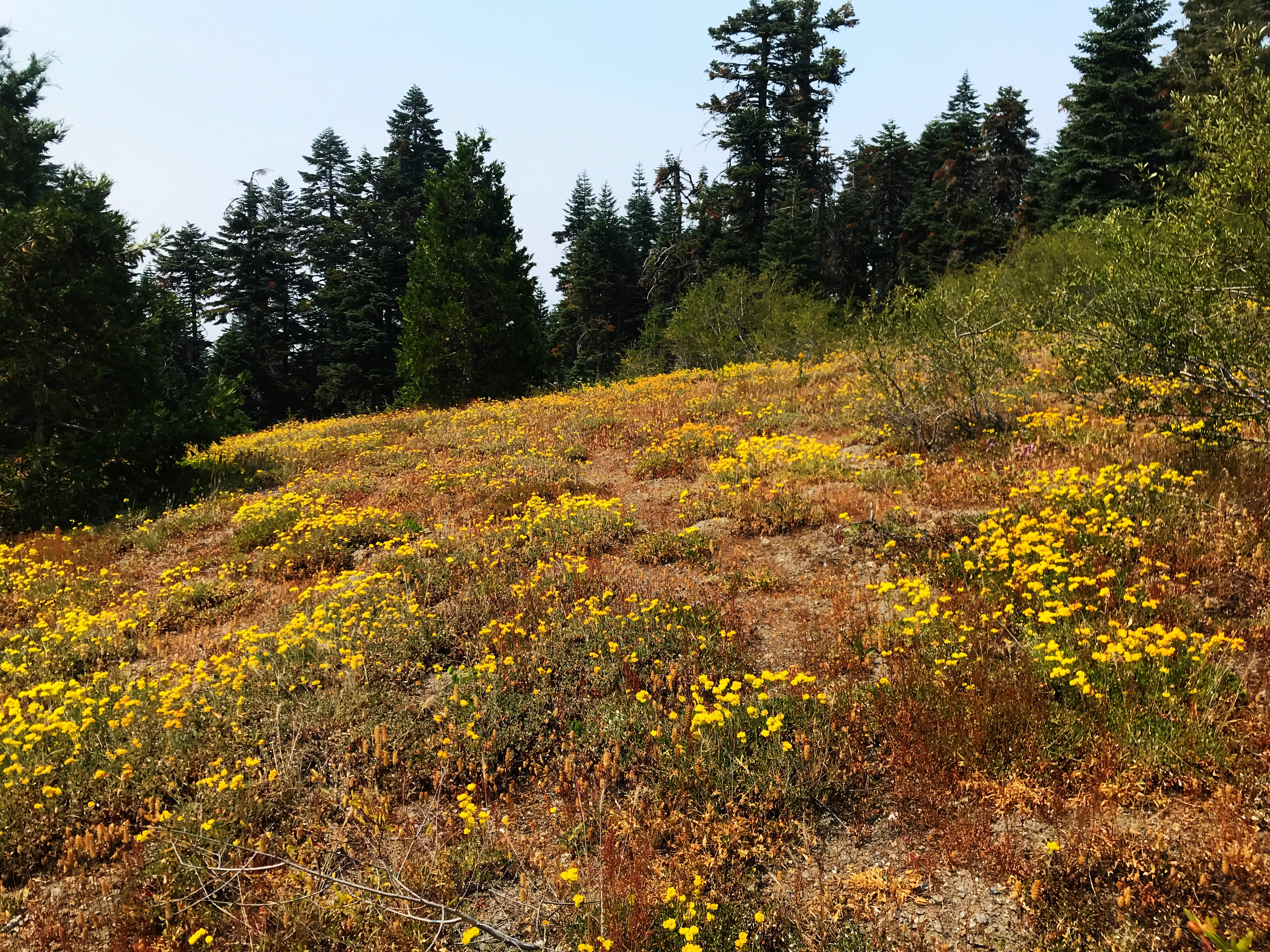
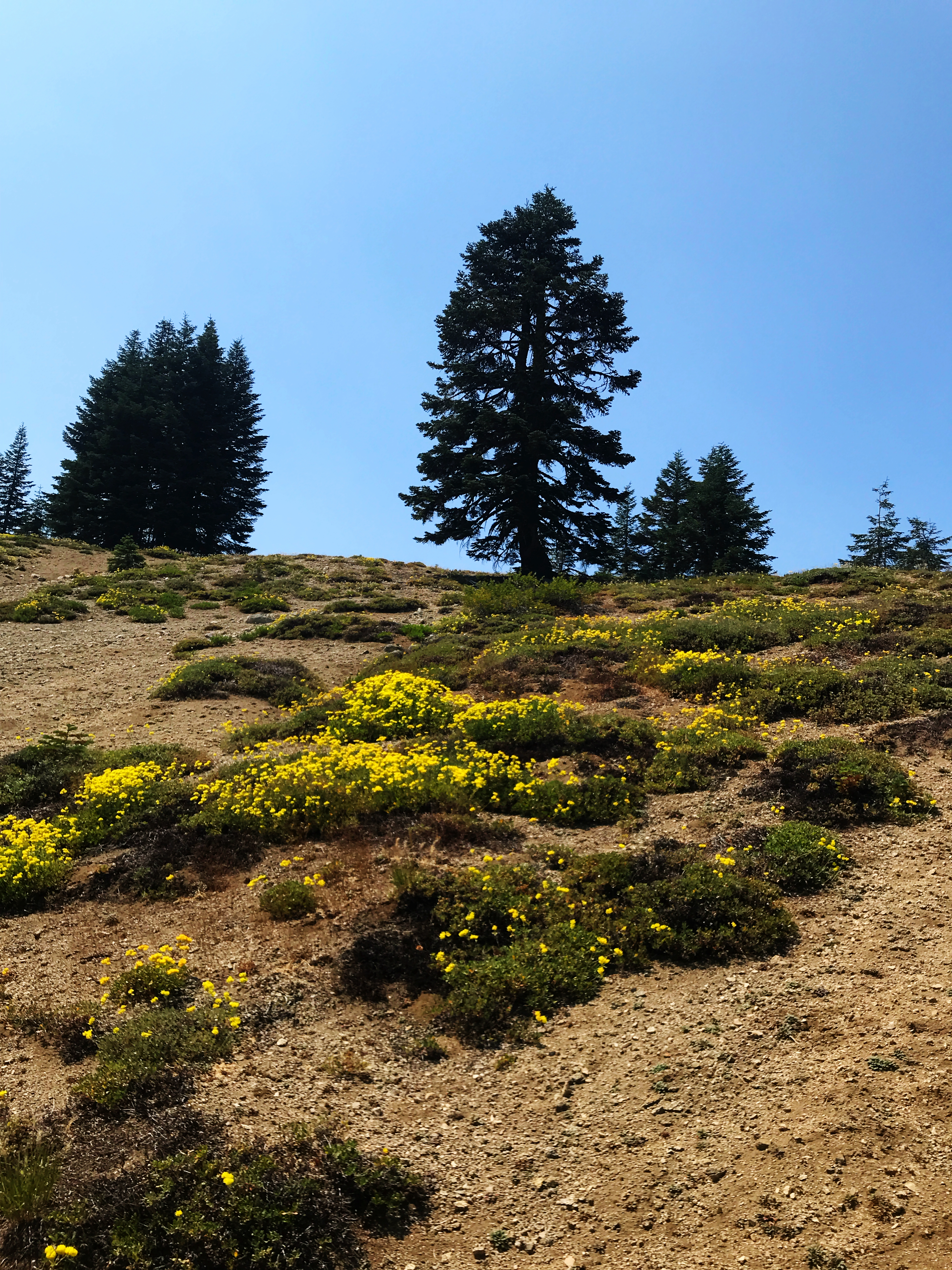
The descent was lovely. In essence, the trail traversed three different bowls, gradually losing altitude. There were only a few clusters of wildflowers, but it was pretty nonetheless.

WRWOE4797

AWORE0349

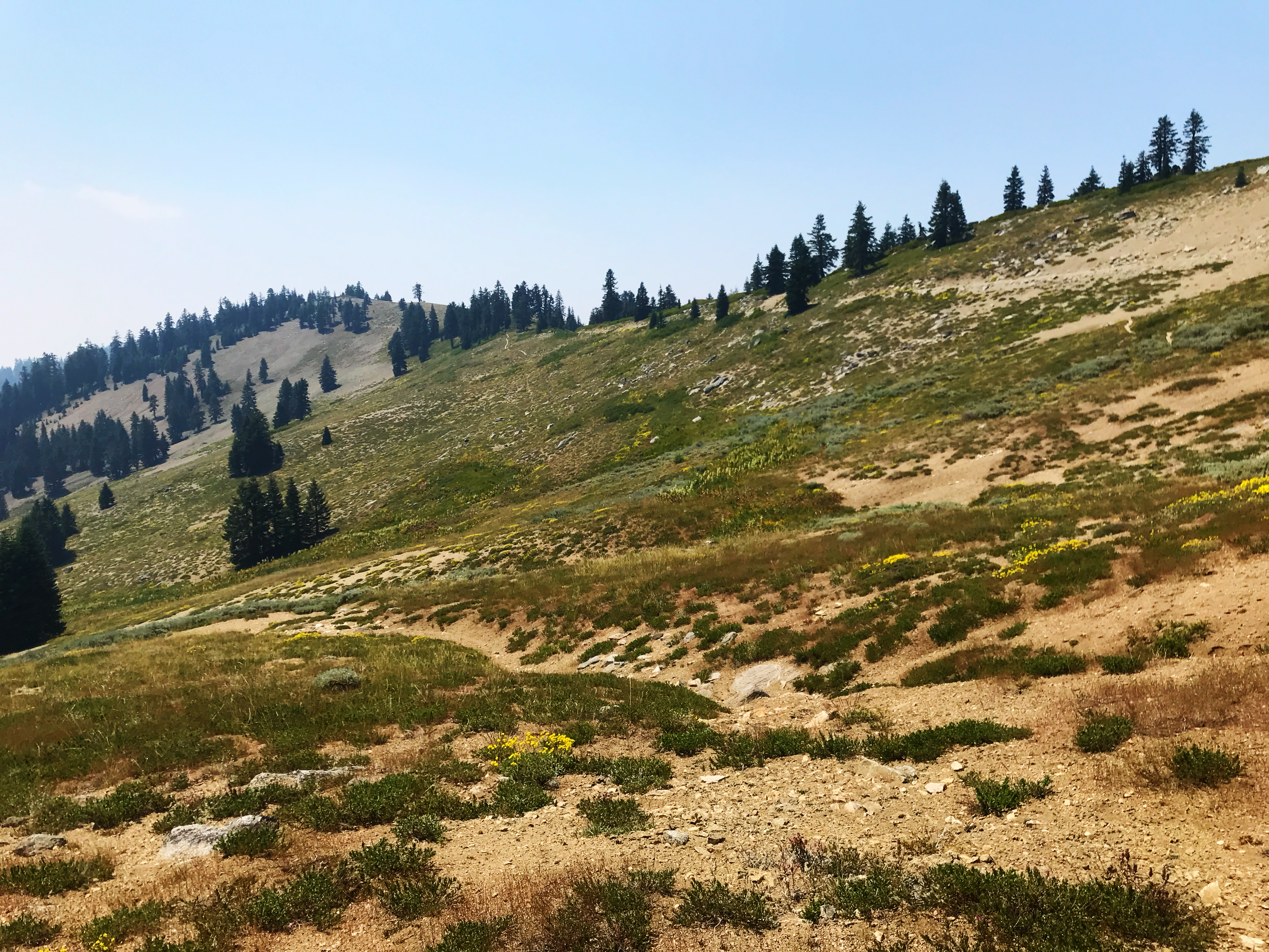
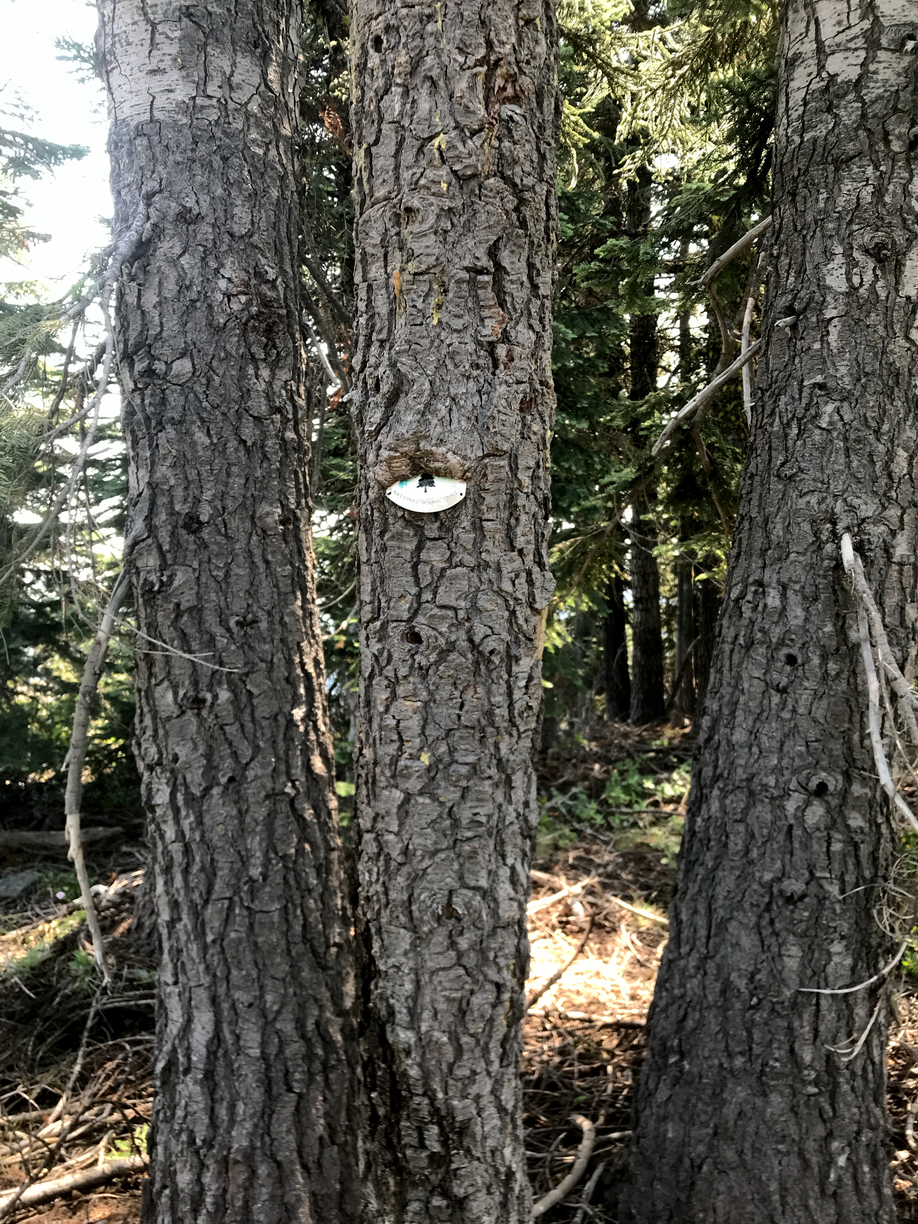
Between bowls, the trail wove in and out of the trees. I could always count on the ubiquitous PCT signs to mark the way, but occasionally the trees grew hungry.

TNGFE5127

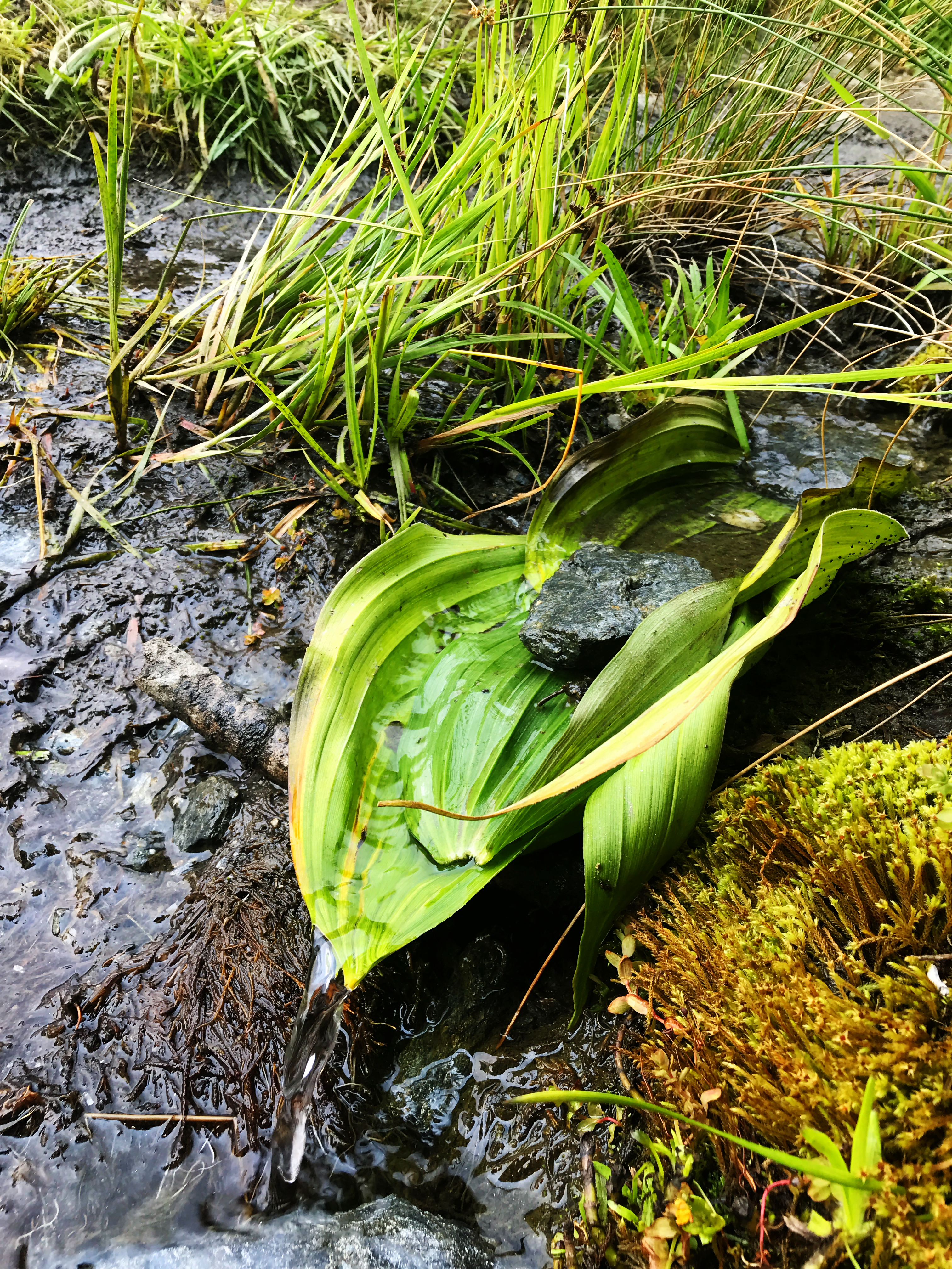
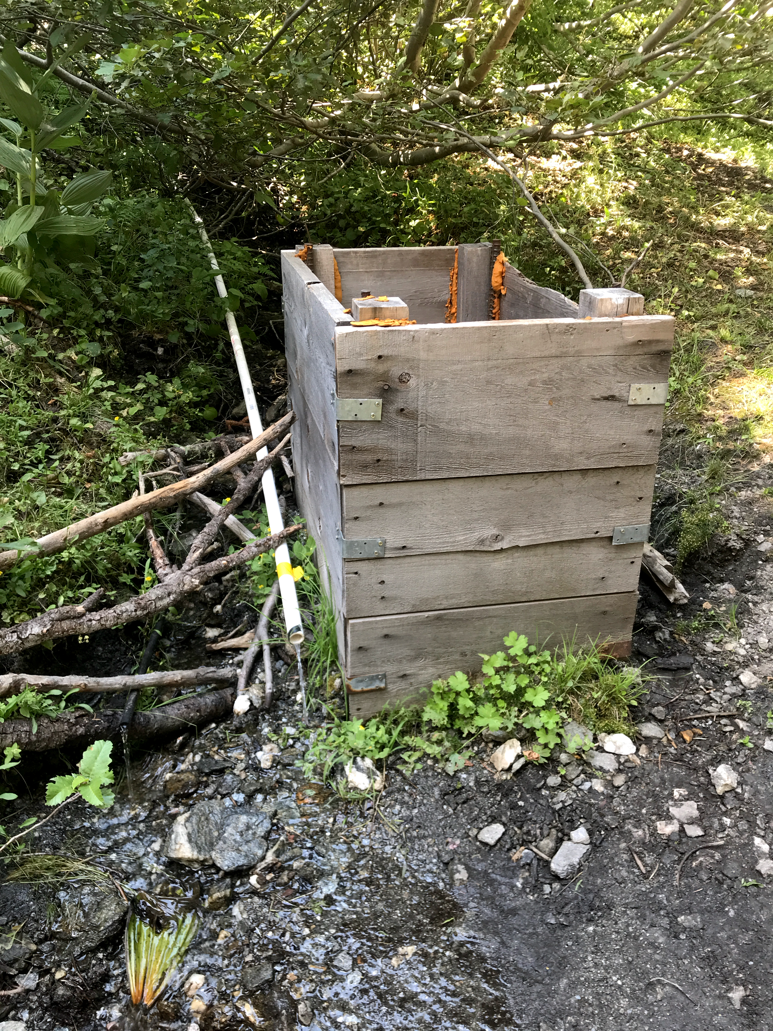
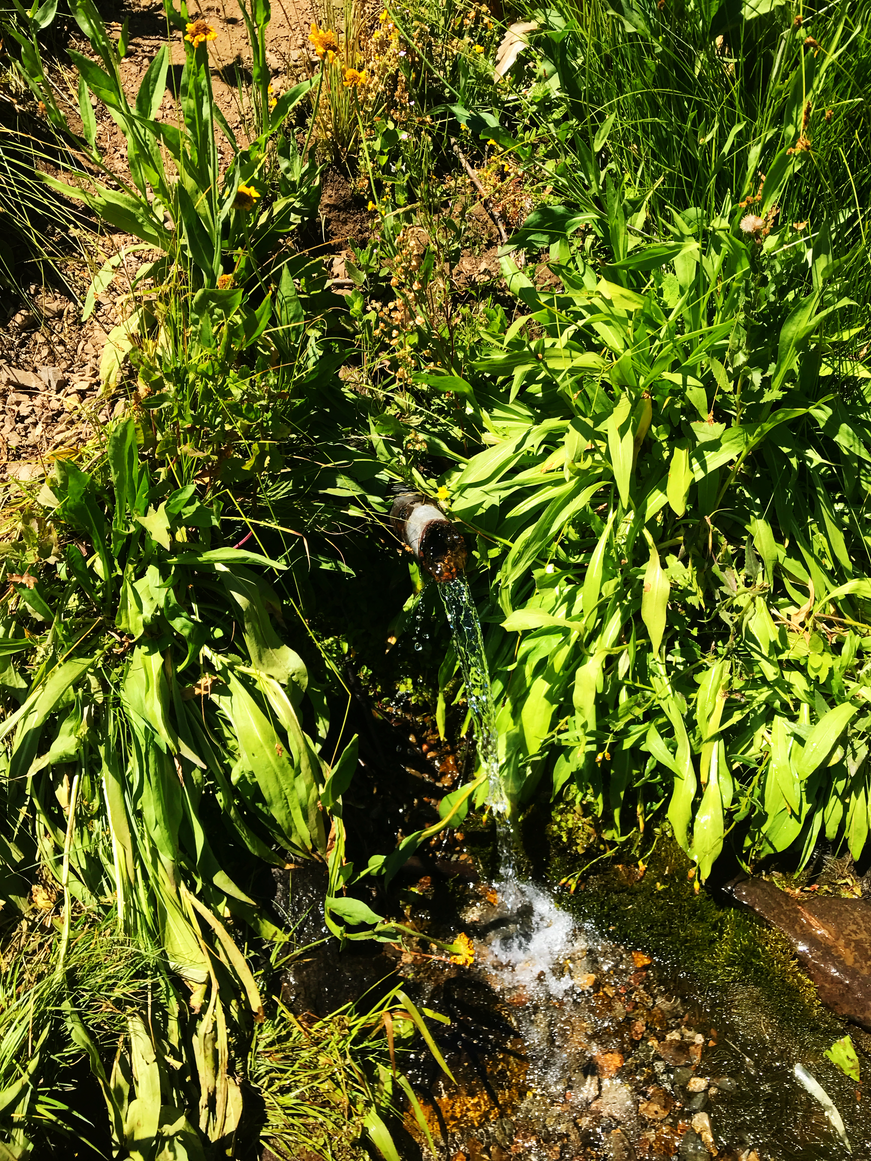
Finally, I reached the tentsite I was targeting for the day, at the headwaters of the West Branch Long John. It was late afternoon, earlier than I’d like to call it a day, but it made the most sense. The headwaters were seasonal, and it was just little stream right at the site, but that always makes things easier.

The tentsite had room for 3-4 tents, but with one exception they were all on a slope. The one in the middle had been dug out, so it was mostly flat. However, when I got there I discovered a guy snoozing, right in the middle of the spot. He was probably college age, and obviously wasn’t staying the night. And he had his solar charger out soaking up the sun. If you’ve got to recharge, you may as well nap, right?

I went ahead and set up my tent, without the stakes, so that I could easily move it at the appropriate time. I tried to be quiet at first, but gradually got noisier. Eventually, the guy woke up, and just then his friends arrived. We all chatted for awhile, and then they headed north.

While I was getting organized, a SOBO stopped by. It was Waffle! What with me flipping past Section B, and his taking a zero in Ashland, we crossed paths again. We talked for awhile, and he apologized for not returning to the campsite at the second stream, several days ago. I told him it was absolutely fine, and that I figured he’d found better water ahead.

Turns out he’s good friends with Sriracha Springs! I explained how we knew each other, and he said that she was on the trail behind him somewhere. I told him I’d keep an eye out for her. We wished each other happy trails, fist bumped, and he headed off to Lake Tahoe.

A side note: When long distance hikers greet each other, or depart, they use a fist bump rather than a handshake. Let’s just say that hiker hands may harbor more bacteria than, well, those of a surgical nurse. And as you can imagine, gastrointestinal bugs are a real pain on the trail. Hence, fist bumps.

Just as I finished getting my stuff together, a guy of retirement age showed up. His name was Lucky, and he had sectioned the AT. Now he was doing a PCT thru, but, as he said, if he didn’t finish this year he would just come back next year. His attitude was mellow, and refreshing.

Lucky was really nice, and very chatty. That made it hard for me to stay focused, but he was a great campsite-mate.

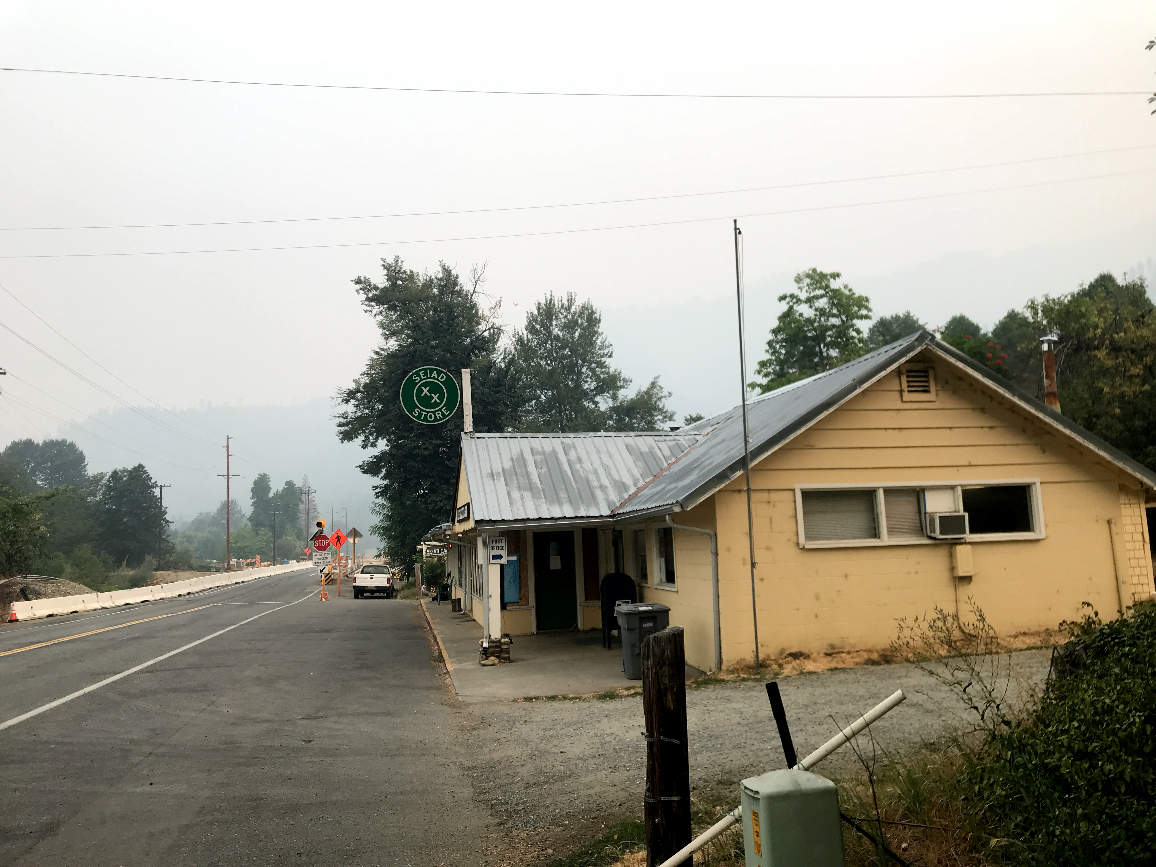
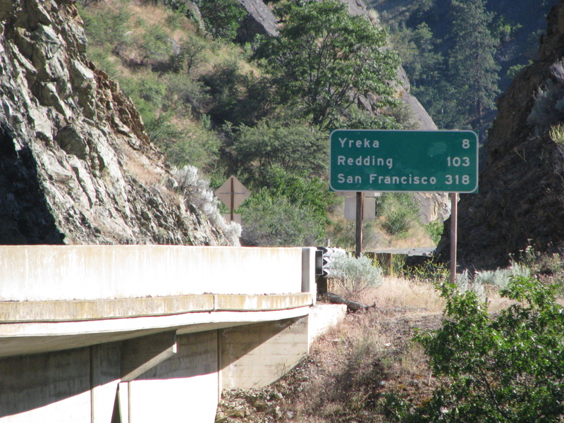
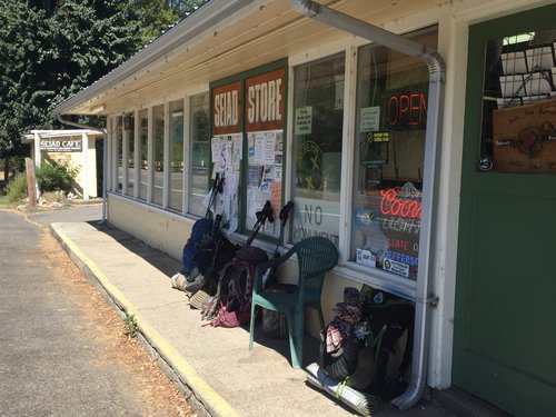
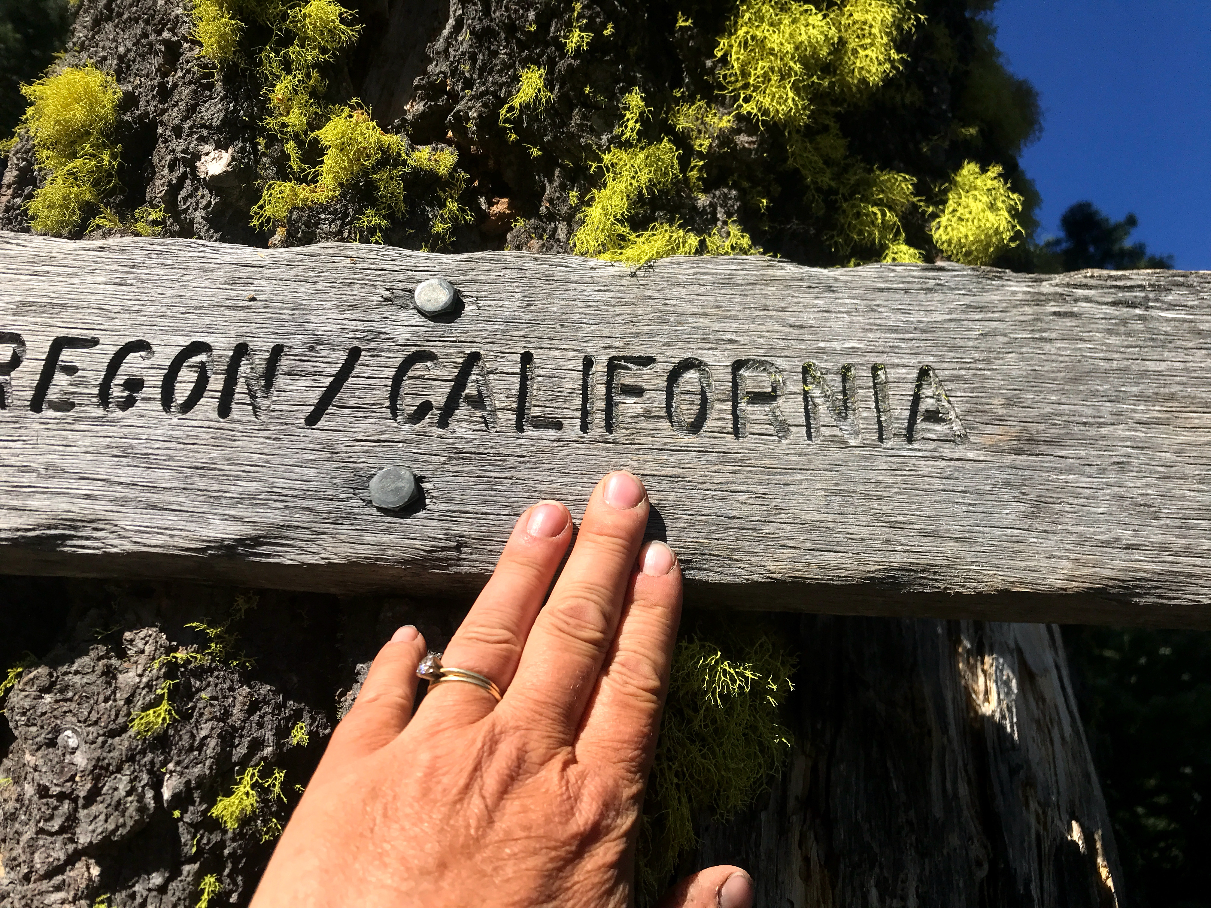
One thing he told me about was the road walk option heading down to Seiad Valley. The trail dips down steeply to a road junction, and that turns into a paved road, which ends up in town. It will save me only a couple of miles, but will also save about 1000 feet of elevation gain. The trail goes steeply up at the junction point, and then it has a notoriously steep slope downward. Given my energy level, and the smoke, the road walk is looking pretty good.

I loaded up all my water, preparing for the filter-and-go in the morning, and crawled into bed. Tomorrow is an early day, and, God willing, I’ll cross the border.


August 1, 2018: South Towards the Border

At Mt. Ashland Campground, Mile 1710

Callahan’s has an a la carte menu for hiker services. Last night, I only paid for a campsite, but I woke up early and got a shower as well. And it was worth every penny.

I got to breakfast around 8:00, per my plan, and lingered over my coffee and crepes. Rough life, indeed. I then packed up, and headed for the hills.

The trail quite literally runs in front of Callahan’s. It hits Old Highway 99, and goes under I-5. I had a bit of a walk, but eventually made it to Section R.

Callahans I-5

The PCT has been divided into sections, for organizational purposes. California has sections A-R, and Oregon/Washington have sections B-L. Because Section R goes over the border, it is also considered Oregon Section A. But everyone says Section R, and thus Oregon functionally starts with B. Are you confused yet?

At any rate, I had now technically completed all of the Oregon/Washington sections, but I still had 26 more miles to go before the California Border. And I wouldn’t be satisfied until I crossed.

The order of the day was up. Not incredibly steep, like, say, in northern Washington (Section K, I’m talking to you), but still up. The smoke was fairly thick, due to the Hendrix Fire.

FXIIE2280

And speaking of the Hendrix Fire, it was still burning, but more contained. There was virtually no risk in doing what I was doing, in terms of fire. But the smoke was still very heavy in the Rogue Valley, where Ashland and Medford lie. And I had to be mentally prepared for heavier smoke up in the Sisikyous.

DYLCE6927
Entering the Rogue River-Siskiyou National Forest

The trail was mostly up. Callahan’s is at 4000 ft, and this part of the trail tops out at 7000 ft. I did better this time, and kept plugging away.

Four miles on, I came across the former Mt. Ashland Inn. It’s now private property, but the owner has put a spigot and a picnic table next to the trail. I gratefully filled up, and pounded a liter. As I enjoyed the cold water, a couple joined me at the table. Their names were Simon and Petra, and they were from Bern. As part of a three month sojourn through the United States, they bought some backpacking gear and were hiking from Callahan’s to Seiad Valley…in other words, Section R. We had a great chat, which included mentioning that family members had spent time living in Bern.

Old Mt Ashland Inn

Simon and Petra took off, and they were clearly faster than I was. I wish them well!

I kept plodding along, up, up, up. There were a few wildflowers here and there, but mostly the trail was devoid of any flora. Some of the slopes were washes, but I’d seen far worse in northern Washington.

My goal for today was Grouse Gap Shelter, but it became apparent that I’d need to stop earlier. I reached the Mt. Ashland road, which had nowhere to pitch a tent…except maybe on the road itself, which would have its own problems. So I decided to explore up the road a bit.

OLYMPUS DIGITAL CAMERA

I knew there was a campground further up, although it was hard to figure out where. I gave myself a reasonable amount of time, but found nothing. With a sigh, I turned around…and then I met a group of hikers coming up the hill.

They were a trail family (a group of hikers who have stayed together for most of the trail), and they, too, were looking for the campground, but for some reason they knew it was further up than I had looked. After a brief conversation, they headed on. I figured in for a penny, in for a pound, and followed them. Naturally they zoomed ahead (it’s the 1700-miles-of-conditioning rule), and shortly thereafter the Mt. Ashland Campground appeared.

Wonder of wonders, there was an Actual Privy, and after availing ourselves of this miracle, we availed ourselves of a large campsite nearby.

The wind had picked up quite a bit, so I staked down my tent in all directions, and utilized nearby rocks to add emphasis. I figured I’d have to set up my umbrella inside my vestibule, to damp down the wind.

I had just pitched my tent, when I heard “Hey, Rest Step, come join us for dinner!” Yay!

The Actual Picnic Table was around a huge boulder, and I grabbed my stove, my pot, my long handled spoon, my pot-shaped cozy, and a pack of Idahoans (instant mashed potatoes, this time with cheese). I fired off the stove, and got to know my campsite-mates.

Poke, Spicy, and Fairweather’s FB post from Mt Ashland

Poke and Spicy are a 40-something couple from Johannesburg, who have set aside their software careers, and sold their house, to be here on the PCT. And Fairweather is a meteorologist, who hails from the Maritime Provinces in Canada. They’ve been so nice, taking me into their trail family for the night. That’s the thing about hikers…the vast majority are these incredible people, with unexpected backstories, and who love this trail as much as I do.