At a campsite with a small stream, Mile 2258
It rained most of the night, but quit early this morning, in time for me to break camp, including putting my rather damp tent into my pack. I chose not to take a pack cover this year, instead relying on the trash compactor bag to keep the critical items dry. It seems to be working okay, although it is rather awkward having a very wet pack. We’ll see how it goes; I can always ask Steve to bring up my pack cover at a resupply point.
My goal was about 11 miles and 1800 feet today, giving myself a short day to make sure I’m getting used to things and that my body is strengthening. I’m a pretty conservative hiker; I’m not 20 anymore, and I’ve got a family back home. I met my goal, and although I’m relatively out of shape, I’ll get back into the swing of things soon enough. I’m just incredibly grateful to be on the trail.
My plan is to hit the Knife’s Edge on Tuesday. I’ll have to check the water sources, because I’m not sure where I can refill before there; I think there’s a long dry stretch ahead. That’s part of the hike: planning water sources, destinations, and the calendar.
The Knife’s Edge is a stretch through the Goat Rocks Wilderness; it is literally a trail along a knife’s edge ridge, punctuated by small rocky knobs. I’ve been looking forward to hiking it.
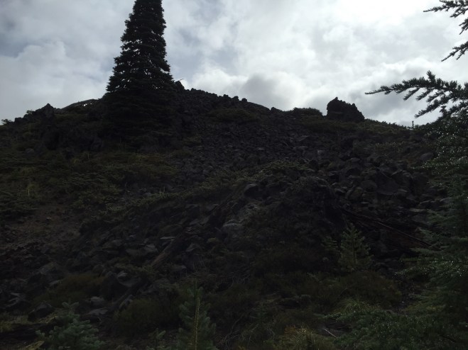
Once I hit the trail, I began skirting an ancient lava flow. It was like a wall had stopped just short of the trail.
I played Hiker Tag with the Scouts all day. They’re separated into multiple groups, and the Scoutmaster isn’t too happy about that. It’s kind of interesting to watch, having BTDT.
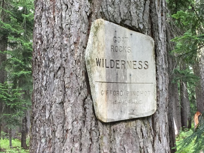
At mile 2255, I left the Mt. Adams Wilderness and entered the Goat Rocks Wilderness. I finally feel like I’m heading north.
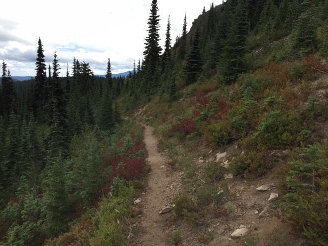
And wouldn’t you know, the weather is improving, and I’m getting to see sights like this.
I camped in a large site, with room for multiple tents. While I was making my stroganoff, a SOBO (Southbound) party appeared. I immediately invited them to join me. I really enjoy spending time with other hikers. It’s an amazing community.
One of the girls in the party was, believe it or not, sporting a Venturing hat! I introduced myself, and long story short, she was Casey Burt, from a Bremerton crew, and past president of both the Chief Seattle and Western Region Area 1 Venturing Officer’s Association. We had missed meeting each other by probably a year, but we knew a ton of the same people, and it was like old home week! Her group consisted of sectioners and thrus; Casey is a SOBO thru. It was really awesome to hang out with other hikers.

And speaking of sectioners and thrus, they aren’t exactly alike, but they are similar enough. A thru hiker is a person who completes the entire trail in a season, usually roughly April to late September. This is usually accomplished by hiking from the Mexican border to the Canadian border. Sometimes people will flip, usually in response to weather or a personal obligation. I met one couple who hiked from Campo, CA (at the border), to northern CA. From there they went to a wedding in Washington, headed to the Canadian border, and began hiking south to their jump-off point.
A section hiker is just that: a person who hikes a section of the trail. This usually refers to a longer section, rather than a day hike or overnight; many people section for several years in order to complete the trail. The PCT is actually divided up into sections, and oftentimes section hikers will use these to determine their hike from year to year. For example, my hike last year consisted of 2/3 of Washington Section H; this year, I plan to finish H, and continue through I, J, K, and L.
While I was getting water that night, I met Shadowfax; he’s a Scottish NOBO (Northbound) thru, of retirement age. We had a delightful conversation.
Tomorrow, staging for the Knife’s Edge.
Footnotes: Casey continued south, and reached Campo on December 5! Her trail name is SAR (for Search and Rescue).
Shadowfax did indeed finish the trail, and was generally keeping the same pace as I did all the way north.
