It’s the end of my hike. I’m pretty sad that I didn’t make the border this year. I know I made all the right decisions, but it’s still tough. Two acts of Mother Nature got in the way, and sometimes that’s just the way it happens. The day after I got home, I learned that the storm I experienced was the strongest summer storm on record in our region.
My family and friends have been wonderfully supportive, and they are completely on board for next summer as well.
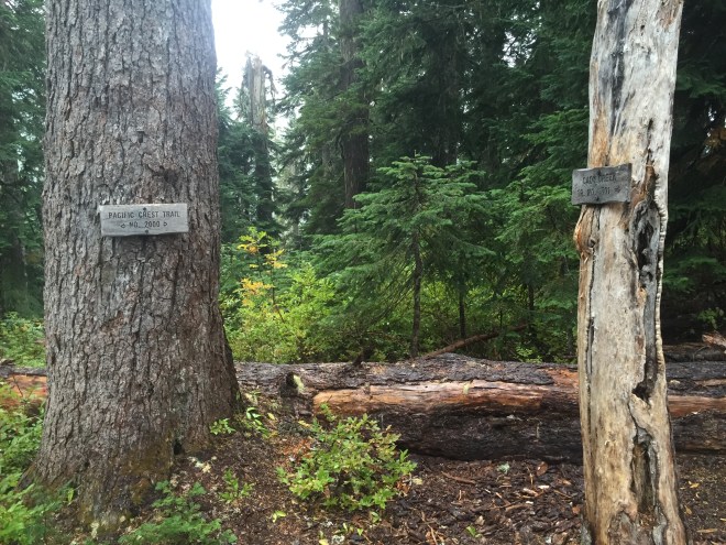
So, by the numbers: I did 252 miles on-trail this year, from Divide Camp near Mt. Adams (2239) to Lake Sally Ann near the Glacier Peak Wilderness (2491), plus eight more miles of entry/exit.
Last year, I hiked from the Bridge of the Gods (2144) to Divide Camp, 95 miles on-trail. And later that summer, I hiked from Cady Creek to Lake Sally Ann to Red Pass (2503).
Next year, God willing, I will rejoin the trail at the North Fork of the Sauk River Trail, just south of Red Pass, at mile 2500. And then I will hike to the Northern Terminus, at Monument 78, and PCT mile 2650.
But it’s far more than just the miles. I’ve met some incredible people along the way. I’ve pushed myself through pain and fatigue. I’ve seen some stunning parts of God’s creation. And I’m so very grateful for all of it.
So, here’s to the adventures of 2015, and may 2016 bring me to Canada.
In July 2016, I headed out for several sections. Check out my next adventureshere
Late last night, I had to come up with an exit plan. There are several access trails along this stretch of the PCT, going east and west, but ultimately I chose to go back four miles to the eastbound Cady Creek trail; it was familiar from last year, the PCT segment was familiar from yesterday, and it dropped the fastest into less exposed territory. I would end up at a trailhead in the neighborhood of Lake Wenatchee. The only problem with the trail was that it is overgrown. Not as in “push the brush aside,” nor “I need my machete.” This was overgrown as in “Dr. Livingstone, I presume?” And sodden brush of that caliber gets your raingear soaking wet in a hurry. But it was still the best option. What I didn’t realize was that, given the fire danger, the Wenatchee Ranger District had closed every single one of its trails, including the eastbound ones from the PCT. I texted Steve to meet me at the Cady Creek (Little Wenatchee Ford) trailhead, probably mid-afternoon.
In the meantime, I spent the night reheating my bottles. This was yet another reason to bail: I was using a lot more than my budgeted fuel; I always have extra, but at this rate there was a chance my canister could be empty before I hiked down the Suiattle.
Steve didn’t get the bailout message until very early Sunday morning. And I didn’t get his latest until the same time. Apparently they were now predicting wet snow.
Within an hour of getting my message, he was on the road, with (per my request), lots of dry clothes, towels, etc.
I got up early that morning, stuffed all of my Snickers into my rain shell pocket, and began the process of keeping the must-stay-dry stuff into heavy duty plastic, while separating it from the can-get-wet stuff, and then shoving the tent in the outside of the pack. This totally threw off the balance, especially because the tent was much heavier than normal.
As soon as I was done, I turned on my music, and headed south. It was crucial to keep going; even stopping for a couple of minutes made it hard to warm back up. I kept munching the Snickers, and heading down the trail. My plan was that, if Steve hadn’t arrived yet, I would hang out in the trailhead privy, wearing my sleep clothes and my quilt, until he got there.
I did stop for a minute at the Cady Creek junction, to say goodbye to the trail; even though I was doing the right thing, I was still mighty sad.
Cady Creek Trail Junction
9.5 miles, lots of heavy brush, a few scrambles, a heavy creek to ford, some rather interesting blowdowns, and 5 hours later, I arrived at the trailhead, and my waiting husband. The first thing I said to Steve was “252 miles…this year.”
He gave me an enormous hug, and after I had changed into my dry clothes, we headed down the road. There were barricades in place, due to the closure, but we just drove around them. The next stop was burgers and shakes at the 59er Diner, and then we headed over Stevens Pass towards home.
I woke up to a bit of very infrequent rain, and so I put my fly and quilt out to dry. But all of a sudden the wind picked up dramatically, and the rain started dumping, from a squall line coming through. The wind was strong enough that there were whitecaps on tiny, sheltered Pear Lake. I pulled all my gear back inside, grabbed my Ursack, and had breakfast in my tent. When the squall passed, I quickly threw my gear together.
The guys began to stir as I was breaking camp. One of them was in a hammock under a tarp, but two of them had pitched an inexpensive tent on a deceptively flat space with no duff or other debris on it…in other words, a puddle in the making. They were afloat this morning. I gave them the updated weather forecast; my guess is they packed it up and headed downhill.
The destination today was Lake Sally Ann. The cool thing about this was that I’d pass the Cady Creek Trail, which was where I joined the PCT late last September, for a brief section to White and Red Passes. Connecting more dots…gotta love that.
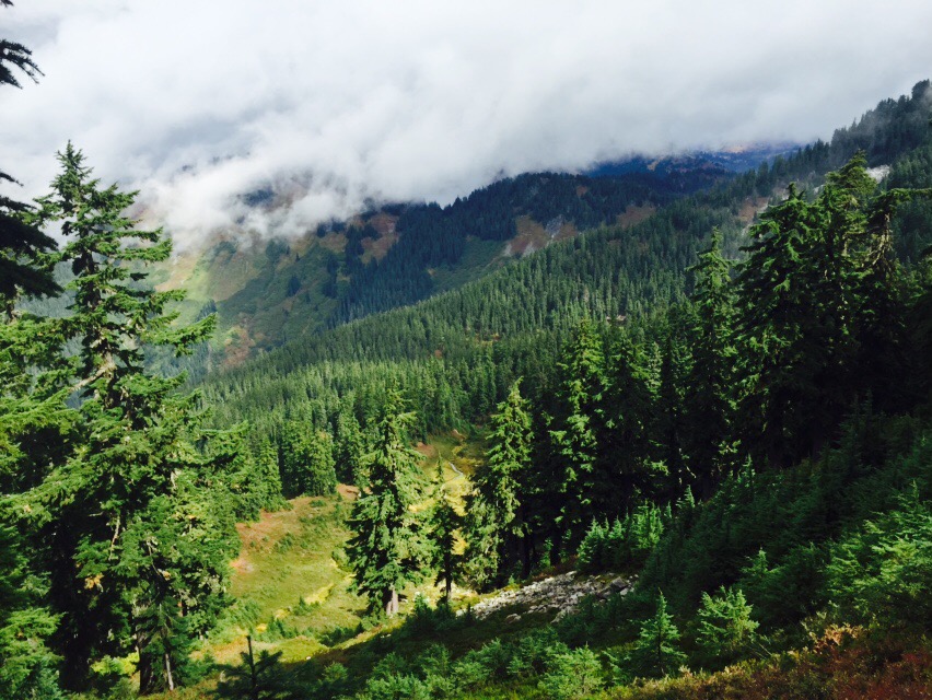
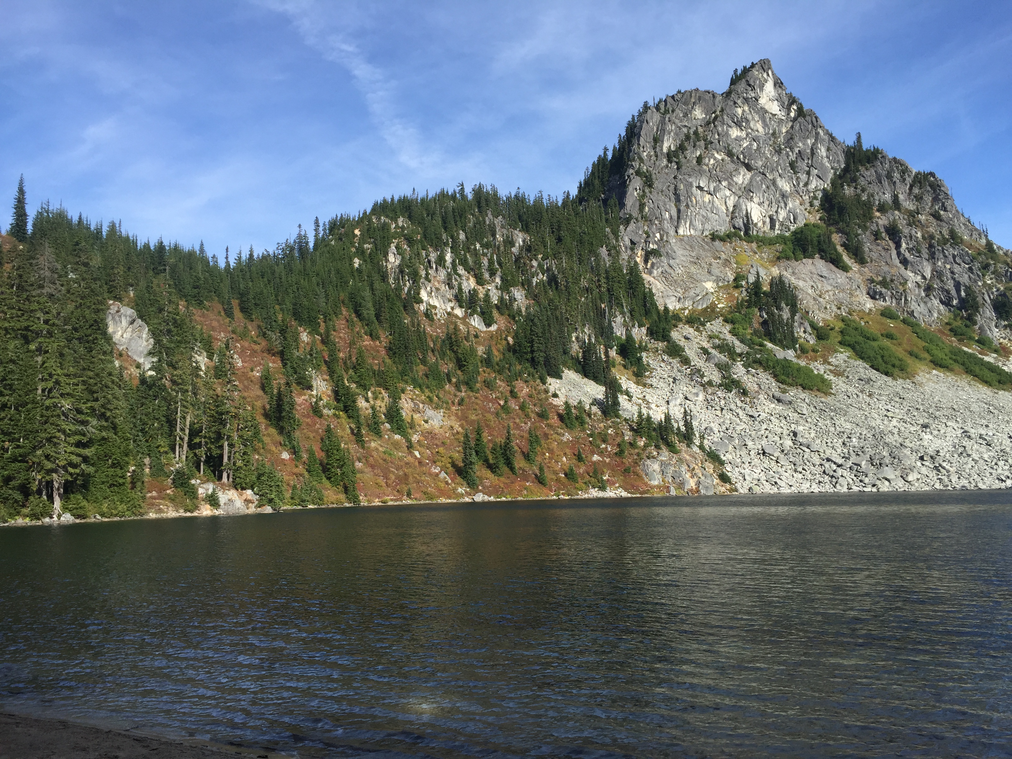
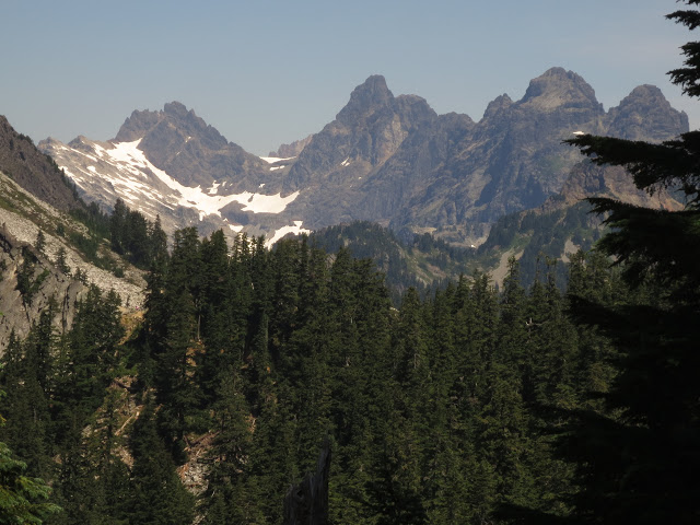
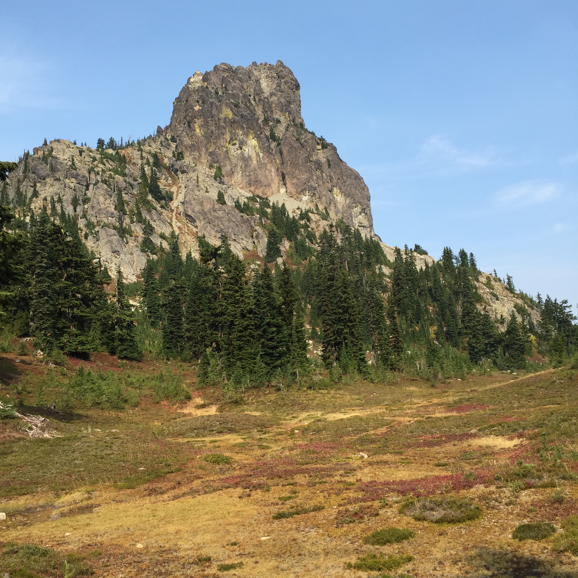
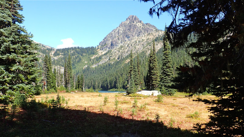
Just a little ways after I started this morning, I had my first really decent view of Glacier Peak. And that is something I’ve been waiting for, all year long.
First view of Glacier Peak
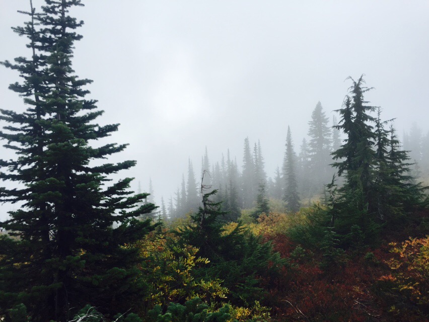
Unlike Friday, the rain was much more enthusiastic today. But every once in a while I’d get a glimpse of the sun.
A tiny bit of sun on the fall foliage
The last bit of sun I saw
The terrain here isn’t the up-and-down-the-ridge variety of Section J (although I know that’s coming). The less rigorous workout made it easier to maintain my body temperature under my rain shell.
Five miles and 1200 ft in, I got to the junction with the West Cady Ridge trail, which leads to the North Fork of the Skykomish road. I had hiked this trail in July of 2014, although I was stopped short by traverses across snowfields. But it was kind of like connecting a dot.
From there, it was two miles to the Cady Creek Trail junction. This was where I had joined the PCT for the White/Red Passes section last August.
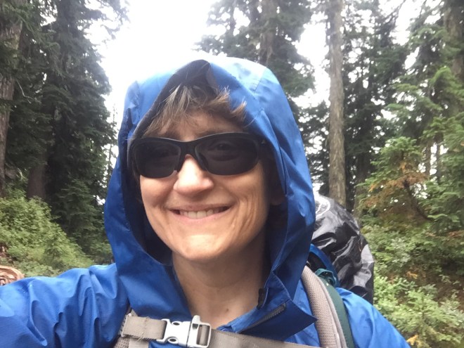
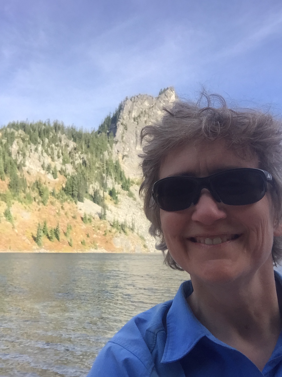
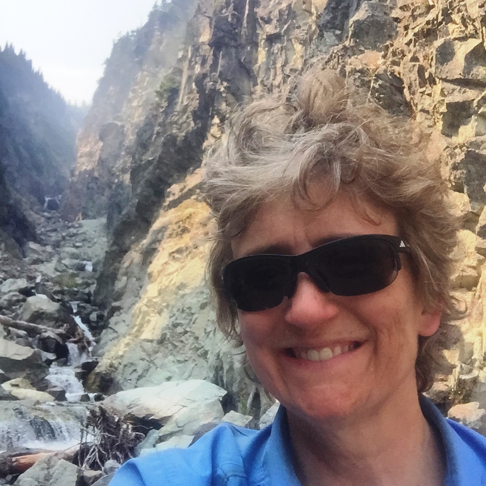
Selfie in the rain, before traversing the ridges to Lake Sally Ann.
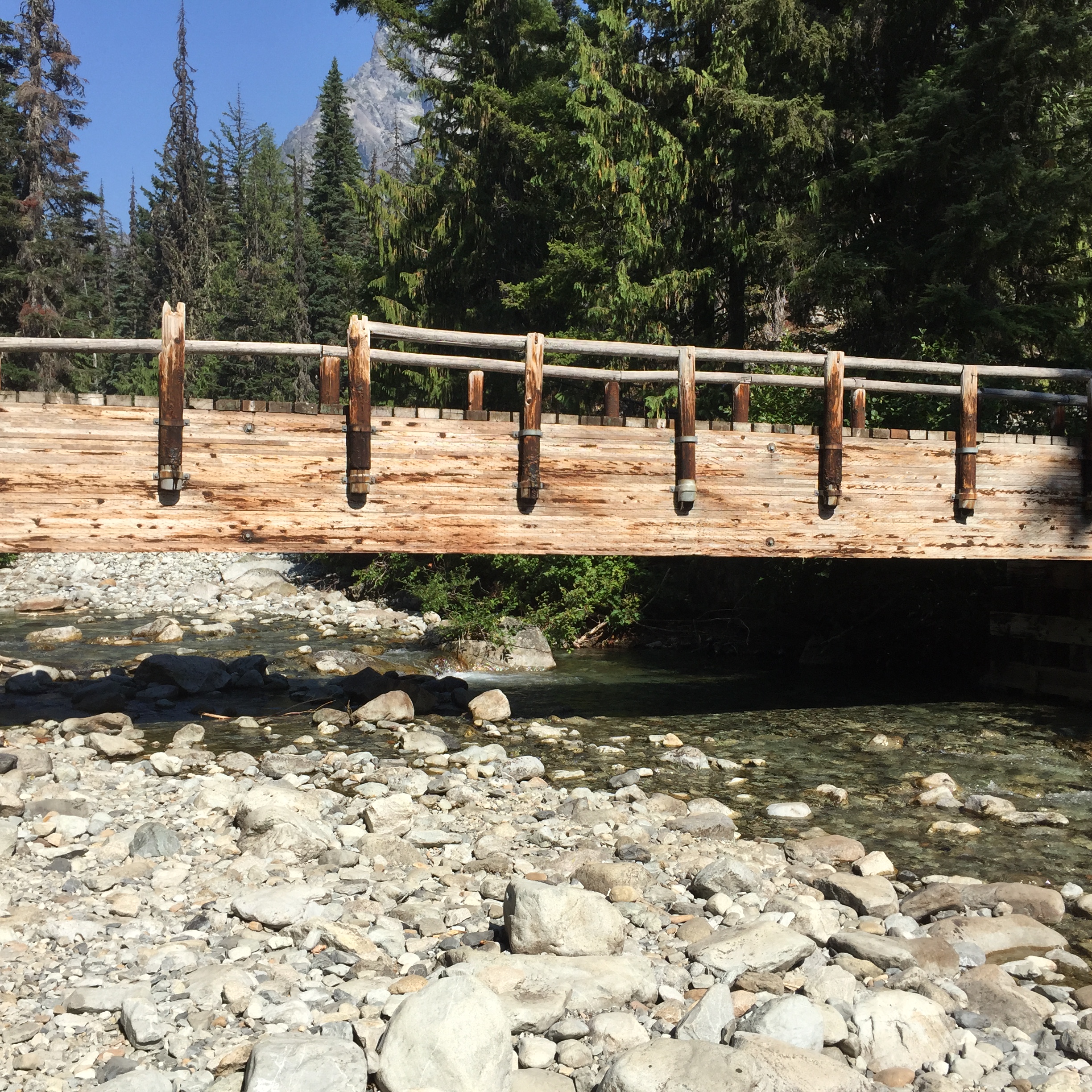
And then it was four more miles of open, uphill ridge traverses until I reached Lake Sally Ann, at Mile 2491. This is normally a gorgeous hike, full of beautiful foliage and a large population of grouse. But on this day it got wetter, and wetter, and windier, and windier, and colder, and colder. Is anybody detecting a trend here? By the time I reached Lake Sally Ann late in the afternoon, it was VERY wet and VERY windy and VERY cold.
I set up my tent in record time, in a fairly tight grove of trees, and away from the lake to keep wind exposure to a minimum. Setting up camp in heavy rain is predictably more complex than in other weather situations. For example, the gear in ziplocs need to be sheltered while I pull my mattress out of its waterproof bag; I then inflate the mattress, which keeps me off of the damp floor, and then get all of my gear into the tent, making sure that everything is inside plastic. This doesn’t protect things from the damp air, but it saves putting my gear in the inevitable small puddles.
I filled every one of my water containers and got in the tent. While this was happening, the wind was increasing even more, and because I wasn’t moving while gathering water, and because I was keeping my main insulation layer in the tent, to stay dry for that night, I got very cold, very fast. Later that night, I estimated the wind was steady at 20 knots, gusts to 30, and that was inside my grove of trees. And the rain was torrential and quite literally sideways; it didn’t let up at all. The lows were probably in the mid 40s. I can only imagine what the lake looked like; I am sure there must have been whitecaps.
Once in the tent, in my quilt, with a large space blanket under my mattress (to reflect heat back upward), and in all of my dry sleep clothes, I made a massive dinner and poured the calories down the throat. Cheesy pasta, hot lemonade, two kinds of candy, you get the idea. From there, I made hot water bottles from each of my two smaller water containers. I couldn’t boil, as they would have melted, but they were mighty warm.
I was able to text Steve again, and asked for a very specific weather forecast: the region around Glacier Peak, about 5000 ft elevation, for a week, beginning tomorrow. That forecast? Winds staying steady, rain staying steady, and low temperatures dropping into the mid 30s. The hypothermia risk in that kind of weather is about as severe as you can get.
It rained overnight, and the poor duo with the slack rainfly were obviously soaked. Fortunately, it’s an easy downhill hike back to the trailhead, so I wasn’t too concerned.
I left Lake Valhalla around 8:00, and connected the dots to Smithbrook and Lake Janus. That’s going to be the story, through Red Pass: connecting places and trail segments which I’ve already hiked with places and segments that I haven’t yet done. It’s kind of fun. In terms of the PCT, the south part of Section K is the one I’ve hiked the most.
Smithbrook-PCT junction *
I’ve been to Lake Janus twice before. It was nice to see the lake, and then this time head up to Grizzly Peak. This was something I’ve wanted to do, but haven’t been able to put together; it’s more of an overnight than a day hike, and that’s the only thing I’ve ever been able to do around here.
Lake Janus *
I ascended Grizzly, which is one of the only peaks on the entire trail where you actually go over the summit. From there, it was easy to see Heather Lake. I hiked to Heather several years ago, when we camped at Lake Wenatchee for a few days.
On my way up to Grizzly, I saw Daniel, who I’d met at the Dinsmores’ two nights ago. He was the triple crowner, who had decided to make it to the border however it took him…if the trail opened, if he had to do a roadwalk for dozens and dozens of miles, whatever it was. It was great to see him. He took off, and with his speed I knew we wouldn’t meet up again.
Near the summit of Grizzly Peak
After the summit, there was a beautiful ramble as I slowly descended to Wenatchee Pass. I was the only person to be seen, and I was filled with a giddy joy. What a privilege to be up here!
Just me and the trail.
From the summit, I dipped down, and then descended to Wenatchee Pass, just before tonight’s destination, Pear Lake. What with Pear, and nearby Peach and Top lakes, Ira Spring and Harvey Manning referred to this weekend trip as “A Pear, A Peach, and a Topping.”
Heading down to Pear Lake
I didn’t find a spot by myself; the only obvious campsite was rather large, and was being partially used by three guys on a weekend trip. They were down at the lake, trying for fish, and I grabbed a tiny corner of the site. The guys were quite nice about it, although I’m sure they would have much rather been by themselves. My spot was under a grove of trees, with a very slight slope; the slope would prove advantageous during the night.
Pear Lake *
I was able to text with Steve a few times; this doesn’t happen frequently, as signal can be iffy. He was at the Gipsy Kings concert. It would have been fun to be there, but there’s the whole problem with teleportation. I think we need a few date nights when I get home.
I got a shower and loaded up my pack, before we took off for Skykomish. Because of the uncertainty of everything, I’m carrying two extra days’ worth of food. Food is heavy.
Andrea, Jerry, and I. It was wonderful to get to know them better.
Jerry and Carl and I had breakfast at the Cascadia, and I once again did myself proud in the calorie department. Burp. We said goodbye at the Sky Deli, and I grabbed the deli’s hitch sign (“PCT Hiker to Stevens Pass”) and proceeded to stick out my thumb. Nobody pulled off of the highway, but a mom (Sarah) and her little daughter (Eva) were at the deli, and mom said, “You’re a hiker! Get in! We can take you to the pass.” And it was a delightful drive.
They dropped me off at the pass, and I adjusted my pack (yet again), grabbed a Powerade, and got the latest info on the trail. Nothing has changed.
At Stevens, just before hitting the trail northboundSign at the trailhead, regarding the Wolverine/Blankenship fire closures. Even this sign was out of date, as Rainy Pass was inaccessible from the west side, due to the fire and slide at Newhalem.PCT North trailhead at Stevens Pass
I crossed the pedestrian bridge and set off from the northbound trailhead. There’s probably a couple of miles of flat, paralleling the highway. I took advantage of this to catch up on my recording.
My destination was just up the trail, to Lake Valhalla. It’s very easy, and is a popular day hike; I was here last year, relaxing at the beach and handing out magic to the thrus. This year, the hike was discouraging. I’m going to be hiking through a bunch of weather, to a dead end; I was asking why I’m even doing this. But I just kept walking. Listened to a podcast, kept walking. Kept walking. Kept walking.
The weather forecast is pretty dismal. Rain should be moving in by Friday. There’s functionally 100% chance of rain, between Friday morning and Saturday night; it then tapers off to almost 100% chance of rain. It’s gonna be a damp one. But if you want to hike in Washington, you’d better be able to deal with rain.
I doubt I’ll see many PCT hikers on this section. There’s probably only a few doing what I’m doing, getting to a stopping place and not missing any of the trail until that point.
Heading up to Lake Valhalla. Today, I’m appreciating blue skies.
I had an entire large campsite to myself, with a family off in the distance. Two gentlemen came through but camped elsewhere; they had attempted to drive up Smithbrook Road to get to the trail via Union Gap, but Smithbrook is closed due to fire danger. The road actually goes over the crest and into Eastern Washington, which is undoubtedly the reason for the closure.
Lake ValhallaI was amazed at how low the lake was. The sandy beach was very pleasant, though.Selfie in the sun
Later on, a father and his teenage son showed up, with shiny new gear. Unfortunately for them, they only threw the rain fly on top of the tent, and didn’t bother staking it out. This may not bode well.
I had my current favorite dinner: 4 oz of spaghetti, cooked until not quite al dente, and then dehydrated. Rehydrate in boiling water for a minute, drain. Toss with 2 packs olive oil, and then 2 packs parmesan. About 800 calories. I’ve got to think about what I’ll be eating the next few days, as I will undoubtedly be cooking in my vestibule, out of the weather.
And speaking of weather, it’s starting to move in; things are clouding up, with mackerel skies and mare’s tails.
I texted with Steve for a bit. I told him I’ve faced bigger challenges in my life than just putting off a dream for a year. I can do this. But I don’t want to. I want to keep going, and hit the border. And I don’t want to wait; I want to do it right now. But that’s not even an option, from the side of the fire that I’m on.
So I’ll just keep plugging away, and knock off 77 miles. And good heavens, I’ve done part of this segment in the rain before, so I guess I can do it again. I’m not going to push myself too hard, because why? I’ve got enough food, and the trail is familiar enough. So sometime next Thursday-ish, I’ll head down the hill.
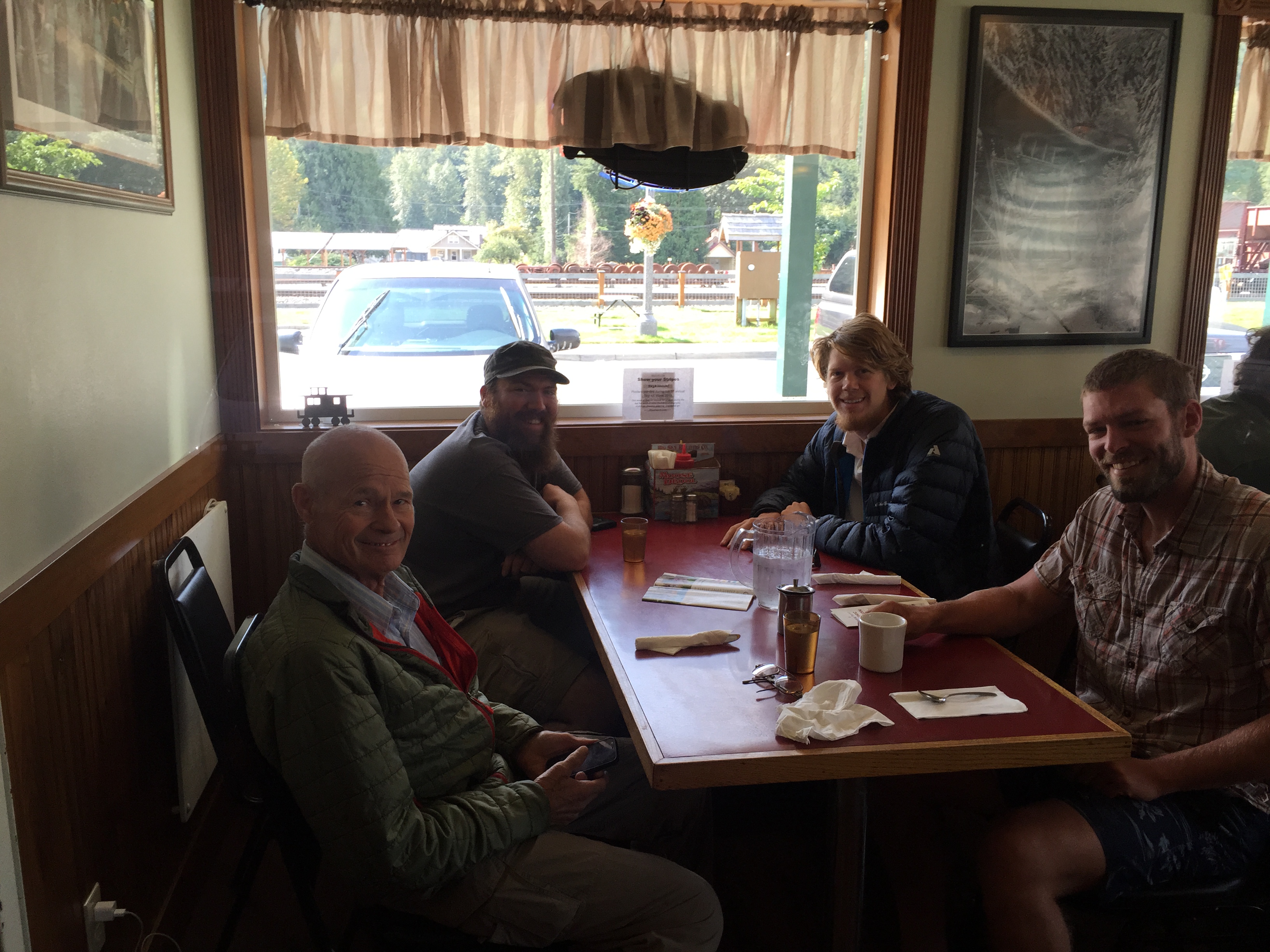
This morning, we all piled in the truck and headed up to the Cascadia for breakfast. I had a huge scramble, hash browns, toast, half of Meander’s biscuits and gravy, and somebody else’s bacon. And somebody’s extra ice cream bar on the way home. Jerry just kind of looked at me, and I said, “No, I don’t normally eat like this.” LOL
Today I had the pleasure of meeting Meander (aka Edward Intven, think “In da Van”). I’ve seen him several places online, and he’s a delightful gentleman with a lovely spirit. He joined us for breakfast, and met up with Flash, who is staying with the Dinsmores, and River, who just dropped by the restaurant. They are all members of the Class of 2013, and it was a complete and wonderful coincidence. I had the pleasure of sharing a table with them at breakfast. Fun times!
Let’s see, who else is here. I met Climbin’ Lineman (aka Carl), who is a gentleman of retirement age, from Salt Lake. He is very devout, and because of that will not travel on Sundays. More power to him.
Patriot is here…we met at Snoqualmie. He’s in his late teens, and from Louisiana. He’s also an Eagle, and so he and Brendan spent some time geeking out over Scouts yesterday.
Other names I remember: Trout (aka Gone Slow), Shady Acres, Heather, Kirby, Weekend, Double Happiness, Penny Lane (aka Jen Marie), Daniel Barrett (a Triple Crowner, trail name unknown). Wish I could remember everyone’s name.
Climbin’ Lineman, Trout, Patriot, and Shady Acres at the CascadiaRiver, Flash, Rest Step, and Meander.Part of my breakfast.
After breakfast, Andrea broke out the camera. She keeps an online album every year, with all of the hikers who come through.
I made it into Andrea’s 2015 PCT Hiker Album! L-R Kirby, Climbin’ Lineman, Heather, and I.
Yesterday, I just hung out with Andrea, Jerry, and the hikers. I really needed a quiet day, especially with all the emotions regarding my decision. Jerry and I went down for coffee yesterday afternoon. He’s got a large group of friends in the community, and they’re always meeting at the restaurant. It’s kind of like Dad and the boys down at the marina.
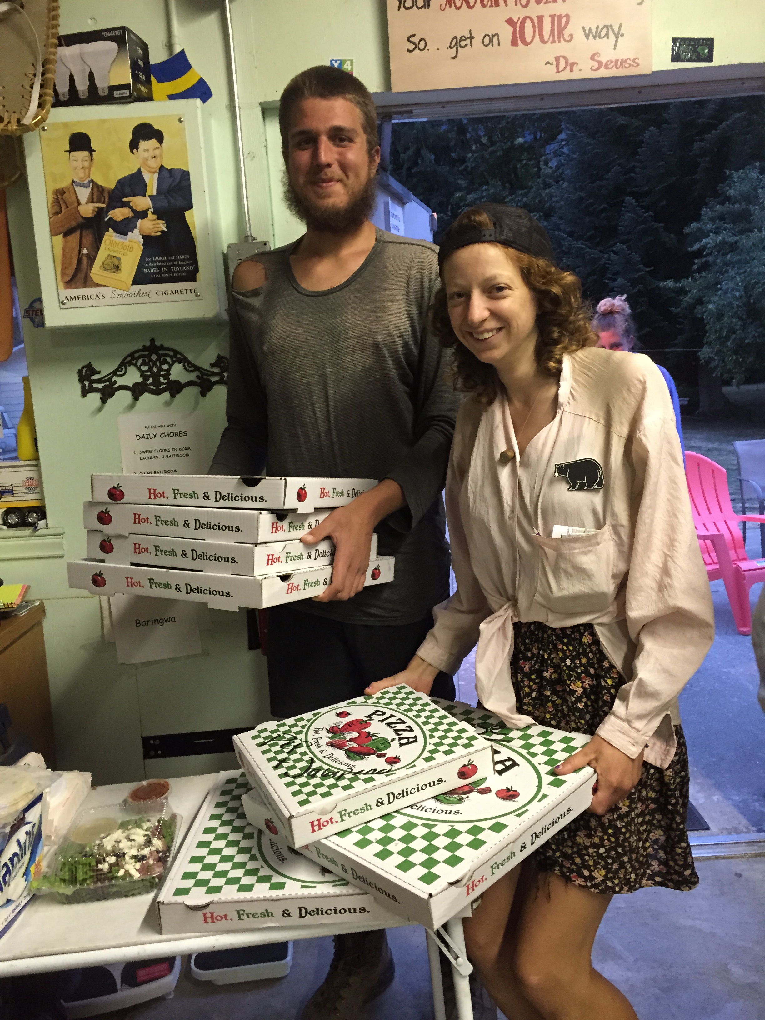
Dinner was easy: we all pooled our money, and Jerry and a few of the hikers went down to Gold Bar to pick up pizza. Lots of pizza. Enormous quantities of pizza. Everybody hung out in the hiker dorm, swapping tales, inhaling dinner, etc. Mellow and very peaceful.
Pizza for the masses. These were enormous, and there was almost one pizza per hiker.Because if you’re gonna have a pizza party, it’d better be good! With Kirby, Rest Step, Patriot, Daniel, Valorie, Sam, Gretchen, TJ, and Kasey. *
So, the decision. I was correct to assume that the Dinsmores have the latest info. Andrea was talking with the powers that be on a regular basis, and posting what she learned in the hiker dorm.
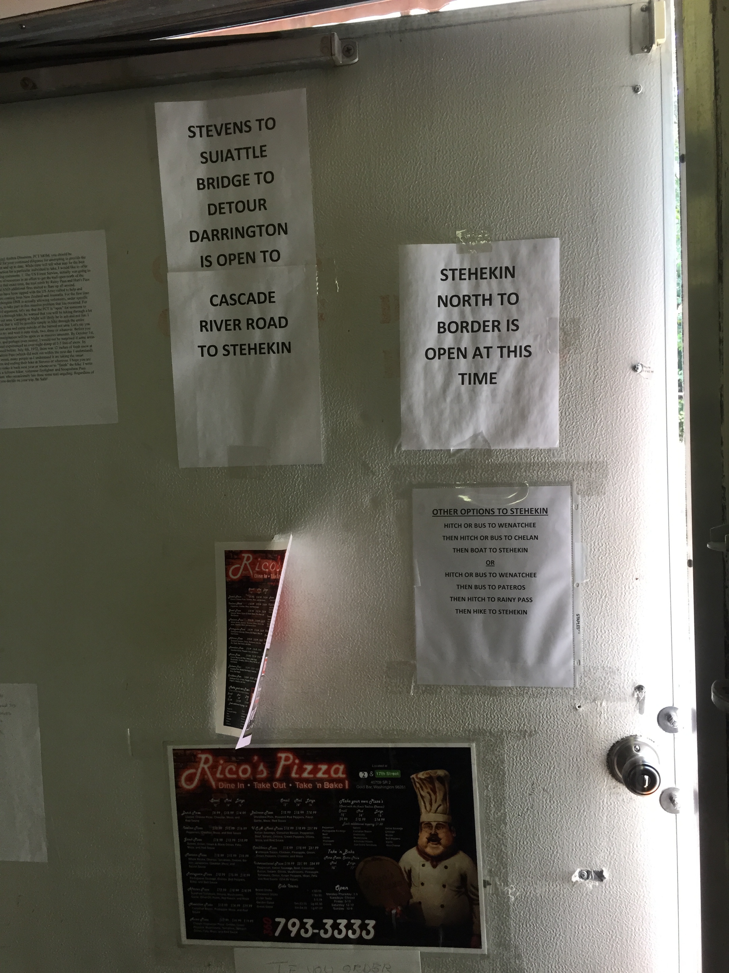
Closure from Suiattle River north to High Bridge, the junction to Stehekin.
It’s clear what I need to do, and it’s not the decision I wanted to make. I’m going to continue my footpath, north from Stevens (mile 2461) to the trail closure at Suiattle River (mile 2538), and come off of the trail. The factors in that decision:
The PCT is closed from the Suiattle River Trail (mile 2538), north to Stehekin.
Highway 20 is closed west of Rainy Pass, at Newhalem, due to a fire and landslide. This effectively shuts off any trail access from the west, north of the Suiattle closure.
Highway 20 has been periodically closed east of Rainy Pass, due to the Okanogan Complex fires.
The only way to get to Stehekin is to take Highway 2, east over Stevens, to Chelan (via Wenatchee, if you’re on a bus).
From Stehekin, it’s possible to hike north to Rainy Pass, and from there to the border. However, Forest Service personnel, volunteers, and knowledgeable residents have warned about smoke and ash, due to the current fires, and due to the smaller fire north of Rainy Pass.
I have asthma, and I have a proclivity towards bronchitis.
Unlike hikers from out of state, it’s easy for me to get back on the trail next year, at Suiattle.
So for now, it looks like my hike is over at Suiattle River. That will give me roughly 300 miles this year, with another 100 and small change next year. Andrea recommends returning in early to mid July of next year, depending on the snowpack, so as to avoid the most dangerous part of wildfire season. And my guys completely get this, and are totally willing to support me as I return to the trail next summer.
This is NOT how I wanted my hike to end. I wanted to finish at the Northern Terminus. I guess sometimes we don’t get what we want, and it works out for other reasons. I’ll be home with Patrick at the beginning of school. Not quite the first day, but the first week. I get to spend time with Steve, learning about wine, which is his passion. But I’ve got to let myself grieve the plan that I had.
So I’ll enjoy my time here with friends, and then after breakfast tomorrow I’ll hitch up to the trail, and head north…to finish out this section of my dream.
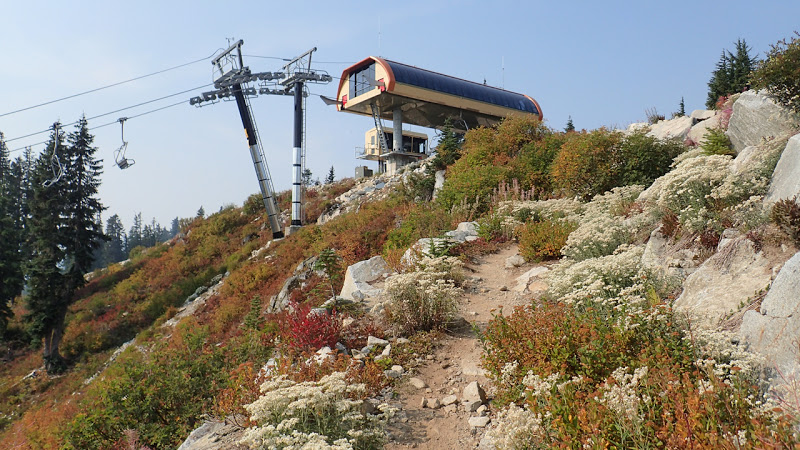
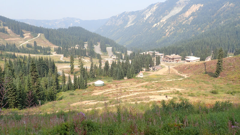
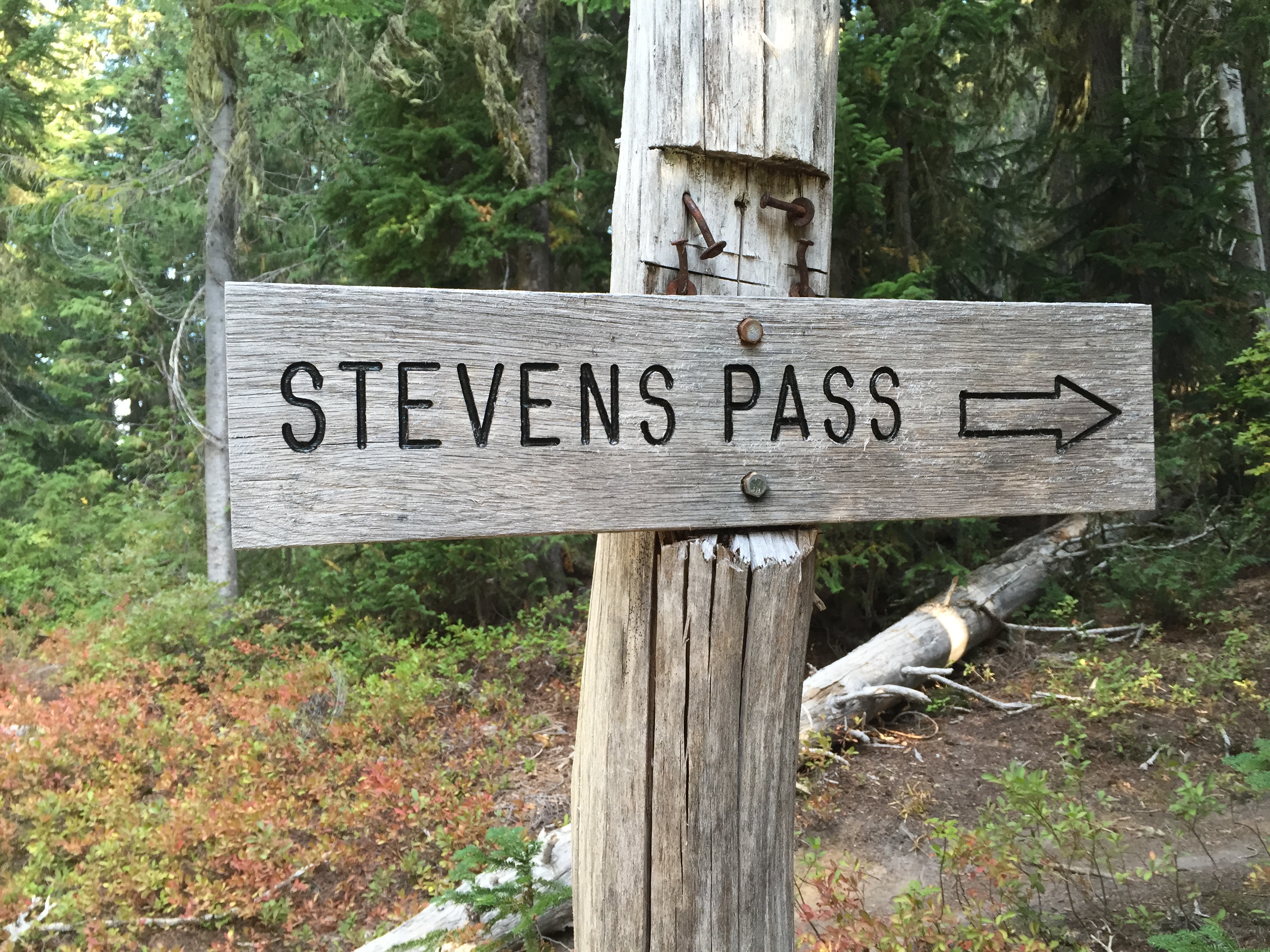
I got up at 5:30, to give myself time to hit the trailhead at 10:00. The trail was five miles, traversing a bowl before climbing a ridge to a chairlift at Stevens Pass. I worked my way along the ski slopes, and finally down to the parking lot.
Fall Colors above Stevens *Climbing the last ridge, past a chairlift *The descent into Stevens Pass *
Brendan and Alex weren’t there yet, but I met a guy named Fred, who spends most of the year travelling in his van, just seeing different places. He was waiting for his monthly check to arrive (tomorrow), and was getting low on food. And lo and behold, here comes Brendan and Alex with an ENORMOUS vanload of chow. Perfect timing.
We stopped in Skykomish, at the Sky Deli, and I got my coveted BURGER AND SHAKE MMMM!! And then it was down the hill to Baring, and the Dinsmores.
Jerry greeted me with a big hug, and then the kiddos proceeded to unload the van. Eyes started popping in all directions. Not even thrus could put this much food away. They were incredibly grateful.
Andrea came out and gave me another big hug, and her eyes started bugging out as well. Most of the food will last quite well in the hiker dorm fridge, and Brendan ended up taking a bunch home, but there were some mighty happy hikers.
I was very grateful just to be here; I know this is where I’ll need to make my decision, and there’s no better place to do it than in the midst of the hiking community, with the very latest info.
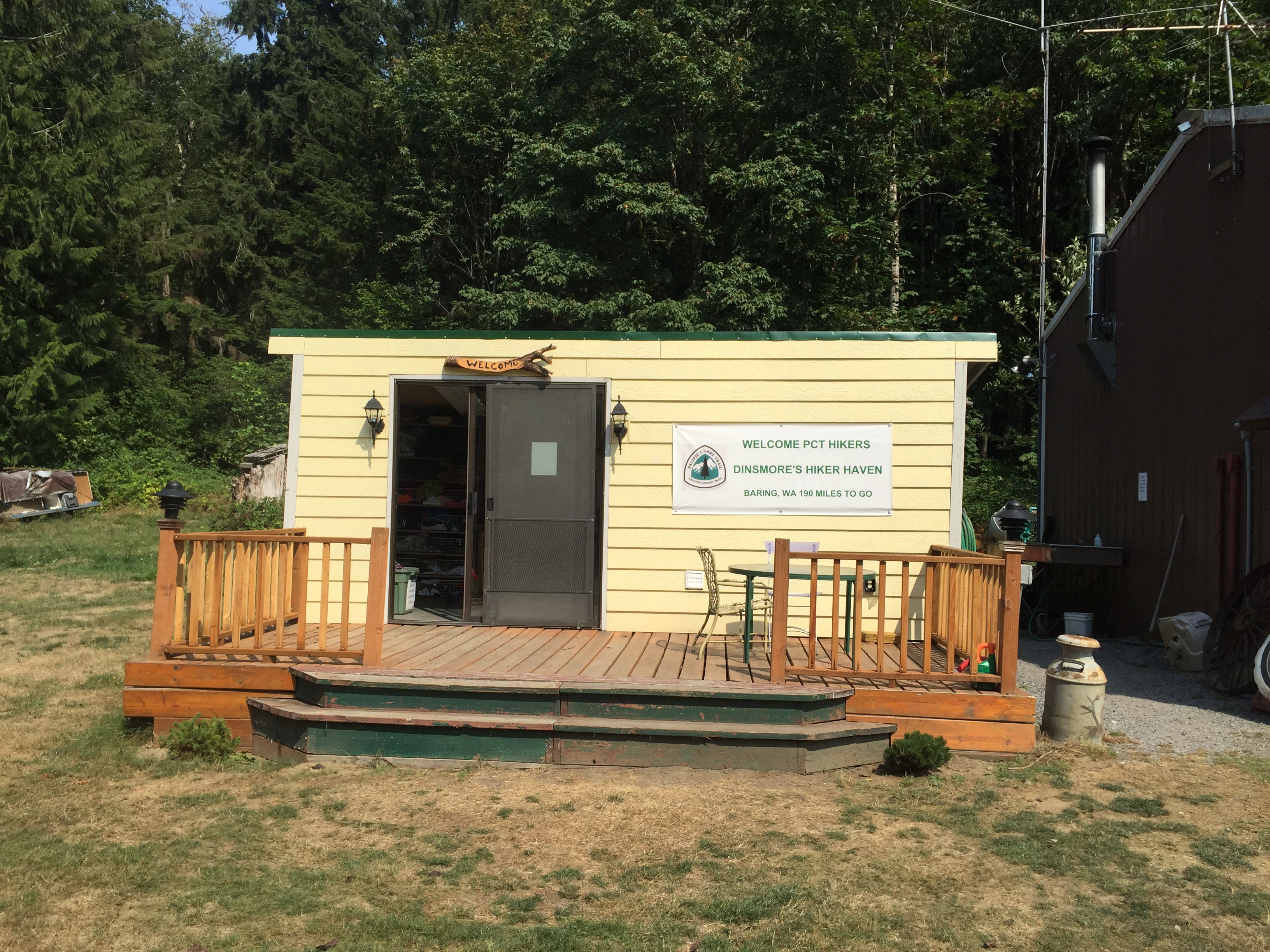
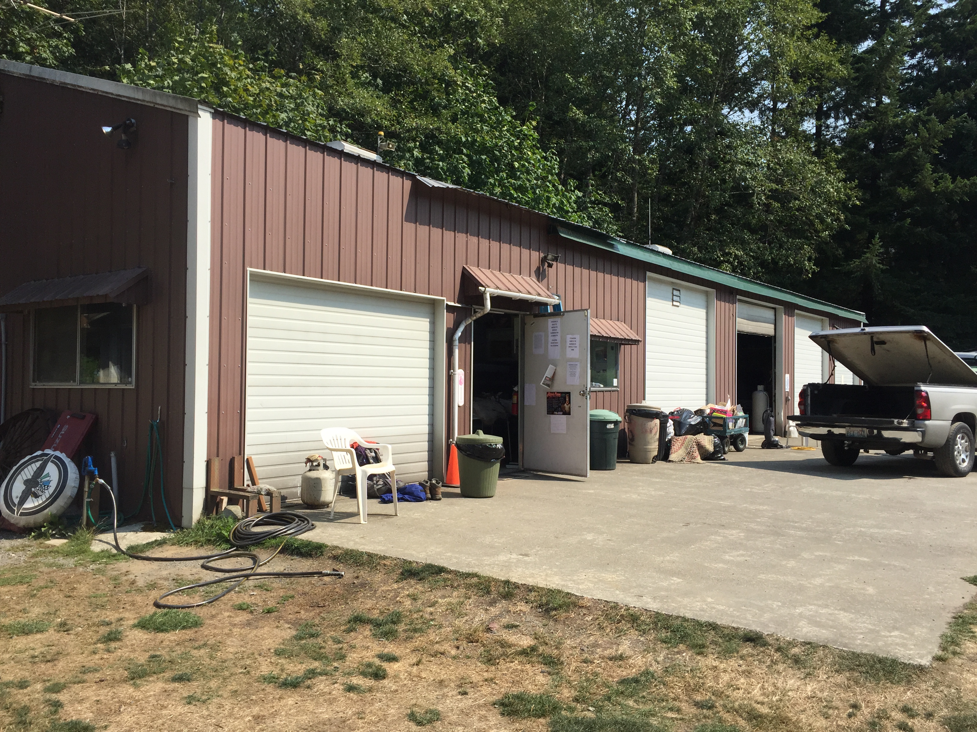
The shower and laundry house. Before washing clothes or taking a shower, hikers need to pre-wash their socks and their feet.The garage. A large portion, to the left, contains the hiker dorm.
Anyway, while the kids were feeding people, I started my laundry, grabbed a shower, and began sorting my resupply. Brendan had brought up my bounce bag as well. Many thrus or longer distance sectioners will have a bounce box. This contains things needed periodically, or sometime in the future, and is generally sent a few resupplies up the road. I have a duffel, which the family brings up whenever they meet me; it’s got a couple of sets of street clothes, some extra toiletries, and the like. It was nice to wear a cotton t-shirt while my hiking clothes were in the laundry. But even if I didn’t have the bag, the Dinsmores have a big stash of loaner clothes for laundry time. Last year, the favorite was a purple prom dress, which appeared several times in the annual hiker photo album which Andrea puts together.
Once I was done shuffling things, Brendan and Alex headed down the hill. I wish we’d had more time to hang out; seeing family has been a huge deal for me.
Another cool thing that happened was that I met Soul Sista (aka Ronnie). She’s done a lot of work with packs, and was able to help me get mine adjusted better. We ended up setting the height to halfway between small and xtra small. But ultimately, she couldn’t get it where it needed to be, and she strongly recommends I get a new pack. Maybe it’s time to take a look at the new Mariposa. Anyway, she is up here for a few weeks, camping on the 2 acres of lawn, and generally helping out. There are several people who come up here and pitch in during the summer, cooking, repairing, driving folks, etc. Did I say this community is awesome?
I slept in the hiker dorm last night. Since Jerry and Andrea introduced a No Alcohol policy, there’s no reason to stay up late and party. The lights were out by ten. Of course, maybe that was because we were all excited about having a Real Bed!
The hiker dorm at Dinsmores Hiker Haven. They have bunk beds (with real mattresses), recliners, a basic kitchen w/fridge, microwave, and pantry), a huge hiker box with sorted supplies, a wood stove, and TONS of memorabilia from hikers through the years.
Today was the push to Lake Susan Jane, 13 miles, 3700 gain. There were three full ridges to climb. The first, to Pieper Pass, was probably only 1000 ft, so just a warmup. On my way there, I met a father and his two elementary-age kids. They were heading south from Stevens to Snoqualmie. The kids looked a little unsure, so I told them that there was a pancake restaurant at the end of their hike. This got their attention, and the dad gave me a grateful grin as they headed on their way.
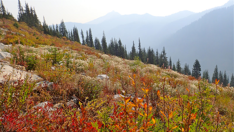
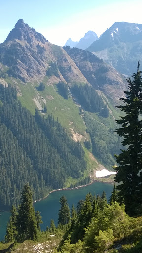
I did take the time to enjoy the views * along the way, though. The smoke was visible off and on, throughout the entire section.
Trap Pass was a real attention-getter, and I definitely got to use my namesake hiking maneuver. On the way up to Trap Pass, I met two very cool women, Colleen and Lexie, from Skykomish. They were out for a few days, doing their first solo backpack, with brand-new gear and everything. I introduced myself, and we fell into conversation. I told them how cool it was that they were out doing this, and that it totally rocks my world when I see women (especially above a certain age) out here, going for it. I gave them a few pointers, such as how to hold trekking poles, etc. They were going very slowly, but they were going, and that’s the cool part. They also shared trail mix, and a couple of sticks of pepperoni. The latter was a surprise to me. I gobbled it down, and suddenly felt that post-protein clearheadedness. Guess what I’m buying in Skykomish?
I crested the pass and headed down the other side. There were quite a few people out there, as has been the case the entire section. I doubt I’ve gone 20 minutes at any time without seeing somebody.
Trap Lake was sparkling a gorgeous blue as I descended the ridge. I took the side trail to get water and have a quick snack. I also managed to get turned around in the tangled rabbit warren of trails around the lake, so by the time I got straightened around, and I fixed a problem with my hydration system, it was close to 4:00.
Trap LakeLexie and Colleen, mighty hiker women
So, 4:00. I had six more miles and 1500 feet to go, before Lake Susan Jane. I needed to be there no later than 7:30, because (skipping the details) I hike in my sunglasses, and the sun is setting earlier each day. Needless to say, I needed to step on the gas. I went faster than I am generally comfortable with (not too fast, though). I climbed a short ridge, did a long descent to Hope and Mig Lakes, climbed a more enthusiastic ridge to Lake Susan Jane, and swapped out my sunglasses just before hitting my campsite. Whew. I got camp set up in record time.
I’m really looking forward to tomorrow. Not only is this a familiar section of trail, but I should be seeing Brendan and Alex around 10, taking them to lunch (BURGER! SHAKE!) and heading to the Dinsmores’!
I got to sleep around 8 last night, and slept like a rock. I used my earplugs, and it made a world of difference. I wasn’t overly concerned, simply because there were decent people nearby. Man, did that feel good.
I said goodbye to Paul and Matt, and headed back up to the main trail. I took some time to record, and then started the ascent up the ridge.
Heading up Cathedral Pass
The ridge climb that I put off yesterday was much cooler today. I made it up to Cathedral Pass, and the operative word was Gorgeous. As in the ridge was gorgeous, the pass was gorgeous, Cathedral Rock was gorgeous…are you detecting a trend here? High alpine heather, beautiful path, and O, the MOUNTAINS! I had more fun, just rambling along the top of the ridge and taking pictures.
Cathedral Pass ridge rambleCathedral Rock
And then I met a girl named Kelly. She’s a SOBO sectioner, and is one of the few sectioners I’ve met who will be travelling farther than I am. She also brought fire news, which matched what Paul had said the night before. The Okanogan fire is now over 144K acres. Hwy 20 is closed at Newhalem (west of Rainy Pass, which is the PCT junction); that probably affects the Cascade Pass detour (the workaround for the Blankenship closure from Suiattle River to Stehekin). Hwy 20 is also closed the other direction, due to the Okanogan fire.
The long and the short of it is that if all of this info is correct (and it was very current), my trip will be over not long after Stevens. I sat down in the shadow of Cathedral rock and just cried for a few minutes. This means so much to me, and I just want to see it completed, hopefully this year. I need to wait until I get to the Dinsmores’ to get the best info, but I’m really concerned. I messaged Steve, and he confirmed what she said, but added that the situation is very fluid. I took a deep breath (okay, a very deep breath), and kept walking. This is incredible country, and I don’t want to miss it because I’m focused on what’s happening further north.
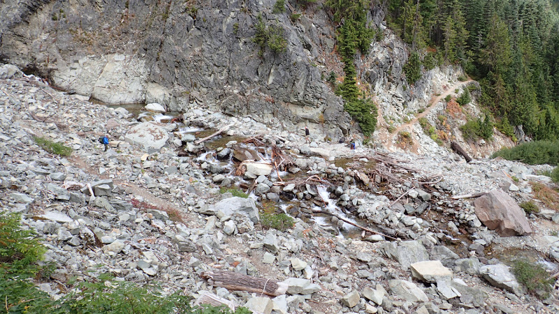
A handful of miles wandering along stunning ridges, and I came to a sign warning of a “Dangerous Ford.” There was an alternate route posted, for stock; as I understand it, it’s better to take the stock route early in the season. As it had been very dry lately, I took the main route. The creek is the drainage for the Hyas Glacier, on Mt. Daniel, west of the trail. The creek runs through a fairly narrow slot, and once it opens up above the trail, it splits into several sections. I skipped the log bridge and just plowed through. From there, it was a matter of carefully following cairns, because the trail was practically invisible from one section to the next. And at the end, there was a bit of scrambling and a veggie belay or two. (A veggie belay is when you use branches and such to pull yourself up a slope.)
Hikers crossing the unnamed creek. The last part of the crossing is hidden to the right. *The creek looks deceptively small here. For perspective, the diameter of the root ball, on the right of the log bridge, was roughly as tall as I am.
I gradually ascended a long ridge, heading toward Deception Lakes.
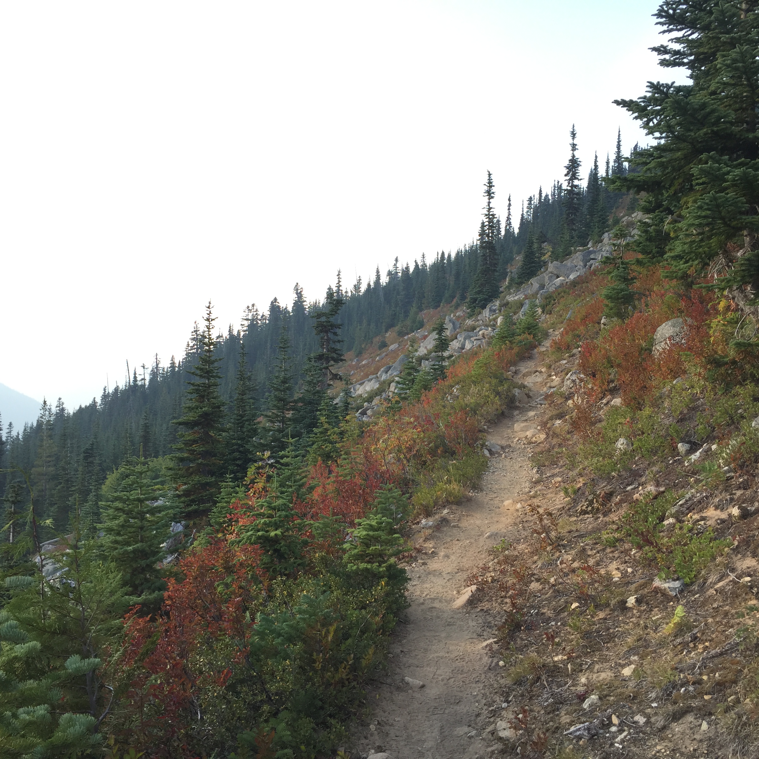
The first colors of fall, heading toward Deception Lakes
I made camp, and I had the place to myself. I had been warned about the mice (bring a mousetrap, or a cat), but with my Ursack and my water bottle stowed away from my tent, I ended up having the quietest night I’ve ever had in a campsite, ever, anywhere. No sound at all. And that made for some good sleep, which was exactly what I needed.
I hit the rack last night a bit after 9:30, and I could feel it today. There’s a reason they call 9:00 “Hiker Midnight.”
This morning, I got up, said goodbye to my camp mates, who were fixing their breakfast, and headed down the trail. As I descended the ridge, I met a couple at the next campsite; they were about my age. The wife said to me, “Way to go! We need to show these kids that it doesn’t have to be just 20-somethings out here solo hiking.” And I replied, “No, it doesn’t. I’m 51, and in fact today’s my birthday.”
With an “Oh my gosh!” she rummaged around in her pack, and pulled out a big chunk of homemade peanut brittle! She handed it to me, and I got another delightful round of Happy Birthday, dear Rest Step!
The husband heard my name, and asked if I had been in the Mountaineers. So I explained the connection. What a great encounter that was!
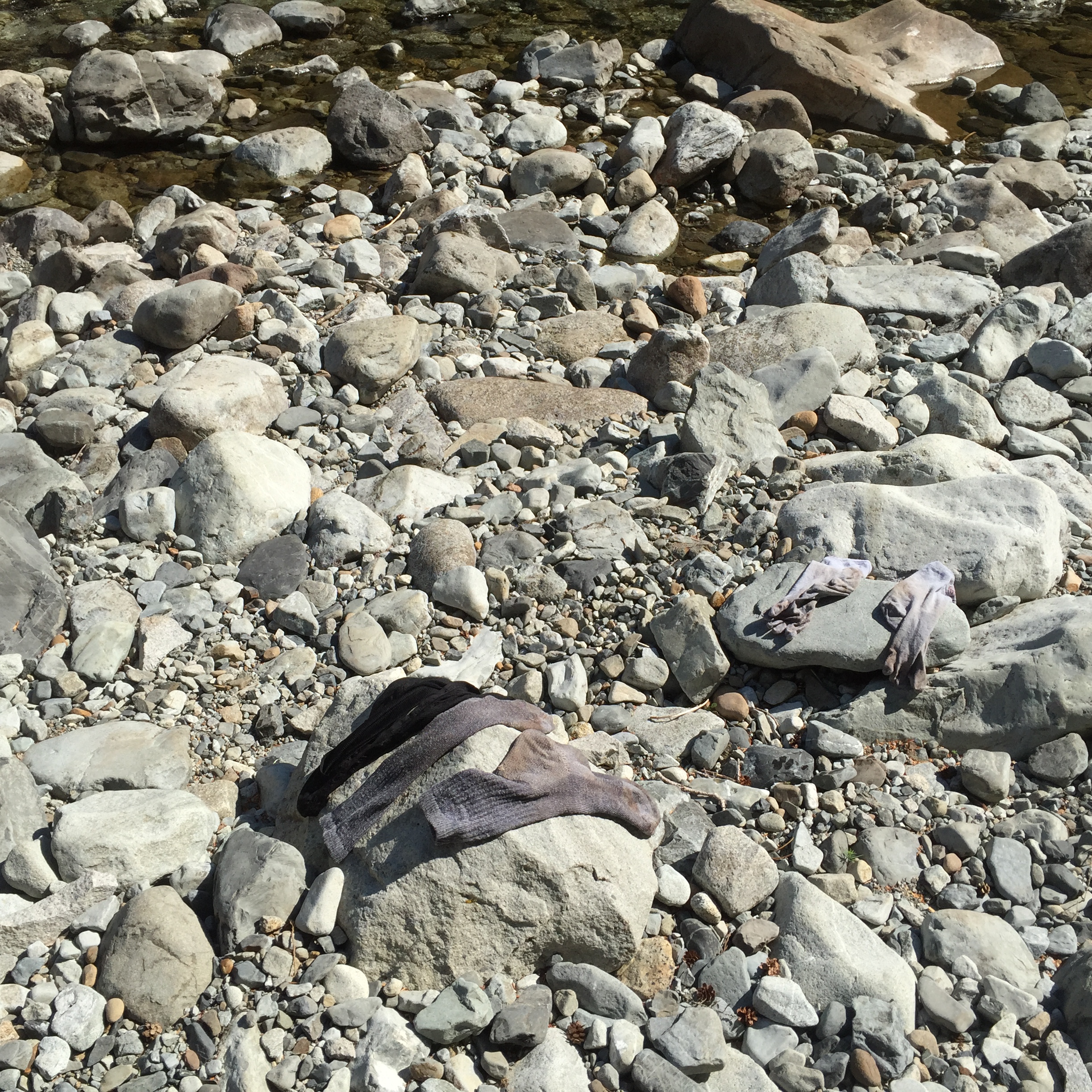
I descended the ridge, to Waptus River. There’s a lovely wood bridge which crosses the river, although it was so low it would have been an easy ford. I treated myself to a bit of relaxation: washing up (no soap), rinsing out my socks (eww), refilling with clear, cold water (yum), and putting my feet up while I had a mid-morning snack.
The view from the Waptus River laundromatThat’s as clean as my socks ever gotCrossing Waptus River and heading north
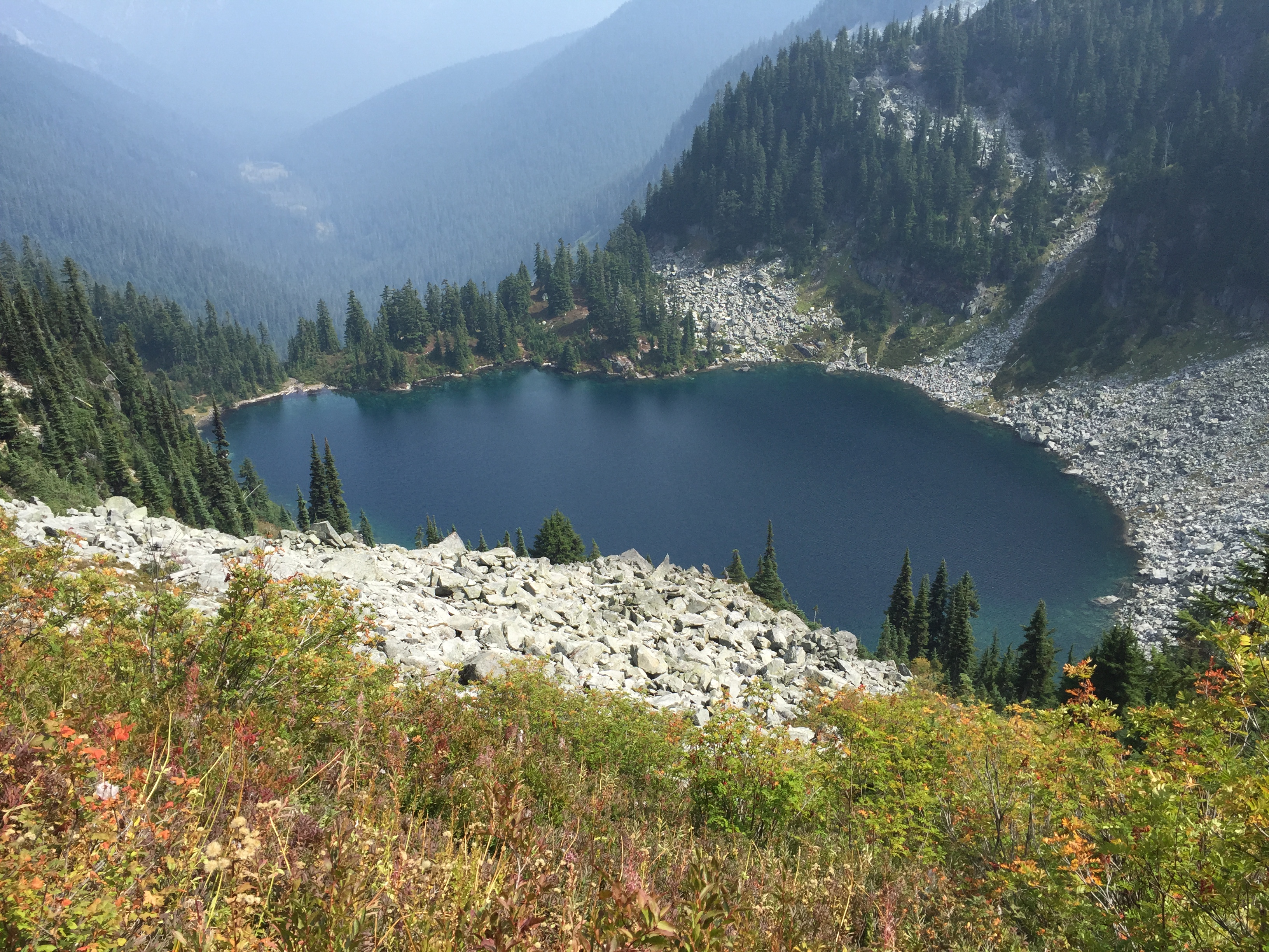
My goal today was a campsite at the base of Cathedral Rock. ‘Twas a lofty goal, but not to be. I hiked around Waptus Lake, and up Spinola Creek, and when I got to the Deep Lake side trail, it became very apparent that I was going to stop here. The ascent up the ridge to Cathedral Pass has a southern aspect, the sun was very hot, and I didn’t feel like schlepping water up the ridge to a dry camp. So Deep Lake became the destination of choice.
Hiking in to Deep Lake, with Cathedral Rock in the background *
After scouting around, I found a large campsite with two tents and room for one more. One of them was unoccupied, but there was a father/son pair (Paul and Matt) in the other.
The ranger came around while I was setting up my camp. She wanted to check my permit, make sure I knew LNT, and make sure I knew there was a backcountry toilet a little ways away. Life’s little pleasures…a loo with a seat!
I went down with Paul, to soak my feet in the lake; Matt was out fishing. We found a lovely rock, where I could soak my burning feet in water that was exactly the right temperature (and clear enough for a very easy fill-up).
What a place to soak your feet! *
After a long, roundabout conversation, we discovered a connection! He works for the City of Everett, and I made the connection back to Tom, the husband of one of Lynn’s best friends). Tom and Paul have worked together since forever. So I can now say that I shared a campsite with my son’s godmother’s best friend’s husband’s longtime colleague. How about that?
The sun was sinking, so we headed back to the campsite. I fixed dinner, had a bit of dessert, and crawled in bed before 8. Luxury!
Tonight I’m grateful for many things. A birthday song. A river, a lake, and a mountain view. Friends along the way. And most of all, my family.