Thursday, August 20, 2015, Mile 2409: Traipsing through the Talus

At Delate Creek, Mile 2409

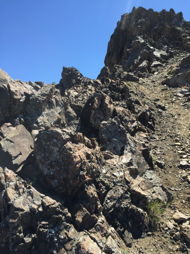
Today was a hell of a day, a lot tougher than I expected. The first eight miles were basically all talus, all the time. Talus is rockfall on the slope of a mountain, and often requires careful foot placement, plus a bit of scrambling when the boulders are large. Scree is the little stuff…pebbles and small rocks.  Talus is the larger stuff, ranging from boot-size to refrigerator-sized boulders. My balance isn’t the best, although it’s definitely improved over the years! But talus has never been my friend, and hence my forward progress was rather slow.

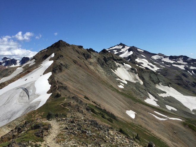
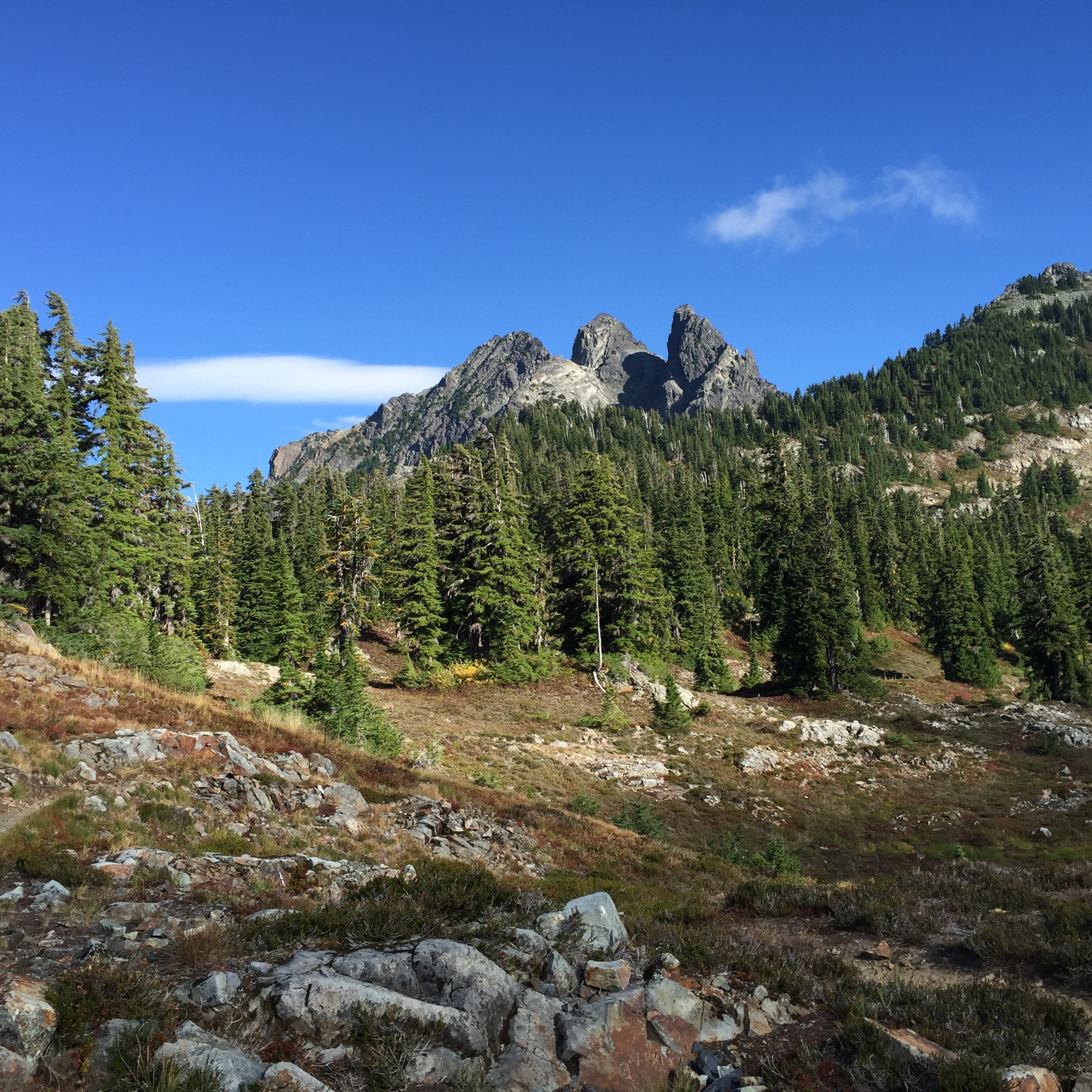
The weather made it much more complex, and much less rewarding.  The ridge northwest to Chikamin Peak, and the entire Chikamin/Four Brothers area, was completely socked in…entirely covered with cloud, which was punctuated by heavy wind and the occasional bit of rain.  It was just one thing after another, and I did not have fun. And I missed quite a bit of gorgeous scenery.

2015-08-20 11.55.43
The advantage of talus slopes: marmots
four brothers
What I missed, thanks to the weather on Chikamin Ridge and the Four Brothers **

Fortunately, after I rounded a ridge through Chikamin Pass, it was a whole different ball game. The talus was still there, but I could actually see; the clouds were gone, and the weather was much calmer.

2015-08-20 14.21.29
Park Lakes from Chikamin Pass

One of the other things that were bothering me was the mental inventory I was taking of my food. I calculated the speed at which I was travelling today, and what was in my food supply, and it wasn’t adding up. It definitely didn’t add up if there were more days like today, and I was getting a bit concerned.

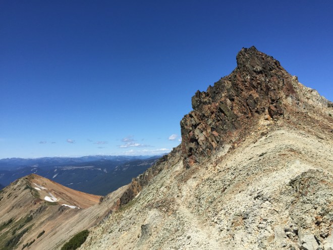
Anyway, I rounded that ridge, and suddenly the scenery was a) there, and b) really lovely. I continued the traverse down the ridge, and who did I meet but a retired couple, Unbreakable and No Trace, the kindest and humblest hikers around. They are on their second thru, and are Triple Crowners…a fact that they neglected to mention. We spent probably fifteen minutes talking about the trail, about being older than the average hiker, and all kinds of things. Fifteen minutes is a long time for an impromptu trail conversation.

Unbreakable reminded me that the shuttle bus to Stehekin only takes cash. I said to her, “Don’t worry, I’ve got it covered. I put small bills in my resupply for Stevens.”

She replied, “Wow, you’re organized!” And I replied, “Not always…I forgot to do specific research on this section, especially regarding talus slopes, where I tend to go slow, so I’ll need an extra day, and I’m a little short on food. Grr.”

And without hesitation, they pulled out a couple of Idahoan instant potato packs and a Top Ramen, and handed them to me! Trail magic! And it really made a difference in my attitude. What a privilege it was to meet them!

The scenery along this stretch is incredible. I climbed one last ridge, taking lots of pictures, including one of my beloved Mt. Stuart.

2015-08-20 15.19.11
Three Queens
2015-08-20 16.50.31
Three Queens
2015-08-20 14.53.21
Mt. Stuart with lenticular clouds

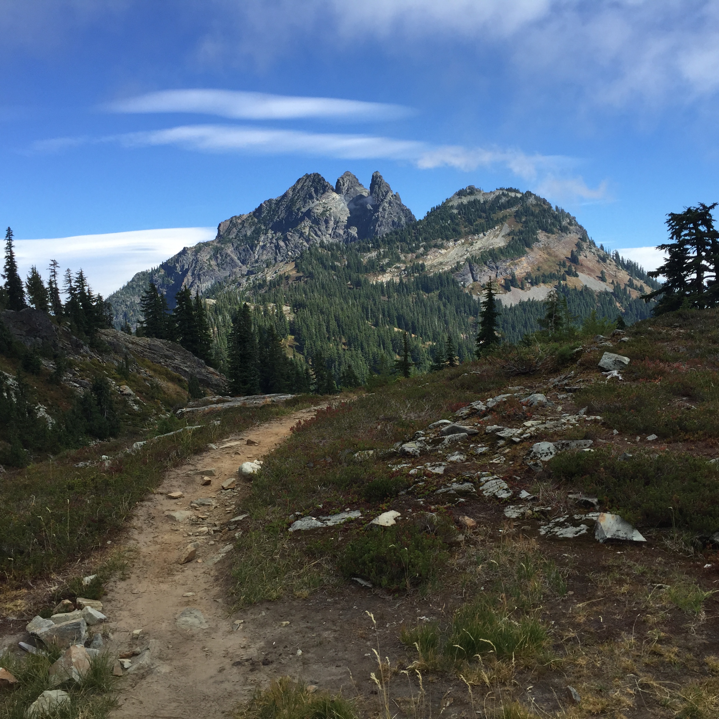
Finally, I descended, perhaps 1500 feet, to the beautiful Delate Falls.

There was a campsite just before the falls, so that became home sweet home. There was no convenient place to get water at the falls, unless I crawled under the bridge, but fortunately there was a spring just past the bridge. I topped off and went back to camp.

Go figure, I’m really tired, so I’m not even going to do my evening route planning. That can wait until my brain is awake.

Footnote: Although these pictures were taken in early summer a few years ago, they are well -labeled; they give the feel of today’s hike, and what I would have encountered had there been any visibility along Chikamin and Four Brothers. I saw zero snow. http://www.wta.org/go-hiking/trip-reports/trip_report.2011-07-24.9626619341

*Photo credit: Eric Aalto

**Photo credit: http://www.grandcanyontreks.org

Tuesday, July 28, 2015, Mile 2281: The Knife’s Edge

At Tieton Pass, Mile 2281

The wind kicked up quite a bit last night, enough so that I had to get up and snug down the tent. I didn’t know how it was over the ridge, but there’s no way I’d do the Knife’s Edge in that kind of wind. So I slept in a bit, to give the wind time to die down.

The other problem is that, well, there’s no water until after the Knife’s Edge. It’s a constant juggle of where I am, where I want to go, where the water is, and how my foot is doing.

So I got up, headed back down to the last water source, checked to see if there was a hose there that I dropped (yes, I retrieved it), and then headed out. Thank God, the wind died down. I was not about to do the Knife’s Edge with a howling crosswind. In talking with other hikers, it appears that the wind was local to the Cispus Drainage.

Before I left camp, I met a group of four retirees, out having a week’s worth of fun. We hit it off, and were leapfrogging throughout the morning. And I also met a group of three women from Tallahassee, and leapfrogged with them.

After descending into the drainage, it was (predictably) time to climb back up over the ridge, toward Snowgrass Flats. The weather was clear, and suddenly the eye candy began.

2015-07-28 09.51.25
Mt. St. Helens
2015-07-28 09.59.19
Mt. Adams
2015-07-28 10.11.49
I loved this little section of trail. Some wonderful souls spent a great deal of time putting this together.

And all of a sudden, blam! There was Mt. Adams, appearing for the first time, now that the weather had cleared. One of the women from Tallahassee took a very nice picture of me.

2015-07-28 11.04.42

It was time to work our way around the next ridge, which included a lunch stop with all of the aforementioned folks.

2015-07-28 12.21.45
From our lunch spot, we could see all three of the volcanoes: Adams, St. Helens, and Rainier peeking over the trail to the north. Also on the right is the very turquoise Goat Lake.

And then, The Decision. Do I do the traditional route, which traverses Packwood Glacier, or do I do the Old Snowy Alternate, which scrambles steeply up and down Old Snowy, a mountain with year round snow and glaciers, plus lots of steep scree slopes.

I chose to do the traditional route. The only problem with that is that, well, there’s a glacier, with a 30 degree slope and no safe runout. Fortunately, there were footprints kicked in, so with some solid concentration, I safely crossed. And with the exceptionally low snow pack this year, the actual glacier was only about a hundred feet across. But the rest of the traverse was over an enormous talus slope, with refrigerator-sized boulders.  With my unique version of visual perception, and the ongoing pain in my ankle, it was a hell of a time getting across; I had to cross a slope, descend (read butt scoot), cross the glacier, and then re-ascend.

2015-07-28 13.42.07
The north end of the talus slope, after the glacier and boulders

Once I crossed the slope, I headed up a ridge, and there was the Knife’s Edge!

2015-07-28 13.49.17
Almost there
2015-07-28 14.02.48
Mt. Rainier, the Knife’s Edge, and me

It’s really, really pretty, and it’s not as dangerous as some of the slopes I’ve been on over the years. There were a couple of spots which made me stop and think “Oh, how interesting!” but for the most part it wasn’t too big of a deal. I would definitely not want to be up there in the dark, wind, or fog.

2015-07-28 13.48.41

The trail winds along a very steep ridge, and around rocky knobs

2015-07-28 15.04.48

2015-07-28 15.39.00
Looking back south. Old Snowy and its glaciers are just right of center.

The trail gradually came off of the ridge, and then turned west at Elk Pass. It became a lovely meadow walk, heading gradually downhill, past the headwaters of several creeks, around Lutz Lake, and eventually to Tieton Pass.

2015-07-28 16.32.48
Standing guard over my trail. I just started talking to him, and eventually he scampered into the brush.

When I finally made it down the series of ridges, to Elk Pass, it became apparent that my lovely forward progress, which probably averaged around ½ mph with the scree, talus, and photo ops, needed some help…if I were to make White Pass by Wednesday. So I dropped it in low and added another four miles before reaching camp around 8PM.

At this point, each and every step was a pain…quite literally. By the time I reached camp at Tieton Pass, I was just DONE. I knew I needed to be up by 5, to make it up the next ridge and then down again, given my slow forward progress, and given the closing time of the store at White Pass, where my resupply was waiting. So I pounded a Snickers bar for dinner, and crawled into bed.

Footnote 1: The talus slope/glacier traverse is notorious. A PCTA (Pacific Crest Trail Association) work crew spent a week in 2013 putting the trail back into place. The pictures give a good sense of what that area looks like. I didn’t use my camera while on the slope. Take a look at the link…it’s pretty incredible.

Footnote 2: I would later learn that during the rather miserable rain/wind/snow/fog the last week of August, some of my fellow hikers ended up crawling the entire length of the Knife’s Edge.