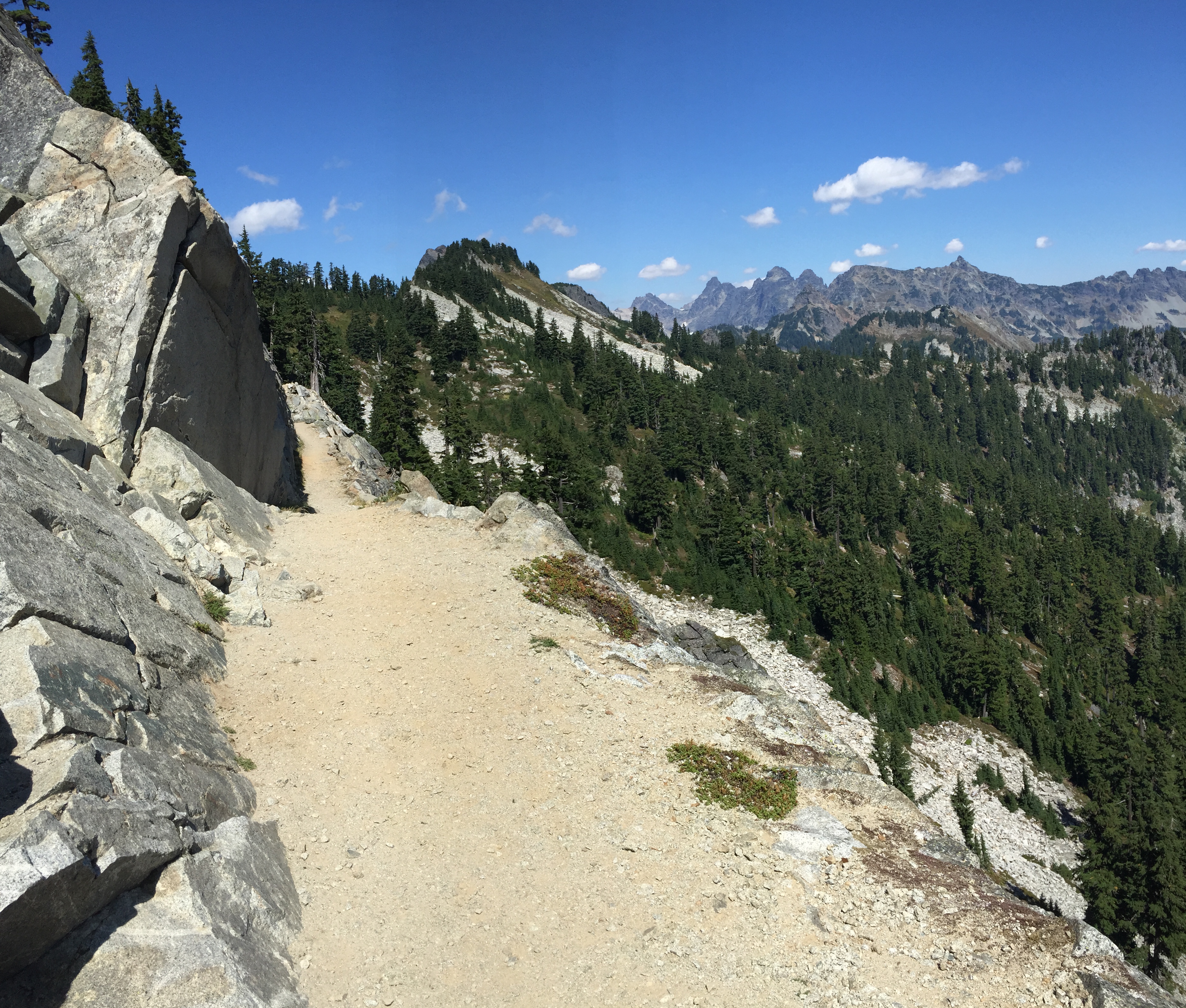
Today was the push to Lake Susan Jane, 13 miles, 3700 gain. There were three full ridges to climb. The first, to Pieper Pass, was probably only 1000 ft, so just a warmup. On my way there, I met a father and his two elementary-age kids. They were heading south from Stevens to Snoqualmie. The kids looked a little unsure, so I told them that there was a pancake restaurant at the end of their hike. This got their attention, and the dad gave me a grateful grin as they headed on their way.
I did take the time to enjoy the views * along the way, though. The smoke was visible off and on, throughout the entire section.
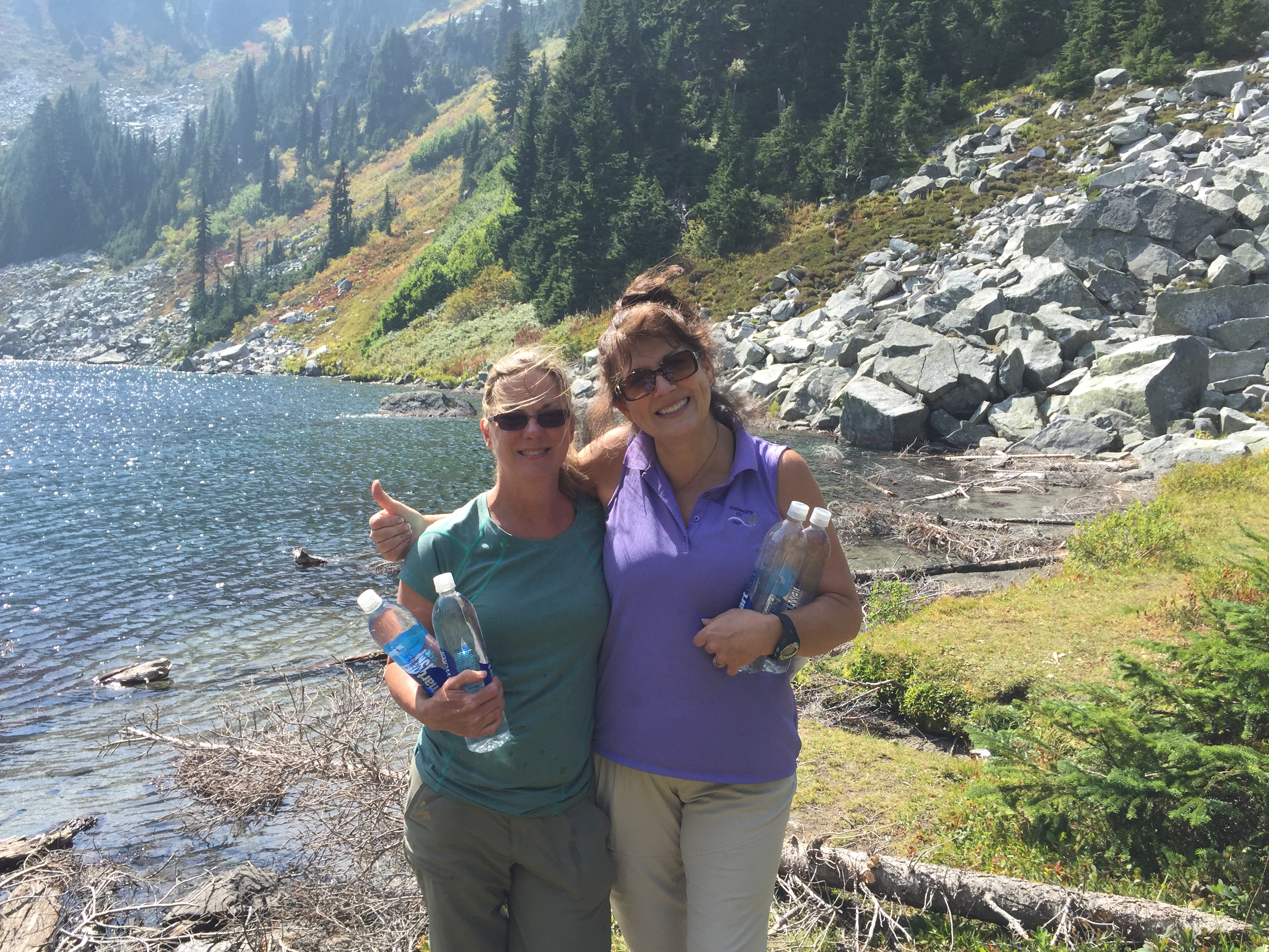
Trap Pass was a real attention-getter, and I definitely got to use my namesake hiking maneuver. On the way up to Trap Pass, I met two very cool women, Colleen and Lexie, from Skykomish. They were out for a few days, doing their first solo backpack, with brand-new gear and everything. I introduced myself, and we fell into conversation. I told them how cool it was that they were out doing this, and that it totally rocks my world when I see women (especially above a certain age) out here, going for it. I gave them a few pointers, such as how to hold trekking poles, etc. They were going very slowly, but they were going, and that’s the cool part. They also shared trail mix, and a couple of sticks of pepperoni. The latter was a surprise to me. I gobbled it down, and suddenly felt that post-protein clearheadedness. Guess what I’m buying in Skykomish?
I crested the pass and headed down the other side. There were quite a few people out there, as has been the case the entire section. I doubt I’ve gone 20 minutes at any time without seeing somebody.
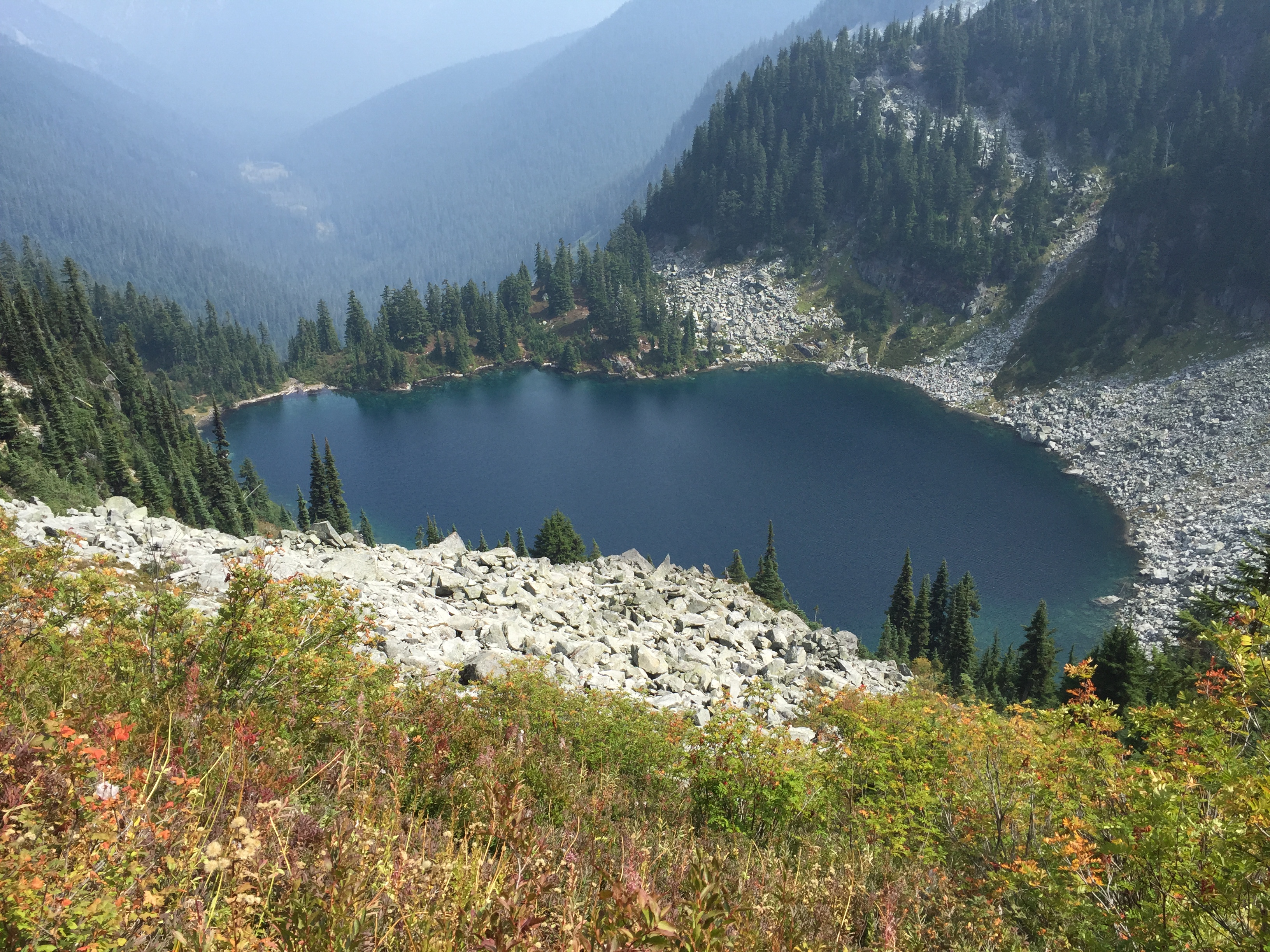
Trap Lake was sparkling a gorgeous blue as I descended the ridge. I took the side trail to get water and have a quick snack. I also managed to get turned around in the tangled rabbit warren of trails around the lake, so by the time I got straightened around, and I fixed a problem with my hydration system, it was close to 4:00.
Trap LakeLexie and Colleen, mighty hiker women
So, 4:00. I had six more miles and 1500 feet to go, before Lake Susan Jane. I needed to be there no later than 7:30, because (skipping the details) I hike in my sunglasses, and the sun is setting earlier each day. Needless to say, I needed to step on the gas. I went faster than I am generally comfortable with (not too fast, though). I climbed a short ridge, did a long descent to Hope and Mig Lakes, climbed a more enthusiastic ridge to Lake Susan Jane, and swapped out my sunglasses just before hitting my campsite. Whew. I got camp set up in record time.
I’m really looking forward to tomorrow. Not only is this a familiar section of trail, but I should be seeing Brendan and Alex around 10, taking them to lunch (BURGER! SHAKE!) and heading to the Dinsmores’!
I got to sleep around 8 last night, and slept like a rock. I used my earplugs, and it made a world of difference. I wasn’t overly concerned, simply because there were decent people nearby. Man, did that feel good.
I said goodbye to Paul and Matt, and headed back up to the main trail. I took some time to record, and then started the ascent up the ridge.
Heading up Cathedral Pass
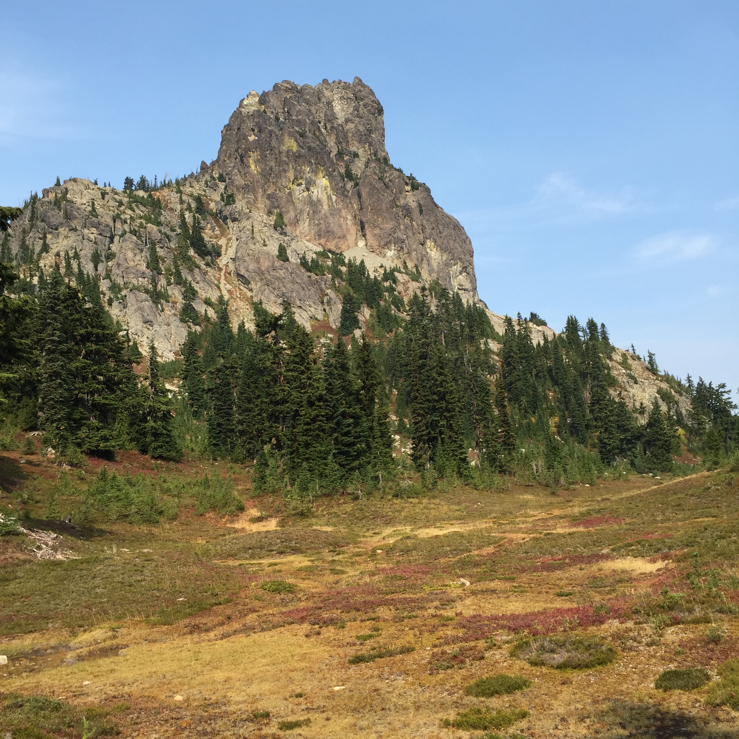
The ridge climb that I put off yesterday was much cooler today. I made it up to Cathedral Pass, and the operative word was Gorgeous. As in the ridge was gorgeous, the pass was gorgeous, Cathedral Rock was gorgeous…are you detecting a trend here? High alpine heather, beautiful path, and O, the MOUNTAINS! I had more fun, just rambling along the top of the ridge and taking pictures.
Cathedral Pass ridge rambleCathedral Rock
And then I met a girl named Kelly. She’s a SOBO sectioner, and is one of the few sectioners I’ve met who will be travelling farther than I am. She also brought fire news, which matched what Paul had said the night before. The Okanogan fire is now over 144K acres. Hwy 20 is closed at Newhalem (west of Rainy Pass, which is the PCT junction); that probably affects the Cascade Pass detour (the workaround for the Blankenship closure from Suiattle River to Stehekin). Hwy 20 is also closed the other direction, due to the Okanogan fire.
The long and the short of it is that if all of this info is correct (and it was very current), my trip will be over not long after Stevens. I sat down in the shadow of Cathedral rock and just cried for a few minutes. This means so much to me, and I just want to see it completed, hopefully this year. I need to wait until I get to the Dinsmores’ to get the best info, but I’m really concerned. I messaged Steve, and he confirmed what she said, but added that the situation is very fluid. I took a deep breath (okay, a very deep breath), and kept walking. This is incredible country, and I don’t want to miss it because I’m focused on what’s happening further north.
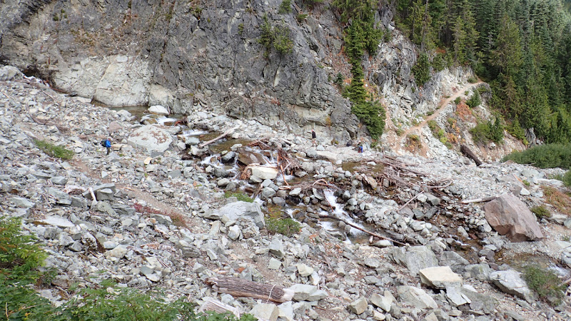
A handful of miles wandering along stunning ridges, and I came to a sign warning of a “Dangerous Ford.” There was an alternate route posted, for stock; as I understand it, it’s better to take the stock route early in the season. As it had been very dry lately, I took the main route. The creek is the drainage for the Hyas Glacier, on Mt. Daniel, west of the trail. The creek runs through a fairly narrow slot, and once it opens up above the trail, it splits into several sections. I skipped the log bridge and just plowed through. From there, it was a matter of carefully following cairns, because the trail was practically invisible from one section to the next. And at the end, there was a bit of scrambling and a veggie belay or two. (A veggie belay is when you use branches and such to pull yourself up a slope.)
Hikers crossing the unnamed creek. The last part of the crossing is hidden to the right. *The creek looks deceptively small here. For perspective, the diameter of the root ball, on the right of the log bridge, was roughly as tall as I am.
I gradually ascended a long ridge, heading toward Deception Lakes.
The first colors of fall, heading toward Deception Lakes
I made camp, and I had the place to myself. I had been warned about the mice (bring a mousetrap, or a cat), but with my Ursack and my water bottle stowed away from my tent, I ended up having the quietest night I’ve ever had in a campsite, ever, anywhere. No sound at all. And that made for some good sleep, which was exactly what I needed.
I hit the rack last night a bit after 9:30, and I could feel it today. There’s a reason they call 9:00 “Hiker Midnight.”
This morning, I got up, said goodbye to my camp mates, who were fixing their breakfast, and headed down the trail. As I descended the ridge, I met a couple at the next campsite; they were about my age. The wife said to me, “Way to go! We need to show these kids that it doesn’t have to be just 20-somethings out here solo hiking.” And I replied, “No, it doesn’t. I’m 51, and in fact today’s my birthday.”
With an “Oh my gosh!” she rummaged around in her pack, and pulled out a big chunk of homemade peanut brittle! She handed it to me, and I got another delightful round of Happy Birthday, dear Rest Step!
The husband heard my name, and asked if I had been in the Mountaineers. So I explained the connection. What a great encounter that was!
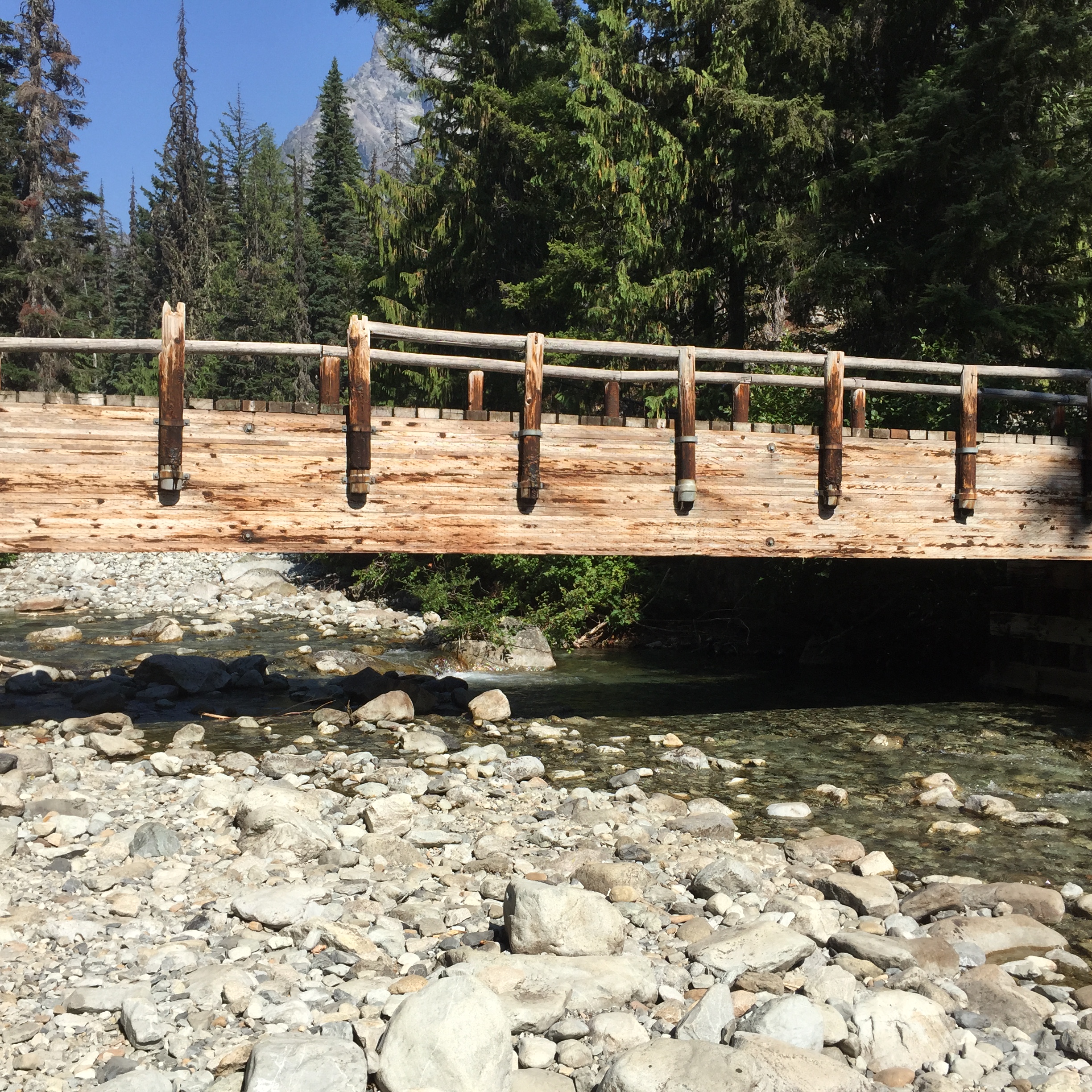
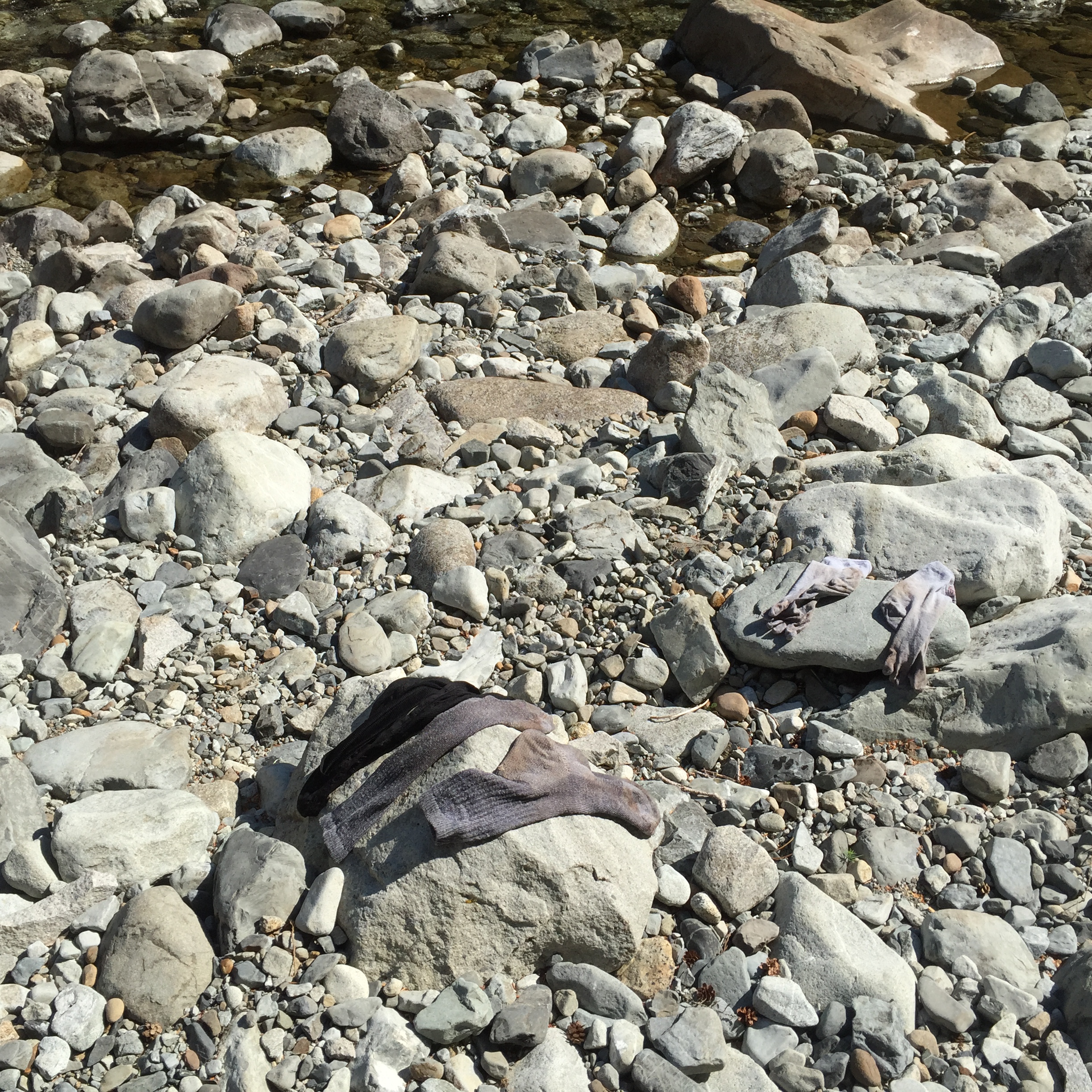
I descended the ridge, to Waptus River. There’s a lovely wood bridge which crosses the river, although it was so low it would have been an easy ford. I treated myself to a bit of relaxation: washing up (no soap), rinsing out my socks (eww), refilling with clear, cold water (yum), and putting my feet up while I had a mid-morning snack.
The view from the Waptus River laundromatThat’s as clean as my socks ever gotCrossing Waptus River and heading north
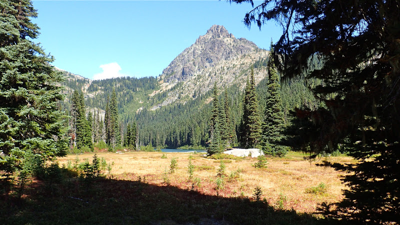
My goal today was a campsite at the base of Cathedral Rock. ‘Twas a lofty goal, but not to be. I hiked around Waptus Lake, and up Spinola Creek, and when I got to the Deep Lake side trail, it became very apparent that I was going to stop here. The ascent up the ridge to Cathedral Pass has a southern aspect, the sun was very hot, and I didn’t feel like schlepping water up the ridge to a dry camp. So Deep Lake became the destination of choice.
Hiking in to Deep Lake, with Cathedral Rock in the background *
After scouting around, I found a large campsite with two tents and room for one more. One of them was unoccupied, but there was a father/son pair (Paul and Matt) in the other.
The ranger came around while I was setting up my camp. She wanted to check my permit, make sure I knew LNT, and make sure I knew there was a backcountry toilet a little ways away. Life’s little pleasures…a loo with a seat!
I went down with Paul, to soak my feet in the lake; Matt was out fishing. We found a lovely rock, where I could soak my burning feet in water that was exactly the right temperature (and clear enough for a very easy fill-up).
What a place to soak your feet! *
After a long, roundabout conversation, we discovered a connection! He works for the City of Everett, and I made the connection back to Tom, the husband of one of Lynn’s best friends). Tom and Paul have worked together since forever. So I can now say that I shared a campsite with my son’s godmother’s best friend’s husband’s longtime colleague. How about that?
The sun was sinking, so we headed back to the campsite. I fixed dinner, had a bit of dessert, and crawled in bed before 8. Luxury!
Tonight I’m grateful for many things. A birthday song. A river, a lake, and a mountain view. Friends along the way. And most of all, my family.
At a campsite on the ridge between Escondido Tarns and Waptus River, Mile 2422
Today was 13 miles and 3500 feet net gain. There’s definitely a trend here: up a ridge, down a ridge, up a ridge, and so on. I was to learn that Section J is considered the toughest section of the trail. The raw stats are 72 miles and 19K feet, but like any trail stats it doesn’t take the tread into consideration. I don’t know about “toughest,” as I’ve also heard that Section K is the “second toughest on the entire trail.” But J is certainly a challenge.
A side note: The PCT is broken into sections. These are mostly based on ease of access, e.g. Snoqualmie Pass to Stevens Pass. California, with nearly 1700 miles of trail, has Sections A-R. Oregon and Washington, with just under 1000 miles, re-start at A and continue to L. Last year, I hiked the lion’s share of Washington Section H; it is my goal this year to finish H, and continue on through I, J, K, and L.
Anyway, I broke camp, tanked up at the little spring just past the falls, and got a couple of pictures. It’s really a lovely place.
Delate Falls
The first several miles were a slow ascent, and then in the afternoon I began the real climb up toward the Escondido Tarns. I discovered that listening to podcasts really helps me going up the ridges. They’re engaging, and there’s no competition between the beat of the music and the ever-changing rhythm of my feet as the trail gets more or less steep.
Climbing the ridge toward the Escondido Tarns
I reached the crest later in the afternoon, and the wind had turned cold. I wasn’t wearing an insulation layer, because I’d been climbing, but crossing the ridge and beginning the slow descent to the tarns proved to be a bit nippy. I should have refilled at the first (much clearer) tarn, but alas, I gave my filter a workout at the second.
The second of the two tarns *Twilight is approaching as I head down the other side of the ridge
With insulation layer in place, end-of-the-day fatigue beginning to set in, and with a long but gentle descent in front of me, I headed down the trail. My goal was a campsite on the ridge, before the descent to Waptus River. I kept the podcasts going, and arrived at my destination a little before 8:00.
There were a small handful of campsites nestled together, and a party of three had claimed the first two spots. They were very welcoming. One of them was busy putting together a Backpacker’s Pantry cheesecake mix, and said I was more than welcome to share when it was finished. I said that would be a great treat, as tomorrow was my birthday, and it’s always good to celebrate early.
Birthday cheesecake with new friends!
Anyway, after I’d set up camp and eaten my stroganoff, they came over singing Happy Birthday, dear Rest Step! I was grinning all over…how cool was that? And hearing my trail name just plain makes me smile.
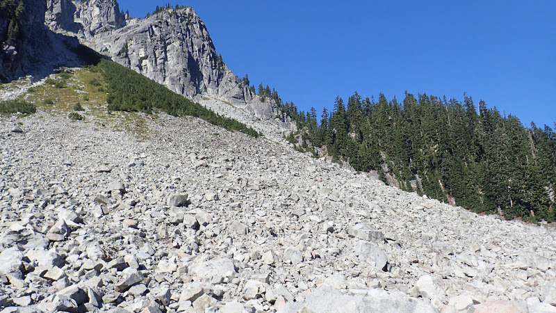
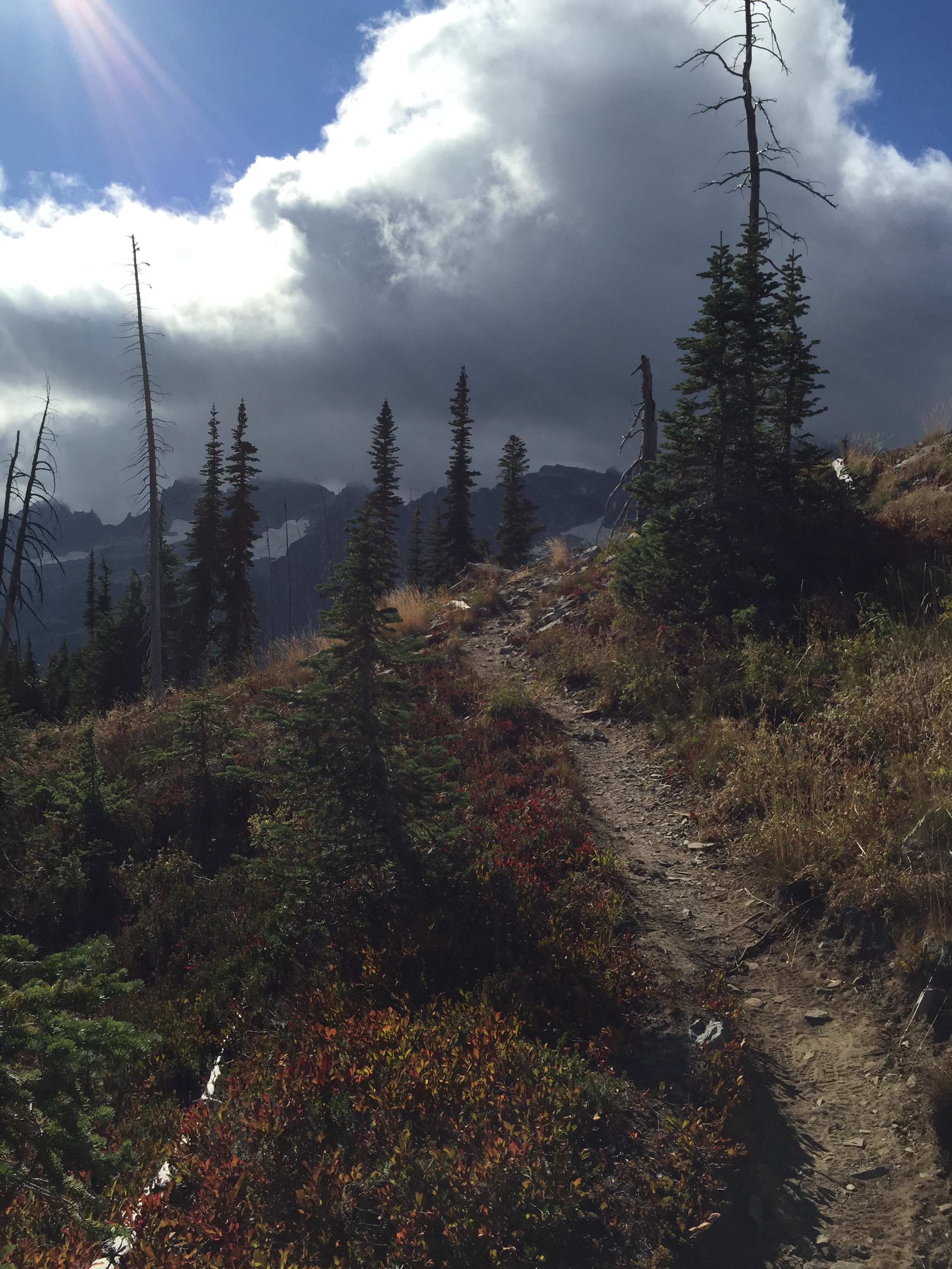
Today was a hell of a day, a lot tougher than I expected. The first eight miles were basically all talus, all the time. Talus is rockfall on the slope of a mountain, and often requires careful foot placement, plus a bit of scrambling when the boulders are large. Scree is the little stuff…pebbles and small rocks. Talus is the larger stuff, ranging from boot-size to refrigerator-sized boulders. My balance isn’t the best, although it’s definitely improved over the years! But talus has never been my friend, and hence my forward progress was rather slow.
The weather made it much more complex, and much less rewarding. The ridge northwest to Chikamin Peak, and the entire Chikamin/Four Brothers area, was completely socked in…entirely covered with cloud, which was punctuated by heavy wind and the occasional bit of rain. It was just one thing after another, and I did not have fun. And I missed quite a bit of gorgeous scenery.
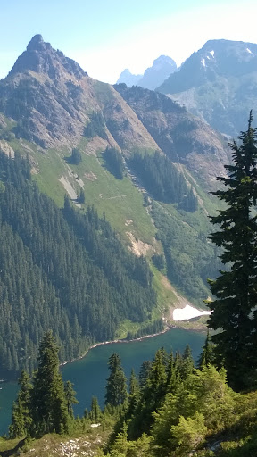
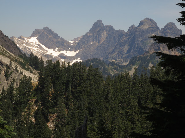
The advantage of talus slopes: marmotsWhat I missed, thanks to the weather on Chikamin Ridge and the Four Brothers **
Fortunately, after I rounded a ridge through Chikamin Pass, it was a whole different ball game. The talus was still there, but I could actually see; the clouds were gone, and the weather was much calmer.
Park Lakes from Chikamin Pass
One of the other things that were bothering me was the mental inventory I was taking of my food. I calculated the speed at which I was travelling today, and what was in my food supply, and it wasn’t adding up. It definitely didn’t add up if there were more days like today, and I was getting a bit concerned.
Anyway, I rounded that ridge, and suddenly the scenery was a) there, and b) really lovely. I continued the traverse down the ridge, and who did I meet but a retired couple, Unbreakable and No Trace, the kindest and humblest hikers around. They are on their second thru, and are Triple Crowners…a fact that they neglected to mention. We spent probably fifteen minutes talking about the trail, about being older than the average hiker, and all kinds of things. Fifteen minutes is a long time for an impromptu trail conversation.
Unbreakable reminded me that the shuttle bus to Stehekin only takes cash. I said to her, “Don’t worry, I’ve got it covered. I put small bills in my resupply for Stevens.”
She replied, “Wow, you’re organized!” And I replied, “Not always…I forgot to do specific research on this section, especially regarding talus slopes, where I tend to go slow, so I’ll need an extra day, and I’m a little short on food. Grr.”
And without hesitation, they pulled out a couple of Idahoan instant potato packs and a Top Ramen, and handed them to me! Trail magic! And it really made a difference in my attitude. What a privilege it was to meet them!
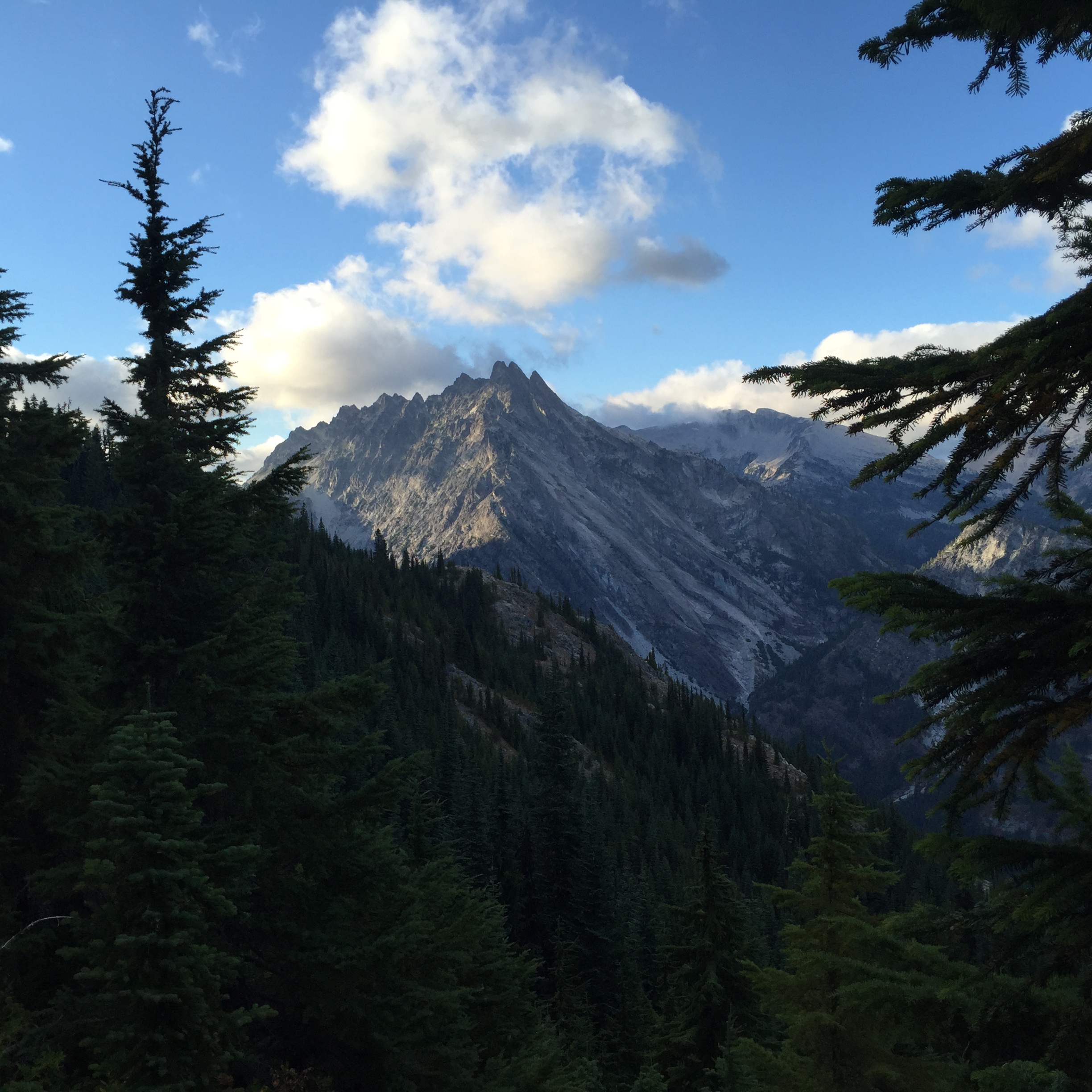
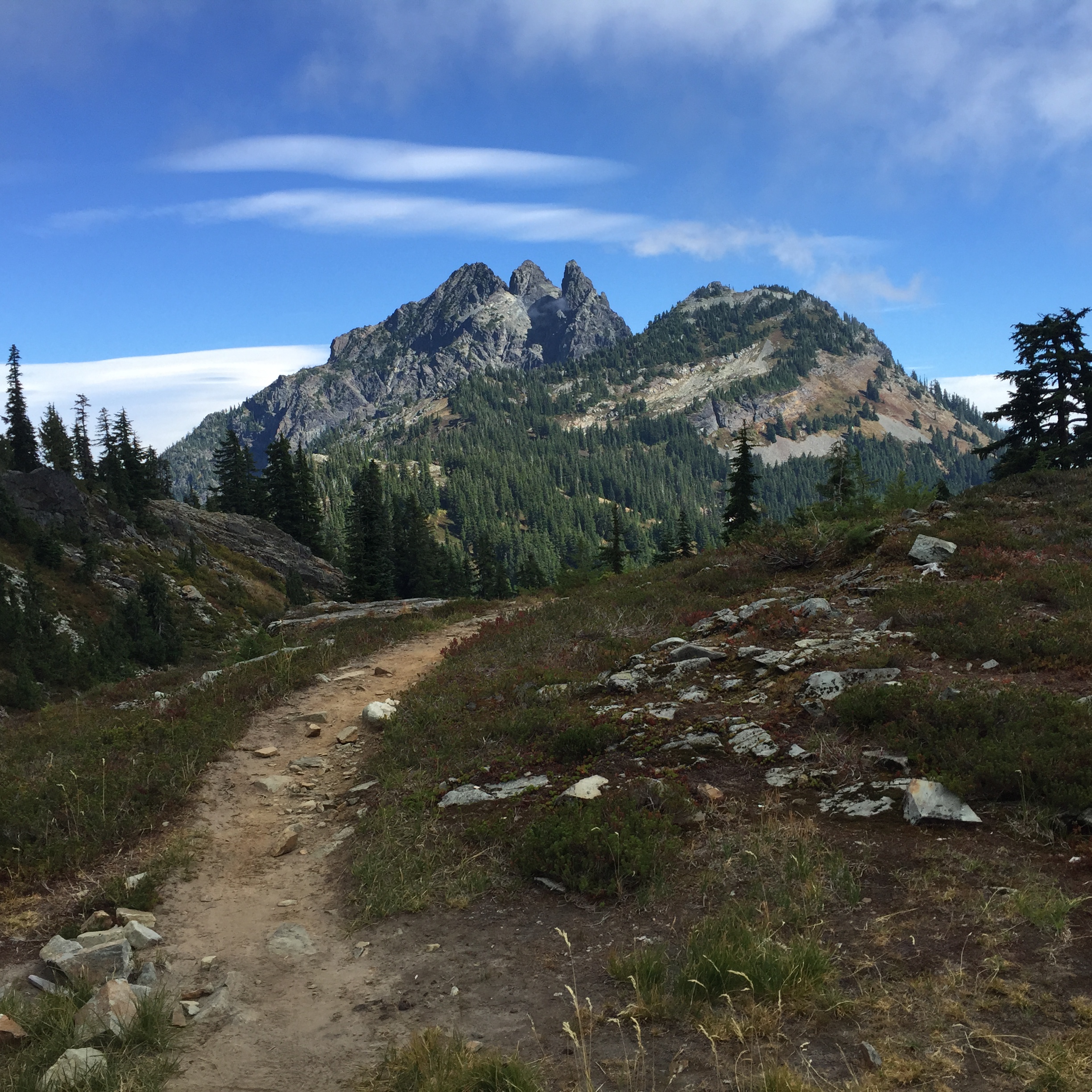
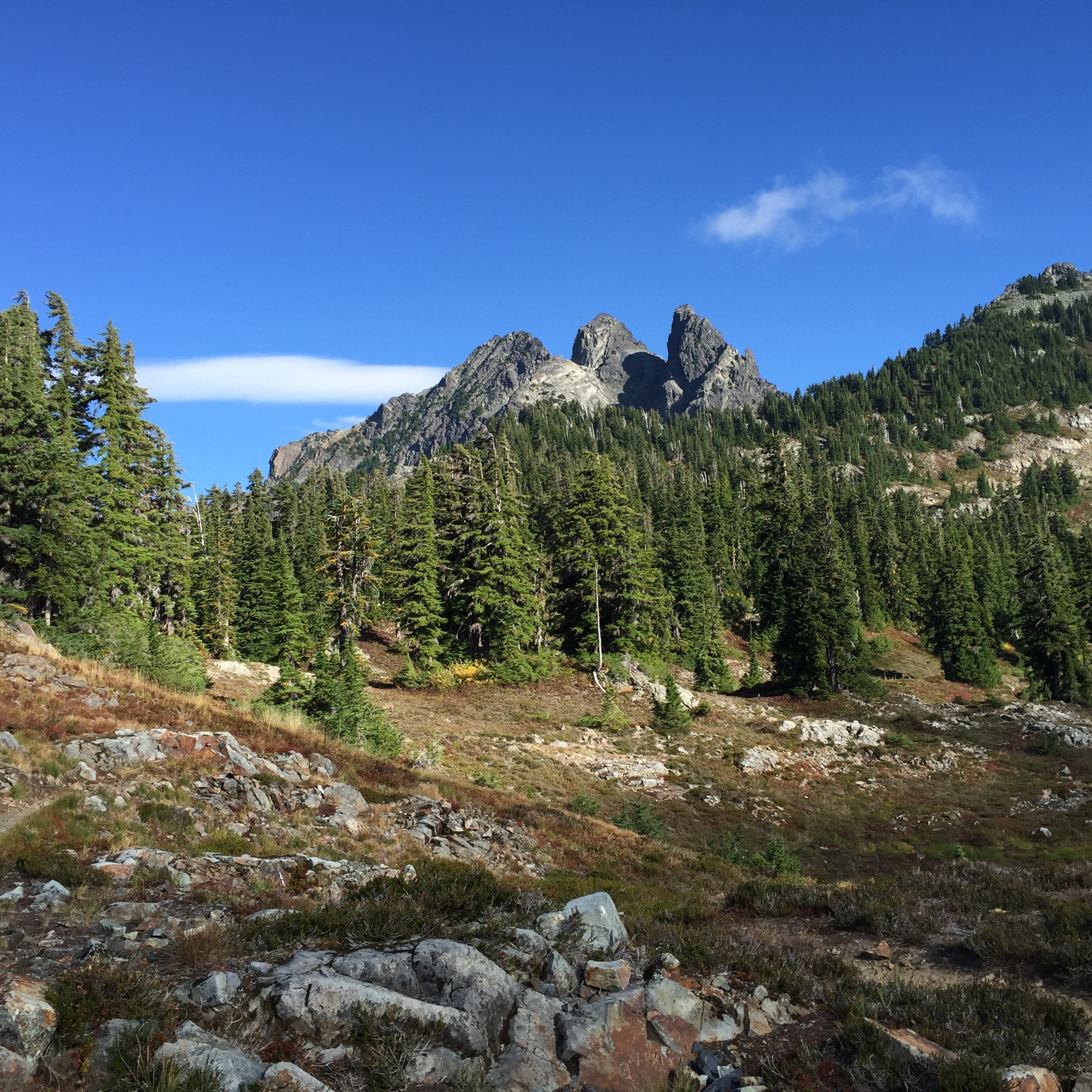
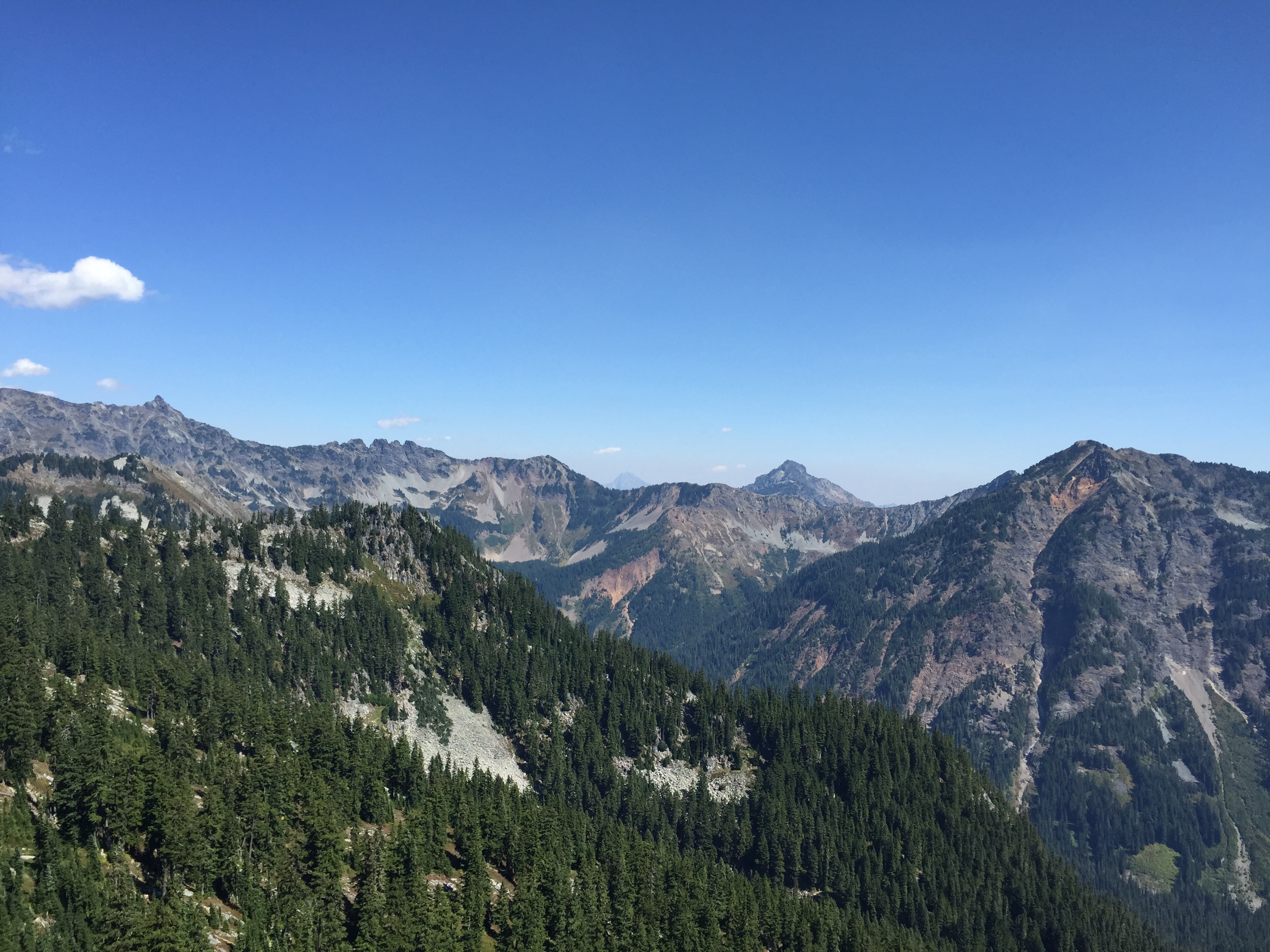
The scenery along this stretch is incredible. I climbed one last ridge, taking lots of pictures, including one of my beloved Mt. Stuart.
Three QueensThree QueensMt. Stuart with lenticular clouds
Finally, I descended, perhaps 1500 feet, to the beautiful Delate Falls.
There was a campsite just before the falls, so that became home sweet home. There was no convenient place to get water at the falls, unless I crawled under the bridge, but fortunately there was a spring just past the bridge. I topped off and went back to camp.
Go figure, I’m really tired, so I’m not even going to do my evening route planning. That can wait until my brain is awake.
Footnote: Although these pictures were taken in early summer a few years ago, they are well -labeled; they give the feel of today’s hike, and what I would have encountered had there been any visibility along Chikamin and Four Brothers. I saw zero snow. http://www.wta.org/go-hiking/trip-reports/trip_report.2011-07-24.9626619341
Predictably, this morning started with an enormous breakfast, probably the biggest combo on the menu. While making a dent in it, I met a whole group of hikers, some of which were about to hit the trail, and some of whom were taking a zero or two. Little Brown, about my age, and a local as well. Wormwood, a young guy with an REI shirt, modded to say PCT. Blue Sky, a thru from central Asia; he’s the one who gave Thermometer his name. Country Mouse and her SO Shadow. And Samson, who is celebrating his birthday today.
I was definitely ready to go. After Steve and Patrick left, it just wasn’t the same, so I skedaddled right after breakfast. I stopped at the Chevron to pick up a little cash, and to grab a Powerade, which I drank while walking to the TH.
The last time I crossed under I-90 was when our Venturing Crew went snowshoeing, in 2012. That was a great day. I remember the ranger saying, “You guys are really fast.” Well, several of us had done Philmont a few short months prior, so that probably explained it.
I’m not feeling very fast these days, with my miles per day maxing out in the mid teens. We were talking about this over breakfast, and Blue Sky just looked at me. He said, “I usually hike 15-17 miles per day, and sometimes I don’t even get out of camp until 10:30.”
I said, “Wow, that sounds exactly like me!”
And Samson said, “Well, my son met me for a section in northern Oregon, and he just couldn’t keep up with me. But like you said, I’ve got a couple of thousand miles of conditioning, and that’s just the way it is.”
That really helped me feel better. Sometimes I feel like a poser because my mileage is relatively low, and because it takes me longer than average to break camp in the morning. But this is my own hike, and I’m incredibly grateful to be out here.
The weather today is gorgeous, with less smoke than there has been lately. I’ve been using my inhaler regularly, because there’s a lot of smoke coming from the Cougar Creek fire to the south. There’s a chance of rain on Friday 8/21, which should help. And the weather will be drying out for my birthday on Saturday.
I get to do the Kendall Katwalk again today! I’ll always remember meeting Acorn the Elder on the far side of the Katwalk, last year. We had met briefly at Mosquito Creek, on my first section.
I’m looking forward to the second half of my hike, even though according to this year’s mileage it’s not even half: I’m starting at roughly mile 150 out of roughly 400. I’m really, really grateful. I’ve felt ups, I’ve felt downs, I know I’m not the only one with “hiker brain,” who can’t spit out her words to save her life. I’ve met so many awesome people. And the best part is being able to introduce my guys to this incredible community.
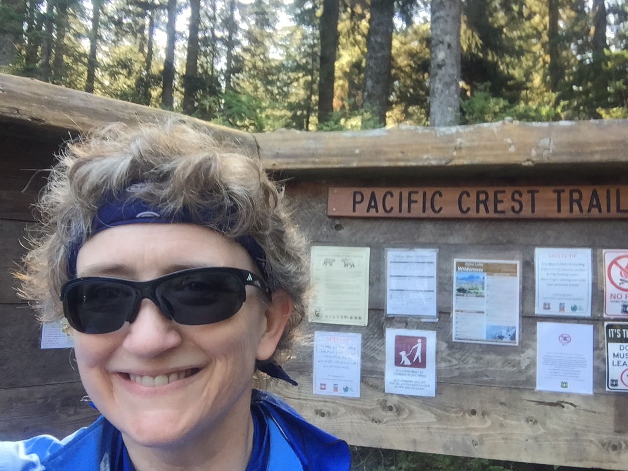
When I arrived, I took my picture by the TH sign. Just a bit up from the TH, there’s a picnic table, and somebody had put out a cooler of drinks and a trail register. I was one of the first ones to sign.
Hitting the trail again!
I made a tactical error, and only put a liter of water in my Platy. Turns out it was far hotter, drier, and more exposed than I had remembered. Oops.
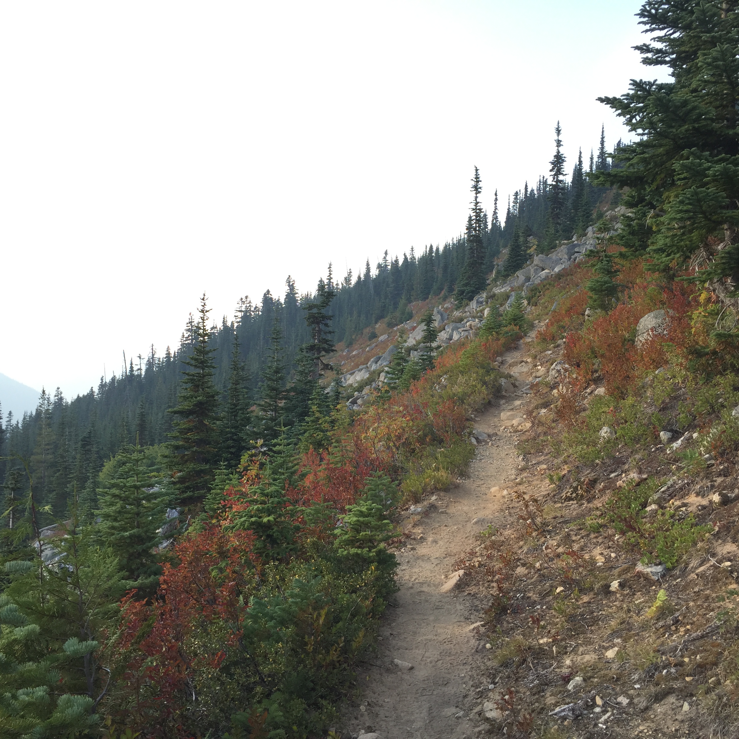
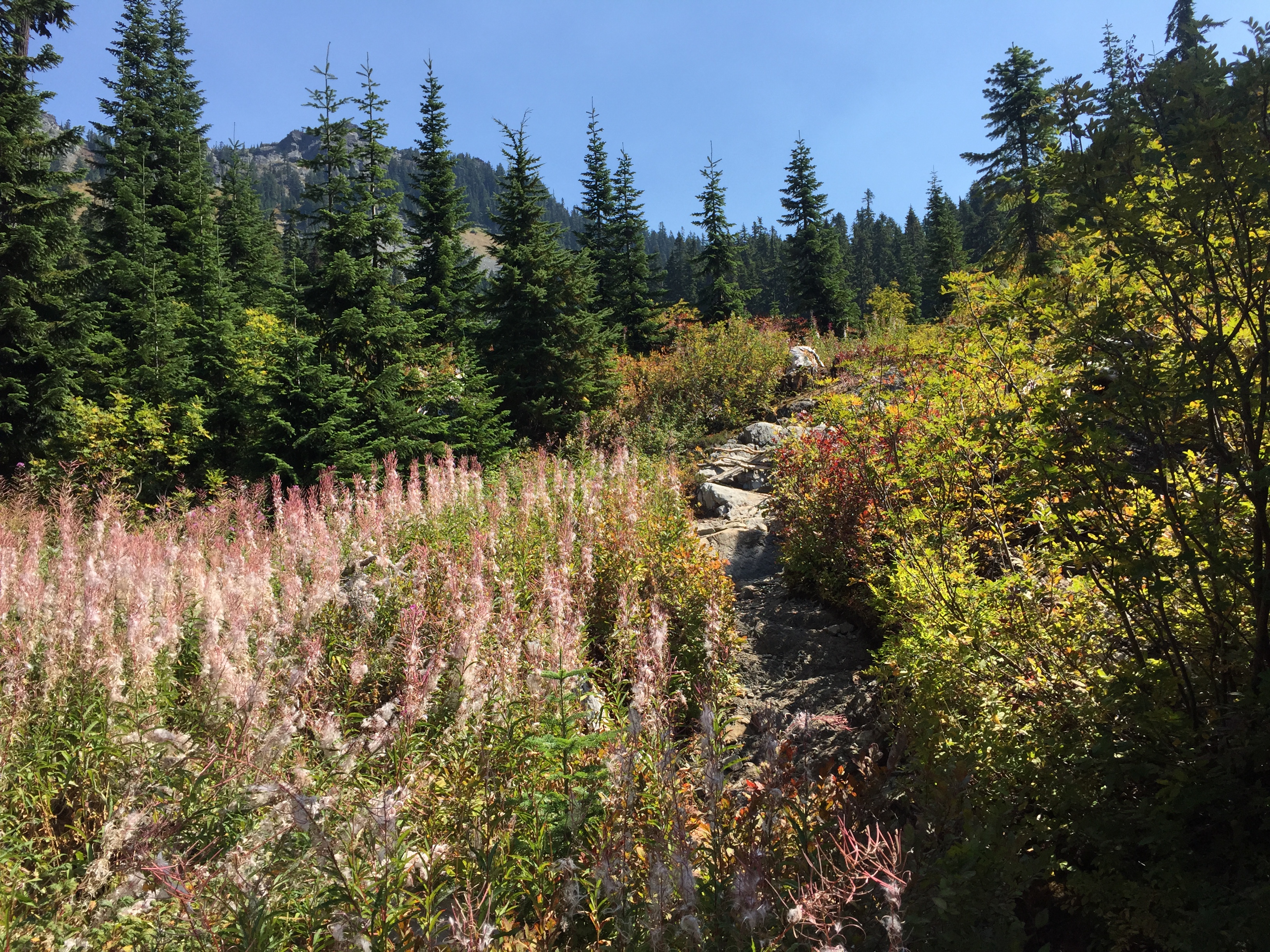
The fall colors were mighty early this year
On the way up, I met a group of women in their 60s-70s. They were out for a day hike, and when they asked me how far I was going, I said, “Well, actually, Canada.” Then I said, “I’m going to be 51 this week, and it’s my mission to show women that they can get out there, hike by themselves, and ain’t nobody gonna stop us.” I got some serious high fives. And one of the women asked if I needed anything, so I said I was a bit short of water. She very graciously gave me half a liter, which was just exactly enough to take me over the Katwalk and across to Ridge Lake. Magic is everywhere.
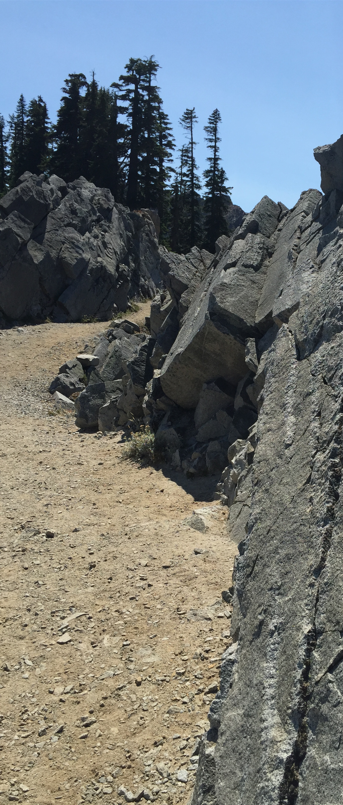
The Kendall Katwalk itself is a 150 yard section of the trail which was literally blasted out of the mountain, saving 2-3 days of hiking. Very interesting story, and well worth a read. The trail is wide and safe enough for stock. And the views are stunning.
Looking back at the south side of the KatwalkNorthbound across the Katwalk, headed toward Ridge Lake
One of the cool things for me today was seeing Mt. Stuart for the first time. I’ve spent a lot of time hiking in the Teanaway, and seeing Stuart was like old home week. I’m finally back in my neck of the woods! And the whole trail is much more familiar to me. Not that I’ve hiked it all, but it feels like the trails that I know.
Mt. Stuart is visible in the distance (center). You can also see the smoke from the Chelan Complex fire.One more view, looking south *
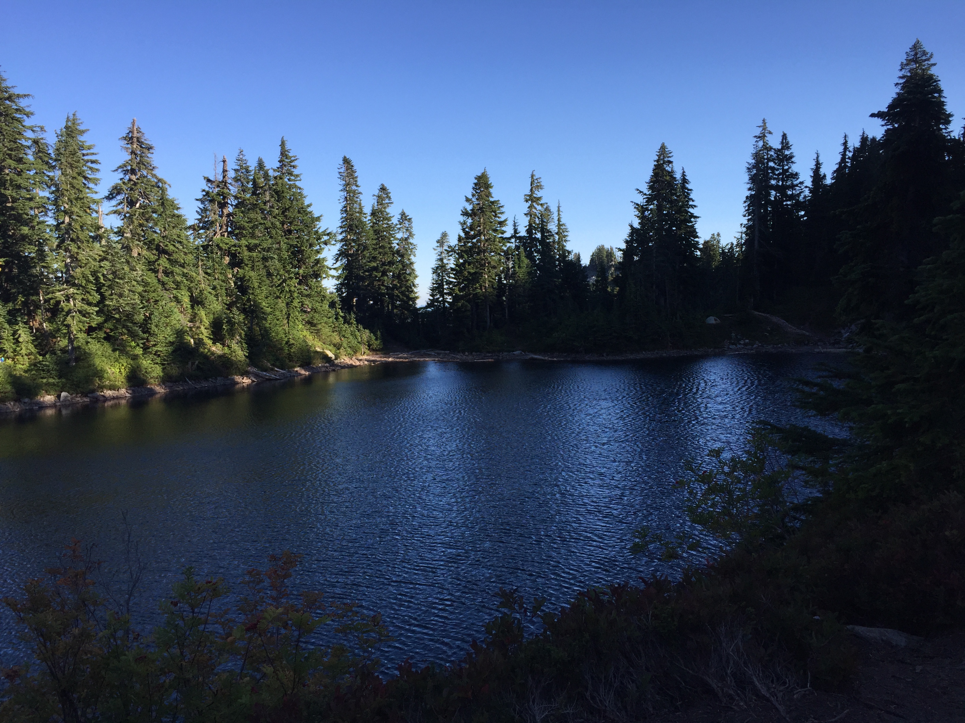
I arrived at Ridge Lake around 4. I was actually thinking of going farther, but in retrospect it was a good thing I didn’t. I learned that there was no water for nine miles past this point, but I didn’t get this info until well after I’d set up camp. So I’ll grab a good load tomorrow.
Ridge LakeA snug camp, staked out against the windIt was good to be back on the trail
When I went to collect water down at a little beach area, I met a Girl Scout troop from my neck of the woods. There were two adults, a junior leader, and about half a dozen girls. They’re doing Section J. I’ve never come across a Girl Scout troop who backpacks like this, and it was wonderful to meet them.
One of the adults invited me down to the beach to join them, and I introduced myself as a Venturing Crew advisor. When they learned what I was doing, they were tickled pink, and all kinds of questions ensued. The leaders in particular were very interested in my gear list, so I talked about most of it, and the rationales behind choosing each piece. I also talked specifically with the young adult leader, Katherine, and it was very clear that she was able to do the whole trail. She was thinking seriously about it, after returning from an extended trip overseas. I love encouraging people to hike the trail, as it’s such a life changing experience.
They offered to let me camp with them, but I said I was looking for something a bit more protected from the wind. So they headed back to their campsite.
And then a woman, Lady Rose, and her dog, came down to the beach. Her trail name is after the Lady Rose, a cargo and passenger vessel which until recently plied the waters of Barkley Sound in BC. Lady Rose and her pup were heading up to Stevens, until morning nausea became debilitating. She decided to return, and see if perhaps she was expecting…and she was pretty excited about that.
I love having all these random conversations! It’s one of the really awesome things about long distance hiking.
As I mentioned, the water tomorrow is further than expected. The Park Lakes are about 9 miles and 2700 gain from Ridge Lake. They’re off the trail, so I’ll take enough to see me through Delate Creek, about 10 miles from here.
I was just mulling/wishing for a zero in my own house. That’s probably mostly because I miss my guys. I always miss my guys. I just wish I could show them what it’s like out here, because it’s part of who I am, and I want them to see it.
*Photo credit: Eric Aalto
Footnote: Jennifer was at the trailhead within the next several days, and she found my name in the register!