At Lake Sally Ann, Mile 2491
I woke up to a bit of very infrequent rain, and so I put my fly and quilt out to dry. But all of a sudden the wind picked up dramatically, and the rain started dumping, from a squall line coming through. The wind was strong enough that there were whitecaps on tiny, sheltered Pear Lake. I pulled all my gear back inside, grabbed my Ursack, and had breakfast in my tent. When the squall passed, I quickly threw my gear together.
The guys began to stir as I was breaking camp. One of them was in a hammock under a tarp, but two of them had pitched an inexpensive tent on a deceptively flat space with no duff or other debris on it…in other words, a puddle in the making. They were afloat this morning. I gave them the updated weather forecast; my guess is they packed it up and headed downhill.
The destination today was Lake Sally Ann. The cool thing about this was that I’d pass the Cady Creek Trail, which was where I joined the PCT late last September, for a brief section to White and Red Passes. Connecting more dots…gotta love that.
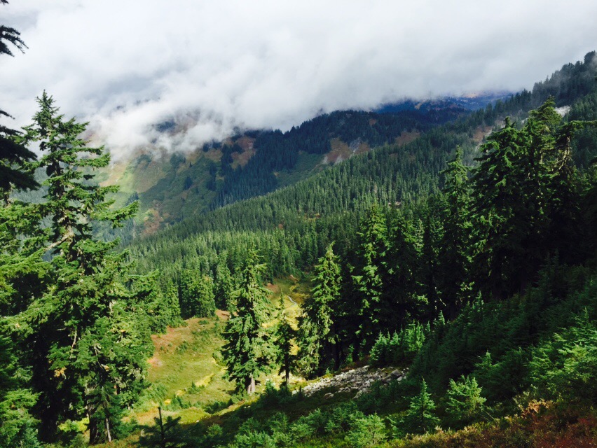
Just a little ways after I started this morning, I had my first really decent view of Glacier Peak. And that is something I’ve been waiting for, all year long.

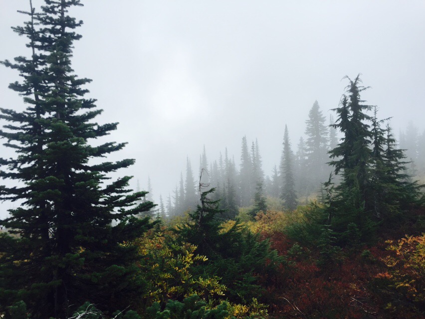
Unlike Friday, the rain was much more enthusiastic today. But every once in a while I’d get a glimpse of the sun.
The terrain here isn’t the up-and-down-the-ridge variety of Section J (although I know that’s coming). The less rigorous workout made it easier to maintain my body temperature under my rain shell.
Five miles and 1200 ft in, I got to the junction with the West Cady Ridge trail, which leads to the North Fork of the Skykomish road. I had hiked this trail in July of 2014, although I was stopped short by traverses across snowfields. But it was kind of like connecting a dot.
From there, it was two miles to the Cady Creek Trail junction. This was where I had joined the PCT for the White/Red Passes section last August.
And then it was four more miles of open, uphill ridge traverses until I reached Lake Sally Ann, at Mile 2491. This is normally a gorgeous hike, full of beautiful foliage and a large population of grouse. But on this day it got wetter, and wetter, and windier, and windier, and colder, and colder. Is anybody detecting a trend here? By the time I reached Lake Sally Ann late in the afternoon, it was VERY wet and VERY windy and VERY cold.
I set up my tent in record time, in a fairly tight grove of trees, and away from the lake to keep wind exposure to a minimum. Setting up camp in heavy rain is predictably more complex than in other weather situations. For example, the gear in ziplocs need to be sheltered while I pull my mattress out of its waterproof bag; I then inflate the mattress, which keeps me off of the damp floor, and then get all of my gear into the tent, making sure that everything is inside plastic. This doesn’t protect things from the damp air, but it saves putting my gear in the inevitable small puddles.
I filled every one of my water containers and got in the tent. While this was happening, the wind was increasing even more, and because I wasn’t moving while gathering water, and because I was keeping my main insulation layer in the tent, to stay dry for that night, I got very cold, very fast. Later that night, I estimated the wind was steady at 20 knots, gusts to 30, and that was inside my grove of trees. And the rain was torrential and quite literally sideways; it didn’t let up at all. The lows were probably in the mid 40s. I can only imagine what the lake looked like; I am sure there must have been whitecaps.
Once in the tent, in my quilt, with a large space blanket under my mattress (to reflect heat back upward), and in all of my dry sleep clothes, I made a massive dinner and poured the calories down the throat. Cheesy pasta, hot lemonade, two kinds of candy, you get the idea. From there, I made hot water bottles from each of my two smaller water containers. I couldn’t boil, as they would have melted, but they were mighty warm.
I was able to text Steve again, and asked for a very specific weather forecast: the region around Glacier Peak, about 5000 ft elevation, for a week, beginning tomorrow. That forecast? Winds staying steady, rain staying steady, and low temperatures dropping into the mid 30s. The hypothermia risk in that kind of weather is about as severe as you can get.
I called it.
My hike was done.
