Sunday, August 30, 2015: Bailout

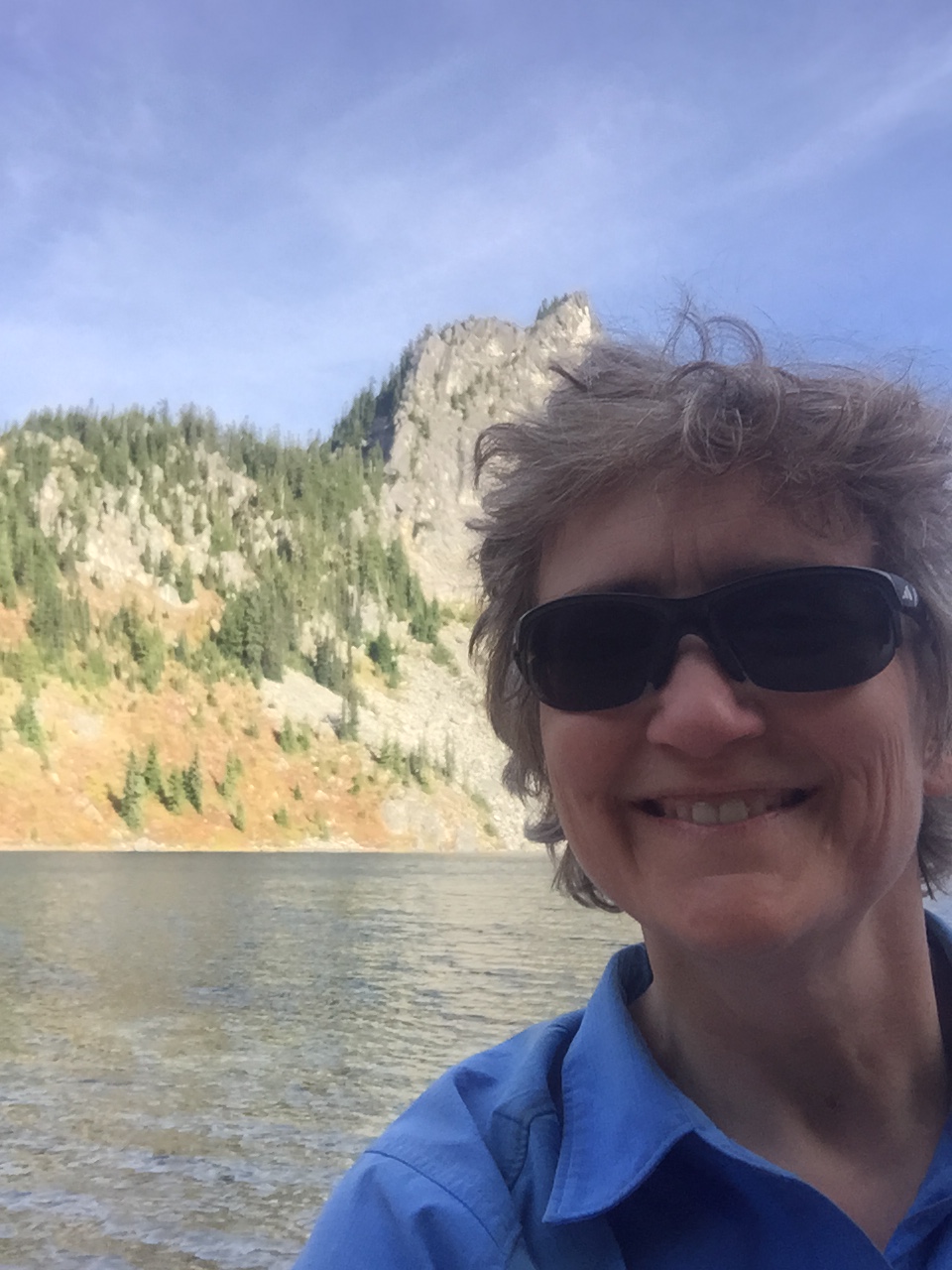
Late last night, I had to come up with an exit plan. There are several access trails along this stretch of the PCT, going east and west, but ultimately I chose to go back four miles to the eastbound Cady Creek trail; it was familiar from last year, the PCT segment was familiar from yesterday, and it dropped the fastest into less exposed territory. I would end up at a trailhead in the neighborhood of Lake Wenatchee. The only problem with the trail was that it is overgrown. Not as in “push the brush aside,” nor “I need my machete.” This was overgrown as in “Dr. Livingstone, I presume?” And sodden brush of that caliber gets your raingear soaking wet in a hurry. But it was still the best option. What I didn’t realize was that, given the fire danger, the Wenatchee Ranger District had closed every single one of its trails, including the eastbound ones from the PCT. I texted Steve to meet me at the Cady Creek (Little Wenatchee Ford) trailhead, probably mid-afternoon.

In the meantime, I spent the night reheating my bottles. This was yet another reason to bail: I was using a lot more than my budgeted fuel; I always have extra, but at this rate there was a chance my canister could be empty before I hiked down the Suiattle.

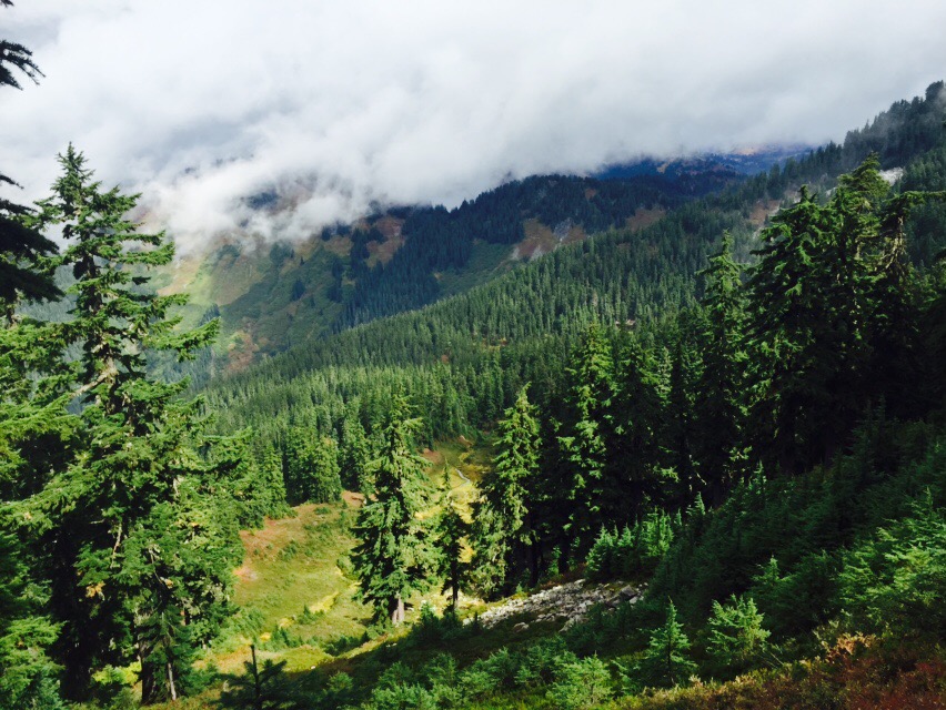
Steve didn’t get the bailout message until very early Sunday morning. And I didn’t get his latest until the same time. Apparently they were now predicting wet snow.

Within an hour of getting my message, he was on the road, with (per my request), lots of dry clothes, towels, etc.

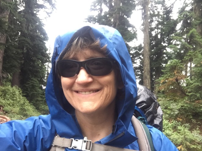
I got up early that morning, stuffed all of my Snickers into my rain shell pocket, and began the process of keeping the must-stay-dry stuff into heavy duty plastic, while separating it from the can-get-wet stuff, and then shoving the tent in the outside of the pack. This totally threw off the balance, especially because the tent was much heavier than normal.

As soon as I was done, I turned on my music, and headed south. It was crucial to keep going; even stopping for a couple of minutes made it hard to warm back up. I kept munching the Snickers, and heading down the trail. My plan was that, if Steve hadn’t arrived yet, I would hang out in the trailhead privy, wearing my sleep clothes and my quilt, until he got there.

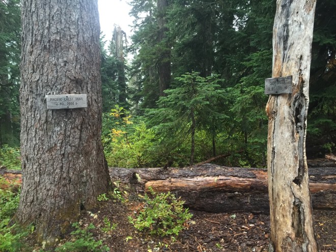
I did stop for a minute at the Cady Creek junction, to say goodbye to the trail; even though I was doing the right thing, I was still mighty sad.

2015-08-29 14.03.27
Cady Creek Trail Junction

9.5 miles, lots of heavy brush, a few scrambles, a heavy creek to ford, some rather interesting blowdowns, and 5 hours later, I arrived at the trailhead, and my waiting husband. The first thing I said to Steve was “252 miles…this year.”

He gave me an enormous hug, and after I had changed into my dry clothes, we headed down the road. There were barricades in place, due to the closure, but we just drove around them. The next stop was burgers and shakes at the 59er Diner, and then we headed over Stevens Pass towards home.

Saturday, August 29, 2015, Mile 2491: The Storm

At Lake Sally Ann, Mile 2491

I woke up to a bit of very infrequent rain, and so I put my fly and quilt out to dry. But all of a sudden the wind picked up dramatically, and the rain started dumping, from a squall line coming through. The wind was strong enough that there were whitecaps on tiny, sheltered Pear Lake. I pulled all my gear back inside, grabbed my Ursack, and had breakfast in my tent. When the squall passed, I quickly threw my gear together.

The guys began to stir as I was breaking camp. One of them was in a hammock under a tarp, but two of them had pitched an inexpensive tent on a deceptively flat space with no duff or other debris on it…in other words, a puddle in the making. They were afloat this morning. I gave them the updated weather forecast; my guess is they packed it up and headed downhill.

The destination today was Lake Sally Ann. The cool thing about this was that I’d pass the Cady Creek Trail, which was where I joined the PCT late last September, for a brief section to White and Red Passes. Connecting more dots…gotta love that.

Just a little ways after I started this morning, I had my first really decent view of Glacier Peak. And that is something I’ve been waiting for, all year long.

2015-08-29 09.29.41
First view of Glacier Peak

Unlike Friday, the rain was much more enthusiastic today. But every once in a while I’d get a glimpse of the sun.


A tiny bit of sun on the fall foliage


The last bit of sun I saw

The terrain here isn’t the up-and-down-the-ridge variety of Section J (although I know that’s coming). The less rigorous workout made it easier to maintain my body temperature under my rain shell.

Five miles and 1200 ft in, I got to the junction with the West Cady Ridge trail, which leads to the North Fork of the Skykomish road. I had hiked this trail in July of 2014, although I was stopped short by traverses across snowfields. But it was kind of like connecting a dot.

From there, it was two miles to the Cady Creek Trail junction. This was where I had joined the PCT for the White/Red Passes section last August.

2015-08-29 09.43.10
Selfie in the rain, before traversing the ridges to Lake Sally Ann.

And then it was four more miles of open, uphill ridge traverses until I reached Lake Sally Ann, at Mile 2491. This is normally a gorgeous hike, full of beautiful foliage and a large population of grouse. But on this day it got wetter, and wetter, and windier, and windier, and colder, and colder. Is anybody detecting a trend here? By the time I reached Lake Sally Ann late in the afternoon, it was VERY wet and VERY windy and VERY cold.

I set up my tent in record time, in a fairly tight grove of trees, and away from the lake to keep wind exposure to a minimum. Setting up camp in heavy rain is predictably more complex than in other weather situations. For example, the gear in ziplocs need to be sheltered while I pull my mattress out of its waterproof bag; I then inflate the mattress, which keeps me off of the damp floor, and then get all of my gear into the tent, making sure that everything is inside plastic. This doesn’t protect things from the damp air, but it saves putting my gear in the inevitable small puddles.

I filled every one of my water containers and got in the tent. While this was happening, the wind was increasing even more, and because I wasn’t moving while gathering water, and because I was keeping my main insulation layer in the tent, to stay dry for that night, I got very cold, very fast. Later that night, I estimated the wind was steady at 20 knots, gusts to 30, and that was inside my grove of trees. And the rain was torrential and quite literally sideways; it didn’t let up at all. The lows were probably in the mid 40s. I can only imagine what the lake looked like; I am sure there must have been whitecaps.

Once in the tent, in my quilt, with a large space blanket under my mattress (to reflect heat back upward), and in all of my dry sleep clothes, I made a massive dinner and poured the calories down the throat. Cheesy pasta, hot lemonade, two kinds of candy, you get the idea. From there, I made hot water bottles from each of my two smaller water containers. I couldn’t boil, as they would have melted, but they were mighty warm.

I was able to text Steve again, and asked for a very specific weather forecast: the region around Glacier Peak, about 5000 ft elevation, for a week, beginning tomorrow. That forecast? Winds staying steady, rain staying steady, and low temperatures dropping into the mid 30s. The hypothermia risk in that kind of weather is about as severe as you can get.

I called it.

My hike was done.

Friday, August 28, 2015, Mile 2480: Connecting the Dots

At Pear Lake, Mile 2480

It rained overnight, and the poor duo with the slack rainfly were obviously soaked. Fortunately, it’s an easy downhill hike back to the trailhead, so I wasn’t too concerned.

I left Lake Valhalla around 8:00, and connected the dots to Smithbrook and Lake Janus. That’s going to be the story, through Red Pass: connecting places and trail segments which I’ve already hiked with places and segments that I haven’t yet done. It’s kind of fun. In terms of the PCT, the south part of Section K is the one I’ve hiked the most.

Smithbrook Sign
Smithbrook-PCT junction *

I’ve been to Lake Janus twice before. It was nice to see the lake, and then this time head up to Grizzly Peak. This was something I’ve wanted to do, but haven’t been able to put together; it’s more of an overnight than a day hike, and that’s the only thing I’ve ever been able to do around here.

Lake Janus
Lake Janus *

I ascended Grizzly, which is one of the only peaks on the entire trail where you actually go over the summit. From there, it was easy to see Heather Lake. I hiked to Heather several years ago, when we camped at Lake Wenatchee for a few days.

On my way up to Grizzly, I saw Daniel, who I’d met at the Dinsmores’ two nights ago. He was the triple crowner, who had decided to make it to the border however it took him…if the trail opened, if he had to do a roadwalk for dozens and dozens of miles, whatever it was.  It was great to see him. He took off, and with his speed I knew we wouldn’t meet up again.

2015-08-28 15.19.50
Near the summit of Grizzly Peak

After the summit, there was a beautiful ramble as I slowly descended to Wenatchee Pass.  I was the only person to be seen, and I was filled with a giddy joy.  What a privilege to be up here!

2015-08-28 15.31.42
Just me and the trail.

From the summit, I dipped down, and then descended to Wenatchee Pass, just before tonight’s destination, Pear Lake. What with Pear, and nearby Peach and Top lakes, Ira Spring and Harvey Manning referred to this weekend trip as “A Pear, A Peach, and a Topping.”

2015-08-28 15.55.28
Heading down to Pear Lake

I didn’t find a spot by myself; the only obvious campsite was rather large, and was being partially used by three guys on a weekend trip. They were down at the lake, trying for fish, and I grabbed a tiny corner of the site. The guys were quite nice about it, although I’m sure they would have much rather been by themselves. My spot was under a grove of trees, with a very slight slope; the slope would prove advantageous during the night.

Pear Lake Large
Pear Lake *

I was able to text with Steve a few times; this doesn’t happen frequently, as signal can be iffy. He was at the Gipsy Kings concert. It would have been fun to be there, but there’s the whole problem with teleportation. I think we need a few date nights when I get home.

*Photo credit: bradwalksthepct2015.blogspot.com

Thursday, August 27, 2015, Mile 2467: The Last Section

At Lake Valhalla, Mile 2467

Memory eternal, Dad. I hope you’re proud of me.

I got a shower and loaded up my pack, before we took off for Skykomish. Because of the uncertainty of everything, I’m carrying two extra days’ worth of food. Food is heavy.

2015-08-27 09.45.48
Andrea, Jerry, and I. It was wonderful to get to know them better.

Jerry and Carl and I had breakfast at the Cascadia, and I once again did myself proud in the calorie department. Burp. We said goodbye at the Sky Deli, and I grabbed the deli’s hitch sign (“PCT Hiker to Stevens Pass”) and proceeded to stick out my thumb. Nobody pulled off of the highway, but a mom (Sarah) and her little daughter (Eva) were at the deli, and mom said, “You’re a hiker! Get in! We can take you to the pass.” And it was a delightful drive.

They dropped me off at the pass, and I adjusted my pack (yet again), grabbed a Powerade, and got the latest info on the trail. Nothing has changed.

2015-08-27 12.04.20 edit
At Stevens, just before hitting the trail northbound
2015-08-27 12.34.41
Sign at the trailhead, regarding the Wolverine/Blankenship fire closures. Even this sign was out of date, as Rainy Pass was inaccessible from the west side, due to the fire and slide at Newhalem.
2015-08-27 12.34.59
PCT North trailhead at Stevens Pass

I crossed the pedestrian bridge and set off from the northbound trailhead. There’s probably a couple of miles of flat, paralleling the highway. I took advantage of this to catch up on my recording.

My destination was just up the trail, to Lake Valhalla. It’s very easy, and is a popular day hike; I was here last year, relaxing at the beach and handing out magic to the thrus. This year, the hike was discouraging. I’m going to be hiking through a bunch of weather, to a dead end; I was asking why I’m even doing this. But I just kept walking. Listened to a podcast, kept walking. Kept walking.  Kept walking.

2015-08-27 14.22.12

The weather forecast is pretty dismal. Rain should be moving in by Friday. There’s functionally 100% chance of rain, between Friday morning and Saturday night; it then tapers off to almost 100% chance of rain. It’s gonna be a damp one. But if you want to hike in Washington, you’d better be able to deal with rain.

I doubt I’ll see many PCT hikers on this section. There’s probably only a few doing what I’m doing, getting to a stopping place and not missing any of the trail until that point.

2015-08-27 13.54.29
Heading up to Lake Valhalla. Today, I’m appreciating blue skies.

I had an entire large campsite to myself, with a family off in the distance. Two gentlemen came through but camped elsewhere; they had attempted to drive up Smithbrook Road to get to the trail via Union Gap, but Smithbrook is closed due to fire danger. The road actually goes over the crest and into Eastern Washington, which is undoubtedly the reason for the closure.

2015-08-27 16.40.57
Lake Valhalla
2015-08-27 16.41.04
I was amazed at how low the lake was. The sandy beach was very pleasant, though.
2015-08-27 16.45.38
Selfie in the sun

Later on, a father and his teenage son showed up, with shiny new gear. Unfortunately for them, they only threw the rain fly on top of the tent, and didn’t bother staking it out.  This may not bode well.

I had my current favorite dinner: 4 oz of spaghetti, cooked until not quite al dente, and then dehydrated.  Rehydrate in boiling water for a minute, drain. Toss with 2 packs olive oil, and then 2 packs parmesan. About 800 calories. I’ve got to think about what I’ll be eating the next few days, as I will undoubtedly be cooking in my vestibule, out of the weather.

And speaking of weather, it’s starting to move in; things are clouding up, with mackerel skies and mare’s tails.

I texted with Steve for a bit. I told him I’ve faced bigger challenges in my life than just putting off a dream for a year. I can do this. But I don’t want to. I want to keep going, and hit the border. And I don’t want to wait; I want to do it right now. But that’s not even an option, from the side of the fire that I’m on.

So I’ll just keep plugging away, and knock off 77 miles. And good heavens, I’ve done part of this segment in the rain before, so I guess I can do it again. I’m not going to push myself too hard, because why? I’ve got enough food, and the trail is familiar enough. So sometime next Thursday-ish, I’ll head down the hill.