At Deception Lakes, Mile 2444
What a day.
I got to sleep around 8 last night, and slept like a rock. I used my earplugs, and it made a world of difference. I wasn’t overly concerned, simply because there were decent people nearby. Man, did that feel good.
I said goodbye to Paul and Matt, and headed back up to the main trail. I took some time to record, and then started the ascent up the ridge.

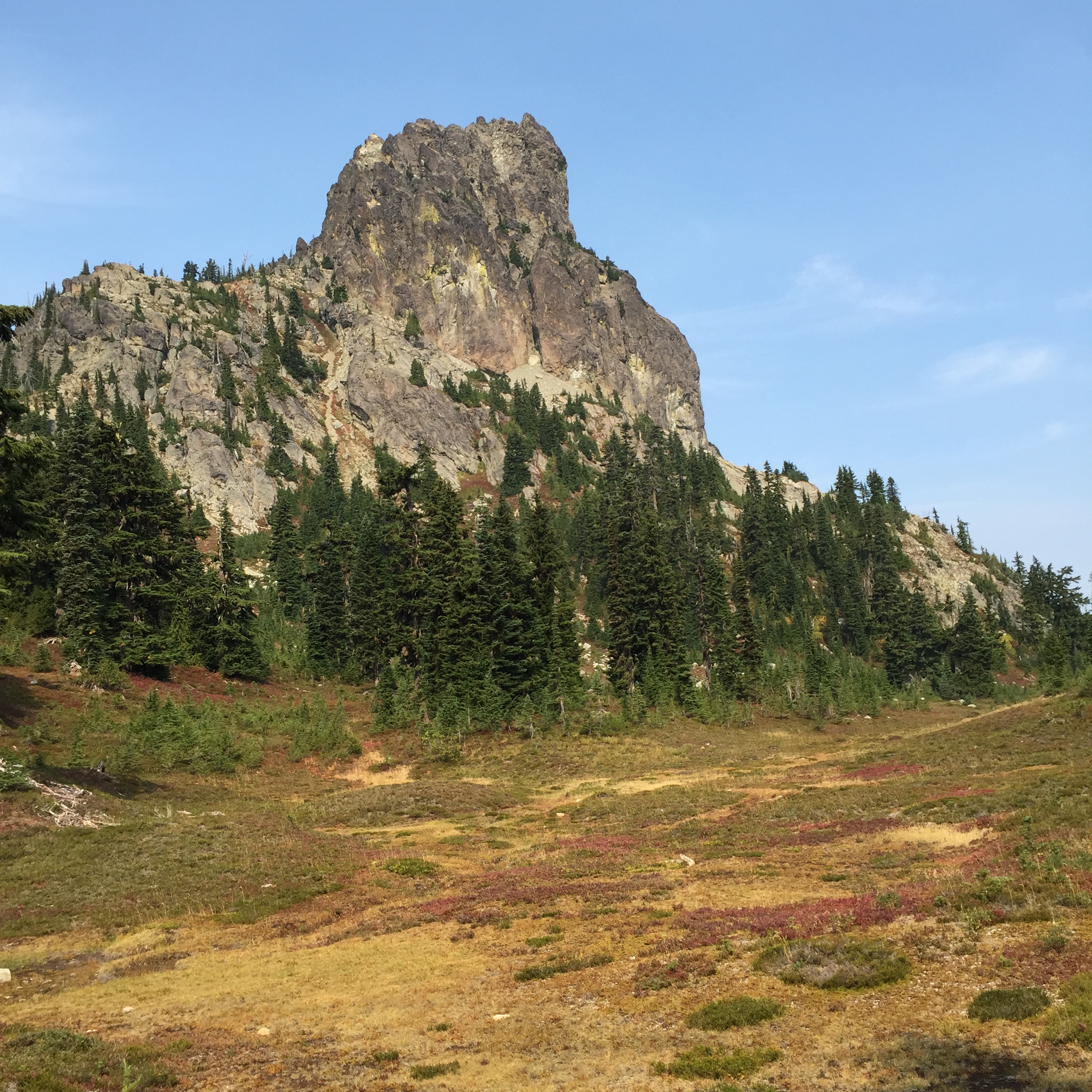
The ridge climb that I put off yesterday was much cooler today. I made it up to Cathedral Pass, and the operative word was Gorgeous. As in the ridge was gorgeous, the pass was gorgeous, Cathedral Rock was gorgeous…are you detecting a trend here? High alpine heather, beautiful path, and O, the MOUNTAINS! I had more fun, just rambling along the top of the ridge and taking pictures.

And then I met a girl named Kelly. She’s a SOBO sectioner, and is one of the few sectioners I’ve met who will be travelling farther than I am. She also brought fire news, which matched what Paul had said the night before. The Okanogan fire is now over 144K acres. Hwy 20 is closed at Newhalem (west of Rainy Pass, which is the PCT junction); that probably affects the Cascade Pass detour (the workaround for the Blankenship closure from Suiattle River to Stehekin). Hwy 20 is also closed the other direction, due to the Okanogan fire.
The long and the short of it is that if all of this info is correct (and it was very current), my trip will be over not long after Stevens. I sat down in the shadow of Cathedral rock and just cried for a few minutes. This means so much to me, and I just want to see it completed, hopefully this year. I need to wait until I get to the Dinsmores’ to get the best info, but I’m really concerned. I messaged Steve, and he confirmed what she said, but added that the situation is very fluid. I took a deep breath (okay, a very deep breath), and kept walking. This is incredible country, and I don’t want to miss it because I’m focused on what’s happening further north.
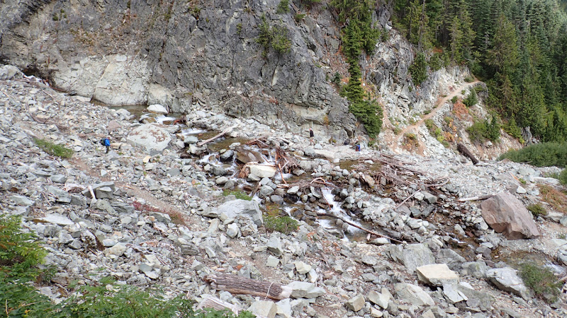
A handful of miles wandering along stunning ridges, and I came to a sign warning of a “Dangerous Ford.” There was an alternate route posted, for stock; as I understand it, it’s better to take the stock route early in the season. As it had been very dry lately, I took the main route. The creek is the drainage for the Hyas Glacier, on Mt. Daniel, west of the trail. The creek runs through a fairly narrow slot, and once it opens up above the trail, it splits into several sections. I skipped the log bridge and just plowed through. From there, it was a matter of carefully following cairns, because the trail was practically invisible from one section to the next. And at the end, there was a bit of scrambling and a veggie belay or two. (A veggie belay is when you use branches and such to pull yourself up a slope.)

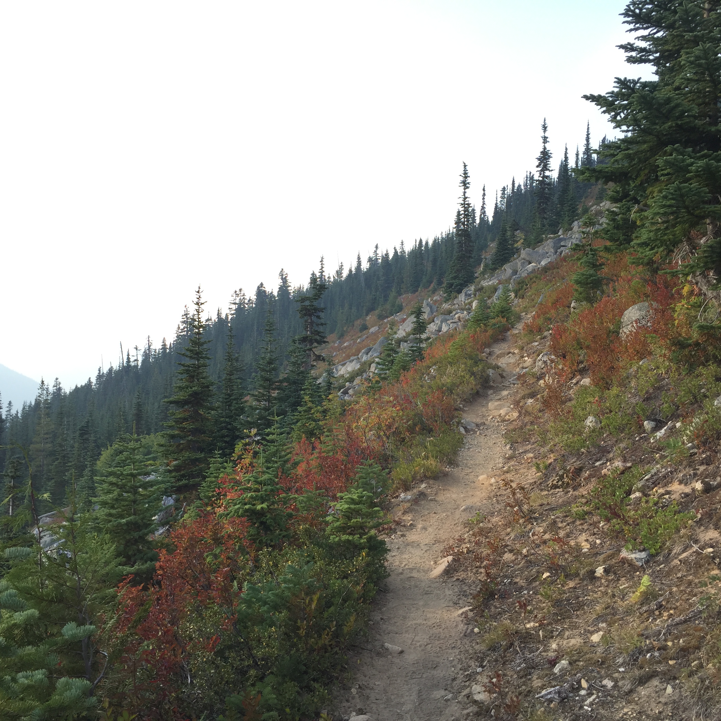
I gradually ascended a long ridge, heading toward Deception Lakes.
I made camp, and I had the place to myself. I had been warned about the mice (bring a mousetrap, or a cat), but with my Ursack and my water bottle stowed away from my tent, I ended up having the quietest night I’ve ever had in a campsite, ever, anywhere. No sound at all. And that made for some good sleep, which was exactly what I needed.
*Photo credit: Eric Aalto
