Happy 50th to me!!! Hit the trail at 7:15. It was up in one form or another as I wrapped around Table Mountain at 2157, and then hit Three Corners. The ravines echoed with logging operations. Saw Hood, St. Helens, and Adams. Hood was pretty close, and Adams far. Hard to believe that this will change so radically in a week or so.
The way opens up to a clearing with power lines.The river catches the early morning sun.Mt. Adams in the far distance…tantalizing. This is the goal for my section hike.Mt. Hood, fading away to the south.Mt. Rainier to the far north.An old burn.Rowanberry, also known as Mountain Ash.
Took the side trail up to Three Corners Spring at 3400 ft., mile 2160. The trail is about a third of a mile. I didn’t go all the way to the viewpoint, but focused on the water instead. It was a welcome sight! There is a hose from the spring to a rusty, decrepit trough. Water is a little brown but fine to drink. To get the water, you need to “pump” the hose, and when it refills, you empty it into your container.
The end of my first dry stretch, 8.8 miles. The note on top describes the location of the spring, and details for getting water.About 1/3 mile up from the junction is this sign on the ground: “Water Trough.”The industrial strength hose is connected to a reliable spring. The trough is rusted through, so to obtain water you need to lower the hose until it is full, and then empty it into your water container. The water is brownish but good, and I had a full liter of Nuun (electrolyte replacement).Water is full, and we’re heading for Rock Creek.
From Three Corners, it was all downhill to Rock Creek, at 2164. What a delightful place! Perfect spot to soak tired feet, water cool but not too cold. There was even a backrest on the rock…almost as good as a recliner. I filled up everything, because yes indeed, we have another long-ish dry spell tomorrow. Met Slaughterhouse, a girl from Kansas/Colorado. She was great, and happily took the foot soaking perch as soon as I was done.
Rock Creek is the perfect place to relax: water temp is just right, there’s a comfy rock with a back rest, and the piggies feel like a million bucks when you’re done. Fantastic birthday present!And it’s not just for the piggies…the creek is lovely.Awesome to see the work of Scouts, even three decades on.
Meeting her put a spring in my step, and I made great time to my campsite at 2165. It’s near a seasonal stream which is still flowing, so I’ll be able to top off in the morning. The campsite has room for two more but so far no one has asked. There’s a giant cedar log across the length, and its girth is more than twice as tall as my pack.
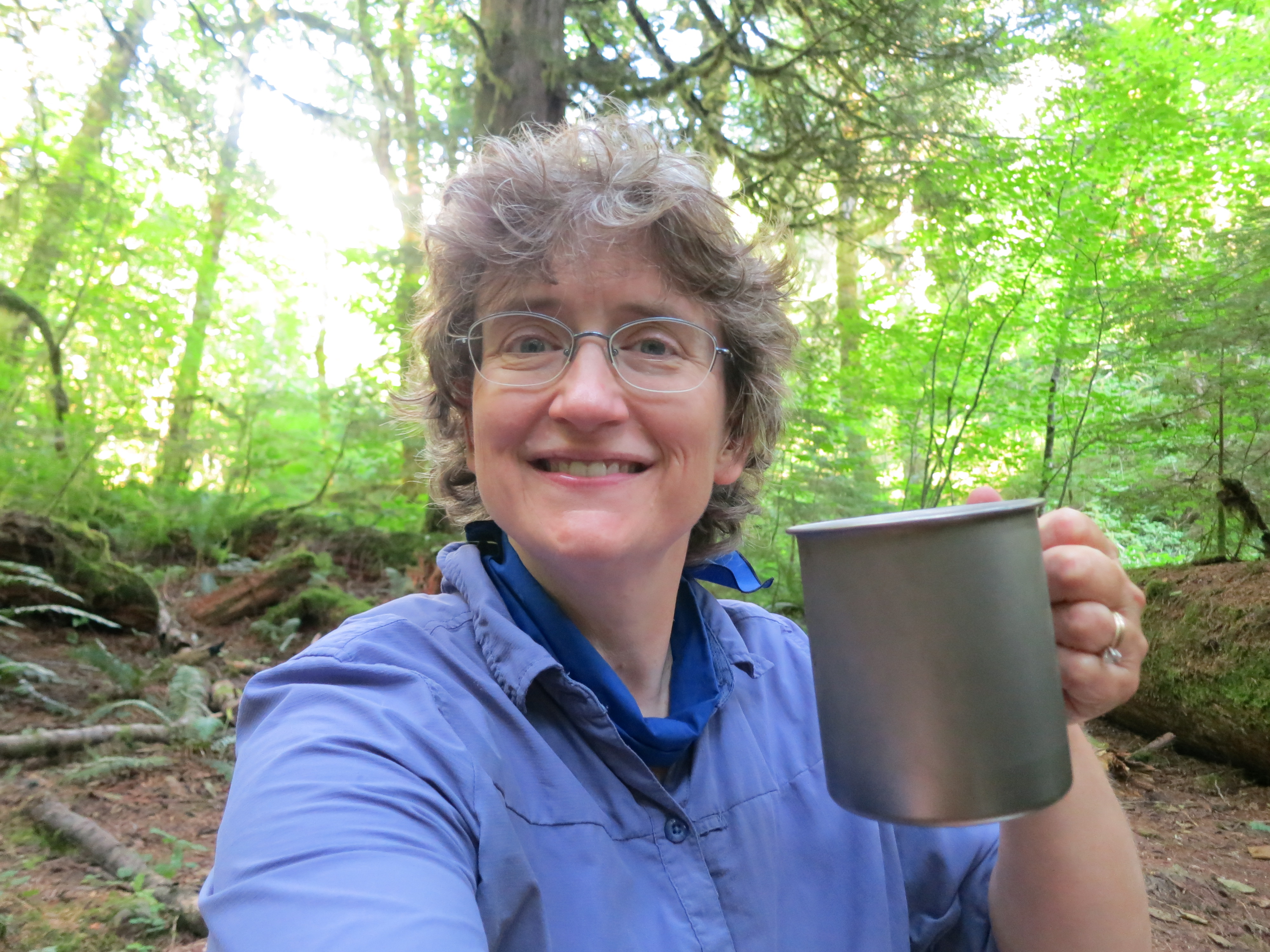
Where I spent my birthday.A fallen old growth cedar is a great place to lean a pack.Okay, it’s only cocoa, but I had to drink a toast to the next 50 years.
I miss my guys, but I’ve got to say, this is a heck of a way to turn 50. I have the best family in the world.
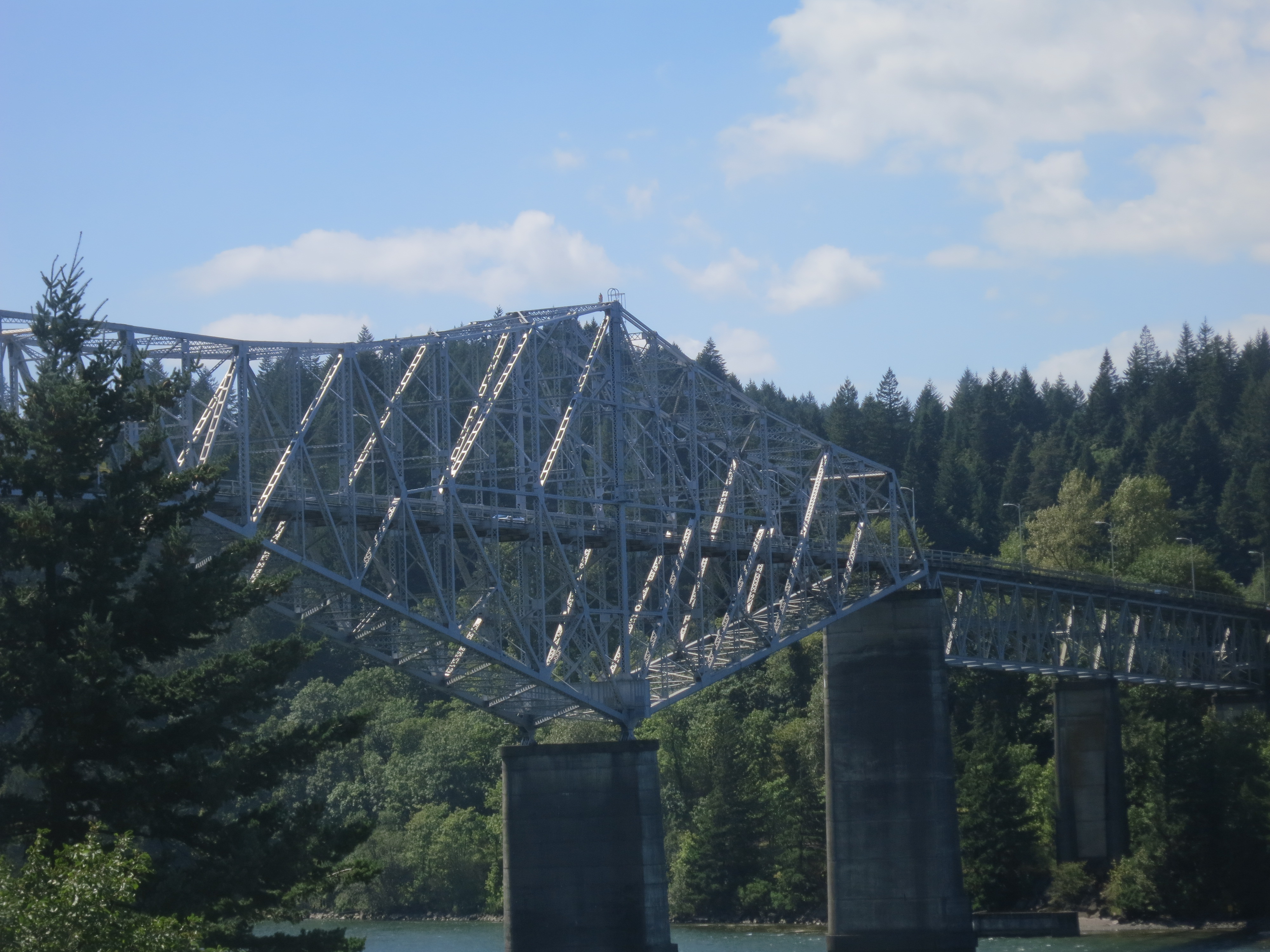
This is it! We got up before dawn, and had breakfast next door to the hotel. Then Steve and I walked up to the bridge. He took a few pictures, and I was on my way, a little teary with excitement, at 7:30. Mile 2144!
One last picture before crossing the bridge.Almost halfway across the bridge, where I enter Washington.Across the bridge, and ready to go.The beginning of the Washington PCT, at mile 2145.Only 507 miles to go…although Halfmile’s GPS survey in 2014 shows it to be 515 miles. Details, details.
So my pack is heavy! I pounded out four miles by 11:00, but as the grade increased, I slowed way down. Wondering if I estimated food consumption correctly.
Coming out of the trees, just up from the river.Looking down at the river and the dam.Crossing a small stream, with an appropriately labeled bridge.Prickly Lettuce. Even at the end of wildflower season, there were little gems like this.Greenleaf Creek
I was counting on loading up with water at Cedar Creek, so I had skipped Greenleaf (2150). Cedar Creek was way down a ravine, on a dirt road, with no proof of its existence. Reluctantly, I pushed on.
The Bonneville Dam spillway.
Fortunately it’s been wet lately, so a mile after the missing Cedar Creek junction, I crossed the seasonal stream which becomes Cedar, at approximately 2152. Loaded up on 3.5 L because there’s no water until an iffy spring at 2160 (Three Corner), and no guaranteed unto Rock Creek at 2164. That gave me just shy of a liter for every three miles. This is the water ratio I need to work out, given weather, exposure, hiking speed, and elevation gain. And for medical reasons, I need to always have extra water on hand. Running out isn’t an option, and that makes the ratio even harder to compute.
Stopping at the seasonal upstream portion of Cedar Creek, to fill up on water.
This entire section, Cascade Locks to Panther Creek, consists of two ridges/ravines, and relatively little water. As a new section hiker, it has been hard to judge my water consumption. There’s a balancing act: pack weight vs pace vs water need vs water availability vs food requirements vs estimated food requirements. My pack weight is high, my pace is low, my water need is high, the water availability is low, and I’ve got a full load of food. The lesson here is to try and find a sweet spot, and make that sweet spot an easier and easier place to find.
Met Slacker at the spring. He was really cool, and said he hopes he can do something great for his 50th. This will be awhile 🙂
Heading NW after getting waterThe Columbia, with just a hint of late-summer color in the foreground.
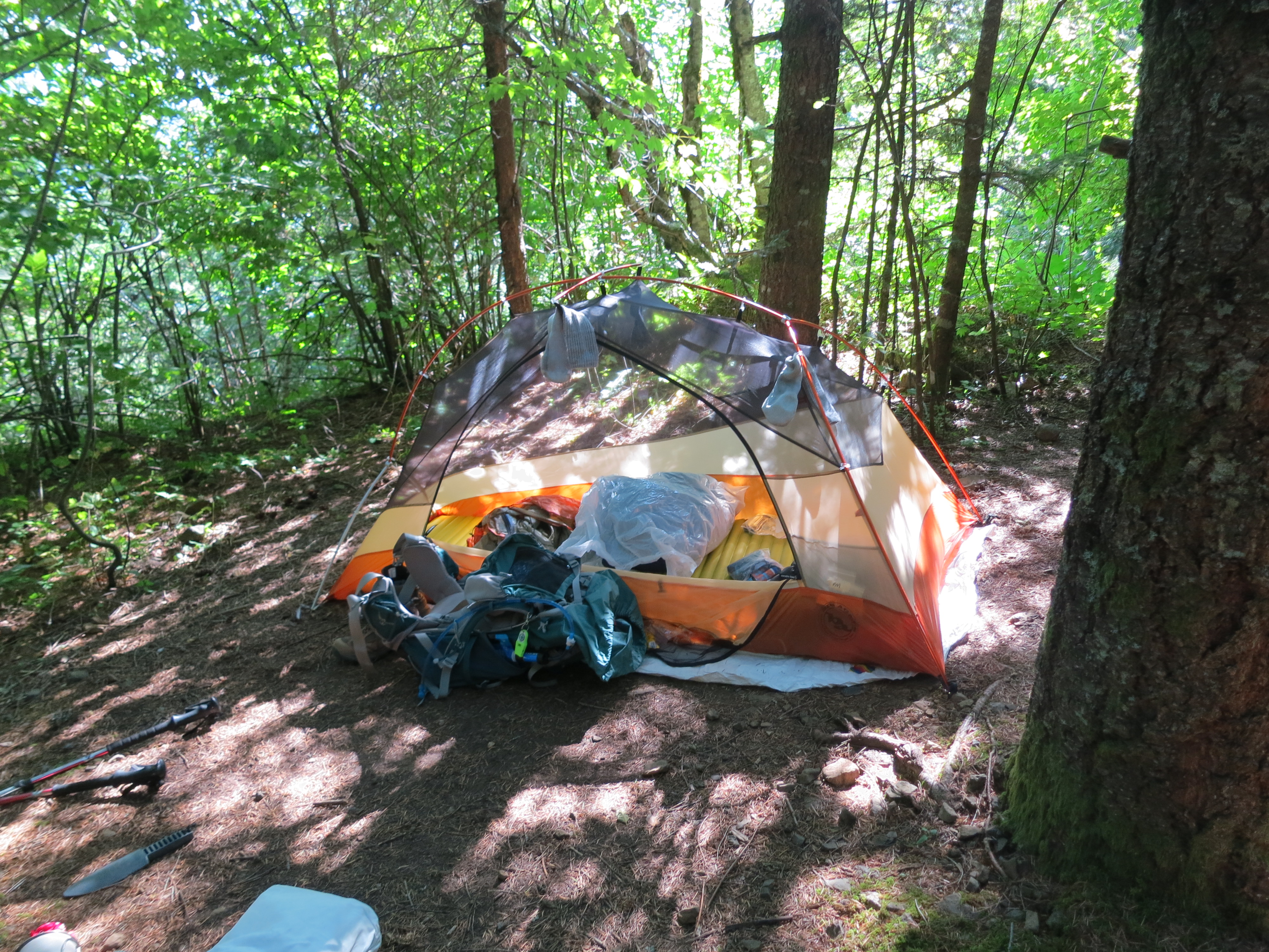
Called it a day at the campsite at 2154. Nine-plus miles, 3300 feet of elevation gain, with a bitch of a pack. Tomorrow I should start about 4 lbs lighter, and I won’t have a dry spell nearly this long again. Spent an hour or so reading, and then bed before 6:30.
Setting up campBecause every good hike starts with a selfie in the tent.
At the Best Western Hotel in Cascade Locks, Mile 2144
Steve and I drove to Cascade Locks, with my excitement building. This is definitely a hiker town, with thru-hikers everywhere, carrying their resupply boxes, and a big advertisement for Shrek’s, in the grocery store. Shrek is a trail angel who hosts any and all hikers coming through. He’s known for his oversize green bandannas. I met Mountain Mamma, who commented on my Philmont t-shirt. She works with Scouts and Venturers in Michigan. And she chided me for saying I “can only” do a section hike. The correct phrase is I *am* doing a section hike. We’re all on the trail. Mountain Mamma, Steve, and I shared milkshakes and had a great time hanging out. Love it!
The view from our hotel room…tantalizing!Bridge of the Gods
After shakes, we hit the grocery store and ended up at the pub, for one last burger. Then we strolled around town, checked out the old locks, and generally had a great time before heading back to the hotel. Tomorrow!
As a child, growing up in the Pacific Northwest, I had heard of the Cascade Crest Trail. I probably even hiked a bit of it. It lived in an almost-forgotten spot in my mind…until 2012.
That year, our family spent Labor Day camping east of the crest. We stopped on our way home, at a little Chevron station on top of Snoqualmie Pass. PCT hikers know exactly which Chevron this is…it’s the mail stop for the majority of the Snoqualmie Pass resupplies.
When we arrived, the place was crawling with PCT hikers. It took me a second, but then I realized why they were milling around, with semi-battered Priority Mail boxes. And that’s when I felt it: an almost tangible punch in the gut, which said “you know, you can do this too.”
Long story short, I made plans to do a short section in August 2014. I would hike from the Bridge of the Gods, in Cascade Locks, OR, and meet family and friends a hundred miles north, at a campground near Mt. Adams. It would be the longest hike I had done, and the longest with no resupply by a factor of three. I was nervous, a little unsure, and very excited. And I also hoped that this would be the beginning of many miles along the PCT.
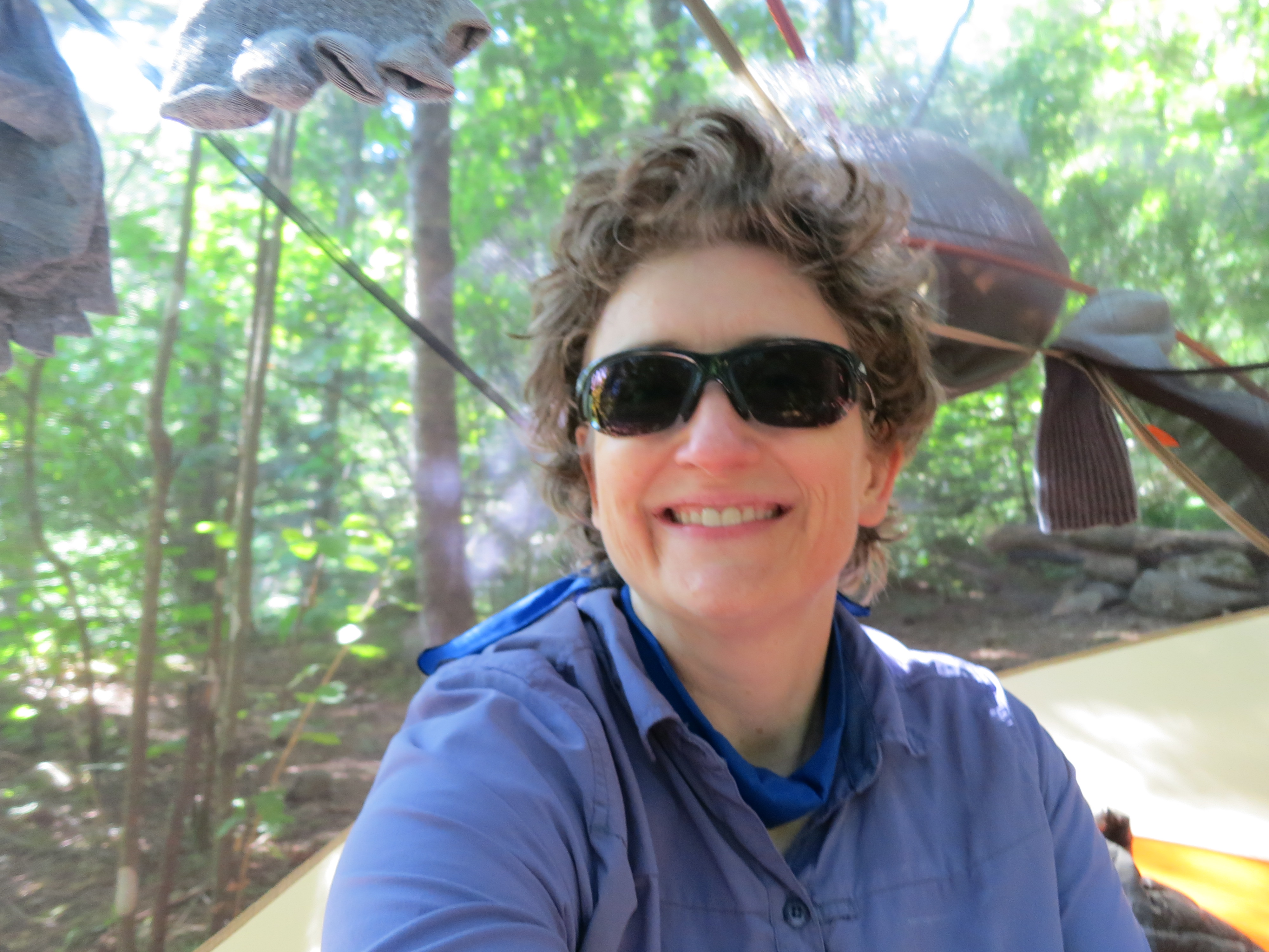
I had to reorganize because half my stuff was still wet, so I got another late start. My boots and yesterday’s socks were soaked, so I just put everything on and planned for a day’s worth of squelching.
Got water at the piped spring at 2193; there were six of us hanging out and chatting, including the Warden and Firestarter. Next stop was Crest Horse Camp, 2195.
Heading up towards Crest Horse Camp Trailhead.
Along this stretch I decided it was time to purvey a little Trail Magic. I pulled all my leftovers from days 1-4, plus all of the food for days 9-10, set it out with a Magic sign, and a note from Rest Step. Within ten minutes, three thrus descended like vultures. They were very grateful, and my pack was noticeably lighter. As were my spirits. Getting closer to that sweet spot, and Trail Magic is wonderful for both the giver and the receiver.
At Crest TH, I purveyed a little trail magic: putting out a sign, and leaving extra food for hungry and happy thru-hikers.Just after the Crest Horse Camp TH…seven miles to my destination.
Entered the Indian Heaven Wilderness this afternoon, and passed Sheep Lake at 2197. At Green Lake, there was a family picking blueberries. I chatted with the youngest daughter, and she described the blueberry pancakes her family would be making. I tried not to drool, but those theoretical pancakes rapidly developed into the stuff of legend.
Got water at Green Lake, with some creative filtering.One of the main trails through the Indian Heaven Wilderness, mile 2199.Within the Indian Heaven Wilderness, this style of PCT emblem was used.Climbing up the ridge heading toward Blue Lake.More rowanberries, this time in red. You can just see Adams peeking through the trees.Mt. Adams is getting closer and clearer.
Another handful of miles, and I reached Blue Lake (2203), after a thirteen mile day. I was able to spread out my wet gear, and get things dried out. Even my boots were 95% dry after a couple of hours in the sun. And the pair of socks which were rinsed on Day 3 were dry enough to wear tomorrow.
I’ve subscribed to Backpacker Magazine for years. It’s generally got one or two articles I find interesting, and the annual gear reviews can be helpful. But it’s got a lot of fluff (how to use your cellphone as a survival tool by ripping out the wires? Seriously?), and so I take it with a grain of salt.
Recently, the magazine ran a series of articles on women in the backcountry. I’m pretty interested in that…the more women we can get on the trails, the better. So to say I was disappointed in their take on things is an understatement.
I could echo the words of several bloggers and hikers I know…all of whom were disgusted by the whole thing. “How Not to Pee on Your Shoes?” Really? But I hate reinventing the wheel, and I love sharing what’s right about the women-in-hiking blogosphere. So let me introduce you to Allison Driscoll, author of the very popular Trail to Summit blog. She did a survey of Actual Women who Actually Hike, and came up with some great data to hand back to the powers that be at Rodale…er…Backpacker Magazine.
So without further ado, say hello to Allison and Trail to Summit.
I recently discovered this incredible poem from Elizabeth Austen, read by her at Hedgebrook Rises! in 2013. The poem was published as part of her collection EVERY DRESS A DECISION (Blue Begonia Press, 2011). Elizabeth Austen is the Washington State Poet Laureate, 2014-2016.
I dedicate this to the Mighty Hiker Women of the world, especially those who are unsure, and perhaps fearful, but who feel the inexorable pull of the wild places.
Through a chance encounter on Facebook, I met Valerie Ross, of the San Diego Girl Scouts Council. SDGS has an incredible backpacking program, and Val is one of eight adult volunteers. This is the first time I’ve heard of a GS Council with this sort of program (please, somebody, prove me wrong). So I wanted to find out more about it. I’ll let Val take it from here.
“I started backpacking as a shy, gangly, fly-me-under-the-radar 16-year-old in 1976. My big brother led me into the Golden Trout Wilderness for my first-ever trip, and I walked out of the forest a week later standing 10 feet tall and confident that I could do anything. I never stopped backpacking, and never lost that feeling of exhilaration one gets from walking into the Sierras and feeling its power and grace. My two daughters grew up backpacking with me and their aunties, and as the years passed I noticed that I saw countless Boy Scouts in the wilderness but absolutely no Girl Scouts. (In fact, over the last 39 years, I’ve only come across one Girl Scout backpacking group that wasn’t associated with my Council). I wanted to change that.
“Eighteen years ago I took my Council’s (San Diego Girl Scouts) backpack training to meet the training requirement for taking my own troop backpacking. Some years after that, I became a Council trainer and helped develop the program we have today. SDGS currently trains 300-400 girls and adults each year in wilderness hiking and backpacking. We now have 8 trainers and every year we lead an average of 4 advanced trips (Sierras, CA central coast, AT, hut-to-huts, etc.).”
In 2013, a group of high school and college age girls from across the Council hiked the High Sierra Trail. They made a short video on top of Mt. Whitney. The best part of the video? “I can do anything!”
Again from Val: “This SDGS backpacking program actually goes back to the 1950s & 60s. It’s not new, but is a legacy that just keeps developing.
“One aspect of our program that I feel most responsible for (and proud of, to be honest) is our Youth Leadership program. After girls finish basic backpacking, we invite them to return to help train and lead our classes/trips. These girls are stunning – they train girls and adults right alongside the lead trainer, mentoring girls and demonstrating such confidence in public speaking, all outdoor skills & knowledge, and our wilderness ethic – that is, the way we have each other’s backs and look after our fellow hikers.
On the John Muir Trail, at Island Pass. Mt. Banner is in the background.
“As for the backpack trainings & trips – my goal is that by time a girl leaves for college, I want to know that she’s capable of any backcountry adventure she dreams up. And we’ve had any number of girls go on to become JMT thru-hikers, a PCT thru-hiker (this year’s class), Peace Corps members, leaders in their university’s outdoor adventure programs…. Each of these girls has a story to tell, too. We’re teaching these awesome young women down here in SD, and it’s such a joy to help them develop the skills and knowledge they need to realize their dreams. And, they go on to inspire the current corps of Youth Leaders, which is pretty cool.”
This year, the girls hiked 34 miles, along the John Muir Trail, from Mammoth to Yosemite. They too put together a short video. Notice the ranger station section at the beginning; the girls were working with the rangers, and the adults pulled back. As with any successful outdoor program, the youth need to take charge.
“So I know you just asked for a blurb, not a book. I don’t know which great tale to tell (years & years of them – scary helicopter rescues, poignant moments, hilarious ‘you know you’re backpacking when you’re cleaning your bowl with your underpants’ moments). But I can tell you this — the moments I live for, when I’m most rewarded, go something like this one: I was descending Forester Pass with a group of my girls in August, 2011 – a huge snow year. After hours of carefully navigating the sun cups and snowfields over the top, we stopped to rest at a promontory with views extending north – snow-covered mountains as far as the eye could see, truly a purple mountain’s majesty. ‘I never knew this existed!’ one of them whispered into the silence, and that’s it, in one sentence: the reason, the purpose and the joy of helping a girl discover something she will treasure for the rest of her life.
“And for those who are ready to try backpacking, my advice is to get out and do it. You can’t learn to backpack by reading about it. You have to get your feet dirty, be humble enough to make mistakes, and have the confidence to laugh when you’re learning. It’s important to be humble: realize that you’ll never know it all, and that there’s no room for arrogance in the backcountry. Be Safe is the other half of the motto Be Prepared, and both are essential. By accruing experience, and being patient with the process, you’ll gain an acumen that can never be achieved by just reading others’ accounts. So yes – absolutely – read articles, books, blogs and posts. But there’s no substitute for experience. Go with a buddy/group that you trust to teach you properly (or at least, give you a start); someone who will have your back (and you’ll have theirs). Then keep building – the more time you spend outside the more familiar you’ll be with nature’s rhythms and your own rhythms and needs, as well. Never stop observing, and never stop learning.”
For those of you who are youth leaders, whether in Boy Scouts, Girl Scouts, or a similar group, SDGS has some terrific resources www.sdgirlscouts.org/backpacking . Check out their flyers for the three levels of classes offered to girls and leaders (Wilderness Hiking, Basic Backpacking & Advanced trips). This site also contains the training handbooks which go along with the courses; they have a wealth of information.
Programs like this for girls are shockingly rare. Please share this info, and this post. We need to grow a generation of strong, capable women. And if you know of similar programs, please let me know so that I can share your stories. Mighty Hiker Women, unite!
With clear blue skies and warm sun in the forecast, I grabbed my pack, and Booker the Rhodesian Ridgeback (aka the Wonder Pup), and we headed north. Today’s destination was the Chain Lakes Trail between Mt. Baker and Mt. Shuksan, very near the Canadian border.
To get to the trail, you take the Mt. Baker Highway (542) up past the ski area. At the very end, you’ll find Artist Point. This is a fantastic place to take out-of-town guests. Even those who aren’t inclined to hike can have an in-your-face view of Shuksan, just by stepping out of the car. And there are a variety of short trails for those who would like to explore just a little.
Booker and I had a little longer trail in mind. The Chain Lakes Loop explores several lakes in the area, and winds over ridges, through basins, and back up again. It’s a moderate level hike, eight miles and about 1700 feet net elevation gain. The trail has its fair share of talus (rocky slopes), but no scrambles or anything even close. We took the counter clockwise route, out of the Artist Point parking lot. More trail info can be found at Washington Trails Association’s Chain Lakes page.
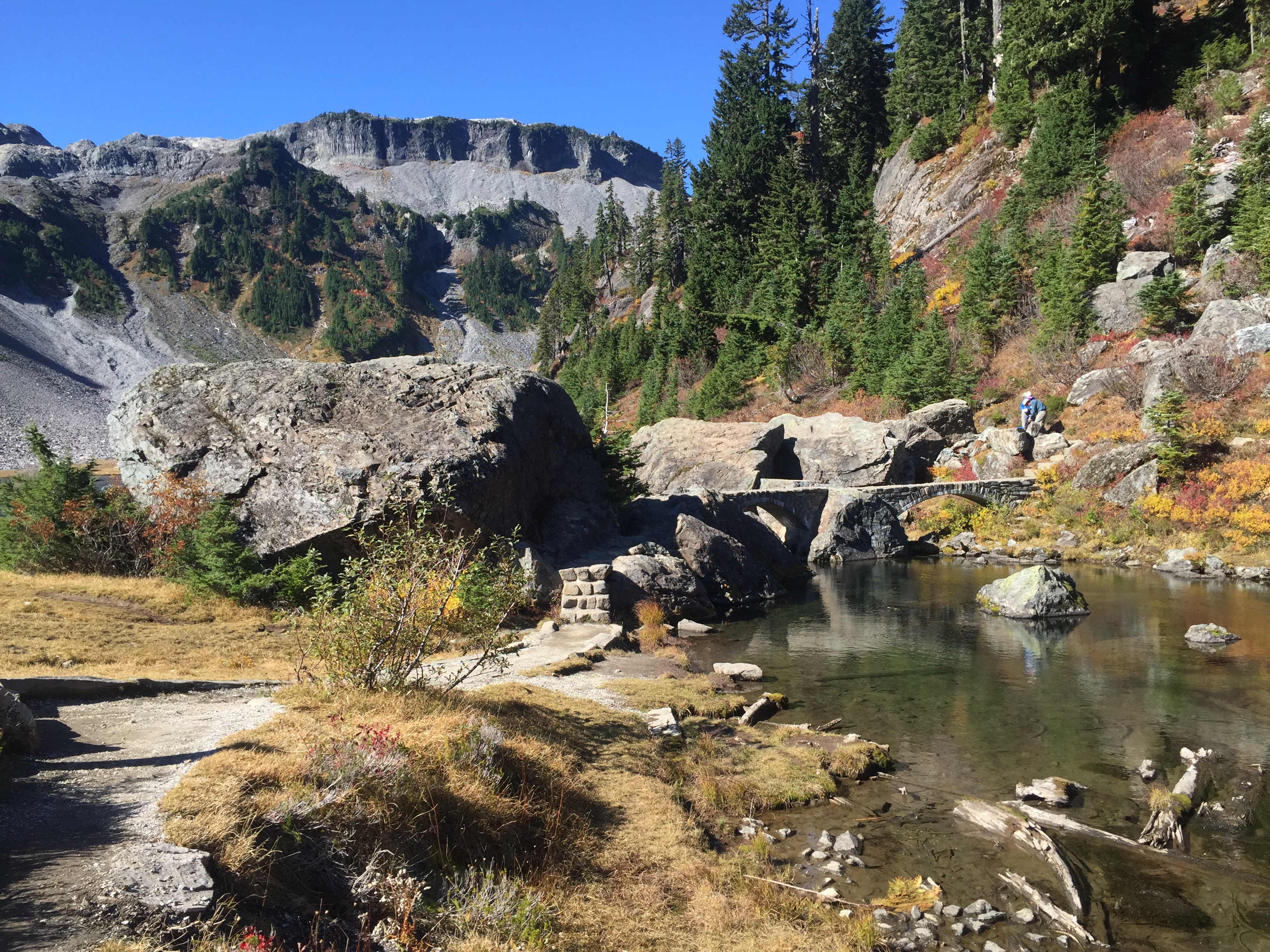
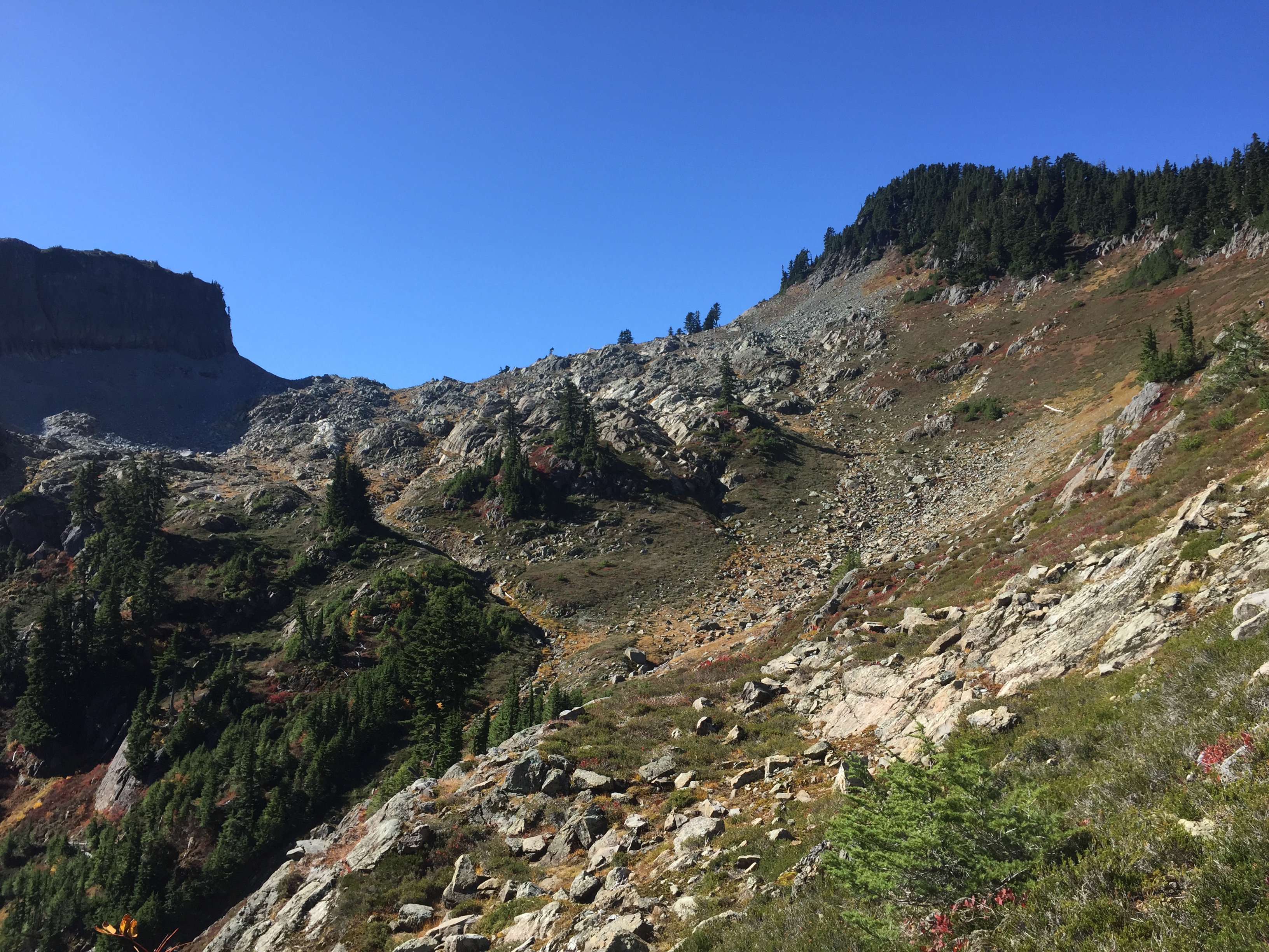
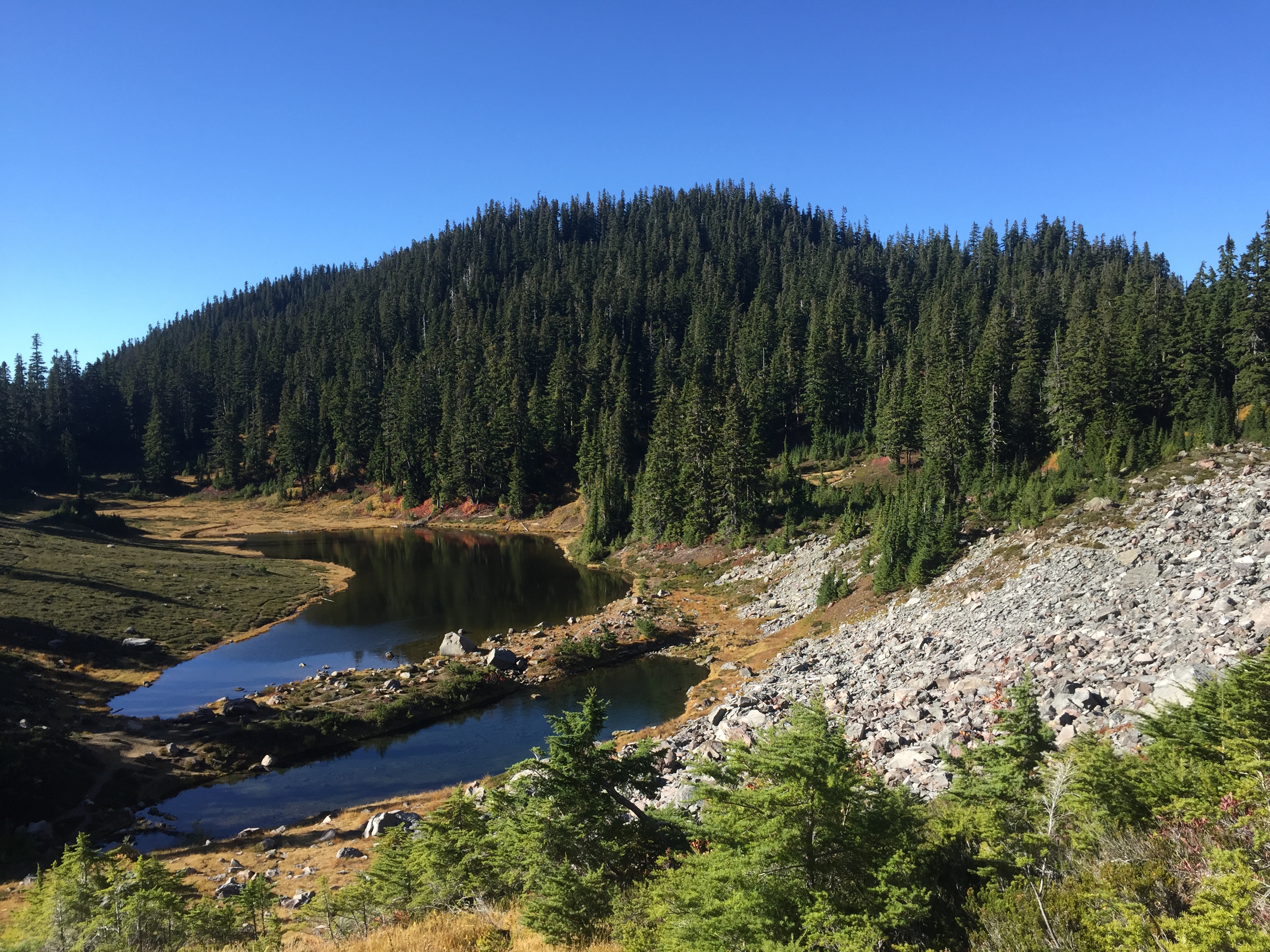
Descending into the Bagley Lakes basinStone bridge across the stream between the Bagley Lakes. Table Mountain is in the background.Looping around the stream and the northern Bagley Lake.Climbing out of the Bagley Lakes basin, to Herman Saddle. Table Mountain is to the left, and Mt. Herman is to the right.Mt. Shuksan, as seen from the climb out of the Bagley Lakes basin.The view from the saddle. Shuksan is to the left, Table in the middle, and Baker to the right. A heck of a place to have lunch.Booker enjoyed his milk bones, and then relaxed on his new blanket. Rough life.Descending toward Hayes LakeMazama LakesAfter traversing the Hayes/Iceberg/Mazama Lakes basin, the trail climbs through several talus slopes on the other side of Table Mountain.Booker was glad to reach the saddleAnd the second saddle proved just as gorgeous as the first. Table Mountain is on the left, Shuksan on the right, and if you look carefully you can see Artist Point in the center.
When I grow up, I want to be like Bronka Sundstrom and her hiking partner. They are 90 and 92, respectively, and are still avid hikers. Did I mention she’s a Holocaust survivor as well? Check out this article from Craig Romano, a local guidebook author.
And check out his website, CraigRomano.com, for more articles and photographs of Our Fair State (aka Washington).